Dinmontlair Knowe

Hill, Mountain in Roxburghshire

Scotland

Dinmontlair Knowe

In the Newcastleton Forest, by the Kershope Burn National Cycle Route 10 follows this track, bound for Scotch Knowe and a crossing into England.

This photograph was taken during the Coronavirus (COVID-19) pandemic of 2020/21/22.
In the Newcastleton Forest, by the Kershope Burn Credit: James T M Towill

Dinmontlair Knowe is a prominent hill located in Roxburghshire, a historic county in the Scottish Borders region of Scotland. Standing at an elevation of approximately 455 meters (1,492 feet), it is considered one of the highest points in the area. The hill is situated within the picturesque Cheviot Hills, which straddle the border between Scotland and England.

Dinmontlair Knowe is characterized by its distinctive conical shape and rugged terrain, making it a popular destination for outdoor enthusiasts and hillwalkers. The hill offers breathtaking panoramic views of the surrounding countryside, including sweeping vistas of rolling hills, lush valleys, and meandering rivers.

The hill is named after the fictional character "Dandie Dinmont" from Sir Walter Scott's novel, Guy Mannering. Dandie Dinmont was a renowned terrier breeder who lived in the nearby area during the 19th century. The term "Knowe" refers to a small hill or knoll in Scots dialect.

The area surrounding Dinmontlair Knowe is rich in natural beauty and biodiversity, with diverse flora and fauna inhabiting the hill and its surroundings. The hill is home to various species of birds, including red grouse and peregrine falcons, as well as a variety of wildflowers and heather.

Due to its accessibility and stunning views, Dinmontlair Knowe is a popular spot for outdoor activities such as hiking, hillwalking, and photography. Its location within the Cheviot Hills also makes it an ideal base for exploring the wider region and its many attractions.

If you have any feedback on the listing, please let us know in the comments section below.

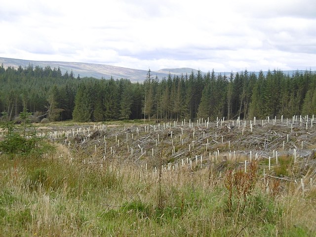
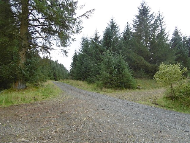
Dinmontlair Knowe Images

Images are sourced within 2km of 55.18719/-2.7100664 or Grid Reference NY5488. Thanks to Geograph Open Source API. All images are credited.

In the Newcastleton Forest, by the Kershope Burn National Cycle Route 10 follows this track, bound for Scotch Knowe and a crossing into England.

This photograph was taken during the Coronavirus (COVID-19) pandemic of 2020/21/22.
In the Newcastleton Forest, by the Kershope Burn
National Cycle Route 10 follows this track, bound for Scotch Knowe and a crossing into England. This photograph was taken during the Coronavirus (COVID-19) pandemic of 2020/21/22.
Forestry track opposite Kershope Head A firm track for cycling and walking takes the visitor through the edge of the Newcastleton Forest alongside the Kershope Burn.

This photograph was taken during the Coronavirus (COVID-19) pandemic of 2020/21/22.
Forestry track opposite Kershope Head
A firm track for cycling and walking takes the visitor through the edge of the Newcastleton Forest alongside the Kershope Burn. This photograph was taken during the Coronavirus (COVID-19) pandemic of 2020/21/22.
The Kershope Burn near Havering Bog The Kershope Burn in its infancy just south of Scotch Knowe.

This photograph was taken during the Coronavirus (COVID-19) pandemic of 2020/21/22.
The Kershope Burn near Havering Bog
The Kershope Burn in its infancy just south of Scotch Knowe. This photograph was taken during the Coronavirus (COVID-19) pandemic of 2020/21/22.
Straddling the border On the footbridge over the Kershope Burn at Scotch Knowe: Scotland (left), England (right).

This photograph was taken during the Coronavirus (COVID-19) pandemic of 2020/21/22.
Straddling the border
On the footbridge over the Kershope Burn at Scotch Knowe: Scotland (left), England (right). This photograph was taken during the Coronavirus (COVID-19) pandemic of 2020/21/22.
At the high point of the 'Reivers Route' 357 metres above sea level at Caplestone Fell finds the National Cycle Route 10 deep within forestry.

This photograph was taken during the Coronavirus (COVID-19) pandemic of 2020/21/22.
At the high point of the 'Reivers Route'
357 metres above sea level at Caplestone Fell finds the National Cycle Route 10 deep within forestry. This photograph was taken during the Coronavirus (COVID-19) pandemic of 2020/21/22.
Bridge near Scotch Knowe This bridge takes the Cross Border Trail into England (or Scotland if coming the other way), a bike and walking route linking Newcastleton and Kielder and signed by the Forestry Commission.  From here there is a short section of single-track before the route rejoins a forestry road for a nice downhill section before turning back and climbing to the Bloody Bush Toll Stone and the communication mast at Larriston Fells.  Longer routes are available.
Bridge near Scotch Knowe
This bridge takes the Cross Border Trail into England (or Scotland if coming the other way), a bike and walking route linking Newcastleton and Kielder and signed by the Forestry Commission. From here there is a short section of single-track before the route rejoins a forestry road for a nice downhill section before turning back and climbing to the Bloody Bush Toll Stone and the communication mast at Larriston Fells. Longer routes are available.
Kershope Head The head of Kershope Burn.
Kershope Head
The head of Kershope Burn.
Logging road, Kershope Forest A well surfaced road on the English side of the Kershope Burn.
Logging road, Kershope Forest
A well surfaced road on the English side of the Kershope Burn.
Kershope Burn A long clearing beside the border burn in Kershope/Newcastleton Forest.
Kershope Burn
A long clearing beside the border burn in Kershope/Newcastleton Forest.
Kershope Burn Taken whilst returning to Scotland. There is no bridge here now, but there are the ruins of one.
Kershope Burn
Taken whilst returning to Scotland. There is no bridge here now, but there are the ruins of one.
Tuley tubes, Little Hind Becks Replanted woodland in Newcastleton Forest.
Tuley tubes, Little Hind Becks
Replanted woodland in Newcastleton Forest.
Crossroads, Newcastleton Forest Road junction above Little Hind Becks.
Crossroads, Newcastleton Forest
Road junction above Little Hind Becks.
Muckle Hind Becks A road runs up beside Muckle Hind Becks. It is soon blocked by windthrow.
Muckle Hind Becks
A road runs up beside Muckle Hind Becks. It is soon blocked by windthrow.
Windthrow, Newcastleton Forest A road, which I had taken by mistake, is blocked by fallen trees.
Windthrow, Newcastleton Forest
A road, which I had taken by mistake, is blocked by fallen trees.
Old dyke, Newcastleton Forest Remains of a wall beside Yellow Sike, off the Tweeden Burn.
Old dyke, Newcastleton Forest
Remains of a wall beside Yellow Sike, off the Tweeden Burn.
Felled area, Newcastleton Forest Tuley tubes show that broadleaved trees are being planted near the Tweeden Burn.
Felled area, Newcastleton Forest
Tuley tubes show that broadleaved trees are being planted near the Tweeden Burn.
Old stell, Newcastleton Forest A ruined sheep fold from before the trees were planted.
Old stell, Newcastleton Forest
A ruined sheep fold from before the trees were planted.
Tweeden Burn, Newcastleton Forest
Show me another place!

Dinmontlair Knowe is located at Grid Ref: NY5488 (Lat: 55.18719, Lng: -2.7100664)

Unitary Authority: The Scottish Borders

Police Authority: The Lothians and Scottish Borders

What 3 Words

///sing.absent.whites. Near Langholm, Dumfries & Galloway

Nearby Locations

Dinmontlair Knowe

Related Wikis

Scottish Marches

Scottish Marches was the term used for the Anglo-Scottish border during the late medieval and early modern eras, characterised by violence and cross-border...

Liddel Castle

Liddel Castle is a ruined castle in Liddesdale, by the Liddel Water, near Castleton in the Scottish Borders area of Scotland, in the former county of Roxburghshire...

Dinlabyre

Dinlabyre is a village on the B6357 in Liddesdale, on the edge of the Newcastleton Forest, close to Castleton, in the Scottish Borders area of Scotland...

Steele Road railway station

Steele Road railway station served the hamlet of Steele Road, Scottish Borders, Scotland, from 1862 to 1969 on the Border Union Railway. == History... ==

Have you been to Dinmontlair Knowe?

Leave your review of Dinmontlair Knowe below (or comments, questions and feedback).