Bulg

Hill, Mountain in Angus

Scotland

Bulg

Craigangower Looking towards Craigangower. New bulldozed track all the way to the summit from Hill of Wirren.
Craigangower Credit: Ben Aslak

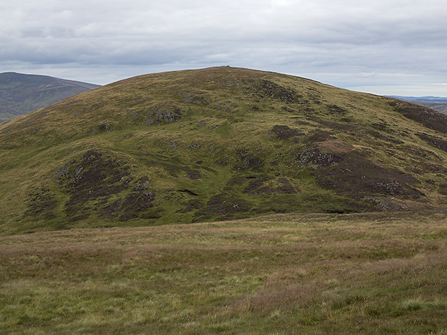
Bulg, Angus, also known as Bulg Hill or Bulg Mountain, is a prominent geographical feature located in the Angus region of Scotland. It is situated near the village of Kirkton of Auchterhouse and stands at an elevation of approximately 387 meters (1,270 feet) above sea level.

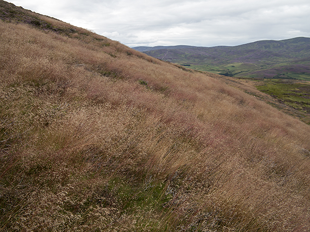
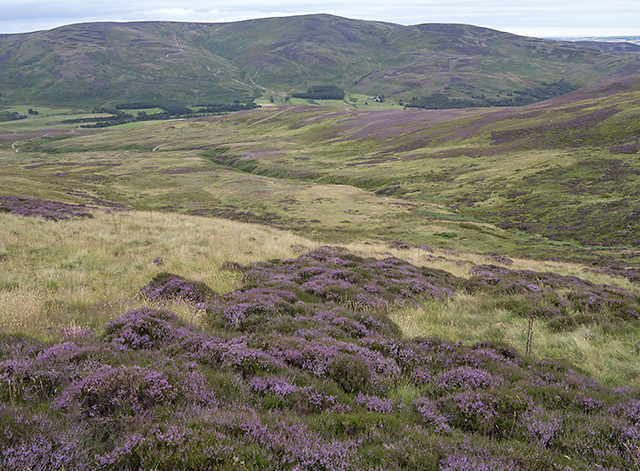
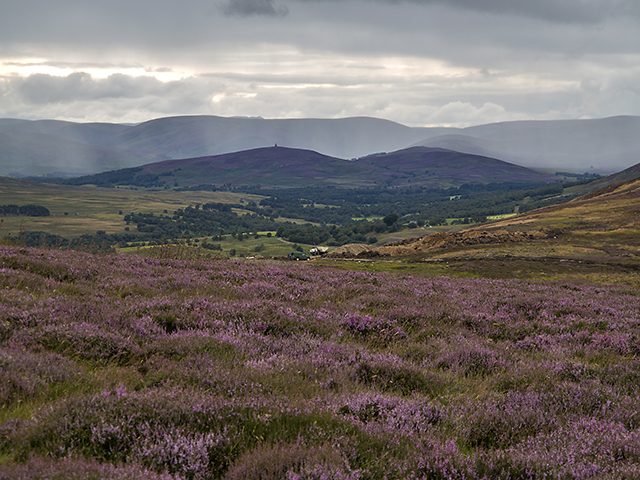
Bulg Hill is a rounded hill that forms part of the Sidlaw Hills range, which stretches across the southern part of the Scottish Highlands. It is composed mainly of sandstone and provides breathtaking panoramic views of the surrounding countryside, including the Sidlaw Hills, the Angus Glens, and the city of Dundee.

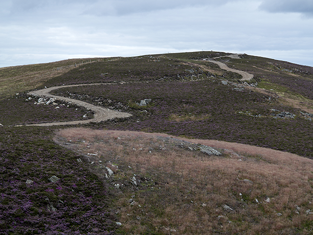
The hill is a popular destination for outdoor enthusiasts, hikers, and nature lovers who are drawn to its natural beauty and the tranquility of the surrounding landscape. There are various walking trails and paths that allow visitors to explore the hill and its environs. Wildlife such as deer, rabbits, and a variety of bird species can often be spotted in the area.

At the summit of Bulg Hill, there is a trig point, which serves as a navigational marker and offers an excellent viewpoint. On clear days, it is possible to see as far as the Grampian Mountains to the north and the Firth of Tay to the east.

Bulg Hill is not only a picturesque natural landmark but also holds historical significance. It is believed to have been an ancient meeting place for the local community, and remnants of prehistoric settlements have been discovered in the vicinity.

Overall, Bulg, Angus is a captivating hill/mountain that offers both natural beauty and historical interest, making it a noteworthy attraction for visitors to the Angus region of Scotland.

If you have any feedback on the listing, please let us know in the comments section below.

Bulg Images

Images are sourced within 2km of 56.874482/-2.7498168 or Grid Reference NO5476. Thanks to Geograph Open Source API. All images are credited.

Craigangower Looking towards Craigangower. New bulldozed track all the way to the summit from Hill of Wirren.
Craigangower
Looking towards Craigangower. New bulldozed track all the way to the summit from Hill of Wirren.
Road and butts on Hill of Wirren Looking up Glen Esk towards Mount Keen.
Road and butts on Hill of Wirren
Looking up Glen Esk towards Mount Keen.
Moorland by the Burn of Holmhead Boggy ground by the Burn of Holmhead, with heather in bloom in early August.
Moorland by the Burn of Holmhead
Boggy ground by the Burn of Holmhead, with heather in bloom in early August.
Lower slopes of Bulg A faint path through bracken and heather on the lower slopes of Bulg (from Am Bulg, the bag; thus bag hill, a round hill).
Lower slopes of Bulg
A faint path through bracken and heather on the lower slopes of Bulg (from Am Bulg, the bag; thus bag hill, a round hill).
Hillside south of Glen Esk Ragwort growing on the hillside above the river North Esk, with the 607 metre summit of Bulg visible in the distance.
Hillside south of Glen Esk
Ragwort growing on the hillside above the river North Esk, with the 607 metre summit of Bulg visible in the distance.
View from Craigangower The southern flank of Bulg viewed on a descent from Craigangower - relatively easy walking here on grass and heather.
View from Craigangower
The southern flank of Bulg viewed on a descent from Craigangower - relatively easy walking here on grass and heather.
Craigangower Craigangower, with a newly constructed hill track - these seem to be proliferating in Glen Esk, with construction underway at a number of nearby sites. The name Craigangower derives from Craig nan Gabhar, Hill of the Goats.
Craigangower
Craigangower, with a newly constructed hill track - these seem to be proliferating in Glen Esk, with construction underway at a number of nearby sites. The name Craigangower derives from Craig nan Gabhar, Hill of the Goats.
North east of Bulg On the lower north eastern slopes of Bulg, heather gives way to a reddish tinged species of grass - this is of delicate structure such that it is swayed by the slightest breeze.
North east of Bulg
On the lower north eastern slopes of Bulg, heather gives way to a reddish tinged species of grass - this is of delicate structure such that it is swayed by the slightest breeze.
Above the Burn of Holmhead A view from the lower slopes of Bulg, over the course of the Burn of Holmhead, a short tributary of the North Esk barely 3km in length.
Above the Burn of Holmhead
A view from the lower slopes of Bulg, over the course of the Burn of Holmhead, a short tributary of the North Esk barely 3km in length.
Craig of Dalhastnie A view towards the 341 metre summit of Craig of Dalhastnie from the lower slopes of Bulg.
Craig of Dalhastnie
A view towards the 341 metre summit of Craig of Dalhastnie from the lower slopes of Bulg.
Moorland north of Bulg The lower slopes of Bulg, viewed as the weather deteriorates on an August evening. Heavy rain can be seen in the distance, beyond the Maul Monument situated on the Hill of Rowan 7km distant.
Moorland north of Bulg
The lower slopes of Bulg, viewed as the weather deteriorates on an August evening. Heavy rain can be seen in the distance, beyond the Maul Monument situated on the Hill of Rowan 7km distant.
The Slack of Forbie The upper region of the Burn of Forbie between Bulg and Craigangower, marked as the Slack of Forbie on OS mapping. This is the source of the Burn of Forbie, one of many tributaries of the North Esk. Farmland north of Montrose and the North Sea can be seen in the distance.
The Slack of Forbie
The upper region of the Burn of Forbie between Bulg and Craigangower, marked as the Slack of Forbie on OS mapping. This is the source of the Burn of Forbie, one of many tributaries of the North Esk. Farmland north of Montrose and the North Sea can be seen in the distance.
Craigangower summit area Fencing on the summit of Craigangower, with Bulg visible beyond the Slack of Forbie. The prominent granite tor on the summit of Clachnaben can also be seen on the skyline almost 15km distant.
Craigangower summit area
Fencing on the summit of Craigangower, with Bulg visible beyond the Slack of Forbie. The prominent granite tor on the summit of Clachnaben can also be seen on the skyline almost 15km distant.
North east of the Hill of Wirren Hill tracks leading from the Hill of Wirren to Craigangower, with Bulg also visible (centre left of image).
North east of the Hill of Wirren
Hill tracks leading from the Hill of Wirren to Craigangower, with Bulg also visible (centre left of image).
Construction work near Craig of Dalhastnie Construction underway near the Craig of Dalhastnie - this is possibly for a new section of hill track.
Construction work near Craig of Dalhastnie
Construction underway near the Craig of Dalhastnie - this is possibly for a new section of hill track.
Summit cairn on Bulg The large cairn on the summit of Bulg, with hills to the north of Glen Esk visible on the skyline.
Summit cairn on Bulg
The large cairn on the summit of Bulg, with hills to the north of Glen Esk visible on the skyline.
Construction work near Craig of Dalhastnie Construction work underway near the Craig of Dalhastnie.
Construction work near Craig of Dalhastnie
Construction work underway near the Craig of Dalhastnie.
Uplands to lowlands A view to the east from the Hill of Wirren - Craigangower ridge. This is the eastern edge of the vast Mounth plateau, where high ground gives way to arable lowlands in the Howe of the Mearns. The contrast between upland and lowland areas can clearly be seen in this image, with purple and green dappled hillsides giving way to a patchwork of forest and farmland, which ends abruptly on the shore of the North Sea.
Uplands to lowlands
A view to the east from the Hill of Wirren - Craigangower ridge. This is the eastern edge of the vast Mounth plateau, where high ground gives way to arable lowlands in the Howe of the Mearns. The contrast between upland and lowland areas can clearly be seen in this image, with purple and green dappled hillsides giving way to a patchwork of forest and farmland, which ends abruptly on the shore of the North Sea.
Show me another place!

Bulg is located at Grid Ref: NO5476 (Lat: 56.874482, Lng: -2.7498168)

Unitary Authority: Angus

Police Authority: Tayside

What 3 Words

///asterisk.topical.reservoir. Near Brechin, Angus

Nearby Locations

Bulg

Related Wikis

Millden

Millden is a hamlet, estate and farmstead in Glenesk, Angus, Scotland. It is situated in the upper course of the Glen Esk valley, where the Burn of Turret...

Colmeallie stone circle

The Colmeallie stone circle is a recumbent stone circle in Glen Esk, Angus, Scotland. It is located 8 km north of Edzell at Colmeallie Farm, adjacent to...

Tarfside

Tarfside is a small hamlet in Angus, Scotland. It is situated in Glen Esk, on the upper course of the River North Esk, around 8 miles north of Edzell,...

Edzell Castle

Edzell Castle is a ruined 16th-century castle, with an early-17th-century walled garden. It is located close to Edzell, and is around 5 miles (8 km) north...

Nearby Amenities

Located within 500m of 56.874482,-2.7498168
Bulg
Ele: 605
Name Gd: Am Bulg
Natural: peak
Lat/Long: 56.8743585/-2.7500926
The data included in this document is from www.openstreetmap.org. The data is made available under ODbL.

Have you been to Bulg?

Leave your review of Bulg below (or comments, questions and feedback).