Harter's Hill

Hill, Mountain in Somerset Mendip

England

Harter's Hill

Lane and warning sign
Lane and warning sign Credit: Rob Purvis

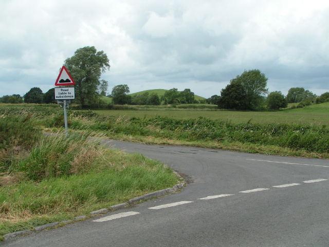
Harter's Hill, located in Somerset, England, is a prominent geographical feature that stands at an elevation of approximately 329 meters (1,079 feet) above sea level. Belonging to the Mendip Hills range, it is classified as both a hill and a mountain depending on the criteria used. The hill is situated near the village of East Harptree and is easily accessible from the A368 road.

Harter's Hill is known for its picturesque surroundings and panoramic views of the surrounding countryside. The summit offers breathtaking vistas of the Chew Valley Lake, Blagdon Lake, and the surrounding Somerset Levels. On a clear day, it is even possible to catch a glimpse of the distant Welsh mountains.

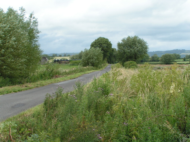
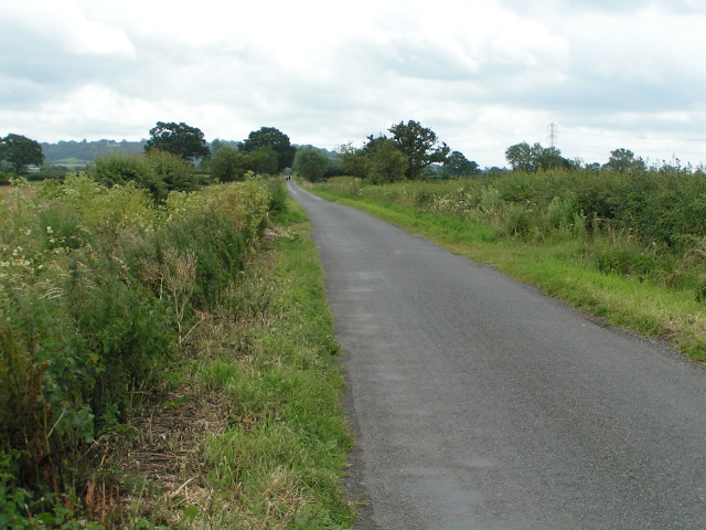
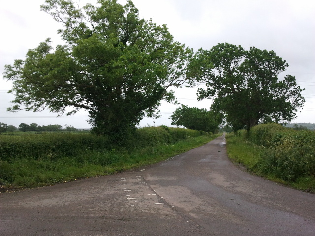
The hill is covered in lush vegetation, with patches of woodlands and open grassy areas. It is home to a diverse range of flora and fauna, including wildflowers, grasses, and various species of birds. Hikers and nature enthusiasts frequent Harter's Hill to enjoy its natural beauty and explore its numerous walking trails.

For those seeking outdoor activities, the hill provides ample opportunities for recreational pursuits such as hiking, hillwalking, and birdwatching. The surrounding area also offers other attractions, including the nearby East Harptree Woods, which are known for their ancient trees and rich biodiversity.

In conclusion, Harter's Hill is a captivating natural landmark in Somerset, offering stunning views, diverse wildlife, and a range of outdoor activities. Its combination of scenic beauty, accessibility, and ecological significance makes it a popular destination for locals and visitors alike.

If you have any feedback on the listing, please let us know in the comments section below.

Harter's Hill Images

Images are sourced within 2km of 51.182479/-2.6611063 or Grid Reference ST5342. Thanks to Geograph Open Source API. All images are credited.

Lane and warning sign
Wild flowers and trees in the wind
Walkers in the distance
Here be giants ...! At the western end of Coxley, the bull, statue of "The Thinker" and the horse advertise an architectural reclamation yard to the north of the filling station
Here be giants ...!
At the western end of Coxley, the bull, statue of "The Thinker" and the horse advertise an architectural reclamation yard to the north of the filling station
The Pound Inn, Coxley
Footpath near Woodford Bridge The kissing gate leads to a fence; the footpath leads beside the field of maize
Footpath near Woodford Bridge
The kissing gate leads to a fence; the footpath leads beside the field of maize
Maize field and solitary tree near Woodford Bridge
Land for sale, on Queen's Sedge Moor, on the south side of Long Drove
Lane junction near Barrow Farm
A39, Wells Road, Coxley The A39 is one of the longest routes in South West England. It stretches from Bath in Somerset to Falmouth in Cornwall passing some famous historical places including Wells and Glastonbury and touring along the Somerset, Devon and Cornish Coasts, before skirting to the north of Bodmin Moor and crossing the county to the historic port of Falmouth on the southern shore. The section running between the North Devon Link Road at Barnstaple in Devon and the A30 at Fraddon in Cornwall is known as the Atlantic Highway, and was classified as a trunk road until 2002.
A39, Wells Road, Coxley
The A39 is one of the longest routes in South West England. It stretches from Bath in Somerset to Falmouth in Cornwall passing some famous historical places including Wells and Glastonbury and touring along the Somerset, Devon and Cornish Coasts, before skirting to the north of Bodmin Moor and crossing the county to the historic port of Falmouth on the southern shore. The section running between the North Devon Link Road at Barnstaple in Devon and the A30 at Fraddon in Cornwall is known as the Atlantic Highway, and was classified as a trunk road until 2002.
Coxley, Main Road (A39) and Christ Church Christ Church at Coxley is a Commissioners' Church <span class="nowrap"><a title="http://en.wikipedia.org/wiki/Commissioners%27_church" rel="nofollow ugc noopener" href="http://en.wikipedia.org/wiki/Commissioners%27_church">Link</a><img style="margin-left:2px;" alt="External link" title="External link - shift click to open in new window" src="https://s1.geograph.org.uk/img/external.png" width="10" height="10"/></span>  built 1838-9 in the Gothic Revival style. It is a Grade II listed building (English Heritage ID:268127 <span class="nowrap"><a title="http://www.britishlistedbuildings.co.uk/en-268127-christ-church-st-cuthbert-out-somerset" rel="nofollow ugc noopener" href="http://www.britishlistedbuildings.co.uk/en-268127-christ-church-st-cuthbert-out-somerset">Link</a><img style="margin-left:2px;" alt="External link" title="External link - shift click to open in new window" src="https://s1.geograph.org.uk/img/external.png" width="10" height="10"/></span>  British Listed Buildings)
Coxley, Main Road (A39) and Christ Church
Christ Church at Coxley is a Commissioners' Church LinkExternal link built 1838-9 in the Gothic Revival style. It is a Grade II listed building (English Heritage ID:268127 LinkExternal link British Listed Buildings)
Christ Church, Coxley Christ Church at Coxley is a Commissioners' Church <span class="nowrap"><a title="http://en.wikipedia.org/wiki/Commissioners%27_church" rel="nofollow ugc noopener" href="http://en.wikipedia.org/wiki/Commissioners%27_church">Link</a><img style="margin-left:2px;" alt="External link" title="External link - shift click to open in new window" src="https://s1.geograph.org.uk/img/external.png" width="10" height="10"/></span>  built 1838-9 in the Gothic Revival style. It is a Grade II listed building (English Heritage ID:268127 <span class="nowrap"><a title="http://www.britishlistedbuildings.co.uk/en-268127-christ-church-st-cuthbert-out-somerset" rel="nofollow ugc noopener" href="http://www.britishlistedbuildings.co.uk/en-268127-christ-church-st-cuthbert-out-somerset">Link</a><img style="margin-left:2px;" alt="External link" title="External link - shift click to open in new window" src="https://s1.geograph.org.uk/img/external.png" width="10" height="10"/></span>  British Listed Buildings)
Christ Church, Coxley
Christ Church at Coxley is a Commissioners' Church LinkExternal link built 1838-9 in the Gothic Revival style. It is a Grade II listed building (English Heritage ID:268127 LinkExternal link British Listed Buildings)
Coxley Main Road (A39) The A39 is one of the longest routes in South West England. It stretches from Bath in Somerset to Falmouth in Cornwall passing some famous historical places including Wells and Glastonbury and touring along the Somerset, Devon and Cornish Coasts, before skirting to the north of Bodmin Moor and crossing the county to the historic port of Falmouth on the southern shore. The section running between the North Devon Link Road at Barnstaple in Devon and the A30 at Fraddon in Cornwall is known as the Atlantic Highway, and was classified as a trunk road until 2002.
Coxley Main Road (A39)
The A39 is one of the longest routes in South West England. It stretches from Bath in Somerset to Falmouth in Cornwall passing some famous historical places including Wells and Glastonbury and touring along the Somerset, Devon and Cornish Coasts, before skirting to the north of Bodmin Moor and crossing the county to the historic port of Falmouth on the southern shore. The section running between the North Devon Link Road at Barnstaple in Devon and the A30 at Fraddon in Cornwall is known as the Atlantic Highway, and was classified as a trunk road until 2002.
Coxley Main Road, The Pound Inn The A39 is one of the longest routes in South West England. It stretches from Bath in Somerset to Falmouth in Cornwall passing some famous historical places including Wells and Glastonbury and touring along the Somerset, Devon and Cornish Coasts, before skirting to the north of Bodmin Moor and crossing the county to the historic port of Falmouth on the southern shore. The section running between the North Devon Link Road at Barnstaple in Devon and the A30 at Fraddon in Cornwall is known as the Atlantic Highway, and was classified as a trunk road until 2002.
Coxley Main Road, The Pound Inn
The A39 is one of the longest routes in South West England. It stretches from Bath in Somerset to Falmouth in Cornwall passing some famous historical places including Wells and Glastonbury and touring along the Somerset, Devon and Cornish Coasts, before skirting to the north of Bodmin Moor and crossing the county to the historic port of Falmouth on the southern shore. The section running between the North Devon Link Road at Barnstaple in Devon and the A30 at Fraddon in Cornwall is known as the Atlantic Highway, and was classified as a trunk road until 2002.
A39, Glastonbury Road The A39 is one of the longest routes in South West England. It stretches from Bath in Somerset to Falmouth in Cornwall passing some famous historical places including Wells and Glastonbury and touring along the Somerset, Devon and Cornish Coasts, before skirting to the north of Bodmin Moor and crossing the county to the historic port of Falmouth on the southern shore. The section running between the North Devon Link Road at Barnstaple in Devon and the A30 at Fraddon in Cornwall is known as the Atlantic Highway, and was classified as a trunk road until 2002.
A39, Glastonbury Road
The A39 is one of the longest routes in South West England. It stretches from Bath in Somerset to Falmouth in Cornwall passing some famous historical places including Wells and Glastonbury and touring along the Somerset, Devon and Cornish Coasts, before skirting to the north of Bodmin Moor and crossing the county to the historic port of Falmouth on the southern shore. The section running between the North Devon Link Road at Barnstaple in Devon and the A30 at Fraddon in Cornwall is known as the Atlantic Highway, and was classified as a trunk road until 2002.
Glastonbury Road (A39) approaching Wells The A39 is one of the longest routes in South West England. It stretches from Bath in Somerset to Falmouth in Cornwall passing some famous historical places including Wells and Glastonbury and touring along the Somerset, Devon and Cornish Coasts, before skirting to the north of Bodmin Moor and crossing the county to the historic port of Falmouth on the southern shore. The section running between the North Devon Link Road at Barnstaple in Devon and the A30 at Fraddon in Cornwall is known as the Atlantic Highway, and was classified as a trunk road until 2002.
Glastonbury Road (A39) approaching Wells
The A39 is one of the longest routes in South West England. It stretches from Bath in Somerset to Falmouth in Cornwall passing some famous historical places including Wells and Glastonbury and touring along the Somerset, Devon and Cornish Coasts, before skirting to the north of Bodmin Moor and crossing the county to the historic port of Falmouth on the southern shore. The section running between the North Devon Link Road at Barnstaple in Devon and the A30 at Fraddon in Cornwall is known as the Atlantic Highway, and was classified as a trunk road until 2002.
The Pound Inn, Coxley
Gate out of Beech Covert Taking the Monarch's Way down the north slope of Worminster Down
Gate out of Beech Covert
Taking the Monarch's Way down the north slope of Worminster Down
Show me another place!

Harter's Hill is located at Grid Ref: ST5342 (Lat: 51.182479, Lng: -2.6611063)

Administrative County: Somerset

District: Mendip

Police Authority: Avon and Somerset

What 3 Words

///value.chiefs.overheat. Near Wells, Somerset

Nearby Locations

Pill Moor Harter's Hill

Related Wikis

Christ Church, Coxley

Christ Church is a Church of England church in Coxley, Somerset, England. It was built in 1839–40 to the designs of Richard Carver and is a Grade II listed...

Twinhills Woods and Meadows

Twinhills Woods and Meadows (grid reference ST558432) is a 21.2 hectare (52.4 acre) biological Site of Special Scientific Interest on the Monarch's Way...

Wells East Somerset railway station

Wells station in the Somerset city of Wells was the terminus of the East Somerset Railway line from Witham and opened when the line was extended from Shepton...

Polsham railway station

Polsham was a railway station on the Somerset and Dorset Railway in the village of Polsham, Somerset in England. Opening in December 1861 on the Somerset...

Rowdens Road Cricket Ground, Wells

Rowdens Road is a former first-class cricket ground located in Wells, Somerset. The ground was an early home to Wells Cricket Club, though the club no...

Wells City F.C.

Wells City F.C. are a football club based in Wells, Somerset, England. The club is affiliated to the Somerset County FA. They are currently members of...

St Cuthbert Out

St Cuthbert Out, sometimes Wells St Cuthbert Out, is a civil parish in the Mendip district of Somerset, England. It entirely surrounds (but does not include...

Wells (Priory Road) railway station

Wells (Priory Road) was a railway station on the Somerset and Dorset Joint Railway at Wells in the county of Somerset in England. Opening on 15 March 1859...

Have you been to Harter's Hill?

Leave your review of Harter's Hill below (or comments, questions and feedback).