Bleak Hill

Hill, Mountain in Westmorland Eden

England

Bleak Hill

Wet Sleddale View across Wet Sleddale Reservoir seen from the south end of the dam.
Wet Sleddale Credit: Peter McDermott

Bleak Hill is a prominent hill located in the county of Westmorland, England. Part of the picturesque Lake District National Park, it stands at an elevation of approximately 500 meters (1,640 feet) above sea level. The hill is situated in the southern part of the national park, near the village of Shap.

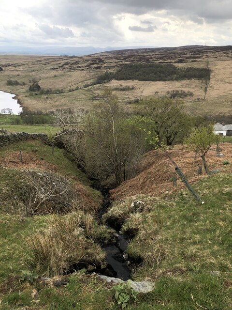
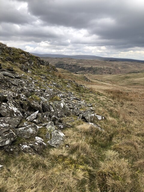
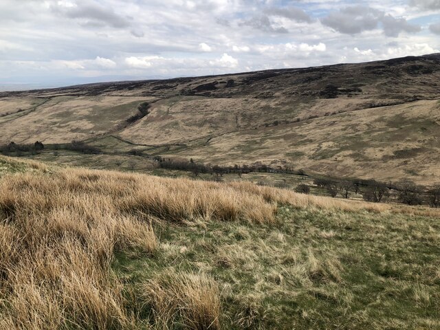
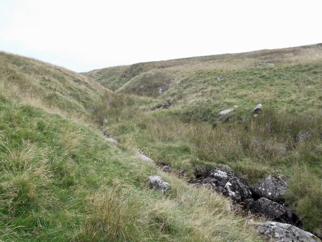
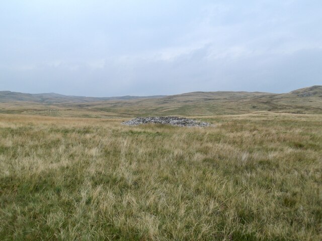
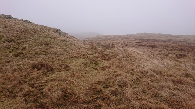
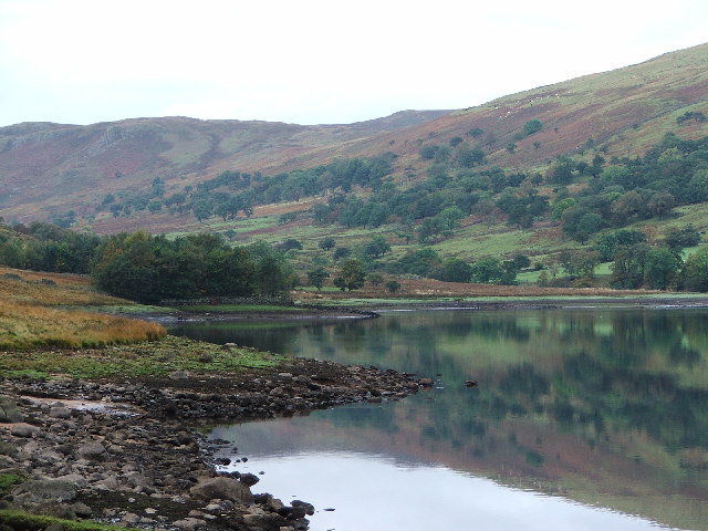
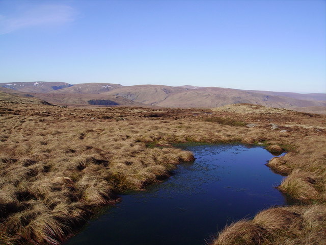
Bleak Hill is characterized by its rugged and rocky terrain, covered in a blanket of heather and grasses. The hill offers breathtaking panoramic views of the surrounding countryside, including the rolling hills, valleys, and nearby lakes. On clear days, it is possible to see as far as the Pennines and the Irish Sea.

The hill is a popular destination for hikers and outdoor enthusiasts due to its challenging yet rewarding trails. One of the most popular routes to the summit is from the village of Shap, taking hikers across open moorland and through picturesque woodlands. The hike provides an opportunity to spot local wildlife, such as red deer, birds of prey, and various species of butterflies.

Bleak Hill holds historical significance as well. It is believed to have been an ancient burial ground, with several burial cairns and standing stones scattered across its slopes. These remnants of the past add an aura of mystery and intrigue to the hill.

Overall, Bleak Hill offers visitors a chance to immerse themselves in the natural beauty of the Lake District while experiencing the history and tranquility that the area has to offer.

If you have any feedback on the listing, please let us know in the comments section below.

Bleak Hill Images

Images are sourced within 2km of 54.502414/-2.7230007 or Grid Reference NY5312. Thanks to Geograph Open Source API. All images are credited.

Wet Sleddale View across Wet Sleddale Reservoir seen from the south end of the dam.
Wet Sleddale
View across Wet Sleddale Reservoir seen from the south end of the dam.
Sleddale Beck View of Sleddale Beck from stepping stones upstream of the reservoir. The beck is dammed to form Wet Sleddale Reservoir, and upon exiting the reservoir the beck earns promotion to the River Lowther.
Sleddale Beck
View of Sleddale Beck from stepping stones upstream of the reservoir. The beck is dammed to form Wet Sleddale Reservoir, and upon exiting the reservoir the beck earns promotion to the River Lowther.
Narrow Gill near Sleddale Hall Unnamed stream running down to Sleddale Beck in a narrow gill.
Narrow Gill near Sleddale Hall
Unnamed stream running down to Sleddale Beck in a narrow gill.
Cairns on the summit of Seat Robert
Outcrops below Glede Howe
Gouthercrag Gill
Gouthercrag Gill
Bridleway to Sleddale Bridleway on rough farm track above Sleddale Beck, between Mosedale and Sleddale Hall.
Bridleway to Sleddale
Bridleway on rough farm track above Sleddale Beck, between Mosedale and Sleddale Hall.
View across Upper Sleddale
Wall corner, Stackhouse Brow
Peathill Gill
Peathill Gill
New stile at the head of Mirk Gill The gill is fenced off to discourage sheep from getting into the narrow gorge a little further down
New stile at the head of Mirk Gill
The gill is fenced off to discourage sheep from getting into the narrow gorge a little further down
An old cairn, Ralfland Forest
Track from Mosedale Cottage to Shap Recent OS maps confidently show a track heading across the moorland between Wet Sleddale and Swindale. It's more of a quad bike track, and needs to be followed carefully especially on a misty day like this one.
Track from Mosedale Cottage to Shap
Recent OS maps confidently show a track heading across the moorland between Wet Sleddale and Swindale. It's more of a quad bike track, and needs to be followed carefully especially on a misty day like this one.
Moorland below Seat Robert The right of way from Truss Gap to Wet Sleddale roughly follows the mid-distance skyline.
Moorland below Seat Robert
The right of way from Truss Gap to Wet Sleddale roughly follows the mid-distance skyline.
Looking towards Great Ladstones The 'track' shown on recent OS maps is visible here - it's a spongy thing, probably from farm quad-bike use, but perfectly practical to follow on foot.
Looking towards Great Ladstones
The 'track' shown on recent OS maps is visible here - it's a spongy thing, probably from farm quad-bike use, but perfectly practical to follow on foot.
Wet Sleddale reservoir and fells beyond
Gouther crag
Gouther crag
Swindale Looking towards High Katelade and Langhowe Pike from the road. Dog Rose in flower in the hedge.
Swindale
Looking towards High Katelade and Langhowe Pike from the road. Dog Rose in flower in the hedge.
Show me another place!

Bleak Hill is located at Grid Ref: NY5312 (Lat: 54.502414, Lng: -2.7230007)

Administrative County: Cumbria

District: Eden

Police Authority: Cumbria

What 3 Words

///puddles.obstruct.departure. Near Shap, Cumbria

Nearby Locations

Bleak Hill Great Ladstones

Related Wikis

Shap Rural

Shap Rural is a very large, but sparsely populated, civil parish in the Eden district of Cumbria in England, covering part of the Lake District National...
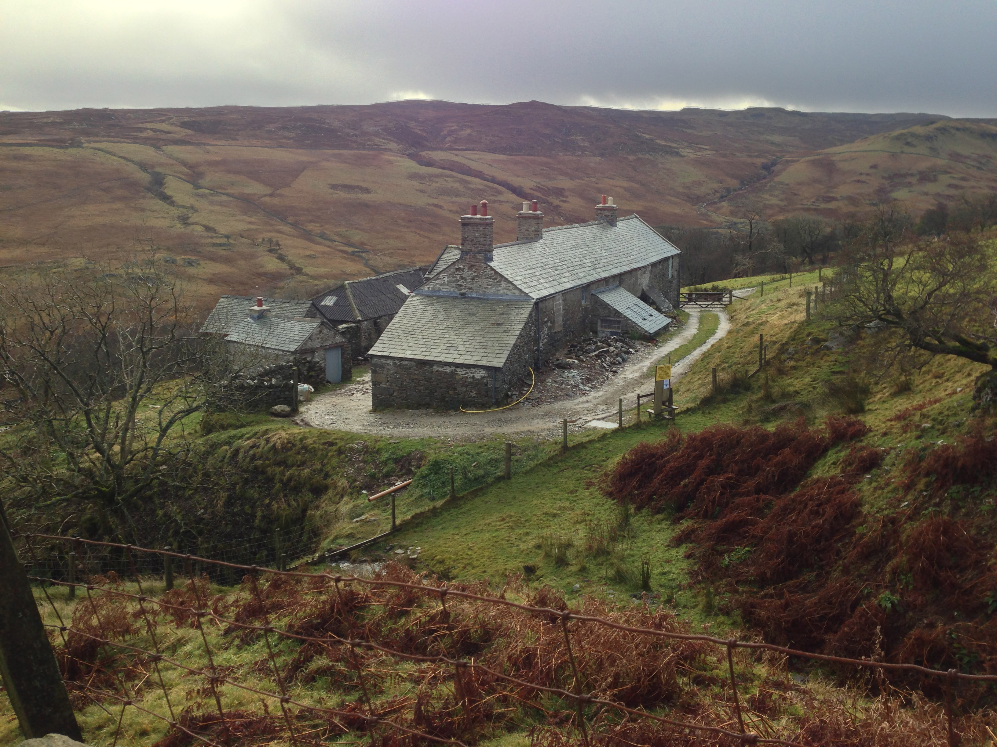
Sleddale Hall

Sleddale Hall is a farmhouse on the north side of the Wet Sleddale valley near Shap in Cumbria, England. It featured as "Crow Crag", Uncle Monty's Lake...

Seat Robert

Seat Robert is a hill in the east of the English Lake District, south west of Shap, Cumbria. It is the subject of a chapter of Wainwright's book The Outlying...

Swindale Beck

Swindale Beck is a stream in Cumbria, England. It is formed at Swindale Head where Mosedale Beck, from the slopes of Tarn Crag, joins Hobgrumble Beck from...

Wet Sleddale Reservoir

Wet Sleddale Reservoir is an artificial reservoir set amongst the Shap Fells 4 kilometres (2 mi) south of the village of Shap in Cumbria, England, and...

Wet Sleddale Horseshoe

The Wet Sleddale Horseshoe is an upland area in the English Lake District, around the Wet Sleddale Reservoir, Cumbria. It is the subject of a chapter of...

Mosedale Beck (Swindale)

Mosedale Beck is a stream in Cumbria, England, which runs between Tarn Crag and Branstree, flowing north to join Swindale Beck at Swindale Head; Swindale...

Keld, Cumbria

Keld (or Keilde) is a hamlet in the English county of Cumbria. It lies within the civil parish of Shap. On the banks of the River Lowther it is a mile...

Nearby Amenities

Located within 500m of 54.502414,-2.7230007
Great Ladstones
Ele: 440
Natural: peak
Lat/Long: 54.504656/-2.7242337
Bleak Hill
Ele: 438
Natural: peak
Lat/Long: 54.5037711/-2.722676
Goose Crag
Place: locality
Lat/Long: 54.499264/-2.7225892
Gambling Crag
Natural: peak
Lat/Long: 54.4982439/-2.7243084
Man Made: cairn
Lat/Long: 54.5047135/-2.7241818
Man Made: cairn
Lat/Long: 54.5002798/-2.7290676
Ford: yes
Lat/Long: 54.4988222/-2.7197902
Willy Fold
Place: locality
Lat/Long: 54.5000113/-2.7173386
Ford: yes
Lat/Long: 54.5037402/-2.7278508
The data included in this document is from www.openstreetmap.org. The data is made available under ODbL.

Have you been to Bleak Hill?

Leave your review of Bleak Hill below (or comments, questions and feedback).