Blackwood Hill

Hill, Mountain in Roxburghshire

Scotland

Blackwood Hill

Benchmark Covered with Moss Old benchmark on the gable of Leysburnfoot.
Photo taken on the 16th January, 2022.
Benchmark Covered with Moss Credit: Rab McMurdo

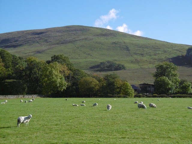
Blackwood Hill is a prominent hill located in the county of Roxburghshire in the Scottish Borders region of Scotland. With an elevation of approximately 525 meters (1,722 feet), it offers breathtaking views of the surrounding countryside.

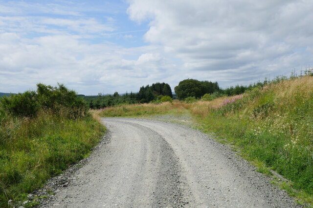
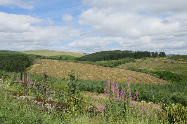
Situated near the village of Roberton, Blackwood Hill is part of a range of hills known as the Moorfoot Hills. It is a popular destination for hikers and outdoor enthusiasts due to its accessibility and stunning natural beauty. The hill is covered in heather and grass, creating a picturesque landscape that changes color with the seasons.

The summit of Blackwood Hill provides panoramic vistas of the rolling hills and valleys of Roxburghshire. On a clear day, it is possible to see as far as the Cheviot Hills and the Northumberland National Park. The hill also offers an excellent vantage point to observe local wildlife, including birds of prey such as buzzards and kestrels.

There are several walking routes that lead to the summit of Blackwood Hill, ranging from easy to moderate difficulty. The paths are well-maintained, and signposts provide clear directions for visitors. The hill is accessible year-round, but caution should be exercised during inclement weather conditions.

Overall, Blackwood Hill is a stunning natural landmark in Roxburghshire, offering visitors the opportunity to immerse themselves in the beauty of the Scottish Borders and enjoy the tranquility of the countryside.

If you have any feedback on the listing, please let us know in the comments section below.

Blackwood Hill Images

Images are sourced within 2km of 55.257571/-2.7383989 or Grid Reference NY5396. Thanks to Geograph Open Source API. All images are credited.

Benchmark Covered with Moss Old benchmark on the gable of Leysburnfoot.
Photo taken on the 16th January, 2022.
Benchmark Covered with Moss
Old benchmark on the gable of Leysburnfoot. Photo taken on the 16th January, 2022.
A logging track meets the trackbed of the former Waverley Route This image is taken with an aspect looking back along the former Waverley Route; a logging track from the nearby minor road joins from the left.

This photograph was taken during the Coronavirus (COVID-19) pandemic of 2020/21/22.
A logging track meets the trackbed of the former Waverley Route
This image is taken with an aspect looking back along the former Waverley Route; a logging track from the nearby minor road joins from the left. This photograph was taken during the Coronavirus (COVID-19) pandemic of 2020/21/22.
Leysburnfoot Alternatively known as 'Will's Bothy', this site is under the care of the Mountain Bothies Association - refer to <span class="nowrap"><a title="https://www.mountainbothies.org.uk/bothies/southern-scotland/leysburnfoot-wills-bothy/" rel="nofollow ugc noopener" href="https://www.mountainbothies.org.uk/bothies/southern-scotland/leysburnfoot-wills-bothy/">Link</a><img style="margin-left:2px;" alt="External link" title="External link - shift click to open in new window" src="https://s1.geograph.org.uk/img/external.png" width="10" height="10"/></span>  The building is captured here partially illuminated by strong sunshine no longer obscured by a passing cloud.

This photograph was taken during the Coronavirus (COVID-19) pandemic of 2020/21/22.
Leysburnfoot
Alternatively known as 'Will's Bothy', this site is under the care of the Mountain Bothies Association - refer to LinkExternal link The building is captured here partially illuminated by strong sunshine no longer obscured by a passing cloud. This photograph was taken during the Coronavirus (COVID-19) pandemic of 2020/21/22.
A view to Catscleuch Culvert Catscleuch Culvert can clearly be seen in the middle of this image, just below the mature conifer plantation.  Catscleuch Culvert is a major feature on the former Border Counties Railway just south of Riccarton Junction whilst the photograph is taken standing above a cattle creep on the former Waverley Route.

This photograph was taken during the Coronavirus (COVID-19) pandemic of 2020/21/22.
A view to Catscleuch Culvert
Catscleuch Culvert can clearly be seen in the middle of this image, just below the mature conifer plantation. Catscleuch Culvert is a major feature on the former Border Counties Railway just south of Riccarton Junction whilst the photograph is taken standing above a cattle creep on the former Waverley Route. This photograph was taken during the Coronavirus (COVID-19) pandemic of 2020/21/22.
Signpost at Riccarton Junction At the point where the Border Counties Railway met the Waverley Line, indicating Whitrope Siding 2.5mi, Hawick 15mi and Kielder 15mi.
Signpost at Riccarton Junction
At the point where the Border Counties Railway met the Waverley Line, indicating Whitrope Siding 2.5mi, Hawick 15mi and Kielder 15mi.
Riccarton Junction former track routes To the left is the Waverley Line coming in from Whitrope, R of centre is the forest road from the B6399 and to the right the Border Counties Line arriving from Hexham. The renovated schoolmaster's house is in view.
Riccarton Junction former track routes
To the left is the Waverley Line coming in from Whitrope, R of centre is the forest road from the B6399 and to the right the Border Counties Line arriving from Hexham. The renovated schoolmaster's house is in view.
Waverley Line south from Riccarton Junction Looking along the Waverley Line on its way south to Newcastleton and Carlisle.
Waverley Line south from Riccarton Junction
Looking along the Waverley Line on its way south to Newcastleton and Carlisle.
Milepost and trackside bin, Riccarton Junction Edinburgh 66 miles, just outside Riccarton Junction.
Milepost and trackside bin, Riccarton Junction
Edinburgh 66 miles, just outside Riccarton Junction.
Border Counties Railway near Riccarton Junction Looking across from the Waverley Line to the former route from Hexham.
Border Counties Railway near Riccarton Junction
Looking across from the Waverley Line to the former route from Hexham.
Former bridge abutment, Riccarton Junction On the Waverley Line a short distance south of the junction. See also <a href="https://www.geograph.org.uk/photo/4148966">NY5397 : 206</a> by James Towill (2014).
Former bridge abutment, Riccarton Junction
On the Waverley Line a short distance south of the junction. See also NY5397 : 206 by James Towill (2014).
Riccarton Hope A valley on the east side of Blackwood Hill, seen from the former Waverley Line.
Riccarton Hope
A valley on the east side of Blackwood Hill, seen from the former Waverley Line.
Waverley Line below Blackwood Hill The former line heading south down to Newcastleton.
Waverley Line below Blackwood Hill
The former line heading south down to Newcastleton.
Remains of platform, Riccarton Junction Once an important stop on the Edinburgh - Carlisle line, now overgrown with grass and shrubs.
Remains of platform, Riccarton Junction
Once an important stop on the Edinburgh - Carlisle line, now overgrown with grass and shrubs.
Generator building, Riccarton Junction A partly restored building alongside the platforms.
Generator building, Riccarton Junction
A partly restored building alongside the platforms.
Sign and station master's house, Riccarton Junction The house has fallen into ruin but the station sign is clear enough.
Sign and station master's house, Riccarton Junction
The house has fallen into ruin but the station sign is clear enough.
Timber stacks by the Waverley Line Some large logs awaiting transport near Riccarton Junction.
Timber stacks by the Waverley Line
Some large logs awaiting transport near Riccarton Junction.
Arnton Fell The southern end of Arnton Fell/Blackwood Hill.
Arnton Fell
The southern end of Arnton Fell/Blackwood Hill.
An Oxeye Daisy At Riccarton Junction Much of the route to Riccarton Junction, as well as the former junction site, features an array of Oxeye Daisies.
An Oxeye Daisy At Riccarton Junction
Much of the route to Riccarton Junction, as well as the former junction site, features an array of Oxeye Daisies.
Show me another place!

Blackwood Hill is located at Grid Ref: NY5396 (Lat: 55.257571, Lng: -2.7383989)

Unitary Authority: The Scottish Borders

Police Authority: The Lothians and Scottish Borders

What 3 Words

///stilted.wharfs.saloons. Near Teviothead, Scottish Borders

Related Wikis

Riccarton Junction railway station

Riccarton Junction, in the county of Roxburghshire in the Scottish Borders, was a railway village and station. In its heyday it had 118 residents and its...

Ninestane Rig

Ninestane Rig (English: Nine Stone Ridge) is a small stone circle in Scotland near the English border. Located in Roxburghshire, near to Hermitage Castle...

Hermitage Water

The Hermitage Water is a river in Liddesdale, in the Scottish Borders area of Scotland. Among its many feeder burns are Braidley Burn, Dinley Burn, Gorrenberry...

Hermitage, Scottish Borders

Hermitage is a village near Newcastleton, on the B6399, in the Scottish Borders area of Scotland. == See also == List of places in the Scottish Borders...

Steele Road railway station

Steele Road railway station served the hamlet of Steele Road, Scottish Borders, Scotland, from 1862 to 1969 on the Border Union Railway. == History... ==

Hermitage Castle

Hermitage Castle is a semi-ruined castle in the border region of Scotland. It is under the care of Historic Scotland. The castle has a reputation, both...

Saughtree

Saughtree is a hamlet in the Scottish Borders at the junction of the B6357 and an unnamed road from Kielder village in Northumberland, England. It is at...

Saughtree railway station

Saughtree railway station is a closed railway station situated a mile north of the hamlet of Saughtree and two miles from the border with England. ��2...

Have you been to Blackwood Hill?

Leave your review of Blackwood Hill below (or comments, questions and feedback).