Black Hill

Hill, Mountain in Aberdeenshire

Scotland

Black Hill

Trees with ruined wall on heather moorland South-west of the Marilyn, Lord Arthur's Hill a finger of forest reaches towards a col; photographed on a dismal October day!
Trees with ruined wall on heather moorland Credit: Trevor Littlewood

Black Hill is a prominent hill located in Aberdeenshire, Scotland. Situated approximately 5 miles south of the town of Stonehaven, it stands at an elevation of 500 meters (1,640 feet) above sea level. The hill is part of the Grampian Mountains range, which stretches across the central and eastern regions of Scotland.

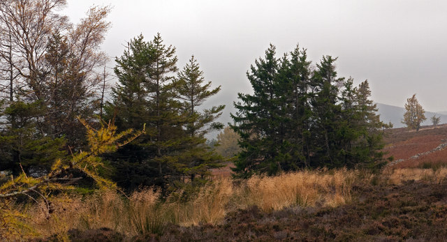
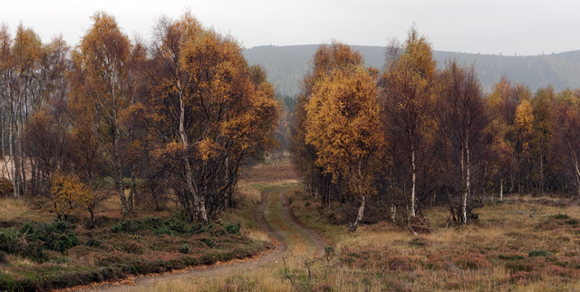
Black Hill is easily recognizable due to its distinctive shape, featuring a steep and rugged slope covered in heather and grass. The hill offers breathtaking panoramic views of the surrounding countryside, including the nearby North Sea coastline and the town of Stonehaven.

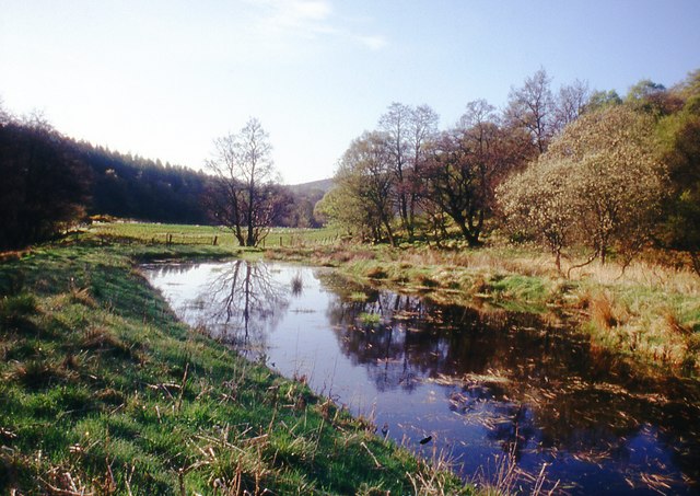
The area surrounding Black Hill is rich in wildlife, with a diverse range of flora and fauna. The heather-covered slopes attract a variety of bird species, including buzzards and kestrels, while red deer and mountain hares can often be spotted roaming the hillside. The hill also boasts a variety of plant life, such as blaeberry bushes and cotton grass, adding to its natural beauty.

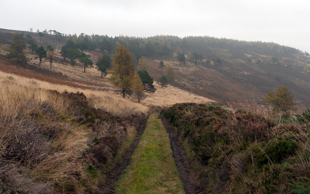
Hiking and walking enthusiasts are drawn to Black Hill for its challenging yet rewarding trails. Several paths lead to the summit, offering different levels of difficulty for outdoor enthusiasts of all abilities. The ascent can be steep in certain sections, but the stunning views at the top make it well worth the effort.

Overall, Black Hill is a picturesque and rugged hill in Aberdeenshire, offering visitors a chance to immerse themselves in Scotland's natural beauty and enjoy breathtaking views of the surrounding landscape.

If you have any feedback on the listing, please let us know in the comments section below.

Black Hill Images

Images are sourced within 2km of 57.263972/-2.7930125 or Grid Reference NJ5219. Thanks to Geograph Open Source API. All images are credited.

Trees with ruined wall on heather moorland South-west of the Marilyn, Lord Arthur's Hill a finger of forest reaches towards a col; photographed on a dismal October day!
Trees with ruined wall on heather moorland
South-west of the Marilyn, Lord Arthur's Hill a finger of forest reaches towards a col; photographed on a dismal October day!
Estate road descending from Lord Arthur's Hill A number of access roads exist on Lord Arthur's Hill; this one is on the south side; the view is eastwards towards Black Hill.
Estate road descending from Lord Arthur's Hill
A number of access roads exist on Lord Arthur's Hill; this one is on the south side; the view is eastwards towards Black Hill.
Estate and farm road approaching group of birch trees The road is on the south side of Lord Arthur's Hill and north of the valley of the River Don. The hills seen dimly in the distance are on the south side of the Don valley.
Estate and farm road approaching group of birch trees
The road is on the south side of Lord Arthur's Hill and north of the valley of the River Don. The hills seen dimly in the distance are on the south side of the Don valley.
Scattered larch on Lord Arthur's Hill
Pond by the River Don
Track walk on Black Hill
Cort Burn The course of the Cort Burn is indicated by the trees lining the banks of the glacial meltwater channel it occupies. In the foreground is the Esset Burn, which the Cort Burn joined a couple of hundred metres upstream from here. On the distant skyline, just left of the highest point, are some of the spoil heaps at Correen Quarry.
Cort Burn
The course of the Cort Burn is indicated by the trees lining the banks of the glacial meltwater channel it occupies. In the foreground is the Esset Burn, which the Cort Burn joined a couple of hundred metres upstream from here. On the distant skyline, just left of the highest point, are some of the spoil heaps at Correen Quarry.
Hillock of Terpersie A clump of trees in a field like this almost always indicates the site of a farm or croft, and this clump is no exception. Hillock of Terpersie is still shown on the maps, although it has been abandoned.
Hillock of Terpersie
A clump of trees in a field like this almost always indicates the site of a farm or croft, and this clump is no exception. Hillock of Terpersie is still shown on the maps, although it has been abandoned.
Cort Burn The burn is invisible among the vegetation as it meanders across the floor of a glacial meltwater channel.
Cort Burn
The burn is invisible among the vegetation as it meanders across the floor of a glacial meltwater channel.
Esset Burn The Esset Burn is formed from the Whitestone and Blacklatch Burns, but is obviously not big enough to have formed this glen, which must be a glacial channel which has silted up and dried out.
Esset Burn
The Esset Burn is formed from the Whitestone and Blacklatch Burns, but is obviously not big enough to have formed this glen, which must be a glacial channel which has silted up and dried out.
First Ford This ford across the splendidly named Auld Fouchie Burn was easily bypassed on a rather precarious pair of planks. We could have jumped across, in fact.
First Ford
This ford across the splendidly named Auld Fouchie Burn was easily bypassed on a rather precarious pair of planks. We could have jumped across, in fact.
Fouchie Shank The track splits here. This one goes straight up the right of Fouchie Shank and leads to a further network of paths.
Fouchie Shank
The track splits here. This one goes straight up the right of Fouchie Shank and leads to a further network of paths.
Second Ford This ford, across the Esset Burn, was an altogether greater challenge than the previous one, which had lulled us into a false sense of security! My companions went some distance upstream looking for a spot narrow enough to step across. I took off my boots and socks and paddled across barefoot, and a very pleasant paddle it was. I had dried my feet and put my socks and boots back on before the others came back after a slightly hazardous crossing further upstream.
Second Ford
This ford, across the Esset Burn, was an altogether greater challenge than the previous one, which had lulled us into a false sense of security! My companions went some distance upstream looking for a spot narrow enough to step across. I took off my boots and socks and paddled across barefoot, and a very pleasant paddle it was. I had dried my feet and put my socks and boots back on before the others came back after a slightly hazardous crossing further upstream.
Fouchie Shank Looking across the glen of the Esset Burn to Fouchie Shank. The path goes up the nearer ridge to the clump of trees on the top.
Fouchie Shank
Looking across the glen of the Esset Burn to Fouchie Shank. The path goes up the nearer ridge to the clump of trees on the top.
Hillock of Terpersie The ruins of Hillock of Terpersie are revealed as one climbs on the path west of the Cort Burn. Drumbarton Hill is on the skyline.
Hillock of Terpersie
The ruins of Hillock of Terpersie are revealed as one climbs on the path west of the Cort Burn. Drumbarton Hill is on the skyline.
Correen Hills A 'panoramic' view taking in Correen Quarry on the summit of the hill on the left, the track leading to it, the forest on Cot Craigs, and on the right the ruins of Hillock of Terpersie with Drumbarton Hill at extreme right.
Correen Hills
A 'panoramic' view taking in Correen Quarry on the summit of the hill on the left, the track leading to it, the forest on Cot Craigs, and on the right the ruins of Hillock of Terpersie with Drumbarton Hill at extreme right.
Correen Quarry Path This is the path to Correen Quarry, but although it's a recognised walk and a Heritage Path, you'd better have a map and be able to read it, because there are no waymarkers.
Correen Quarry Path
This is the path to Correen Quarry, but although it's a recognised walk and a Heritage Path, you'd better have a map and be able to read it, because there are no waymarkers.
Animal Droppings We think these must be deer droppings- they're certainly not sheep or rabbit. The interesting thing about them is that the animal has evidently been eating cowberries, but without chewing them or breaking the skin of the berries which have passed straight through undigested.
Animal Droppings
We think these must be deer droppings- they're certainly not sheep or rabbit. The interesting thing about them is that the animal has evidently been eating cowberries, but without chewing them or breaking the skin of the berries which have passed straight through undigested.
Show me another place!

Black Hill is located at Grid Ref: NJ5219 (Lat: 57.263972, Lng: -2.7930125)

Unitary Authority: Aberdeenshire

Police Authority: North East

What 3 Words

///harshest.replayed.stable. Near Alford, Aberdeenshire

Nearby Locations

Long Gutter Black Hill

Related Wikis

Terpersie Castle

Terpersie Castle (originally built as Dalpersie House) is a 16th-century tower house in Tullynessle, Aberdeenshire, Scotland, located 5 kilometres (3...

Tullynessle

Tullynessle is a hamlet in Aberdeenshire, Scotland, three miles NNW of Alford.The settlement contains the Category A listed Terpersie Castle, a privately...

Brux Castle

Brux Castle was a castle of the Forbeses, about 1.5 miles (2.4 km) east of Kildrummy, Aberdeenshire, Scotland, south of the river Don. The castle was...

Marr, Scotland

Marr (Scottish Gaelic: Màrr) is one of six committee areas in Aberdeenshire, Scotland. It has a population of 34,038 (2001 Census). Someone from Marr...

Have you been to Black Hill?

Leave your review of Black Hill below (or comments, questions and feedback).