Birch Hill

Hill, Mountain in Aberdeenshire

Scotland

Birch Hill

Minor road towards Rhynie
Minor road towards Rhynie Credit: Steven Brown

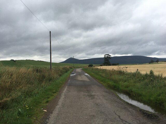
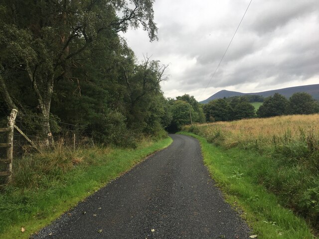
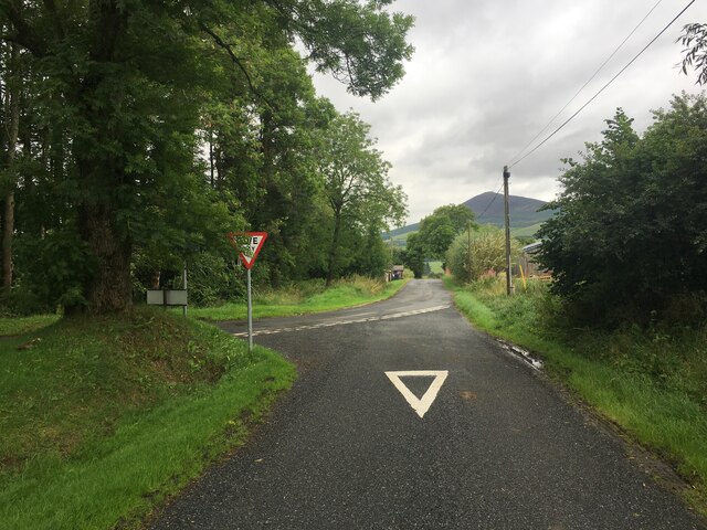
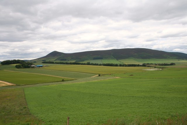
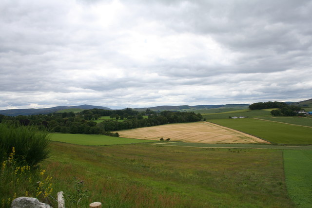
Birch Hill is a prominent hill located in the region of Aberdeenshire, Scotland. Standing at an elevation of approximately 1,053 feet (321 meters), it offers breathtaking panoramic views of the surrounding landscape. The hill is situated in a rural area, characterized by rolling green fields and scattered woodlands.

Birch Hill is easily accessible, with a well-marked trail leading to its summit. The path is suitable for both experienced hikers and casual walkers, making it a popular destination for outdoor enthusiasts of all levels. Along the way, visitors may encounter a diverse range of flora and fauna, including heather, gorse, and various bird species.

At the top of Birch Hill, on a clear day, visitors can enjoy stunning vistas of Aberdeenshire's picturesque countryside, as well as glimpses of nearby towns and villages. The hill's strategic location also provides a unique perspective of the surrounding mountains, offering an awe-inspiring view of the Scottish Highlands.

Nature lovers will appreciate the tranquility and serenity offered by Birch Hill, as it serves as a peaceful escape from the hustle and bustle of everyday life. The hill attracts visitors throughout the year, with each season bringing its own charm. In spring, the hillside bursts into a riot of colorful wildflowers, while autumn paints the landscape with hues of red, orange, and gold.

Birch Hill is not only a natural beauty but also a site of historical significance. Its slopes are dotted with remnants of ancient settlements and burial grounds, providing glimpses into the area's rich past. Overall, Birch Hill in Aberdeenshire is a must-visit destination for those seeking a blend of natural beauty, outdoor adventure, and historical intrigue.

If you have any feedback on the listing, please let us know in the comments section below.

Birch Hill Images

Images are sourced within 2km of 57.338281/-2.8014415 or Grid Reference NJ5127. Thanks to Geograph Open Source API. All images are credited.

Minor road towards Rhynie
Road junction near Rhynie
Kearn Fields Farmland by Bridge of Kearn with Tap o Noth taken from the Clatt Road by Gartnoch Hill.
Kearn Fields
Farmland by Bridge of Kearn with Tap o Noth taken from the Clatt Road by Gartnoch Hill.
Bridge of Kearn and Druminor Farmland by Bridge of Kearn and Druminor Woods.
Bridge of Kearn and Druminor
Farmland by Bridge of Kearn and Druminor Woods.
Tap o' Noth Looking WNW from a point on the A97 between Milton of Noth and Mill of Noth".
Tap o' Noth
Looking WNW from a point on the A97 between Milton of Noth and Mill of Noth".
Semi-detached bungalows On the Bogie Road out of Rhynie.
Semi-detached bungalows
On the Bogie Road out of Rhynie.
The A97 crosses the Ord Burn at Mill of Noth
The Gordon Arms, Rhynie Probably once a coaching inn, now a pub on the A97.
The Gordon Arms, Rhynie
Probably once a coaching inn, now a pub on the A97.
Corrstone Wood Recumbent Stone Circle (1) This was a large circle with a diameter of about 28 metres, and the recumbent setting faces towards Morven through a gap in the nearer hills. It is quite difficult to see because of modern diggings and dumping of stones, and also because it is deeply shaded by trees. In the foreground of this view is the east flanker, fallen over and covered in moss. The recumbent has also fallen on to its back, and the west flanker was re-erected in 1799. See <span class="nowrap"><a title="http://canmore.org.uk/site/17657/corrstone-wood-muir-of-rhynie#668163" rel="nofollow ugc noopener" href="http://canmore.org.uk/site/17657/corrstone-wood-muir-of-rhynie#668163">Link</a><img style="margin-left:2px;" alt="External link" title="External link - shift click to open in new window" src="https://s1.geograph.org.uk/img/external.png" width="10" height="10"/></span> for details. <a href="https://www.geograph.org.uk/photo/4711819">NJ5127 : Corrstone Wood Recumbent Stone Circle (2)</a>
Corrstone Wood Recumbent Stone Circle (1)
This was a large circle with a diameter of about 28 metres, and the recumbent setting faces towards Morven through a gap in the nearer hills. It is quite difficult to see because of modern diggings and dumping of stones, and also because it is deeply shaded by trees. In the foreground of this view is the east flanker, fallen over and covered in moss. The recumbent has also fallen on to its back, and the west flanker was re-erected in 1799. See LinkExternal link for details. NJ5127 : Corrstone Wood Recumbent Stone Circle (2)
Corrstone Wood Recumbent Stone Circle (2) The west flanker was re-erected in 1799, but the recumbent is in situ, though it has fallen on to its back. This was known as the Corr Stone, and gives the wood and hence the circle its name. See <span class="nowrap"><a title="http://canmore.org.uk/site/17657/corrstone-wood-muir-of-rhynie#668163" rel="nofollow ugc noopener" href="http://canmore.org.uk/site/17657/corrstone-wood-muir-of-rhynie#668163">Link</a><img style="margin-left:2px;" alt="External link" title="External link - shift click to open in new window" src="https://s1.geograph.org.uk/img/external.png" width="10" height="10"/></span> for details. <a href="https://www.geograph.org.uk/photo/4711824">NJ5127 : Corrstone Wood Recumbent Stone Circle (3)</a>
Corrstone Wood Recumbent Stone Circle (2)
The west flanker was re-erected in 1799, but the recumbent is in situ, though it has fallen on to its back. This was known as the Corr Stone, and gives the wood and hence the circle its name. See LinkExternal link for details. NJ5127 : Corrstone Wood Recumbent Stone Circle (3)
Corrstone Wood Recumbent Stone Circle (3) In the foreground is the west flanker, re-erected in 1799, and the fallen recumbent is partly visible behind it. The whole is not easy to photograph because of deep shade and overhanging branches. See <span class="nowrap"><a title="http://canmore.org.uk/site/17657/corrstone-wood-muir-of-rhynie#668163" rel="nofollow ugc noopener" href="http://canmore.org.uk/site/17657/corrstone-wood-muir-of-rhynie#668163">Link</a><img style="margin-left:2px;" alt="External link" title="External link - shift click to open in new window" src="https://s1.geograph.org.uk/img/external.png" width="10" height="10"/></span> for details. <a href="https://www.geograph.org.uk/photo/4711839">NJ5127 : Corrstone Wood Recumbent Stone Circle (4)</a>
Corrstone Wood Recumbent Stone Circle (3)
In the foreground is the west flanker, re-erected in 1799, and the fallen recumbent is partly visible behind it. The whole is not easy to photograph because of deep shade and overhanging branches. See LinkExternal link for details. NJ5127 : Corrstone Wood Recumbent Stone Circle (4)
Corrstone Wood Recumbent Stone Circle (4) In the foreground is the west flanker, and to its right is the recumbent, which has fallen on to its back and broken in two. See <span class="nowrap"><a title="http://canmore.org.uk/site/17657/corrstone-wood-muir-of-rhynie#668163" rel="nofollow ugc noopener" href="http://canmore.org.uk/site/17657/corrstone-wood-muir-of-rhynie#668163">Link</a><img style="margin-left:2px;" alt="External link" title="External link - shift click to open in new window" src="https://s1.geograph.org.uk/img/external.png" width="10" height="10"/></span> for details. <a href="https://www.geograph.org.uk/photo/4711845">NJ5127 : Corrstone Wood Recumbent Stone Circle (5)</a>
Corrstone Wood Recumbent Stone Circle (4)
In the foreground is the west flanker, and to its right is the recumbent, which has fallen on to its back and broken in two. See LinkExternal link for details. NJ5127 : Corrstone Wood Recumbent Stone Circle (5)
Corrstone Wood Recumbent Stone Circle (5) The massive recumbent, fallen on its back and broken in two, with the re-erected west flanker beyond it. See <span class="nowrap"><a title="http://canmore.org.uk/site/17657/corrstone-wood-muir-of-rhynie#668163" rel="nofollow ugc noopener" href="http://canmore.org.uk/site/17657/corrstone-wood-muir-of-rhynie#668163">Link</a><img style="margin-left:2px;" alt="External link" title="External link - shift click to open in new window" src="https://s1.geograph.org.uk/img/external.png" width="10" height="10"/></span> for details. <a href="https://www.geograph.org.uk/photo/4711853">NJ5127 : Corrstone Wood Recumbent Stone Circle (6)</a>
Corrstone Wood Recumbent Stone Circle (5)
The massive recumbent, fallen on its back and broken in two, with the re-erected west flanker beyond it. See LinkExternal link for details. NJ5127 : Corrstone Wood Recumbent Stone Circle (6)
Corrstone Wood Recumbent Stone Circle (6) Looking from the interior of the circle at the remains of the recumbent setting. The break in the fallen recumbent is most obvious from this side, as are the smaller stones presumably placed for support between it and the west flanker to support the latter when it was re-erected in 1799. See <span class="nowrap"><a title="http://canmore.org.uk/site/17657/corrstone-wood-muir-of-rhynie#668163" rel="nofollow ugc noopener" href="http://canmore.org.uk/site/17657/corrstone-wood-muir-of-rhynie#668163">Link</a><img style="margin-left:2px;" alt="External link" title="External link - shift click to open in new window" src="https://s1.geograph.org.uk/img/external.png" width="10" height="10"/></span> for details. <a href="https://www.geograph.org.uk/photo/4711812">NJ5127 : Corrstone Wood Recumbent Stone Circle (1)</a>
Corrstone Wood Recumbent Stone Circle (6)
Looking from the interior of the circle at the remains of the recumbent setting. The break in the fallen recumbent is most obvious from this side, as are the smaller stones presumably placed for support between it and the west flanker to support the latter when it was re-erected in 1799. See LinkExternal link for details. NJ5127 : Corrstone Wood Recumbent Stone Circle (1)
Looking towards Rhynie from Corrstone Wood The farm at extreme right is Easter Bogieside. Only the nearest houses are in this square; the kirk and most of the town are just in the next square.
Looking towards Rhynie from Corrstone Wood
The farm at extreme right is Easter Bogieside. Only the nearest houses are in this square; the kirk and most of the town are just in the next square.
View from Corrstone Wood All of the foreground, as far as the nearest farm, which is Mill of Noth, is in this square. Tap o' Noth, the distant hill, is in NJ4829.
View from Corrstone Wood
All of the foreground, as far as the nearest farm, which is Mill of Noth, is in this square. Tap o' Noth, the distant hill, is in NJ4829.
Cattle at Cottown Coming down from Corrstone wood, I noted that there were no cattle in this field so followed the fence down. Then I realised that the gate into the next field was open, and that several cows and calves were coming right into my path. So I made a detour round them, and they just stood and looked at me. Fortunately, I suppose, I must have appeared neither threatening nor edible.
Cattle at Cottown
Coming down from Corrstone wood, I noted that there were no cattle in this field so followed the fence down. Then I realised that the gate into the next field was open, and that several cows and calves were coming right into my path. So I made a detour round them, and they just stood and looked at me. Fortunately, I suppose, I must have appeared neither threatening nor edible.
Show me another place!

Birch Hill is located at Grid Ref: NJ5127 (Lat: 57.338281, Lng: -2.8014415)

Unitary Authority: Aberdeenshire

Police Authority: North East

What 3 Words

///headboard.different.mindset. Near Insch, Aberdeenshire

Nearby Locations

Birch Hill

Related Wikis

Druminnor Castle

Druminnor Castle is an L-plan castle, dating from the early 15th century, about two miles east of Rhynnie, in a steep valley by the Keron burn, in Aberdeenshire...

A97 road

The A97 is a major road in Aberdeenshire, Scotland. A very short section of the road is within Moray. == Route == It runs south from Banff on the north...

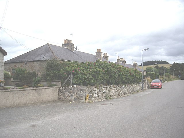
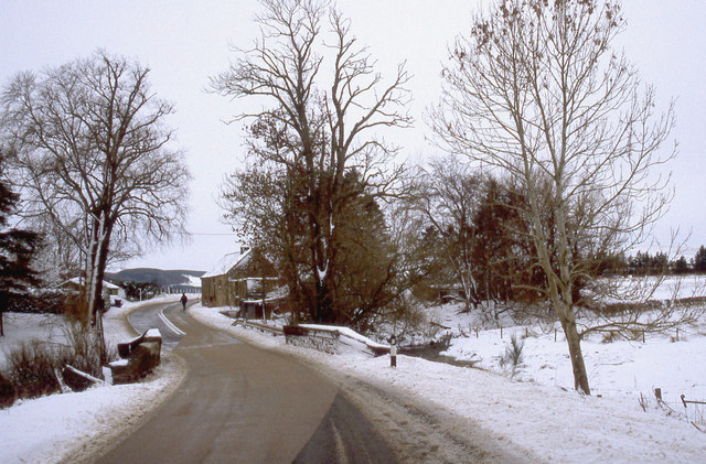
Rhynie, Aberdeenshire

Rhynie () (Scottish Gaelic: Roinnidh) is a village in Aberdeenshire, Scotland. It is on the A97 road, 14 miles (23 km) northwest of Alford. The Rhynie...
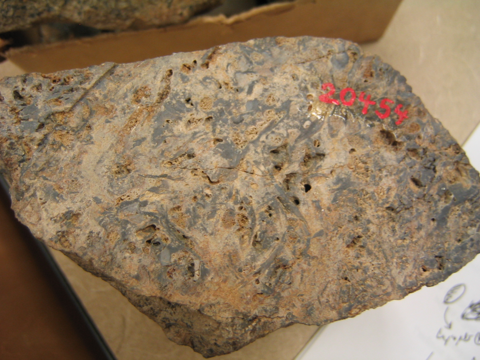
Rhynie chert

The Rhynie chert is a Lower Devonian sedimentary deposit exhibiting extraordinary fossil detail or completeness (a Lagerstätte). It is exposed near the...

Have you been to Birch Hill?

Leave your review of Birch Hill below (or comments, questions and feedback).