Impington

Settlement in Cambridgeshire South Cambridgeshire

England

Impington

Girton, St Andrews <span class="nowrap"><a title="http://www.druidic.org/camchurch/churches/girton.htm" rel="nofollow ugc noopener" href="http://www.druidic.org/camchurch/churches/girton.htm">Link</a><img style="margin-left:2px;" alt="External link" title="External link - shift click to open in new window" src="https://s1.geograph.org.uk/img/external.png" width="10" height="10"/></span>
Girton, St Andrews Credit: mym

Impington is a charming village located in the county of Cambridgeshire, England. It is situated just 3 miles north of the historic city of Cambridge and has a population of around 3,000 residents.

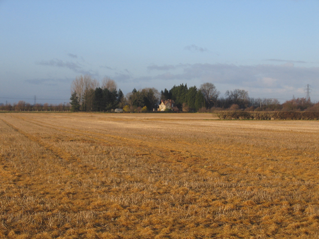
The village is renowned for its picturesque setting, surrounded by beautiful countryside and green open spaces. It boasts a rural atmosphere while still being conveniently close to the amenities and attractions of Cambridge. Impington is well-connected to nearby towns and cities, with excellent road links to London and other major destinations.

Impington is famous for being the home of Impington Village College, a renowned educational institution. The college was established in 1939 and has since gained a reputation for academic excellence and innovation. The college's striking modernist architecture, designed by Walter Gropius and Maxwell Fry, is an iconic landmark in the area.

The village itself features a range of amenities, including a post office, village hall, and local shops. It also has a thriving community with various clubs and societies catering to different interests and age groups. The village's green spaces, such as Impington Recreation Ground and the nearby Histon and Impington Meadows Nature Reserve, provide opportunities for outdoor activities and leisurely walks.

Overall, Impington offers a delightful blend of rural charm and accessibility, making it an attractive place to live or visit for those seeking a peaceful village atmosphere within easy reach of a vibrant city.

If you have any feedback on the listing, please let us know in the comments section below.
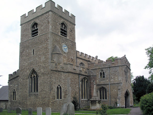
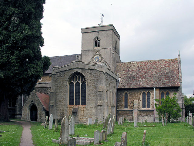
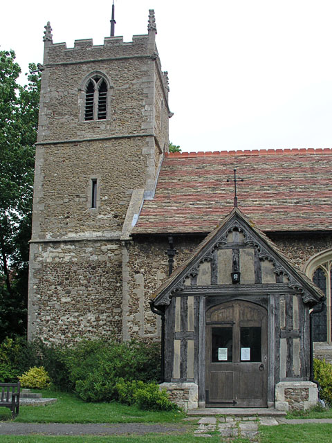
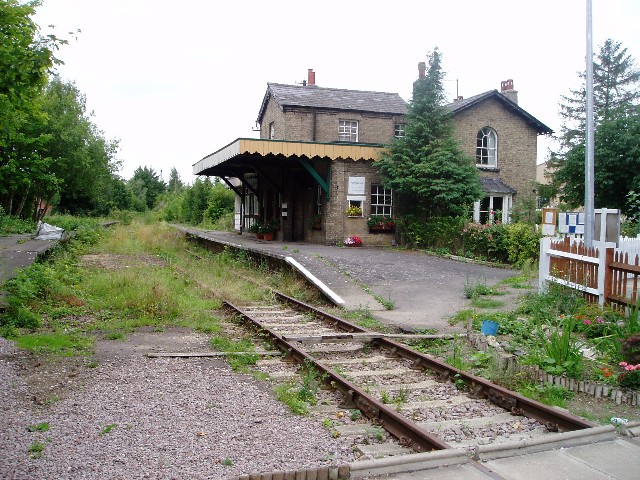
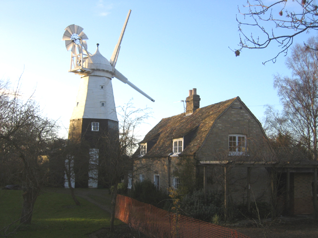
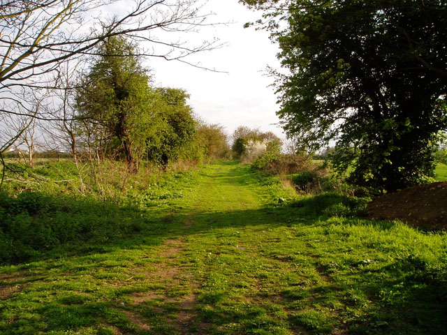
Impington Images

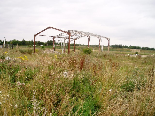
Images are sourced within 2km of 52.247802/0.109262 or Grid Reference TL4463. Thanks to Geograph Open Source API. All images are credited.

Girton, St Andrews <span class="nowrap"><a title="http://www.druidic.org/camchurch/churches/girton.htm" rel="nofollow ugc noopener" href="http://www.druidic.org/camchurch/churches/girton.htm">Link</a><img style="margin-left:2px;" alt="External link" title="External link - shift click to open in new window" src="https://s1.geograph.org.uk/img/external.png" width="10" height="10"/></span>
Girton, St Andrews
Histon, St Andrews <span class="nowrap"><a title="http://www.druidic.org/camchurch/churches/histon.htm" rel="nofollow ugc noopener" href="http://www.druidic.org/camchurch/churches/histon.htm">Link</a><img style="margin-left:2px;" alt="External link" title="External link - shift click to open in new window" src="https://s1.geograph.org.uk/img/external.png" width="10" height="10"/></span>
Histon, St Andrews
Impington, St Andrews <span class="nowrap"><a title="http://www.druidic.org/camchurch/churches/impington.htm" rel="nofollow ugc noopener" href="http://www.druidic.org/camchurch/churches/impington.htm">Link</a><img style="margin-left:2px;" alt="External link" title="External link - shift click to open in new window" src="https://s1.geograph.org.uk/img/external.png" width="10" height="10"/></span>
Impington, St Andrews
Histon station (disused) The controversial guided bus scheme is planned to go along the course of this railway.
Histon station (disused)
The controversial guided bus scheme is planned to go along the course of this railway.
Former bus depot, Kings Hedges Road, Cambridge Still marked as a bus depot on the 1:25000 map, but it looks pretty far gone to me. UPDATE (October 2005): construction has just started on a new housing development on this site, but the picture in the Cambridge Weekly News still shows this structure standing.
Former bus depot, Kings Hedges Road, Cambridge
Still marked as a bus depot on the 1:25000 map, but it looks pretty far gone to me. UPDATE (October 2005): construction has just started on a new housing development on this site, but the picture in the Cambridge Weekly News still shows this structure standing.
St George's Way, Impington These are new houses built on the edge of an older cul-de-sac.
St George's Way, Impington
These are new houses built on the edge of an older cul-de-sac.
Girton wood This is one of the Millennium Project woods planted in 2000. It's under 6 acres in size, and was newly planted in 2000. More info on this little wood can be found on the Woodland Trust's page: <span class="nowrap"><a title="http://www.wt-woods.org.uk/girton" rel="nofollow ugc noopener" href="http://www.wt-woods.org.uk/girton">Link</a><img style="margin-left:2px;" alt="External link" title="External link - shift click to open in new window" src="https://s1.geograph.org.uk/img/external.png" width="10" height="10"/></span>.
Girton wood
This is one of the Millennium Project woods planted in 2000. It's under 6 acres in size, and was newly planted in 2000. More info on this little wood can be found on the Woodland Trust's page: LinkExternal link.
Arbury Camp, Cambridge A major development on the north side of Cambridge on the site of a former bus depot and Green Belt land; the busy A14 runs along the northern edge (left).
Arbury Camp, Cambridge
A major development on the north side of Cambridge on the site of a former bus depot and Green Belt land; the busy A14 runs along the northern edge (left).
Girton Crossing, Histon, Cambs Disused railway, approaching the gates on New Road; the course is to become the much disputed guided bus scheme serving St Ives and Cambridge.
Girton Crossing, Histon, Cambs
Disused railway, approaching the gates on New Road; the course is to become the much disputed guided bus scheme serving St Ives and Cambridge.
Housing estate, Histon, Cambs Farmstead Close from Normanton Way in the north of the village.
Housing estate, Histon, Cambs
Farmstead Close from Normanton Way in the north of the village.
Woodhouse Farm, Impington, Cambs View N across winter stubble along the eastern side of the square; this wedge of farmland extends into north Cambridge between the Huntingdon and Histon roads.
Woodhouse Farm, Impington, Cambs
View N across winter stubble along the eastern side of the square; this wedge of farmland extends into north Cambridge between the Huntingdon and Histon roads.
Impington, Cambs View of the rear of South Road from the NW across the fields.
Impington, Cambs
View of the rear of South Road from the NW across the fields.
Farmland between Histon-Impington and Girton, Cambs View NW across the square towards the sewage works in the distance.
Farmland between Histon-Impington and Girton, Cambs
View NW across the square towards the sewage works in the distance.
Electricity sub-station, Histon, Cambs View inside the compound.
Electricity sub-station, Histon, Cambs
View inside the compound.
Impington windmill, Cambs White-painted tower mill of c.1805 which replaced an earlier postmill; it ceased working c.1929.
Impington windmill, Cambs
White-painted tower mill of c.1805 which replaced an earlier postmill; it ceased working c.1929.
Histon village green and duck pond
Histon green, pond and B1049 road junction
Byway from Cambridge to Landbeach This track follows the course of a Roman road.
Byway from Cambridge to Landbeach
This track follows the course of a Roman road.
Show me another place!

Impington is located at Grid Ref: TL4463 (Lat: 52.247802, Lng: 0.109262)

Administrative County: Cambridgeshire

District: South Cambridgeshire

Police Authority: Cambridgeshire

What 3 Words

///nerve.month.lows. Near Histon, Cambridgeshire

Nearby Locations

Impington

Related Wikis

Impington

Impington is a settlement and civil parish about 3 miles north of Cambridge city centre, in the South Cambridgeshire district, in the county of Cambridgeshire...

Village college

The village college is an institution specific to Cambridgeshire, England, including the Peterborough unitary authority area. It caters for the education...

Impington Village College

Impington Village College is a mixed secondary school and sixth form located in Impington in the English county of Cambridgeshire. The buildings of 1938...

Histon railway station

Histon railway station is a disused railway station in Impington, Cambridgeshire on the Cambridge–St Ives branch of the Great Eastern Railway. The station...

Histon

Histon is a village and civil parish in the South Cambridgeshire district, in the county of Cambridgeshire, England. It is immediately north of Cambridge...

Bridge Road (Impington)

Bridge Road, also known as the Glassworld Stadium for sponsorship purposes, is a football stadium in Impington, a small village connected to Histon in...

Cambridge City F.C.

Cambridge City Football Club is a football club based in Cambridgeshire, England, who currently play in the Northern Premier League Division One Midlands...

Histon F.C.

Histon Football Club is a football club based in the village of Histon, Cambridgeshire, England. The club are currently members of the United Counties...

Nearby Amenities

Located within 500m of 52.247802,0.109262
Impington
Is In: Cambridgeshire, England, UK
Place: village
Population: 3950
Source Population: http://www.scambs.gov.uk/CommunityandLiving/VillageServicesAndAmenities/
Wikidata: Q20023060
Lat/Long: 52.2493091/0.1138256
Crossing: informal
Lat/Long: 52.2518819/0.1091685
Traffic Signals
Lat/Long: 52.251458/0.108555
Turning Circle
Lat/Long: 52.2467599/0.107528
Fuel
Gulf
Brand: Gulf
Brand Wikidata: Q1296860
Brand Wikipedia: en:Gulf Oil
Lat/Long: 52.2491274/0.1070357
Hospital
Cambridge Lea Hospital (Spire)
Check Date: 2024-05-10
Healthcare: hospital
Website: https://www.spirehealthcare.com/cambridge/
Lat/Long: 52.2447321/0.1134644
Traffic Signals
Lat/Long: 52.2452751/0.1105828
Cycleway: asl
Note Cycleway: ASLs on all three approaches
Lat/Long: 52.2453197/0.11081
Pharmacy
Well Pharmacy
Brand: Well Pharmacy
Brand Wikidata: Q7726524
Dispensing: yes
Healthcare: pharmacy
Website: https://finder.well.co.uk/store/impington-station-road
Lat/Long: 52.2455794/0.1096604
Premier Foods
Landuse: industrial
Note: original Chivers site
Lat/Long: 52.247233/0.1035135
Restaurant
Tawa Lounge
Addr Housenumber: 20
Addr Street: The Green
Cuisine: international
Opening Hours: We,Th 08:45-22:30; Fr 08:45-23:00; Sa 09:00-23:00; Su 10:00-16:00
Lat/Long: 52.251441/0.1082285
Post Box
Collection Times: Mo-Fr 09:00; Sa 07:00
Operator: Royal Mail
Post Box Type: lamp
Ref: CB24 369D
Royal Cypher: EIIR
Royal Cypher Wikidata: Q33102113
Lat/Long: 52.2488136/0.1162341
Restaurant
d:licious
Cuisine: sandwich,coffee
Source: http://www.d-licious.org/
Lat/Long: 52.2447224/0.1074395
Doctors
The Firs Surgery
Healthcare: doctor
Lat/Long: 52.2454027/0.1090678
Traffic Signals
Lat/Long: 52.2438245/0.111851
Post Box
Collection Times: Mo-Fr 17:00; Sa 11:15
Operator: Royal Mail
Post Box Apertures: 2
Post Box Type: pillar
Ref: CB4 373;CB4 3733
Royal Cypher: EIIR
Royal Cypher Wikidata: Q33102113
Lat/Long: 52.2518364/0.1063853
Post Box
Collection Times: Mo-Fr 17:00; Sa 11:30
Operator: Royal Mail
Operator Wikidata: Q638098
Post Box Mounting: brick_pillar
Post Box Type: wall
Ref: CB4 370
Royal Cypher: EIIR
Royal Cypher Wikidata: Q33102113
Lat/Long: 52.2477106/0.1087721
Bus Stop
Chivers Way
Bus: yes
Naptan AtcoCode: 0500SHIST004
Naptan Bearing: N
Naptan CommonName: Chivers Way
Naptan Indicator: near
Naptan Landmark: Chivers Way
Naptan NaptanCode: cmbdwtpj
Naptan PlusbusZoneRef: CAMBDGE
Naptan ShortCommonName: Chivers Way
Naptan Street: Station Road
Naptan Verified: no
Public Transport: platform
Source: naptan_import
Lat/Long: 52.2447103/0.109831
Bus Stop
Poplar Road
Bus: yes
Naptan AtcoCode: 0500SHIST005
Naptan Bearing: N
Naptan BusStopType: CUS
Naptan CommonName: Poplar Road
Naptan Indicator: near
Naptan Landmark: Poplar Road
Naptan NaptanCode: cmbdwtpm
Naptan PlusbusZoneRef: CAMBDGE
Naptan ShortCommonName: Poplar Road
Naptan Street: Station Road
Naptan Verified: no
Public Transport: platform
Source: naptan_import
Lat/Long: 52.24743/0.1085976
Bus Stop
Hereward Close
Bench: no
Bin: no
Bus: yes
Fixme: These stops are slightly offset
Lit: yes
Naptan AtcoCode: 0500SIMPI002
Naptan Bearing: SE
Naptan CommonName: Hereward Close
Naptan Indicator: opp
Naptan Landmark: Hereward Close
Naptan NaptanCode: cmbgadpd
Naptan PlusbusZoneRef: CAMBDGE
Naptan ShortCommonName: Hereward Close
Naptan Street: Impington Lane
Naptan Verified: no
Public Transport: platform
Shelter: no
Source: naptan_import
Tactile Paving: no
Lat/Long: 52.2503372/0.1119586
Bus Stop
Village College
Naptan AtcoCode: 0500SIMPI003
Naptan Bearing: SW
Naptan BusStopType: CUS
Naptan CommonName: Village College
Naptan Indicator: o/s
Naptan Landmark: Impington Village College
Naptan NaptanCode: cmbgadpg
Naptan PlusbusZoneRef: CAMBDGE
Naptan ShortCommonName: Village College
Naptan Street: New Road
Naptan Verified: no
Source: naptan_import
Lat/Long: 52.2481209/0.1160578
Bus Stop
Village College
Naptan AtcoCode: 0500SIMPI005
Naptan Bearing: NE
Naptan CommonName: Village College
Naptan Indicator: opp
Naptan Landmark: Impington Village College
Naptan NaptanCode: cmbgadpm
Naptan PlusbusZoneRef: CAMBDGE
Naptan ShortCommonName: Village College
Naptan Street: New Road
Naptan Verified: no
Source: naptan_import
Lat/Long: 52.24812/0.1157649
Bus Stop
Poplar Road
Bus: yes
Naptan AtcoCode: 0500SIMPI012
Naptan Bearing: S
Naptan CommonName: Poplar Road
Naptan Indicator: opp
Naptan Landmark: Poplar Road
Naptan NaptanCode: cmbgadtm
Naptan PlusbusZoneRef: CAMBDGE
Naptan ShortCommonName: Poplar Road
Naptan Street: Station Road
Naptan Verified: no
Public Transport: platform
Source: naptan_import
Lat/Long: 52.2473634/0.1087903
Bus Stop
Hereward Close
Bench: no
Bin: no
Bus: yes
Fixme: These stops are slightly offset
Lit: yes
Naptan AtcoCode: 0500SIMPI015
Naptan Bearing: NW
Naptan BusStopType: CUS
Naptan CommonName: Hereward Close
Naptan Indicator: near
Naptan Landmark: Hereward Close
Naptan NaptanCode: cmbgadwa
Naptan PlusbusZoneRef: CAMBDGE
Naptan ShortCommonName: Hereward Close
Naptan Street: Impington Lane
Naptan Verified: no
Public Transport: platform
Shelter: no
Source: naptan_import
Tactile Paving: no
Lat/Long: 52.2502725/0.112058
Bus Stop
Chivers Way
Bus: yes
Naptan AtcoCode: 0500SIMPI019
Naptan Bearing: S
Naptan CommonName: Chivers Way
Naptan Indicator: opp
Naptan Landmark: Chivers Way
Naptan NaptanCode: cmbgadwm
Naptan PlusbusZoneRef: CAMBDGE
Naptan ShortCommonName: Chivers Way
Naptan Street: Station Road
Naptan Verified: no
Public Transport: platform
Source: naptan_import
Lat/Long: 52.2440181/0.1103255
Bus Stop
Macfarlane Close
Bench: yes
Bin: yes
Bus: yes
Lit: yes
Naptan AtcoCode: 0500SIMPI020
Naptan Bearing: S
Naptan CommonName: Macfarlane Close
Naptan Indicator: opp
Naptan Landmark: Macfarlane Close
Naptan NaptanCode: cmbgadwp
Naptan PlusbusZoneRef: CAMBDGE
Naptan ShortCommonName: Macfarlane Close
Naptan Street: New Road
Naptan Verified: no
Public Transport: platform
Shelter: yes
Source: naptan_import
Tactile Paving: no
Lat/Long: 52.2455799/0.1129925
Bus Stop
Macfarlane Close
Bench: no
Bin: no
Bus: yes
Lit: yes
Naptan AtcoCode: 0500SIMPI021
Naptan Bearing: N
Naptan BusStopType: CUS
Naptan CommonName: Macfarlane Close
Naptan Indicator: near
Naptan Landmark: Macfarlane Close
Naptan NaptanCode: cmbgadwt
Naptan PlusbusZoneRef: CAMBDGE
Naptan ShortCommonName: Macfarlane Close
Naptan Street: New Road
Naptan Verified: no
Public Transport: platform
Shelter: yes
Source: naptan_import
Tactile Paving: no
Lat/Long: 52.2456093/0.112862
Pharmacy
Well Pharmacy
Addr City: Histon
Addr Housenumber: 1
Addr Postcode: CB24 9JD
Addr Street: Station Road
Brand: Well Pharmacy
Brand Wikidata: Q7726524
Dispensing: yes
Healthcare: pharmacy
Website: https://www.nhs.uk/services/pharmacy/WELL/FT890
Lat/Long: 52.2517442/0.1068659
Parking
Lat/Long: 52.2459761/0.1089272
Historic: memorial
Memorial: war_memorial
Lat/Long: 52.2481447/0.108828
Bench
Backrest: yes
Inscription: Lest we forget 2009
Material: wood
Lat/Long: 52.2480511/0.1086353
Bench
Backrest: yes
Material: wood
Lat/Long: 52.2481089/0.108648
Traffic Signals
Lat/Long: 52.2477712/0.1093595
Parking
Lat/Long: 52.2482967/0.1136532
Telephone
Booth: K6
Covered: booth
Listed Status: Grade II
Phone: +44 1223 232211
Lat/Long: 52.2476969/0.1087714
Traffic Signals
Lat/Long: 52.2453897/0.1107682
Traffic Signals
Lat/Long: 52.245211/0.1108891
Traffic Signals
Lat/Long: 52.2438044/0.1117637
Crossing
Crossing: uncontrolled
Crossing Markings: yes
Kerb: flush
Tactile Paving: yes
Lat/Long: 52.246491/0.1141442
Traffic Signals
Lat/Long: 52.2515185/0.108846
Traffic Signals
Lat/Long: 52.245156/0.1108471
Traffic Signals
Lat/Long: 52.2477505/0.1092918
Traffic Signals
Lat/Long: 52.2510758/0.1086042
Traffic Signals
Lat/Long: 52.2511011/0.1087937
Barrier: cycle_barrier
Cycle Barrier: double
Lat/Long: 52.2492147/0.1041062
Crossing: informal
Lat/Long: 52.2443239/0.1120084
Bench
Backrest: yes
Lat/Long: 52.2518859/0.1070696
Historic: memorial
Lat/Long: 52.2518235/0.1080741
Post Box
Collection Times: Mo-Fr 17:15; Sa 11:30
Post Box Type: pillar
Ref: CB24 384
Royal Cypher: EIIR
Royal Cypher Wikidata: Q33102113
Source: local knowledge;survey
Lat/Long: 52.2434096/0.1106117
Crossing
Crossing: unmarked
Crossing Island: no
Tactile Paving: yes
Lat/Long: 52.2517155/0.107523
Parking
Lat/Long: 52.2453619/0.1093443
Crossing
Crossing: uncontrolled
Crossing Island: yes
Lat/Long: 52.2478333/0.1085783
Kerb: regular
Lat/Long: 52.2436975/0.1119967
Crossing: informal
Lat/Long: 52.2502186/0.111971
Barrier: cycle_barrier
Cycle Barrier: double
Cycle Barrier Installation: fixed
Lat/Long: 52.251822/0.1092655
Power: transformer
Voltage: 132000;33000
Lat/Long: 52.2463555/0.102389
Power: pole
Lat/Long: 52.246403/0.1022847
Addr Housenumber: 5
Addr Street: New Road
Lat/Long: 52.2435287/0.1113127
Addr Housenumber: 6
Addr Street: New Road
Lat/Long: 52.2436289/0.1112591
Addr Housenumber: 8
Addr Street: New Road
Lat/Long: 52.2437341/0.1113852
Addr Housenumber: 9
Addr Street: New Road
Lat/Long: 52.2437866/0.1114066
Addr Housenumber: 7
Addr Street: New Road
Lat/Long: 52.2436783/0.1112832
Addr Housenumber: 10
Addr Street: New Road
Lat/Long: 52.2438687/0.1114468
Addr Housenumber: 11
Addr Street: New Road
Lat/Long: 52.2439097/0.111471
Addr Housenumber: 38
Addr Postcode: CB24 9LN
Addr Street: Poplar Road
Lat/Long: 52.2469792/0.1063694
Addr Housenumber: 20
Addr Postcode: CB24 9LN
Addr Street: Poplar Road
Lat/Long: 52.2468396/0.1068281
Addr Housenumber: 88
Addr Street: Station Road
Lat/Long: 52.2448163/0.1096443
Addr Housenumber: 92
Addr Street: Station Road
Lat/Long: 52.2447687/0.1096604
Addr Housenumber: 82
Addr Street: Station Road
Lat/Long: 52.2449444/0.109596
Addr Housenumber: 84
Addr Street: Station Road
Lat/Long: 52.2448903/0.1096148
Pure Resourcing Solutions
Addr City: Cambridge
Addr Housename: The Workspace
Addr Postcode: CB24 9PT
Addr Street: Pioneer Court, Vision Park, Histon
Office: company
Phone: +44 1223 209888
Website: https://www.prs.uk.com/contact-us/get-in-touch?office=cambridge
Lat/Long: 52.2452536/0.1053768
Footpaths around Histon and Impington
Hiking: yes
Information: map
Map Size: city
Map Type: scheme
Tourism: information
Lat/Long: 52.2480614/0.1084402
Board Type: notice
Information: board
Tourism: information
Lat/Long: 52.2480353/0.1085181
Description: Memorial bird bath
Historic: memorial
Inscription: The Royal British Legion 1947-1977 Burma Star Assoc 1959-1977 Sid Bishop 1914-1977
Lat/Long: 52.2481255/0.1085516
Addr City: Histon
Addr Housenumber: 2A
Addr Postcode: CB24 9JD
Addr Street: High Street
Lat/Long: 52.2518763/0.1065519
Addr City: Histon
Addr Housenumber: 4
Addr Postcode: CB24 9JD
Addr Street: High Street
Lat/Long: 52.2518943/0.1064821
WHSmith Local
Shop: convenience
Lat/Long: 52.2518768/0.1063681
Generator Method: photovoltaic
Generator Output Electricity: yes
Generator Source: solar
Generator Type: solar_photovoltaic_panel
Location: roof
Power: generator
Lat/Long: 52.2461454/0.1112607
Generator Method: photovoltaic
Generator Output Electricity: yes
Generator Source: solar
Generator Type: solar_photovoltaic_panel
Location: roof
Power: generator
Lat/Long: 52.2460222/0.1118052
Generator Method: photovoltaic
Generator Output Electricity: yes
Generator Source: solar
Generator Type: solar_photovoltaic_panel
Location: roof
Power: generator
Lat/Long: 52.245651/0.1123202
Generator Method: photovoltaic
Generator Output Electricity: yes
Generator Source: solar
Generator Type: solar_photovoltaic_panel
Location: roof
Power: generator
Lat/Long: 52.2462505/0.1120439
Generator Method: photovoltaic
Generator Output Electricity: yes
Generator Source: solar
Generator Type: solar_photovoltaic_panel
Location: roof
Power: generator
Lat/Long: 52.2481012/0.1132321
Generator Method: photovoltaic
Generator Output Electricity: yes
Generator Source: solar
Generator Type: solar_photovoltaic_panel
Location: roof
Power: generator
Lat/Long: 52.2482909/0.1133649
Generator Method: photovoltaic
Generator Output Electricity: yes
Generator Source: solar
Generator Type: solar_photovoltaic_panel
Location: roof
Power: generator
Lat/Long: 52.248171/0.113778
Generator Method: photovoltaic
Generator Output Electricity: yes
Generator Source: solar
Generator Type: solar_photovoltaic_panel
Location: roof
Power: generator
Lat/Long: 52.248153/0.1138517
Generator Method: photovoltaic
Generator Output Electricity: yes
Generator Source: solar
Generator Type: solar_photovoltaic_panel
Location: roof
Power: generator
Lat/Long: 52.2480815/0.1142326
Generator Method: photovoltaic
Generator Output Electricity: yes
Generator Source: solar
Generator Type: solar_photovoltaic_panel
Location: roof
Power: generator
Lat/Long: 52.2477465/0.1140958
Generator Method: photovoltaic
Generator Output Electricity: yes
Generator Source: solar
Generator Type: solar_photovoltaic_panel
Location: roof
Power: generator
Lat/Long: 52.2477005/0.1140636
Generator Method: photovoltaic
Generator Output Electricity: yes
Generator Source: solar
Generator Type: solar_photovoltaic_panel
Location: roof
Power: generator
Lat/Long: 52.2474953/0.1138142
Generator Method: photovoltaic
Generator Output Electricity: yes
Generator Source: solar
Generator Type: solar_photovoltaic_panel
Location: roof
Power: generator
Lat/Long: 52.2474345/0.1137659
Generator Method: photovoltaic
Generator Output Electricity: yes
Generator Source: solar
Generator Type: solar_photovoltaic_panel
Location: roof
Power: generator
Lat/Long: 52.2474132/0.1135889
Generator Method: photovoltaic
Generator Output Electricity: yes
Generator Source: solar
Generator Type: solar_photovoltaic_panel
Location: roof
Power: generator
Lat/Long: 52.2473507/0.1135567
Generator Method: photovoltaic
Generator Output Electricity: yes
Generator Source: solar
Generator Type: solar_photovoltaic_panel
Location: roof
Power: generator
Lat/Long: 52.2472456/0.1134843
Generator Method: photovoltaic
Generator Output Electricity: yes
Generator Source: solar
Generator Type: solar_photovoltaic_panel
Location: roof
Power: generator
Lat/Long: 52.2471291/0.1111239
Generator Method: photovoltaic
Generator Output Electricity: yes
Generator Source: solar
Generator Type: solar_photovoltaic_panel
Location: roof
Power: generator
Lat/Long: 52.2477711/0.1106438
Generator Method: photovoltaic
Generator Output Electricity: yes
Generator Source: solar
Generator Type: solar_photovoltaic_panel
Location: roof
Power: generator
Lat/Long: 52.248006/0.1103139
Generator Method: photovoltaic
Generator Output Electricity: yes
Generator Source: solar
Generator Type: solar_photovoltaic_panel
Location: roof
Power: generator
Lat/Long: 52.2481012/0.1105124
Generator Method: photovoltaic
Generator Output Electricity: yes
Generator Source: solar
Generator Type: solar_photovoltaic_panel
Location: roof
Power: generator
Lat/Long: 52.2481456/0.1105982
Generator Method: photovoltaic
Generator Output Electricity: yes
Generator Source: solar
Generator Type: solar_photovoltaic_panel
Location: roof
Power: generator
Lat/Long: 52.248203/0.1106411
Generator Method: photovoltaic
Generator Output Electricity: yes
Generator Source: solar
Generator Type: solar_photovoltaic_panel
Location: roof
Power: generator
Lat/Long: 52.2483114/0.1107055
Generator Method: photovoltaic
Generator Output Electricity: yes
Generator Source: solar
Generator Type: solar_photovoltaic_panel
Location: roof
Power: generator
Lat/Long: 52.2482802/0.1107994
Generator Method: photovoltaic
Generator Output Electricity: yes
Generator Source: solar
Generator Type: solar_photovoltaic_panel
Location: roof
Power: generator
Lat/Long: 52.2482195/0.1112071
Generator Method: photovoltaic
Generator Output Electricity: yes
Generator Source: solar
Generator Type: solar_photovoltaic_panel
Location: roof
Power: generator
Lat/Long: 52.2481702/0.1111695
Generator Method: photovoltaic
Generator Output Electricity: yes
Generator Source: solar
Generator Type: solar_photovoltaic_panel
Location: roof
Power: generator
Lat/Long: 52.2480733/0.1111454
Generator Method: photovoltaic
Generator Output Electricity: yes
Generator Source: solar
Generator Type: solar_photovoltaic_panel
Location: roof
Power: generator
Lat/Long: 52.2479124/0.1110595
Generator Method: photovoltaic
Generator Output Electricity: yes
Generator Source: solar
Generator Type: solar_photovoltaic_panel
Location: roof
Power: generator
Lat/Long: 52.2478483/0.1113841
Generator Method: photovoltaic
Generator Output Electricity: yes
Generator Source: solar
Generator Type: solar_photovoltaic_panel
Location: roof
Power: generator
Lat/Long: 52.2477794/0.1116738
Generator Method: photovoltaic
Generator Output Electricity: yes
Generator Source: solar
Generator Type: solar_photovoltaic_panel
Location: roof
Power: generator
Lat/Long: 52.2477777/0.1118079
Generator Method: photovoltaic
Generator Output Electricity: yes
Generator Source: solar
Generator Type: solar_photovoltaic_panel
Location: roof
Power: generator
Lat/Long: 52.2480306/0.1125482
Generator Method: photovoltaic
Generator Output Electricity: yes
Generator Source: solar
Generator Type: solar_photovoltaic_panel
Location: roof
Power: generator
Lat/Long: 52.2480421/0.1123846
Generator Method: photovoltaic
Generator Output Electricity: yes
Generator Source: solar
Generator Type: solar_photovoltaic_panel
Location: roof
Power: generator
Lat/Long: 52.2478746/0.1122022
Generator Method: photovoltaic
Generator Output Electricity: yes
Generator Source: solar
Generator Type: solar_photovoltaic_panel
Location: roof
Power: generator
Lat/Long: 52.2478992/0.1121163
Generator Method: photovoltaic
Generator Output Electricity: yes
Generator Source: solar
Generator Type: solar_photovoltaic_panel
Location: roof
Power: generator
Lat/Long: 52.2481472/0.1117274
Generator Method: photovoltaic
Generator Output Electricity: yes
Generator Source: solar
Generator Type: solar_photovoltaic_panel
Location: roof
Power: generator
Lat/Long: 52.2482326/0.1115987
Generator Method: photovoltaic
Generator Output Electricity: yes
Generator Source: solar
Generator Type: solar_photovoltaic_panel
Location: roof
Power: generator
Lat/Long: 52.2483196/0.1113868
Generator Method: photovoltaic
Generator Output Electricity: yes
Generator Source: solar
Generator Type: solar_photovoltaic_panel
Location: roof
Power: generator
Lat/Long: 52.2483295/0.1112661
Generator Method: photovoltaic
Generator Output Electricity: yes
Generator Source: solar
Generator Type: solar_photovoltaic_panel
Location: roof
Power: generator
Lat/Long: 52.2488517/0.1114941
Generator Method: photovoltaic
Generator Output Electricity: yes
Generator Source: solar
Generator Type: solar_photovoltaic_panel
Location: roof
Power: generator
Lat/Long: 52.2486284/0.1115665
Generator Method: photovoltaic
Generator Output Electricity: yes
Generator Source: solar
Generator Type: solar_photovoltaic_panel
Location: roof
Power: generator
Lat/Long: 52.2485939/0.1116818
Generator Method: photovoltaic
Generator Output Electricity: yes
Generator Source: solar
Generator Type: solar_photovoltaic_panel
Location: roof
Power: generator
Lat/Long: 52.2485709/0.1117623
Generator Method: photovoltaic
Generator Output Electricity: yes
Generator Source: solar
Generator Type: solar_photovoltaic_panel
Location: roof
Power: generator
Lat/Long: 52.2486037/0.1127279
Generator Method: photovoltaic
Generator Output Electricity: yes
Generator Source: solar
Generator Type: solar_photovoltaic_panel
Location: roof
Power: generator
Lat/Long: 52.2486563/0.1125294
Generator Method: photovoltaic
Generator Output Electricity: yes
Generator Source: solar
Generator Type: solar_photovoltaic_panel
Location: roof
Power: generator
Lat/Long: 52.2486973/0.1124275
Generator Method: photovoltaic
Generator Output Electricity: yes
Generator Source: solar
Generator Type: solar_photovoltaic_panel
Location: roof
Power: generator
Lat/Long: 52.2487154/0.1122478
Generator Method: photovoltaic
Generator Output Electricity: yes
Generator Source: solar
Generator Type: solar_photovoltaic_panel
Location: roof
Power: generator
Lat/Long: 52.2487876/0.112111
Generator Method: photovoltaic
Generator Output Electricity: yes
Generator Source: solar
Generator Type: solar_photovoltaic_panel
Location: roof
Power: generator
Lat/Long: 52.2488303/0.112009
Generator Method: photovoltaic
Generator Output Electricity: yes
Generator Source: solar
Generator Type: solar_photovoltaic_panel
Location: roof
Power: generator
Lat/Long: 52.2488435/0.1119044
Generator Method: photovoltaic
Generator Output Electricity: yes
Generator Source: solar
Generator Type: solar_photovoltaic_panel
Location: roof
Power: generator
Lat/Long: 52.2488895/0.1118132
Generator Method: photovoltaic
Generator Output Electricity: yes
Generator Source: solar
Generator Type: solar_photovoltaic_panel
Location: roof
Power: generator
Lat/Long: 52.2489157/0.1117167
Generator Method: photovoltaic
Generator Output Electricity: yes
Generator Source: solar
Generator Type: solar_photovoltaic_panel
Location: roof
Power: generator
Lat/Long: 52.2492359/0.1118588
Generator Method: photovoltaic
Generator Output Electricity: yes
Generator Source: solar
Generator Type: solar_photovoltaic_panel
Location: roof
Power: generator
Lat/Long: 52.2491456/0.1121592
Generator Method: photovoltaic
Generator Output Electricity: yes
Generator Source: solar
Generator Type: solar_photovoltaic_panel
Location: roof
Power: generator
Lat/Long: 52.2491095/0.1122746
Generator Method: photovoltaic
Generator Output Electricity: yes
Generator Source: solar
Generator Type: solar_photovoltaic_panel
Location: roof
Power: generator
Lat/Long: 52.2490208/0.1125669
Generator Method: photovoltaic
Generator Output Electricity: yes
Generator Source: solar
Generator Type: solar_photovoltaic_panel
Location: roof
Power: generator
Lat/Long: 52.2489535/0.1127654
Generator Method: photovoltaic
Generator Output Electricity: yes
Generator Source: solar
Generator Type: solar_photovoltaic_panel
Location: roof
Power: generator
Lat/Long: 52.2489157/0.1129049
Generator Method: photovoltaic
Generator Output Electricity: yes
Generator Source: solar
Generator Type: solar_photovoltaic_panel
Location: roof
Power: generator
Lat/Long: 52.2492491/0.1130283
Generator Method: photovoltaic
Generator Output Electricity: yes
Generator Source: solar
Generator Type: solar_photovoltaic_panel
Location: roof
Power: generator
Lat/Long: 52.2492721/0.1128057
Generator Method: photovoltaic
Generator Output Electricity: yes
Generator Source: solar
Generator Type: solar_photovoltaic_panel
Location: roof
Power: generator
Lat/Long: 52.2495036/0.1121217
Generator Method: photovoltaic
Generator Output Electricity: yes
Generator Source: solar
Generator Type: solar_photovoltaic_panel
Location: roof
Power: generator
Lat/Long: 52.2496235/0.1118025
Generator Method: photovoltaic
Generator Output Electricity: yes
Generator Source: solar
Generator Type: solar_photovoltaic_panel
Location: roof
Power: generator
Lat/Long: 52.251612/0.1104104
Generator Method: photovoltaic
Generator Output Electricity: yes
Generator Source: solar
Generator Type: solar_photovoltaic_panel
Location: roof
Power: generator
Lat/Long: 52.2515069/0.1118535
Generator Method: photovoltaic
Generator Output Electricity: yes
Generator Source: solar
Generator Type: solar_photovoltaic_panel
Location: roof
Power: generator
Lat/Long: 52.251346/0.1121324
Generator Method: photovoltaic
Generator Output Electricity: yes
Generator Source: solar
Generator Type: solar_photovoltaic_panel
Location: roof
Power: generator
Lat/Long: 52.251149/0.1124543
Generator Method: photovoltaic
Generator Output Electricity: yes
Generator Source: solar
Generator Type: solar_photovoltaic_panel
Location: roof
Power: generator
Lat/Long: 52.2511358/0.1126447
Bicycle Parking
Capacity: 12
Covered: no
Lat/Long: 52.2440538/0.1123439
Bicycle Parking
Capacity: 10
Covered: yes
Lat/Long: 52.2439378/0.1128158
Generator Output Electricity: yes
Generator Source: solar
Generator Type: solar_photovoltaic_panel
Location: roof
Power: generator
Lat/Long: 52.2510291/0.1046517
Recycling
Brand: Variety, the Children's Charity
Operator: SOEX UK
Recycling Shoes: yes
Recycling Type: container
Lat/Long: 52.2518417/0.1063884
Bicycle Parking
Bicycle Parking: stands
Capacity: 4
Covered: no
Lat/Long: 52.251858/0.1063145
Bicycle Parking
Bicycle Parking: stands
Capacity: 12
Covered: no
Lat/Long: 52.251697/0.1066308
Bench
Backrest: yes
Lat/Long: 52.2517586/0.108245
Bench
Backrest: yes
Lat/Long: 52.2520391/0.1080315
Bench
Backrest: yes
Lat/Long: 52.2520268/0.1071718
Man & Dog
Artist Name: Tony Hillier
Artwork Type: sculpture
Source: http://www.hisimp.net/wp/wp-content/uploads/2021/02/Histon-Impington-Public-Art-Trail-Final-v2-210204.pdf
Tourism: artwork
Lat/Long: 52.248351/0.1096435
Spider
Artist Name: Tony Hillier
Artwork Type: sculpture
Source: http://www.hisimp.net/wp/wp-content/uploads/2021/02/Histon-Impington-Public-Art-Trail-Final-v2-210204.pdf
Tourism: artwork
Lat/Long: 52.2518603/0.1084169
Pollen
Artist Name: Matt Sanderson
Artwork Type: sculpture
Source: http://www.hisimp.net/wp/wp-content/uploads/2021/02/Histon-Impington-Public-Art-Trail-Final-v2-210204.pdf
Tourism: artwork
Lat/Long: 52.2502654/0.1123316
Seed
Artist Name: Matt Sanderson
Artwork Type: sculpture
Source: http://www.hisimp.net/wp/wp-content/uploads/2021/02/Histon-Impington-Public-Art-Trail-Final-v2-210204.pdf
Tourism: artwork
Lat/Long: 52.2508326/0.112742
Sprouting
Artist Name: Matt Sanderson
Artwork Type: sculpture
Source: http://www.hisimp.net/wp/wp-content/uploads/2021/02/Histon-Impington-Public-Art-Trail-Final-v2-210204.pdf
Tourism: artwork
Lat/Long: 52.251464/0.1113848
Decorative fencing
Artist Name: Matt Sanderson
Artwork Type: sculpture
Source: http://www.hisimp.net/wp/wp-content/uploads/2021/02/Histon-Impington-Public-Art-Trail-Final-v2-210204.pdf
Tourism: artwork
Lat/Long: 52.2517003/0.1094329
World
Artist Name: Matt Sanderson
Artwork Type: sculpture
Source: http://www.hisimp.net/wp/wp-content/uploads/2021/02/Histon-Impington-Public-Art-Trail-Final-v2-210204.pdf
Tourism: artwork
Lat/Long: 52.2516184/0.1101045
Shadow Figures
Artist Name: Helaine Blumenfeld
Artwork Type: sculpture
Source: http://www.hisimp.net/wp/wp-content/uploads/2021/02/Histon-Impington-Public-Art-Trail-Final-v2-210204.pdf
Tourism: artwork
Lat/Long: 52.2443498/0.1077123
Crossing
Crossing: unmarked
Source: survey
Wheelchair: no
Wheelchair Description: Coming from Cambridge, this is a potential dead end as there is no dropped kerb and if the parking space is in use then you cannot go down the side road either.
Lat/Long: 52.2464415/0.1101539
Barrier: kerb
Kerb: lowered
Tactile Paving: no
Wheelchair: yes
Lat/Long: 52.2443254/0.1119457
Barrier: cycle_barrier
Lat/Long: 52.2437555/0.107218
Barrier: kerb
Kerb: lowered
Wheelchair Description: kerb lowered for entrance to building
Lat/Long: 52.2443773/0.1137825
Entrance: yes
Lat/Long: 52.2444287/0.1137239
Man Made: surveillance
Lat/Long: 52.2450023/0.1072562
Man Made: surveillance
Lat/Long: 52.2443118/0.106768
Public Bookcase
Histon & Impington Micro Library
Booth: KX100
Disused Amenity: telephone
Man Made: telephone_box
Public Bookcase Type: phone_box
Lat/Long: 52.2435429/0.1103237
Barrier: cycle_barrier
Lat/Long: 52.2464324/0.1099712
Bicycle Parking
Bicycle Parking: stands
Covered: yes
Lat/Long: 52.2467553/0.1149602
Bicycle Parking
Lat/Long: 52.2466444/0.1153877
Histon Barbershop
Addr Housenumber: 2
Addr Postcode: CB24 9JD
Addr Street: High Street
Building: retail
Female: no
Male: yes
Opening Hours: Mo 09:30-17:30; Tu 09:30-19:00; We-Fr 09:30-17:30; Sa 08:30-16:30
Shop: hairdresser
Unisex: no
Wheelchair: no
Lat/Long: 52.251928/0.1067682
Barrier: bollard
Lat/Long: 52.2436903/0.1116171
Power: substation
Voltage: 11000
Lat/Long: 52.2455567/0.1048092
Histon
Man Made: village_sign
Source: survey
Tourism: artwork
Lat/Long: 52.2516235/0.1079643
Impington
Man Made: village_sign
Source: survey
Tourism: artwork
Lat/Long: 52.2440868/0.1119125
Nuclera Ltd
Addr City: Histon
Addr Housename: One Vision Park
Addr Postcode: CB24 9NP
Addr Street: Station Road
Office: company
Website: https://www.nuclera.com/
Lat/Long: 52.2448161/0.1104664
Recycling
Colour: red
Operator: Terracycle
Recycling Pringles Tubes: yes
Recycling Type: container
Lat/Long: 52.2467371/0.114245
Crossing
Crossing: uncontrolled
Crossing Markings: yes
Kerb: flush
Tactile Paving: yes
Lat/Long: 52.246473/0.1138162
Addr City: Cambridge
Addr Housenumber: 53
Addr Postcode: CB24 9AL
Addr Street: Merrington Place
Addr Village: Impington
Lat/Long: 52.25169/0.1103947
Addr City: Cambridge
Addr Housenumber: 47
Addr Postcode: CB24 9AL
Addr Street: Merrington Place
Addr Village: Impington
Lat/Long: 52.2516396/0.1103907
Addr City: Cambridge
Addr Housenumber: 13
Addr Postcode: CB24 9AL
Addr Street: Merrington Place
Addr Village: Impington
Lat/Long: 52.250639/0.112643
Addr City: Cambridge
Addr Housenumber: 3
Addr Postcode: CB24 9AL
Addr Street: Merrington Place
Addr Village: Impington
Lat/Long: 52.2505928/0.1126122
Entrance: main
Lat/Long: 52.2506084/0.1126667
Addr City: Cambridge
Addr Housenumber: 25
Addr Postcode: CB24 9AL
Addr Street: Merrington Place
Addr Village: Impington
Lat/Long: 52.2509363/0.1123457
Addr City: Cambridge
Addr Housenumber: 15
Addr Postcode: CB24 9AL
Addr Street: Merrington Place
Addr Village: Impington
Lat/Long: 52.2509236/0.112404
Addr City: Cambridge
Addr Housenumber: 27
Addr Postcode: CB24 9AL
Addr Street: Merrington Place
Addr Village: Impington
Entrance: yes
Lat/Long: 52.2509711/0.1123209
Entrance: main
Lat/Long: 52.2509518/0.1123957
Addr City: Cambridge
Addr Housenumber: 29
Addr Postcode: CB24 9AL
Addr Street: Merrington Place
Addr Village: Impington
Entrance: yes
Lat/Long: 52.2509487/0.1122176
Entrance: main
Lat/Long: 52.2516642/0.1104267
Addr City: Cambridge
Addr Housenumber: 46
Addr Postcode: CB24 9AL
Addr Street: Merrington Place
Addr Village: Impington
Lat/Long: 52.2514975/0.1119987
Addr City: Cambridge
Addr Housenumber: 52
Addr Postcode: CB24 9AL
Addr Street: Merrington Place
Addr Village: Impington
Lat/Long: 52.2515312/0.1119336
Addr City: Cambridge
Addr Housenumber: 44
Addr Postcode: CB24 9AL
Addr Street: Merrington Place
Addr Village: Impington
Lat/Long: 52.2514478/0.1120828
Addr City: Cambridge
Addr Housenumber: 38
Addr Postcode: CB24 9AL
Addr Street: Merrington Place
Addr Village: Impington
Lat/Long: 52.2514133/0.1121472
Entrance: main
Lat/Long: 52.2514162/0.1121017
Entrance: main
Lat/Long: 52.2515012/0.1119467
Addr City: Cambridge
Addr Housenumber: 54
Addr Postcode: CB24 9AL
Addr Street: Merrington Place
Addr Village: Impington
Entrance: yes
Lat/Long: 52.2514957/0.1119107
Addr City: Cambridge
Addr Housenumber: 56
Addr Postcode: CB24 9AL
Addr Street: Merrington Place
Addr Village: Impington
Entrance: yes
Lat/Long: 52.2514817/0.1118902
Addr City: Cambridge
Addr Housenumber: 36
Addr Postcode: CB24 9AL
Addr Street: Merrington Place
Addr Village: Impington
Entrance: yes
Lat/Long: 52.2513937/0.1120968
Addr City: Cambridge
Addr Housenumber: 34
Addr Postcode: CB24 9AL
Addr Street: Merrington Place
Addr Village: Impington
Entrance: yes
Lat/Long: 52.2513797/0.1120763
Addr City: Cambridge
Addr Housenumber: 20
Addr Postcode: CB24 9AR
Addr Street: Hunters Close
Addr Village: Impington
Entrance: yes
Lat/Long: 52.2504943/0.114589
Addr City: Cambridge
Addr Housenumber: 14
Addr Postcode: CB24 9AR
Addr Street: Hunters Close
Addr Village: Impington
Entrance: yes
Lat/Long: 52.2503941/0.1145284
Addr City: Cambridge
Addr Housenumber: 18
Addr Postcode: CB24 9AR
Addr Street: Hunters Close
Addr Village: Impington
Entrance: yes
Lat/Long: 52.250475/0.1145068
Addr City: Cambridge
Addr Housenumber: 16
Addr Postcode: CB24 9AR
Addr Street: Hunters Close
Addr Village: Impington
Entrance: yes
Lat/Long: 52.2504415/0.1144865
Addr City: Cambridge
Addr Housenumber: 12
Addr Postcode: CB24 9AR
Addr Street: Hunters Close
Addr Village: Impington
Entrance: yes
Lat/Long: 52.2503388/0.114332
Addr City: Cambridge
Addr Housenumber: 10
Addr Postcode: CB24 9AR
Addr Street: Hunters Close
Addr Village: Impington
Entrance: yes
Lat/Long: 52.2503889/0.1143093
Entrance: yes
Lat/Long: 52.2504038/0.1142589
Entrance: yes
Lat/Long: 52.2504261/0.1141832
Bicycle Parking
Bicycle Parking: stands
Capacity: 30
Covered: yes
Smoothness: good
Surface: paved
Lat/Long: 52.2440188/0.1088023
Bicycle Parking
Access: permissive
Bicycle Parking: stands
Capacity: 46
Capacity Cargo Bike: 1
Lat/Long: 52.2439211/0.1096324
Bicycle Parking
Access: customers
Bicycle Parking: rack
Capacity: 5
Capacity Cargo Bike: 0
Covered: yes
Smoothness: good
Surface: asphalt
Lat/Long: 52.2442881/0.1067334
Crossing
Crossing: uncontrolled
Crossing Island: no
Crossing Markings: zebra
Lat/Long: 52.2442955/0.1099461
The data included in this document is from www.openstreetmap.org. The data is made available under ODbL.

Have you been to Impington?

Leave your review of Impington below (or comments, questions and feedback).