Imeraval

Settlement in Argyllshire

Scotland

Imeraval

Seashore in Port Ellen
Seashore in Port Ellen Credit: Doug Lee

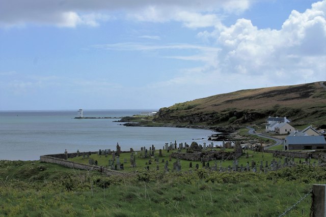
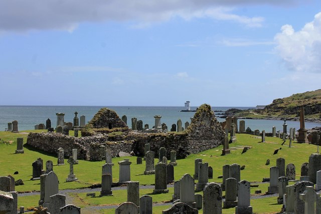
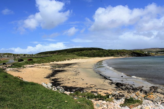
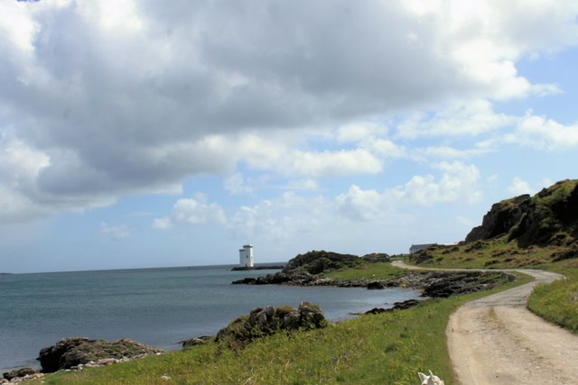
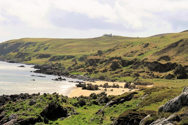
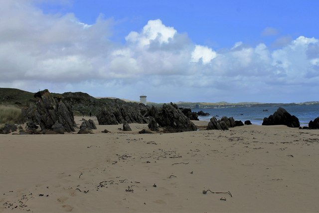
Imeraval is a small village located in Argyllshire, Scotland. Situated near the coast, it offers stunning views of the surrounding countryside and the nearby Loch Fyne. The village is known for its peaceful and picturesque setting, making it a popular destination for those looking to escape the hustle and bustle of city life.

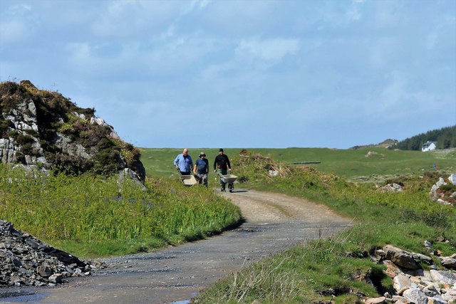
Imeraval is home to a tight-knit community of residents who take pride in maintaining the village's charm and character. The local economy is primarily based on agriculture and tourism, with many visitors drawn to the area for its natural beauty and outdoor recreational opportunities.

In terms of amenities, Imeraval has a few small shops and cafes where residents and visitors can purchase essentials and enjoy a meal or a cup of coffee. The village also has a primary school, providing education for the local children.

Overall, Imeraval is a tranquil and idyllic village that offers a peaceful retreat for those looking to unwind and enjoy the beauty of the Scottish countryside.

If you have any feedback on the listing, please let us know in the comments section below.
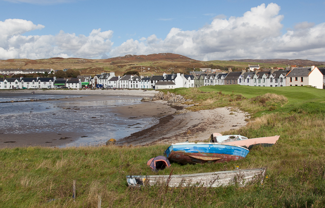
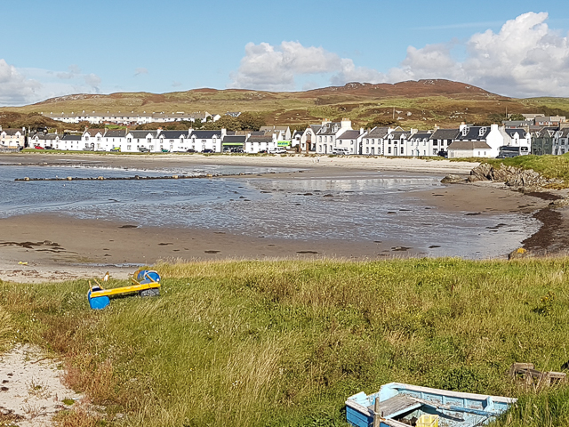
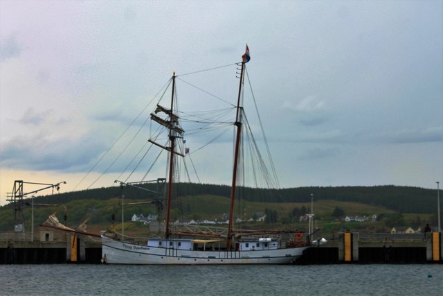
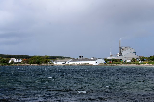
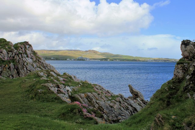
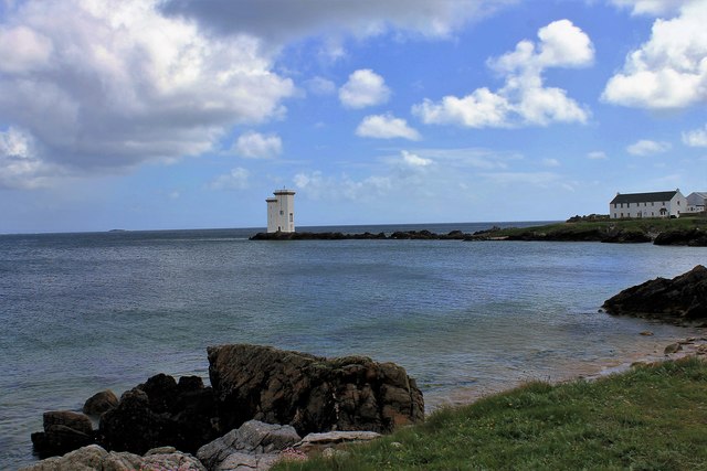
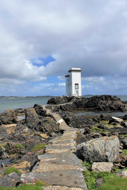
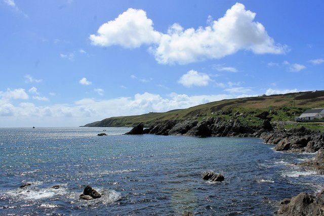
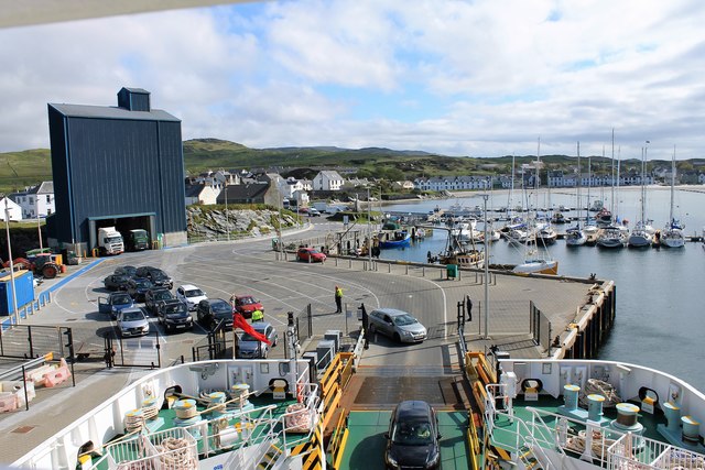
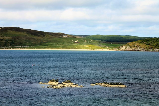
Imeraval Images

Images are sourced within 2km of 55.63385/-6.2047931 or Grid Reference NR3545. Thanks to Geograph Open Source API. All images are credited.

Seashore in Port Ellen
Panorama of Port Ellen
Flying Dutchman at the Quayside The yacht Flying Dutchman at Port Ellen. On the left grain loading gear can be seen.
Flying Dutchman at the Quayside
The yacht Flying Dutchman at Port Ellen. On the left grain loading gear can be seen.
Maltings and Warehouses The large maltings and old distillery of Port Ellen. The distillery has been long shut down and its buildings converted to warehousing.
Maltings and Warehouses
The large maltings and old distillery of Port Ellen. The distillery has been long shut down and its buildings converted to warehousing.
Kilnaughton Cemetery The cemetery of Kilnaughton above the bay with Carraig Fhada beyond.
Kilnaughton Cemetery
The cemetery of Kilnaughton above the bay with Carraig Fhada beyond.
Kilnaughton Chapel The old ruined chapel at Kilnaughton.
Kilnaughton Chapel
The old ruined chapel at Kilnaughton.
Kilnaughton Beach The sands at Kilnaughton.
Kilnaughton Beach
The sands at Kilnaughton.
Long Winding Road to Carraig Fhada Or rather the path that leads to Carraig Fhada.
Long Winding Road to Carraig Fhada
Or rather the path that leads to Carraig Fhada.
Rocks by Alt Leathan Rocks by the shore and Port Ellen in the distance.
Rocks by Alt Leathan
Rocks by the shore and Port Ellen in the distance.
Bay by Carraig Fhada A small bay by the skerry with the dual towered light of Carraig Fhada.
Bay by Carraig Fhada
A small bay by the skerry with the dual towered light of Carraig Fhada.
Lighthouse Path The footpath over the rocks to the lighthouse of Carraig Fhada.
Lighthouse Path
The footpath over the rocks to the lighthouse of Carraig Fhada.
South of the Lighthouse The rocky shore and bays to the south of Carraig Fhada.
South of the Lighthouse
The rocky shore and bays to the south of Carraig Fhada.
Traigh Bhan Traigh Bhan or the Singing Sands.
Traigh Bhan
Traigh Bhan or the Singing Sands.
Treble Cliffs of the Singing Sands The pun was too strong to ignore! More like dykes than cliffs, these stone rows interrupt the singing sands of Traigh Bhan.
Treble Cliffs of the Singing Sands
The pun was too strong to ignore! More like dykes than cliffs, these stone rows interrupt the singing sands of Traigh Bhan.
Carraig Fhada Bridge A wee footbridge links Carraig Fhada to the shore. Could this rival  Seil and Skye as the third bridge over the Atlantic?
Carraig Fhada Bridge
A wee footbridge links Carraig Fhada to the shore. Could this rival Seil and Skye as the third bridge over the Atlantic?
Three Men with Barrows Volunteers fulfil many functions in society even in Islay or maybe especially on Islay. These tree guys have taken on the upkeep of the track to Carraig Fhada and each Sunday meet and carry out repairs to the untarmacked road.
Three Men with Barrows
Volunteers fulfil many functions in society even in Islay or maybe especially on Islay. These tree guys have taken on the upkeep of the track to Carraig Fhada and each Sunday meet and carry out repairs to the untarmacked road.
Loading the Ferry Loading from the pier at Port Ellen. On the left is Diageo's grain store for the maltings on the edge of the village, complete with trucks in the loading bay.
Loading the Ferry
Loading from the pier at Port Ellen. On the left is Diageo's grain store for the maltings on the edge of the village, complete with trucks in the loading bay.
Sgeir nan Ron Sgeir nan Ron, skerry of the seals, a small skerry just off Port Ellen pier. In the distance the sands of Kilnaughton Beach.
Sgeir nan Ron
Sgeir nan Ron, skerry of the seals, a small skerry just off Port Ellen pier. In the distance the sands of Kilnaughton Beach.
Show me another place!

Imeraval is located at Grid Ref: NR3545 (Lat: 55.63385, Lng: -6.2047931)

Unitary Authority: Argyll and Bute

Police Authority: Argyll and West Dunbartonshire

What 3 Words

///belief.format.ropes. Near Port Ellen, Argyll & Bute

Related Wikis

Port Ellen distillery

Port Ellen distillery is located in Port Ellen on the isle of Islay, Scotland. It initially operated between 1825 and 1983 when production shut down....

St John's Church, Port Ellen

St John's Church, Port Ellen is a Category B listed building in Port Ellen, Islay, Argyll and Bute, Scotland. == History == The memorial stone for the...

Port Ellen

Port Ellen (Scottish Gaelic: Port Ìlein) is a small town on the island of Islay, in Argyll, Scotland. The town is named after the wife of its founder,...

Leorin Loch

Leorin Loch is of the impounding variety, located 2.5 kilometres north of Port Ellen, and is one of a group of three lochs supplying water to the island...

Nearby Amenities

Located within 500m of 55.63385,-6.2047931
Name En: Port Ellen
Name Gd: Port Eilein
Traffic Sign: city_limit
Lat/Long: 55.6337502/-6.2009234
Emerivale Cottage
Internet Access: wlan
Internet Access Fee: no
Smoking: no
Tourism: chalet
Wheelchair: no
Lat/Long: 55.634698/-6.2057086
Material: wood
Power: pole
Lat/Long: 55.6351738/-6.2032369
Power: pole
Lat/Long: 55.6353532/-6.2010942
Power: pole
Lat/Long: 55.6357847/-6.1980528
Power: pole
Lat/Long: 55.6346061/-6.1980747
Power: pole
Lat/Long: 55.6345226/-6.198968
Power: pole
Lat/Long: 55.6342226/-6.1981186
Power: pole
Lat/Long: 55.6341128/-6.199779
Power: pole
Lat/Long: 55.6351196/-6.1989625
Power: pole
Lat/Long: 55.6352526/-6.2002119
Power: pole
Lat/Long: 55.6349591/-6.2056215
Power: pole
Lat/Long: 55.6349931/-6.2070134
Power: pole
Lat/Long: 55.6350844/-6.2089671
Material: wood
Power: pole
Lat/Long: 55.6352329/-6.2120468
Power: pole
Lat/Long: 55.6337341/-6.2084464
Carraig Beag
Place: isolated_dwelling
Lat/Long: 55.6335413/-6.2079116
Material: wood
Power: pole
Lat/Long: 55.6352724/-6.2020597
Material: wood
Power: pole
Lat/Long: 55.6350612/-6.2044876
Power: pole
Lat/Long: 55.6351826/-6.211003
Power: pole
Lat/Long: 55.6351295/-6.2099016
Power: pole
Lat/Long: 55.6350425/-6.2080713
Power: pole
Lat/Long: 55.6349503/-6.2058474
Power: pole
Lat/Long: 55.6344454/-6.2087207
Power: pole
Lat/Long: 55.633857/-6.2084938
Imeraval
Name Gd: Iomair a’ Bhaile
Place: hamlet
Lat/Long: 55.6337291/-6.2042363
The data included in this document is from www.openstreetmap.org. The data is made available under ODbL.

Have you been to Imeraval?

Leave your review of Imeraval below (or comments, questions and feedback).