Ilsington

Settlement in Devon Teignbridge

England

Ilsington

Cottages in Haytor Vale Haytor Vale is a village located in the eastern section of Dartmoor below Haytor Rocks.
Cottages in Haytor Vale Credit: Richard Dorrell

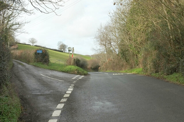
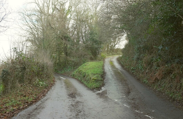
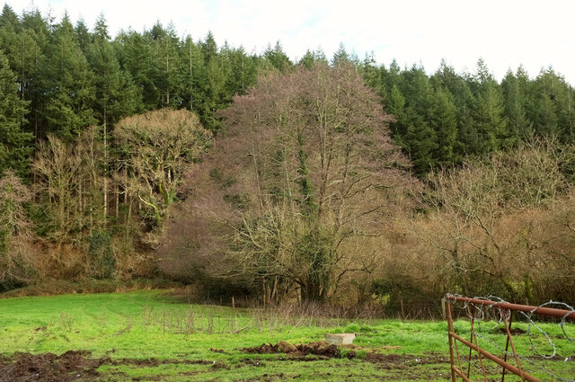
Ilsington is a small village located in the county of Devon, England. It is situated on the eastern edge of Dartmoor National Park, offering a picturesque and tranquil setting. The village is nestled amidst rolling hills, lush green fields, and dense woodlands, making it an ideal destination for nature lovers and outdoor enthusiasts.

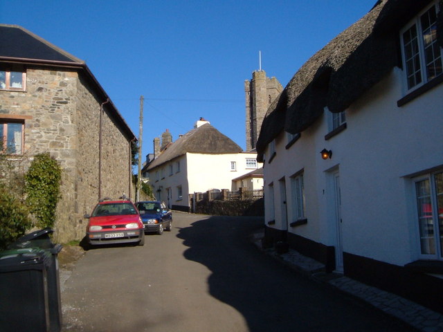
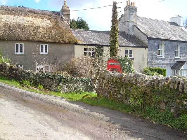
With a population of around 500 residents, Ilsington maintains a close-knit community atmosphere. The village features a charming mix of traditional thatched cottages, stone houses, and modern buildings, showcasing the area's rich architectural heritage. Its narrow lanes are lined with vibrant gardens and well-preserved historic landmarks, such as the 13th-century St. Michael's Church, which is known for its beautiful stained glass windows and intricate carvings.

Ilsington provides various amenities for both locals and visitors. The village has a primary school, a village hall, and a post office, ensuring the basic needs of its residents are met. Additionally, there are a few local shops and a cozy pub where visitors can enjoy a drink or a traditional meal.

Nature enthusiasts can explore the surrounding area through numerous walking trails and paths that offer breathtaking views of the moorland and the Teign Valley. Ilsington also provides easy access to Dartmoor's rugged terrain, where visitors can partake in activities such as hiking, cycling, horse riding, and wildlife spotting.

Overall, Ilsington offers a peaceful and idyllic rural retreat, providing visitors with a glimpse into the beauty of the Devon countryside.

If you have any feedback on the listing, please let us know in the comments section below.

Ilsington Images

Images are sourced within 2km of 50.572417/-3.7193167 or Grid Reference SX7876. Thanks to Geograph Open Source API. All images are credited.

Cottages in Haytor Vale Haytor Vale is a village located in the eastern section of Dartmoor below Haytor Rocks.
Cottages in Haytor Vale
Haytor Vale is a village located in the eastern section of Dartmoor below Haytor Rocks.
Cottages in Haytor Vale The Rock Inn stands centrally in this row of cottages in the village.
Cottages in Haytor Vale
The Rock Inn stands centrally in this row of cottages in the village.
Haytor Vale WI Lodge A news article on the Rendells Estate Agency website, dated 17th June 2021, reads thus: 
'Rendells Commercial department at Newton Abbot are pleased to report another successful auction. They were pleased to be instructed by The Trustees of The Haytor Vale W.I. Hut to value and sell their premises at Haytor Vale within The Dartmoor National Park. The Hut was erected for the members in 1934 by the respected Newton Abbot builders Kennards and the hut has been in continual use by The Haytor Vale W.I. since that date. They have maintained the building and modernized where required over the years and the building is a fine example of its type that shows little sign of age. The property was offered for sale by Auction at the Jolly Farmer Newton Abbot on the 16th of June and the auction was well attended with a number of the W.I. members present. The bidding started at £75,000 which steadily rose to the final bid where the property was sold at £114.000. The members expressed their pleasure at the sum realised which will help them with their future ventures from their new base at The Ilsington Village Hall'.
Haytor Vale WI Lodge
A news article on the Rendells Estate Agency website, dated 17th June 2021, reads thus: 'Rendells Commercial department at Newton Abbot are pleased to report another successful auction. They were pleased to be instructed by The Trustees of The Haytor Vale W.I. Hut to value and sell their premises at Haytor Vale within The Dartmoor National Park. The Hut was erected for the members in 1934 by the respected Newton Abbot builders Kennards and the hut has been in continual use by The Haytor Vale W.I. since that date. They have maintained the building and modernized where required over the years and the building is a fine example of its type that shows little sign of age. The property was offered for sale by Auction at the Jolly Farmer Newton Abbot on the 16th of June and the auction was well attended with a number of the W.I. members present. The bidding started at £75,000 which steadily rose to the final bid where the property was sold at £114.000. The members expressed their pleasure at the sum realised which will help them with their future ventures from their new base at The Ilsington Village Hall'.
Cottamoor Cross This junction, just south of Haytor Vale village, is named as a cross, even though it is only a t-junction.
Cottamoor Cross
This junction, just south of Haytor Vale village, is named as a cross, even though it is only a t-junction.
Gated track Looking east from a little way south of Haytor Vale village.
Gated track
Looking east from a little way south of Haytor Vale village.
Tor Garage Offering a range of garage services from its very rural location.
Tor Garage
Offering a range of garage services from its very rural location.
Lewthorn Cross Road junction a little to the west of Ilsington village.
There have been a couple of changes since Alex McGregor photographed this junction in 2015 - the post box is gone, and the signpost has grown a new arm - see <a href="https://www.geograph.org.uk/photo/4308310">SX7776 : Lewthorne cross</a>.
Lewthorn Cross
Road junction a little to the west of Ilsington village. There have been a couple of changes since Alex McGregor photographed this junction in 2015 - the post box is gone, and the signpost has grown a new arm - see SX7776 : Lewthorne cross.
Very minor road Any modern motor vehicle would brush the vegetation on both sides of this minor road between Lewthorn Cross and Trumpeter.
Very minor road
Any modern motor vehicle would brush the vegetation on both sides of this minor road between Lewthorn Cross and Trumpeter.
Grazing land Cattle pasture between Haytor Vale and Ilsington.
Grazing land
Cattle pasture between Haytor Vale and Ilsington.
South through Green Lane Green Lane is a small settlement east of Haytor Vale.
South through Green Lane
Green Lane is a small settlement east of Haytor Vale.
Cattle grid The road descends into Green Lane village.
Cattle grid
The road descends into Green Lane village.
Green Lane End The signpost is at the junction with the B3387. The road on the right descends into Green Lane village.
Green Lane End
The signpost is at the junction with the B3387. The road on the right descends into Green Lane village.
Willis's Cross The junction is also shown at <a title="https://www.geograph.org.uk/search.php?i=173337416" href="https://www.geograph.org.uk/search.php?i=173337416">Link</a> .
Willis's Cross
The junction is also shown at Link .
Field and woods, Ilsington Looking left from where <a href="https://www.geograph.org.uk/photo/3724198">SX7875 : Valley south of Ilsington</a> was taken. The large wood is Lenda Wood.
Field and woods, Ilsington
Looking left from where SX7875 : Valley south of Ilsington was taken. The large wood is Lenda Wood.
Lane junction near Ilsington Southwest of the village: left for Lounston, right for Sigford.
Lane junction near Ilsington
Southwest of the village: left for Lounston, right for Sigford.
Five Cross A different angle on the junction where <a href="https://www.geograph.org.uk/photo/3727319">SX7874 : Five Cross</a> was taken. The diminutive signpost has been made a respectable size and a hydrant marker has attached itself to the Elizabeth II postbox. The eggs have sold out. In the background, the slightly wiggly lane heads to Haytor Vale and Ilsington.
Five Cross
A different angle on the junction where SX7874 : Five Cross was taken. The diminutive signpost has been made a respectable size and a hydrant marker has attached itself to the Elizabeth II postbox. The eggs have sold out. In the background, the slightly wiggly lane heads to Haytor Vale and Ilsington.
River Lemon Looking downstream from Cocksland Bridge. Immediately below the camera is a small weir.
River Lemon
Looking downstream from Cocksland Bridge. Immediately below the camera is a small weir.
Trees near Pool Down Wood A view from the road up the Liverton Brook valley. Pool Down Wood is in the background. The central tree with a purplish hue can only be an alder.
Trees near Pool Down Wood
A view from the road up the Liverton Brook valley. Pool Down Wood is in the background. The central tree with a purplish hue can only be an alder.
Show me another place!

Ilsington is located at Grid Ref: SX7876 (Lat: 50.572417, Lng: -3.7193167)

Administrative County: Devon

District: Teignbridge

Police Authority: Devon and Cornwall

What 3 Words

///sailors.snowy.spellings. Near Bovey Tracey, Devon

Related Wikis

Ilsington

Ilsington is a village and civil parish situated on the eastern edge of Dartmoor, Devon, England. It is one of the largest parishes in the county, and...
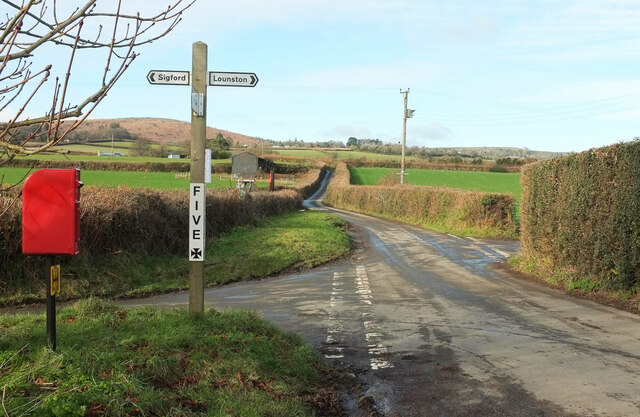
Sigford

Sigford is a small hamlet in the Parish of Ilsington, on the eastern edge of Dartmoor, Devon, England. It is situated at the confluence of three rivers...

Yarner Wood & Trendlebere Down

Yarner Wood & Trendlebere Down in Dartmoor, Devon, England is a woodland managed by Natural England. The woodland is part of the East Dartmoor Woods and...
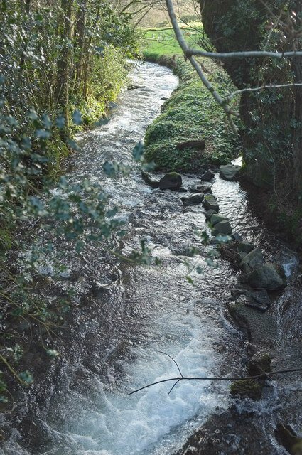
River Sig

The River Sig is a 2.4 mile long river on Dartmoor in the county of Devon, England. It is a tributary to the River Lemon which it meets at Sigford. �...

Nearby Amenities

Located within 500m of 50.572417,-3.7193167
Ilsington
Place: village
Lat/Long: 50.5724187/-3.7174754
Lewthorn Cross
Place: locality
Lat/Long: 50.5718128/-3.7249134
Disused Amenity: post_box
Note: No longer on Royal Mail list. Surveyed in Dec 2021 and post box is definitely no longer in place nor in the vicinity so suggest removing from OSM
Post Box Design: waggon_top
Post Box Mounting: wooden_post
Post Box Type: lamp
Ref: TQ13 202
Royal Cypher: GVIR
Lat/Long: 50.5718689/-3.7247088
Ilsington village store
Name En: Ilsington village store
Shop: convenience
Lat/Long: 50.5716795/-3.7141862
Pub
Carpenters Arms
Name En: Carpenters Arms
Wikidata: Q80476386
Lat/Long: 50.5720786/-3.7159712
Generator Method: photovoltaic
Generator Output Electricity: yes
Generator Source: solar
Generator Type: solar_photovoltaic_panel
Location: roof
Power: generator
Lat/Long: 50.5713144/-3.715872
Generator Method: photovoltaic
Generator Output Electricity: yes
Generator Source: solar
Generator Type: solar_photovoltaic_panel
Location: roof
Power: generator
Lat/Long: 50.5712692/-3.7158251
Generator Method: photovoltaic
Generator Output Electricity: yes
Generator Source: solar
Generator Type: solar_photovoltaic_panel
Location: roof
Power: generator
Lat/Long: 50.5715571/-3.7134849
Generator Method: photovoltaic
Generator Output Electricity: yes
Generator Source: solar
Generator Type: solar_photovoltaic_panel
Location: roof
Power: generator
Lat/Long: 50.5712718/-3.7141715
Generator Method: photovoltaic
Generator Output Electricity: yes
Generator Source: solar
Generator Type: solar_photovoltaic_panel
Location: roof
Power: generator
Lat/Long: 50.5711789/-3.7143512
Generator Method: photovoltaic
Generator Output Electricity: yes
Generator Source: solar
Generator Type: solar_photovoltaic_panel
Location: roof
Power: generator
Lat/Long: 50.5710571/-3.7147857
Generator Method: photovoltaic
Generator Output Electricity: yes
Generator Source: solar
Generator Type: solar_photovoltaic_panel
Location: roof
Power: generator
Lat/Long: 50.5710605/-3.714889
Generator Method: photovoltaic
Generator Output Electricity: yes
Generator Source: solar
Generator Type: solar_photovoltaic_panel
Location: roof
Power: generator
Lat/Long: 50.5710903/-3.7151183
Generator Method: photovoltaic
Generator Output Electricity: yes
Generator Source: solar
Generator Type: solar_photovoltaic_panel
Location: roof
Power: generator
Lat/Long: 50.5714941/-3.7149467
Generator Method: photovoltaic
Generator Output Electricity: yes
Generator Source: solar
Generator Type: solar_photovoltaic_panel
Location: roof
Power: generator
Lat/Long: 50.5719745/-3.7146918
Generator Method: photovoltaic
Generator Output Electricity: yes
Generator Source: solar
Generator Type: solar_photovoltaic_panel
Location: roof
Power: generator
Lat/Long: 50.5721976/-3.717932
Generator Method: photovoltaic
Generator Output Electricity: yes
Generator Source: solar
Generator Type: solar_photovoltaic_panel
Location: roof
Power: generator
Lat/Long: 50.5716176/-3.7185703
Generator Method: photovoltaic
Generator Output Electricity: yes
Generator Source: solar
Generator Type: solar_photovoltaic_panel
Location: roof
Power: generator
Lat/Long: 50.5716559/-3.7191671
Generator Method: photovoltaic
Generator Output Electricity: yes
Generator Source: solar
Generator Type: solar_photovoltaic_panel
Location: roof
Power: generator
Lat/Long: 50.5716806/-3.7198216
Post Office
Ilsington Post Office
Addr City: Ilsington
Addr Housename: Ilsington Village Hall
Addr Postcode: TQ13 9RG
Addr Street: Old Town Hill
Opening Hours: Mo 09:00-13:00; Fr 09:00-11:30
Ref Pol Id: 118560
Source: pol_branch_list_2020‑11‑13
Lat/Long: 50.5719515/-3.7146819
Post Box
Brand: Royal Mail
Brand Wikidata: Q638098
Brand Wikipedia: en:Royal Mail
Collection Times: Mo-Fr 12:00; Sa 12:30; Su off
Drive Through: no
Operator: Royal Mail
Operator Wikidata: Q638098
Post Box Mounting: pier
Post Box Type: lamp
Ref: TQ13 265
Royal Cypher: EIIR
Royal Cypher Wikidata: Q33102113
Source: local knowledge;survey;streetlevel imagery
Lat/Long: 50.5719417/-3.7144202
Defibrillator
Emergency: defibrillator
Lat/Long: 50.5719988/-3.714792
Ilsington Vilage Shop
Shop: convenience
Lat/Long: 50.5719268/-3.7146347
Entrance: yes
Lat/Long: 50.5720496/-3.7159564
The data included in this document is from www.openstreetmap.org. The data is made available under ODbL.

Have you been to Ilsington?

Leave your review of Ilsington below (or comments, questions and feedback).