Braco

Hill, Mountain in Angus

Scotland

Braco

Glen Lethnot One of the smaller Angus Glens running into rounded hills where many tracks lead up to grouse butts.
Glen Lethnot Credit: Gordon Hatton

Braco, Angus is a hill located in the Angus region of Scotland. It is part of the Angus Glens, a range of hills and mountains known for their rugged beauty and stunning views. Braco, Angus stands at an elevation of approximately 515 meters (1,690 feet) above sea level.

The hill is a popular destination for hikers and outdoor enthusiasts, offering a variety of trails and paths for all skill levels. The summit of Braco, Angus provides panoramic views of the surrounding countryside, including the nearby towns of Kirriemuir and Forfar.

The landscape around Braco, Angus is characterized by rolling hills, heather-covered moorland, and scattered woodlands. Wildlife such as red deer, mountain hares, and various bird species can often be spotted in the area.

Braco, Angus is easily accessible by car, with parking available at the base of the hill. Visitors are advised to wear sturdy footwear and dress appropriately for the unpredictable Scottish weather. Overall, Braco, Angus offers a peaceful and picturesque setting for outdoor recreation and exploration.

If you have any feedback on the listing, please let us know in the comments section below.

Braco Images

Images are sourced within 2km of 56.823187/-2.8084454 or Grid Reference NO5070. Thanks to Geograph Open Source API. All images are credited.

Glen Lethnot One of the smaller Angus Glens running into rounded hills where many tracks lead up to grouse butts.
Glen Lethnot
One of the smaller Angus Glens running into rounded hills where many tracks lead up to grouse butts.
Woodland in Glen Lethnot Looking east across the West Water to woodland in Glen Lethnot.
Woodland in Glen Lethnot
Looking east across the West Water to woodland in Glen Lethnot.
Gully of the Burn of Freoch The wood fringed Burn of Freoch heading up the south-western flank of the Hill of Wirren from Glen Lethnot.
Gully of the Burn of Freoch
The wood fringed Burn of Freoch heading up the south-western flank of the Hill of Wirren from Glen Lethnot.
Road up Glen Lethnot Narrow minor road heading northwards up Glen Lethnot.
Road up Glen Lethnot
Narrow minor road heading northwards up Glen Lethnot.
Nathro Hill and Berry Cairn from the air Taken from a plane flying between Manchester and Aberdeen.
Nathro Hill and Berry Cairn from the air
Taken from a plane flying between Manchester and Aberdeen.
Walled fields From the Glen Lethnot road looking across West Water valley to the walled fields
Walled fields
From the Glen Lethnot road looking across West Water valley to the walled fields
West Water, Glen Lethnot Land here is given over to grouse shooting, tick bearing deer are excluded.
West Water, Glen Lethnot
Land here is given over to grouse shooting, tick bearing deer are excluded.
Glen Lethnot Burn of Freoch descends from Hill of Wirren towards an unseen West Water.
Glen Lethnot
Burn of Freoch descends from Hill of Wirren towards an unseen West Water.
Finnoch The fields, and broken dykes remain of Finnoch, a ruined farm in Glen Lethnot.
Finnoch
The fields, and broken dykes remain of Finnoch, a ruined farm in Glen Lethnot.
Road up Glen Lethnot The unfenced road runs through rough grazing and moorland opposite Finnoch.
Road up Glen Lethnot
The unfenced road runs through rough grazing and moorland opposite Finnoch.
Craigs of Stonyford The track is fairly new, and not yet shown on the OS map.
Craigs of Stonyford
The track is fairly new, and not yet shown on the OS map.
The road beside West Water
Across the West Water valley The Hill of Wirren is on the distant horizon.
Across the West Water valley
The Hill of Wirren is on the distant horizon.
Glen Lethnot The West Water flows down between the trees to Brigend.
Glen Lethnot
The West Water flows down between the trees to Brigend.
View towards the West Water A view to the south from West Wirren, with the course of the West Water visible (centre image) and forestry plantations on Nathro Hill beyond. West Wirren is a good vantage point, with Dundee Law and West Lomond Hill both visible - although almost obscured by haze in this image, which is a reverse view of  <a href="https://www.geograph.org.uk/photo/2054352">NO5071 : West Water</a>.
View towards the West Water
A view to the south from West Wirren, with the course of the West Water visible (centre image) and forestry plantations on Nathro Hill beyond. West Wirren is a good vantage point, with Dundee Law and West Lomond Hill both visible - although almost obscured by haze in this image, which is a reverse view of NO5071 : West Water.
Looking up Glen Lethnot The West Water in the floor of the Glen.
Looking up Glen Lethnot
The West Water in the floor of the Glen.
The winding road up Glen Lethnot The West Water flows through the birch trees to the right. Auchowrie Farm <a href="https://www.geograph.org.uk/gridref/NO5073">NO5073</a> can be seen on the far hillside.
The winding road up Glen Lethnot
The West Water flows through the birch trees to the right. Auchowrie Farm NO5073 can be seen on the far hillside.
Road up to the grouse butts Many estate roads have been built into the hills in recent years to facilitate shooting and stalking. This one tackles the steep slopes of the Craigs of Stonyford.
Road up to the grouse butts
Many estate roads have been built into the hills in recent years to facilitate shooting and stalking. This one tackles the steep slopes of the Craigs of Stonyford.
Show me another place!

Braco is located at Grid Ref: NO5070 (Lat: 56.823187, Lng: -2.8084454)

Unitary Authority: Angus

Police Authority: Tayside

What 3 Words

///downturn.equipment.trees. Near Brechin, Angus

Nearby Locations

Braco

Related Wikis

Caterthun

Caterthun, or the Caterthuns, is a ridge of hills near the city of Brechin in Angus, Scotland. The Caterthuns are notable for being the site of two Iron...

Menmuir

Menmuir is a parish in the county of Angus in Scotland. Kirkton of Menmuir consists of only three houses (the Old Schoolhouse, the Manse, the Old Inn)...

Angus (UK Parliament constituency)

Angus is a county constituency of the House of Commons of the Parliament of the United Kingdom (at Westminster). It elects one Member of Parliament (MP...

Edzell Castle

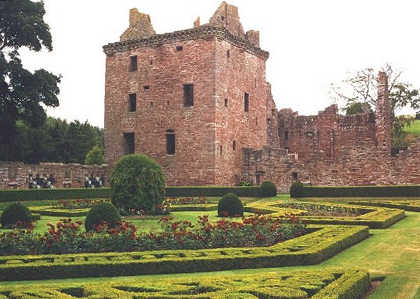
Edzell Castle is a ruined 16th-century castle, with an early-17th-century walled garden. It is located close to Edzell, and is around 5 miles (8 km) north...

Nearby Amenities

Located within 500m of 56.823187,-2.8084454
Braco
Name Gd: Breacach
Place: isolated_dwelling
Lat/Long: 56.8215816/-2.8111427
Westside
Place: locality
Lat/Long: 56.8224134/-2.8111594
Drumhead
Place: locality
Lat/Long: 56.8246503/-2.8114061
Ford: yes
Lat/Long: 56.823154/-2.8155535
Power: pole
Lat/Long: 56.8246187/-2.8006619
Power: pole
Lat/Long: 56.8252363/-2.801271
Power: pole
Lat/Long: 56.8216248/-2.8010209
Power: pole
Lat/Long: 56.821559/-2.8023118
Power: pole
Lat/Long: 56.8214931/-2.8035435
Power: pole
Lat/Long: 56.8214409/-2.8047351
Power: pole
Lat/Long: 56.8213813/-2.8057644
Power: pole
Lat/Long: 56.821327/-2.8068682
Power: pole
Lat/Long: 56.8212705/-2.8079204
Power: pole
Lat/Long: 56.8211963/-2.8092571
Power: pole
Lat/Long: 56.8213416/-2.8098682
Power: pole
Lat/Long: 56.8214879/-2.810508
Power: pole
Lat/Long: 56.8192572/-2.8049249
Power: pole
Lat/Long: 56.8198365/-2.804881
Power: pole
Lat/Long: 56.820355/-2.8048345
Power: pole
Lat/Long: 56.8209089/-2.8047751
The data included in this document is from www.openstreetmap.org. The data is made available under ODbL.

Have you been to Braco?

Leave your review of Braco below (or comments, questions and feedback).