King's Hall Hill
Hill, Mountain in Herefordshire
England
King's Hall Hill

King's Hall Hill is a prominent hill located in the county of Herefordshire, England. Rising to an elevation of approximately 365 meters (1,198 feet), it forms part of the stunning Malvern Hills Area of Outstanding Natural Beauty. The hill is situated near the village of Colwall and offers breathtaking panoramic views of the surrounding countryside.
King's Hall Hill is renowned for its rich historical significance. It derives its name from the nearby King's Hall, a medieval manor house that once stood at the foot of the hill. The remnants of this ancient building can still be observed today, adding to the area's allure.
The hill itself is characterized by its gentle slopes and lush greenery, making it a popular location for outdoor activities such as hiking and nature walks. A network of well-maintained trails crisscrosses the hill, providing visitors with ample opportunities to explore its scenic beauty.
The diverse flora and fauna found on King's Hall Hill further enhance its appeal. The hill is home to a variety of plant species, including vibrant wildflowers and ancient woodland. It also provides a habitat for several animal species, including deer, foxes, and a plethora of birdlife.
In addition to its natural beauty, King's Hall Hill offers a sense of tranquility and serenity, making it a perfect destination for those seeking a peaceful retreat. Its idyllic location, combined with its historical significance and stunning views, make King's Hall Hill a must-visit destination for nature enthusiasts and history buffs alike.
If you have any feedback on the listing, please let us know in the comments section below.
King's Hall Hill Images
Images are sourced within 2km of 52.274617/-2.7257226 or Grid Reference SO5064. Thanks to Geograph Open Source API. All images are credited.


King's Hall Hill is located at Grid Ref: SO5064 (Lat: 52.274617, Lng: -2.7257226)
Unitary Authority: County of Herefordshire
Police Authority: West Mercia
What 3 Words
///suspends.handicaps.wire. Near Orleton, Herefordshire
Related Wikis

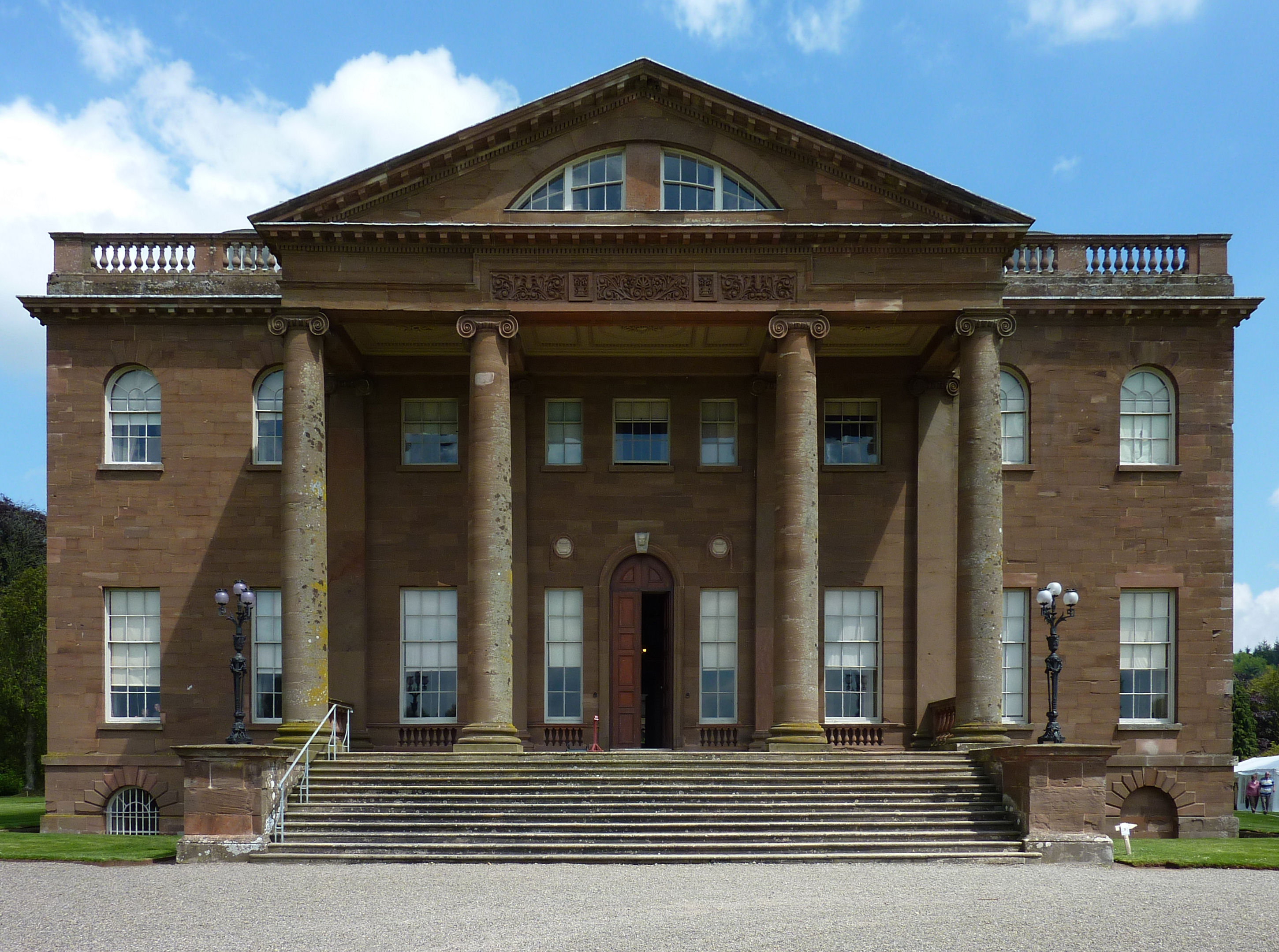
Berrington Hall
Berrington Hall is a country house located about 3 miles (5 km) north of Leominster, Herefordshire, England. During the 20th century it was the seat of...
Eye, Moreton and Ashton
Eye, Moreton and Ashton is a civil parish in the county of Herefordshire, England. The parish is 15 miles (24 km) north from the city and county town of...
Castle Frome
Castle Frome is a village and civil parish in the county of Herefordshire, England, and is 10 miles (16 km) north-east from the city and county town of...

Ashton, Herefordshire
Ashton is a village in the Eye, Moreton and Ashton civil parish of Herefordshire, England, and is 3 miles (5 km) north from Leominster, 15 miles (24 km...
Nearby Amenities
Located within 500m of 52.274617,-2.7257226Have you been to King's Hall Hill?
Leave your review of King's Hall Hill below (or comments, questions and feedback).