Blinkbonny Height

Hill, Mountain in Roxburghshire

Scotland

Blinkbonny Height

Raegill Knowes Quarry Abandoned quarry buildings.
Raegill Knowes Quarry Credit: Sandy Gerrard

Blinkbonny Height is a prominent hill located in Roxburghshire, Scotland. Situated in the southern part of the country, it offers breathtaking views of the surrounding landscape, making it a popular destination for nature enthusiasts and hikers alike.

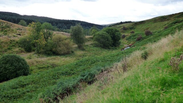
With an elevation of approximately 520 meters (1,706 feet), Blinkbonny Height is classified as a hill rather than a mountain. However, its impressive height still provides visitors with stunning panoramic vistas of the rolling hills, lush green valleys, and meandering rivers that characterize the Scottish Borders region.

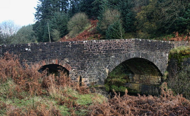
The hill is easily accessible, with a well-marked trail leading up to its summit. The path is relatively steep in some sections, but the effort is rewarded by the breathtaking views awaiting at the top. On clear days, it is possible to see as far as the Cheviot Hills, which lie on the border between Scotland and England.

Blinkbonny Height is also known for its diverse flora and fauna. The hill is home to a variety of heather, grasses, and wildflowers, which create a vibrant and colorful landscape during the warmer months. Birdwatchers can often spot species such as red grouse, merlin, and meadow pipit in the area.

Whether you are an avid hiker seeking a challenging ascent or simply wish to enjoy the tranquility and beauty of the Scottish countryside, Blinkbonny Height is a wonderful destination to explore. Its natural splendor and stunning views make it a must-visit location for outdoor enthusiasts visiting Roxburghshire.

If you have any feedback on the listing, please let us know in the comments section below.

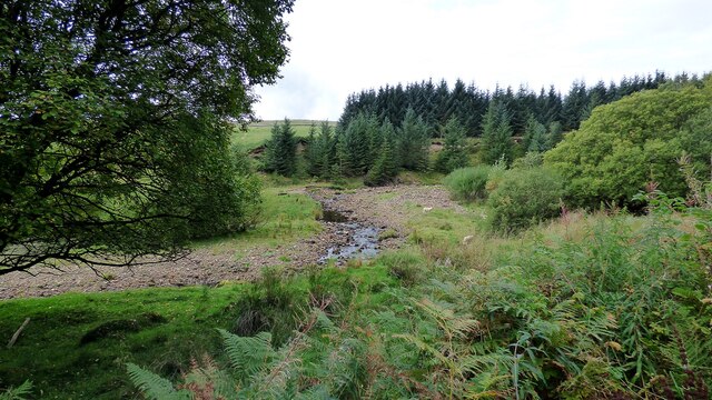
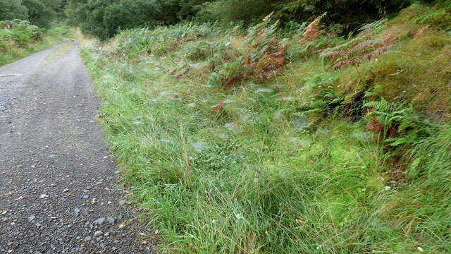
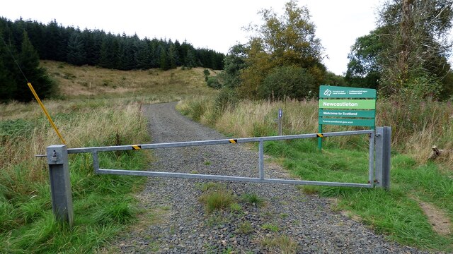
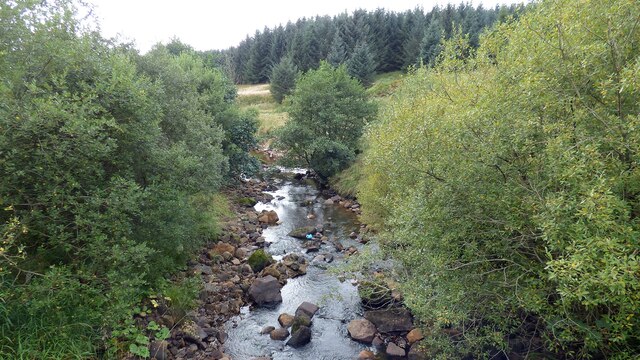
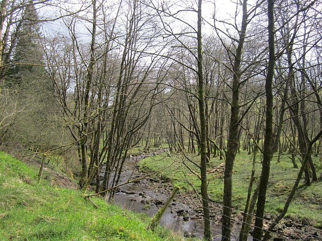
Blinkbonny Height Images

Images are sourced within 2km of 55.155918/-2.7862053 or Grid Reference NY5084. Thanks to Geograph Open Source API. All images are credited.

Raegill Knowes Quarry Abandoned quarry buildings.
Raegill Knowes Quarry
Abandoned quarry buildings.
Kershope Bridge Spans the Scottish English border. Raegill Knowes Quarry and buildings beyond.
Kershope Bridge
Spans the Scottish English border. Raegill Knowes Quarry and buildings beyond.
Kershope Burn at Day Holm Views from the forest track are few and far between which may explain why most of the photographs in this grid square are taken here.
Kershope Burn at Day Holm
Views from the forest track are few and far between which may explain why most of the photographs in this grid square are taken here.
Spider webs beside the forest track at Day Holm
Welcome to Scotland Forest gate across the track leading into Scotland.
Welcome to Scotland
Forest gate across the track leading into Scotland.
Kershope Burn This river denotes the boundary between Scotland and England in this area.
Kershope Burn
This river denotes the boundary between Scotland and England in this area.
Spanning the border: Kershope Bridge The Scotland/England boundary runs down the Kershope Burn, seen here at a low level.

This photograph was taken during the Coronavirus (COVID-19) pandemic of 2020/21/22.
Spanning the border: Kershope Bridge
The Scotland/England boundary runs down the Kershope Burn, seen here at a low level. This photograph was taken during the Coronavirus (COVID-19) pandemic of 2020/21/22.
Forest track near Burnt Shields
Forest track Between Burnt Shields and Tommy's Fell
Forest track
Between Burnt Shields and Tommy's Fell
Kershope Valley The border between England on the left and Scotland on the right.
Kershope Valley
The border between England on the left and Scotland on the right.
Kershope Bridge Kershope Bridge crossing Kershope Burn, the border between England and Scotland.
Kershope Bridge
Kershope Bridge crossing Kershope Burn, the border between England and Scotland.
Kershope Burn Kershope Burn, the border between England and Scotland, seen from Kershope Bridge.
Kershope Burn
Kershope Burn, the border between England and Scotland, seen from Kershope Bridge.
Kershope Bridge Lichen covered tree above Kershope Bridge.
Kershope Bridge
Lichen covered tree above Kershope Bridge.
Kershope Forest Sign at the entrance to part of Kershope Forest.
Kershope Forest
Sign at the entrance to part of Kershope Forest.
Kershope Forest Track in Kershope Forest.
Kershope Forest
Track in Kershope Forest.
Snowy track A sudden snowy downpour in the morning has brought some seasonal sparkle to the English side of the border.
Snowy track
A sudden snowy downpour in the morning has brought some seasonal sparkle to the English side of the border.
Winter across the border Snow has carpeted the Kershope Burn, the border between England and Scotland.
Winter across the border
Snow has carpeted the Kershope Burn, the border between England and Scotland.
Tweeden Burn At the foot of Hillhouse Wood, Newcastleton Forest.
Tweeden Burn
At the foot of Hillhouse Wood, Newcastleton Forest.
Show me another place!

Blinkbonny Height is located at Grid Ref: NY5084 (Lat: 55.155918, Lng: -2.7862053)

Unitary Authority: The Scottish Borders

Police Authority: The Lothians and Scottish Borders

What 3 Words

///lasted.apprehend.outgrown. Near Langholm, Dumfries & Galloway

Nearby Locations

Blinkbonny Height

Related Wikis

Mangerton Tower

Mangerton Tower is a ruined Scottish tower castle house formerly belonging to the Armstrong family. Mangerton Tower is at Mangerton in Newcastleton or...

Kershopefoot

Kershopefoot is a small hamlet in Cumbria, England, traditionally in Cumberland. It is located very close to the Scotland-England border and is near the...

Ettleton

Ettleton is a village near Castleton, in the Scottish Borders area of Scotland, in the former Roxburghshire. == Etymology and history == Ettleton Parish...

Kershope Burn

Kershope Burn is a small river; a tributary of both the Liddel Water and the River Esk; its final destination is the Solway Firth. The early stages begin...

Nearby Amenities

Located within 500m of 55.155918,-2.7862053
Blinkbonny Height
Ele: 265
Natural: peak
Lat/Long: 55.1548215/-2.7861983
The data included in this document is from www.openstreetmap.org. The data is made available under ODbL.

Have you been to Blinkbonny Height?

Leave your review of Blinkbonny Height below (or comments, questions and feedback).