Cot Hillock

Hill, Mountain in Aberdeenshire

Scotland

Cot Hillock

OS Rivet, Bridge near Culsh
OS Rivet, Bridge near Culsh Credit: thejackrustles

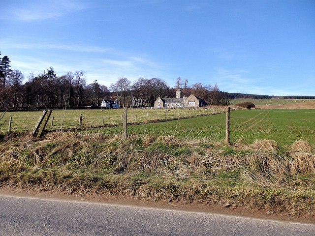
Cot Hillock is a prominent hill located in Aberdeenshire, Scotland. Standing at an elevation of approximately 374 meters (1,227 feet), it offers stunning panoramic views of the surrounding countryside. The hill is situated near the village of Fyvie, about 39 kilometers (24 miles) north of the city of Aberdeen.

Cot Hillock is characterized by its gentle slopes and grassy terrain, making it a popular destination for hikers and nature enthusiasts. Its location within the rolling hills of Aberdeenshire provides visitors with a sense of tranquility and natural beauty.

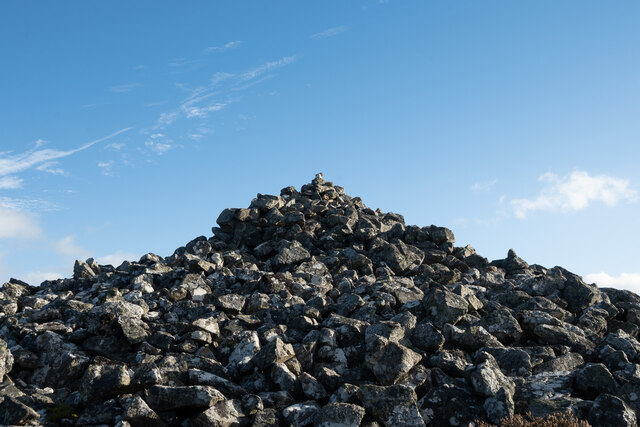
The hill is covered in heather and scattered with rocks, creating a picturesque landscape. As visitors ascend Cot Hillock, they may encounter a variety of wildlife, including birds such as red grouse and skylarks. The hill is also home to several species of wildflowers, which add a splash of color to the surroundings during the summer months.

At the summit of Cot Hillock, visitors are rewarded with breathtaking views of the surrounding area. On a clear day, one can see as far as the North Sea and the distant hills of the Cairngorms National Park. This vantage point offers a unique perspective of Aberdeenshire's diverse landscapes, from fertile farmland to rugged moorland.

Overall, Cot Hillock provides an ideal opportunity to immerse oneself in the natural beauty of Aberdeenshire while enjoying a peaceful and invigorating outdoor experience.

If you have any feedback on the listing, please let us know in the comments section below.
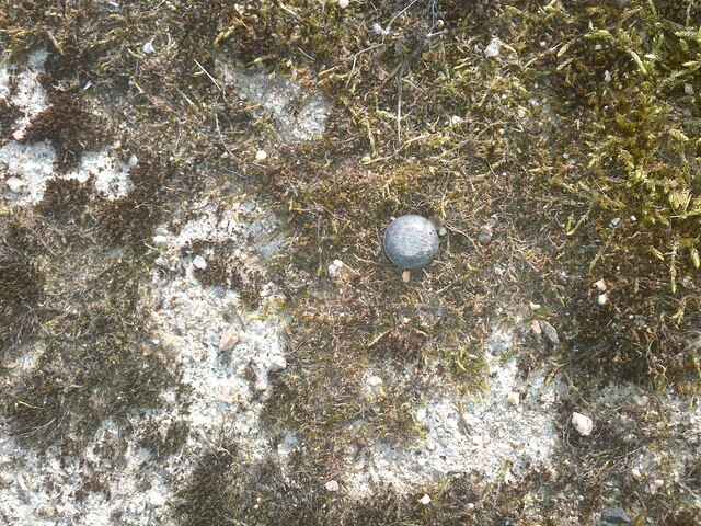
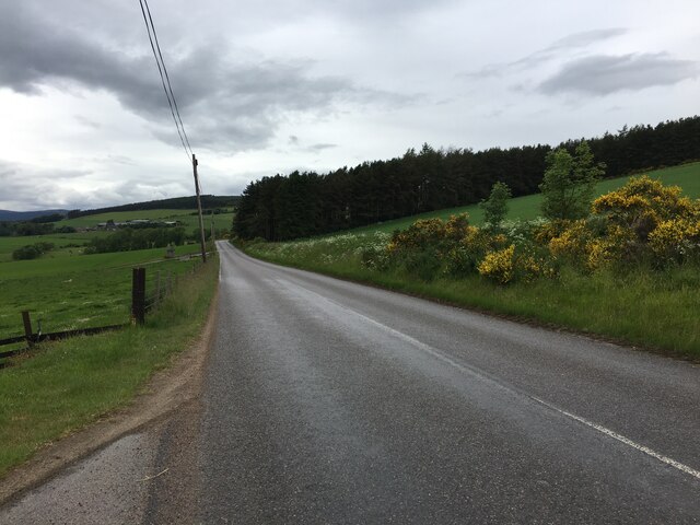
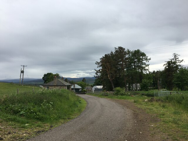
Cot Hillock Images

Images are sourced within 2km of 57.151333/-2.828914 or Grid Reference NJ4907. Thanks to Geograph Open Source API. All images are credited.

OS Rivet, Bridge near Culsh
Bridge, near Culsh
Bridge, near Culsh
B9119 towards Tarland
B9119 near Craskins
B9119 near Craskins
Minor road through Douneside
Close look at the Cairn of Pittenderich
B9119 towards Tarland
Tower Workshop, Tarland Lodge Viewed from the B9119.
Tower Workshop, Tarland Lodge
Viewed from the B9119.
Entrance to Tower Workshop (Antiques) Off B9119 approaching Tarland.
Entrance to Tower Workshop (Antiques)
Off B9119 approaching Tarland.
A covert on Tarland Lodge estate Seen from B9119.
A covert on Tarland Lodge estate
Seen from B9119.
Field near Ranna Looking across to the farm at Melgum with Morven beyond.
Field near Ranna
Looking across to the farm at Melgum with Morven beyond.
Tillychardoch  House A category B graded farmhouse just outside Tarland.
Tillychardoch House
A category B graded farmhouse just outside Tarland.
Behind Beech Hedges The beech hedges of Tillychardoch House with its farmland.
Behind Beech Hedges
The beech hedges of Tillychardoch House with its farmland.
Converted Steading A barn conversion on the edge of Kincraigie woodland.
Converted Steading
A barn conversion on the edge of Kincraigie woodland.
Culsh Earth House Were it not for the large road sign (in the background), you would have difficulty locating this souterrain.
Despite their name, earth houses were not dwellings but cellars, built partly or wholly underground and alongside or attached to houses above ground. They are also known by their French name, souterrain, because they are a widespread type of building found also in Brittany, Cornwall and Ireland. No evidence has been found to show exactly what was stored in them, but grain and other foodstuffs is a distinct possibility. The likely date is from about 400BC to the 1st or 2nd centuries AD.
Culsh Earth House
Were it not for the large road sign (in the background), you would have difficulty locating this souterrain. Despite their name, earth houses were not dwellings but cellars, built partly or wholly underground and alongside or attached to houses above ground. They are also known by their French name, souterrain, because they are a widespread type of building found also in Brittany, Cornwall and Ireland. No evidence has been found to show exactly what was stored in them, but grain and other foodstuffs is a distinct possibility. The likely date is from about 400BC to the 1st or 2nd centuries AD.
Hallhead Plantation This part of the forest has evidently been clear felled some time ago, leaving only a fringe of tall spindly Scots Pines like a tonsure round a small hillock.
Hallhead Plantation
This part of the forest has evidently been clear felled some time ago, leaving only a fringe of tall spindly Scots Pines like a tonsure round a small hillock.
Hallhead Plantation Scots Pines and the occasional Larch, with plenty of gaps allowing other species to flourish below the trees.
Hallhead Plantation
Scots Pines and the occasional Larch, with plenty of gaps allowing other species to flourish below the trees.
Hallhead Plantation Looking down from the upper part of a hairpin bend in the forest road to the lower part, just visible as a pinkish line beyond the trees.
Hallhead Plantation
Looking down from the upper part of a hairpin bend in the forest road to the lower part, just visible as a pinkish line beyond the trees.
Show me another place!

Cot Hillock is located at Grid Ref: NJ4907 (Lat: 57.151333, Lng: -2.828914)

Unitary Authority: Aberdeenshire

Police Authority: North East

What 3 Words

///segmented.lavished.imitate. Near Aboyne, Aberdeenshire

Nearby Locations

Cot Hillock Pittenderich

Related Wikis

Tarland

Tarland (Gaelic: Turlann) is a village in Aberdeenshire, Scotland and is located 5 miles (8 km) northwest of Aboyne, and 30 miles (50 km) west of Aberdeen...

Tomnaverie stone circle

Tomnaverie stone circle is a recumbent stone circle set on the top of a small hill in lowland northeast Scotland. Construction started from about 2500...

Cushnie Castle

Cushnie Castle was a 16th-century tower house, about 6 miles (9.7 km) south west of Alford, Aberdeenshire, Scotland, near Cushnie Burn, in the Glen of...
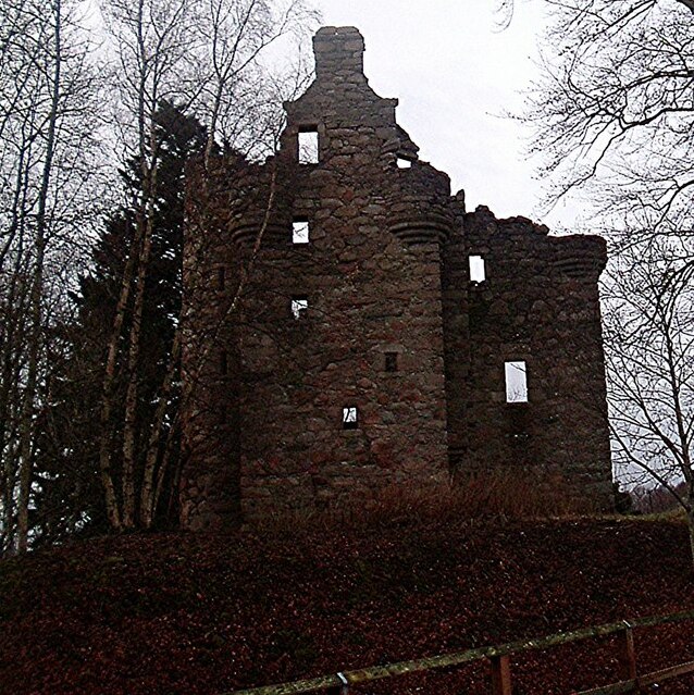
Corse Castle

Corse Castle near Lumphanan in Aberdeenshire, now ruined, was a fortress and centre of a landed estate in the north-east of Scotland. The present castle...

Nearby Amenities

Located within 500m of 57.151333,-2.828914
Power: tower
Lat/Long: 57.1488042/-2.8326426
Power: tower
Lat/Long: 57.1487623/-2.8292109
Power: tower
Lat/Long: 57.1487258/-2.826218
The data included in this document is from www.openstreetmap.org. The data is made available under ODbL.

Have you been to Cot Hillock?

Leave your review of Cot Hillock below (or comments, questions and feedback).