Craig Duchrey

Hill, Mountain in Angus

Scotland

Craig Duchrey

Minor road and bridge crossing the Burn of Auchowrie Looking westward from the entrance track to Auchowrie.
Minor road and bridge crossing the Burn of Auchowrie Credit: Peter Wood

Craig Duchrey is a prominent hill located in the Angus region of Scotland. Standing at an elevation of 563 meters (1,847 feet), it is classified as a Marilyn, which means it is a hill with a prominence of at least 150 meters (492 feet). It is situated approximately 14 kilometers (8.7 miles) northwest of the town of Kirriemuir.

This hill is part of the southern Grampian Mountains and offers stunning panoramic views of the surrounding landscape. Its location makes it a popular destination for hillwalkers and hikers, who are attracted to its relatively moderate difficulty level and breathtaking vistas.

Craig Duchrey is composed mainly of granite and is characterized by its rugged terrain, with steep slopes and craggy outcrops. The hill is covered in heather and grass, providing a picturesque setting, especially during the summer months when the landscape bursts with vibrant colors.

The summit of Craig Duchrey is marked by a small cairn, offering a sense of accomplishment for those who reach the top. On clear days, it is possible to see the nearby hills and mountains, such as Mount Battock and Mount Keen, as well as distant landmarks like the North Sea coastline.

Overall, Craig Duchrey is a captivating hill in the Angus region, attracting outdoor enthusiasts with its natural beauty, challenging terrain, and awe-inspiring vistas.

If you have any feedback on the listing, please let us know in the comments section below.

Craig Duchrey Images

Images are sourced within 2km of 56.832042/-2.8241392 or Grid Reference NO4971. Thanks to Geograph Open Source API. All images are credited.

Minor road and bridge crossing the Burn of Auchowrie Looking westward from the entrance track to Auchowrie.
Minor road and bridge crossing the Burn of Auchowrie
Looking westward from the entrance track to Auchowrie.
Glen Lethnot One of the smaller Angus Glens running into rounded hills where many tracks lead up to grouse butts.
Glen Lethnot
One of the smaller Angus Glens running into rounded hills where many tracks lead up to grouse butts.
The road down Glen Lethnot The glen has areas of grassland and some farming as well as heather covered hillsides such as that in the distance which appears to have had patches of heather burned for the benefit of grouse [and those who shoot them].
The road down Glen Lethnot
The glen has areas of grassland and some farming as well as heather covered hillsides such as that in the distance which appears to have had patches of heather burned for the benefit of grouse [and those who shoot them].
Glen Lethnot above Stonyford The West Water is hidden here by trees and bracken covered slopes, but the wooden tower of a footbridge can just be seen. Grouse moors in the distance.
Glen Lethnot above Stonyford
The West Water is hidden here by trees and bracken covered slopes, but the wooden tower of a footbridge can just be seen. Grouse moors in the distance.
Woodland in Glen Lethnot Looking east across the West Water to woodland in Glen Lethnot.
Woodland in Glen Lethnot
Looking east across the West Water to woodland in Glen Lethnot.
Gully of the Burn of Freoch The wood fringed Burn of Freoch heading up the south-western flank of the Hill of Wirren from Glen Lethnot.
Gully of the Burn of Freoch
The wood fringed Burn of Freoch heading up the south-western flank of the Hill of Wirren from Glen Lethnot.
Road up Glen Lethnot Narrow minor road heading northwards up Glen Lethnot.
Road up Glen Lethnot
Narrow minor road heading northwards up Glen Lethnot.
West Water in Glen Lethnot Looking from the bridge at Stonyford upstream of the West Water.
West Water in Glen Lethnot
Looking from the bridge at Stonyford upstream of the West Water.
Glen Lethnot Road The road in Glen Lethnot heading westwards between Stonyford and Tillybardine.
Glen Lethnot Road
The road in Glen Lethnot heading westwards between Stonyford and Tillybardine.
South-west flank of West Craig Looking up the heathery flank of West Craig from Tillybardine to the south-west.
South-west flank of West Craig
Looking up the heathery flank of West Craig from Tillybardine to the south-west.
Estate bridge at Tillybardine Estate footbridge over the West Water at Tillybardine in Glen Lethnot.
Estate bridge at Tillybardine
Estate footbridge over the West Water at Tillybardine in Glen Lethnot.
Auchowrie steading in Glen Lethnot near Brechin
In-by pasture at Auchowrie near Brechin
Grassy track through heather leading to fenced-off pasture of Auchowrie near Brechin
Burn of Auchowrie in Glen Lethnot near Brechin
Cherry trees next to Auchowrie in Glen Lethnot near Brechin
Road heading up Glen Lethnot Road heading up Glen Lethnot passing the footpath to Glen Esk
Road heading up Glen Lethnot
Road heading up Glen Lethnot passing the footpath to Glen Esk
Mounth road to Glen Esk The start of the old route over to Glen Esk by Clash of Wirren. There are still some new stobs lying about, so fencing is probably still in progress.
Mounth road to Glen Esk
The start of the old route over to Glen Esk by Clash of Wirren. There are still some new stobs lying about, so fencing is probably still in progress.
Show me another place!

Craig Duchrey is located at Grid Ref: NO4971 (Lat: 56.832042, Lng: -2.8241392)

Unitary Authority: Angus

Police Authority: Tayside

What 3 Words

///bystander.liberated.satin. Near Brechin, Angus

Nearby Locations

Craig Duchrey

Related Wikis

Five Glens of Angus

The Five Glens of Angus are the five Highland glens located in the western portion of the Angus region of Scotland. The five glens from westernmost to...

Angus (UK Parliament constituency)

Angus is a county constituency of the House of Commons of the Parliament of the United Kingdom (at Westminster). It elects one Member of Parliament (MP...

Caterthun

Caterthun, or the Caterthuns, is a ridge of hills near the city of Brechin in Angus, Scotland. The Caterthuns are notable for being the site of two Iron...

Menmuir

Menmuir is a parish in the county of Angus in Scotland. Kirkton of Menmuir consists of only three houses (the Old Schoolhouse, the Manse, the Old Inn)...

Tarfside

Tarfside is a small hamlet in Angus, Scotland. It is situated in Glen Esk, on the upper course of the River North Esk, around 8 miles north of Edzell,...

Auchnacree

Auchnacree is an estate in Angus, Scotland, five miles north of Forfar.In 1921 the estate overseer, Mr Frank Rae, discovered what is now called the Auchnacree...

Milden, Angus

Milden is a hamlet, estate and farmstead in Glenesk, Angus, Scotland. It is situated in the upper course of the Glen Esk valley, where the Burn of Turret...

Edzell Castle

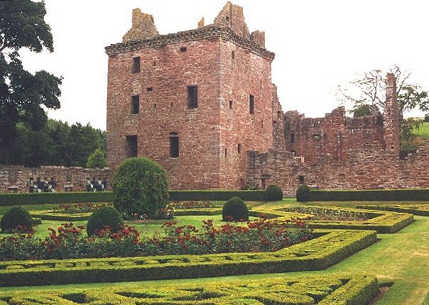
Edzell Castle is a ruined 16th-century castle, with an early-17th-century walled garden. It is located close to Edzell, and is around 5 miles (8 km) north...

Nearby Amenities

Located within 500m of 56.832042,-2.8241392
Craig Duchery
Ele: 467
Natural: peak
Lat/Long: 56.832544/-2.8240017
The data included in this document is from www.openstreetmap.org. The data is made available under ODbL.

Have you been to Craig Duchrey?

Leave your review of Craig Duchrey below (or comments, questions and feedback).