Chapel Hill

Hill, Mountain in Banffshire

Scotland

Chapel Hill

Turbine in the Forest Long before I rounded a bend and saw it, I could hear the rhythmic sound of the wind turbine at Loanhead.
Turbine in the Forest Credit: Anne Burgess

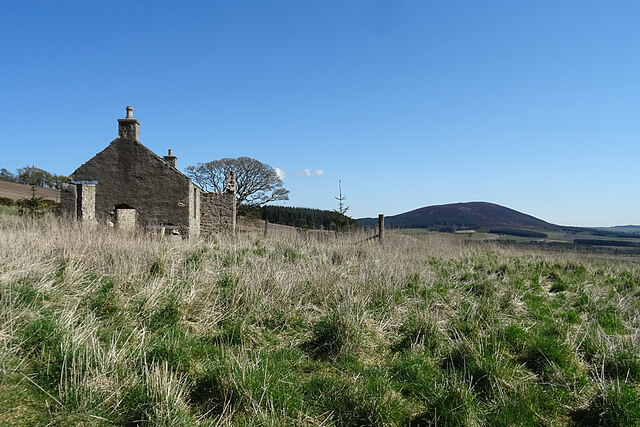
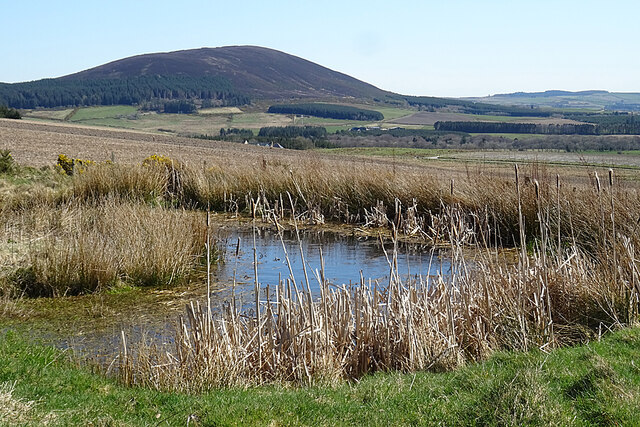
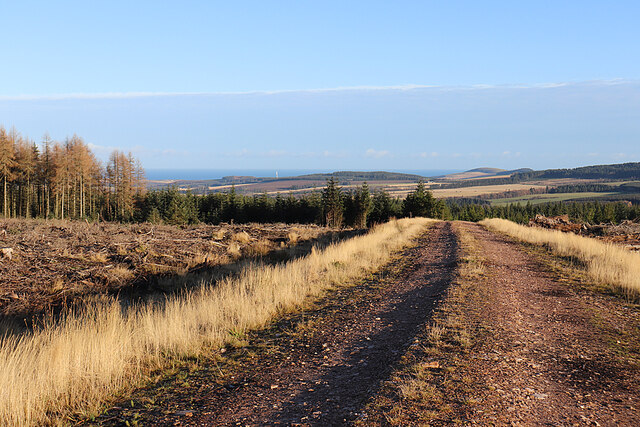
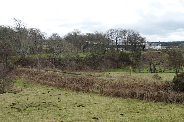
Chapel Hill, located in Banffshire, Scotland, is a picturesque and historic hill/mountain that attracts nature enthusiasts, hikers, and history buffs alike. Standing at an elevation of approximately 257 meters (843 feet), it offers breathtaking panoramic views of the surrounding countryside and the beautiful Moray Firth.

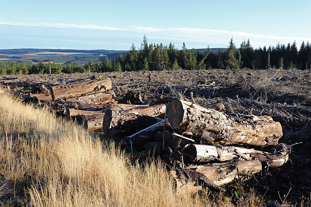
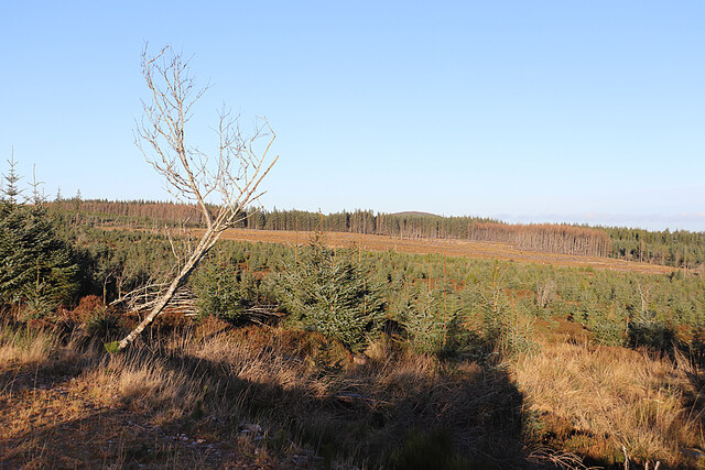
The hill is known for its distinctive shape, featuring a gently sloping eastern side and a steeper western face. Covered in lush greenery, Chapel Hill is home to a diverse range of flora and fauna, making it a haven for wildlife lovers. Visitors can spot various bird species, including buzzards and kestrels, as well as deer, rabbits, and other small mammals.

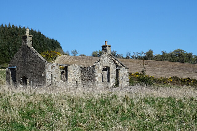
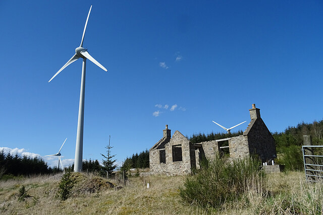
Chapel Hill also holds significant historical importance. At its summit lies the remains of a medieval chapel, believed to have been built in the 13th century. This chapel, dedicated to St. Mary, has long been a pilgrimage site and a symbol of the area's rich religious heritage. The ruins, although weathered by time, still evoke a sense of tranquility and spirituality.

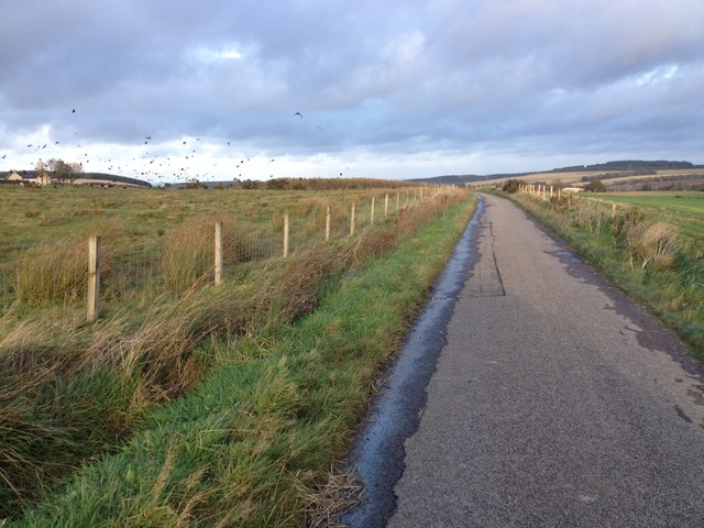
The hill is easily accessible, with footpaths and trails winding their way up to the summit, offering visitors the opportunity to explore its natural beauty. It is a popular destination for outdoor activities such as hiking, walking, and picnicking.

Chapel Hill, Banffshire, is a true gem of the Scottish landscape, offering a perfect blend of natural beauty and historical significance. Whether one seeks a peaceful retreat or an adventure in the great outdoors, this hill/mountain provides an unforgettable experience for all who visit.

If you have any feedback on the listing, please let us know in the comments section below.
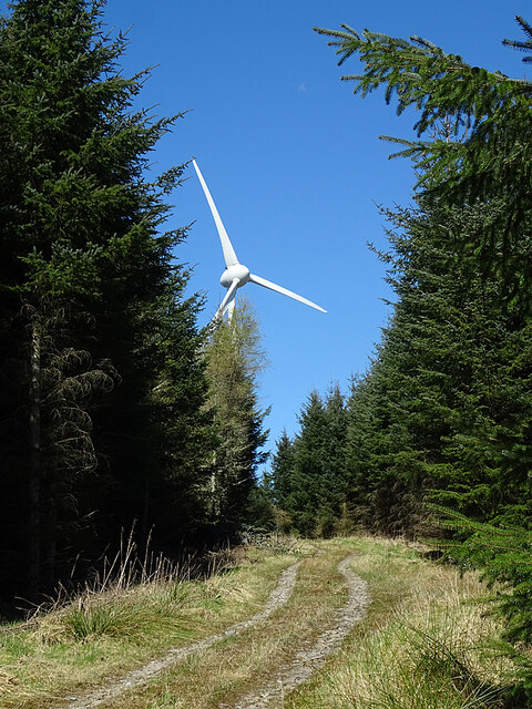
Chapel Hill Images

Images are sourced within 2km of 57.614389/-2.8429138 or Grid Reference NJ4958. Thanks to Geograph Open Source API. All images are credited.

Turbine in the Forest Long before I rounded a bend and saw it, I could hear the rhythmic sound of the wind turbine at Loanhead.
Turbine in the Forest
Long before I rounded a bend and saw it, I could hear the rhythmic sound of the wind turbine at Loanhead.
Loanhead of Myrietown This is exactly the sort of place I would have liked to live in when I was younger. Sheltered by a hill and forest to the north and east, with an open aspect to the south-west and a good view. No problems with noisy neighbours or passers-by dropping litter, but a long way from any shops, and very difficult to get to in a snowy winter. But it now sits almost underneath a wind turbine so I don't suppose anyone would want it now.
Loanhead of Myrietown
This is exactly the sort of place I would have liked to live in when I was younger. Sheltered by a hill and forest to the north and east, with an open aspect to the south-west and a good view. No problems with noisy neighbours or passers-by dropping litter, but a long way from any shops, and very difficult to get to in a snowy winter. But it now sits almost underneath a wind turbine so I don't suppose anyone would want it now.
Loanhead of Myrietown This is exactly the sort of place I would have liked to live in when I was younger. Sheltered by a hill and forest to the north and east, with an open aspect to the south-west and a good view. No problems with noisy neighbours or passers-by dropping litter, but a long way from any shops, and very difficult to get to in a snowy winter. But it now sits almost underneath a wind turbine so I don't suppose anyone would want it now. The distant hill is Knock Hill.
Loanhead of Myrietown
This is exactly the sort of place I would have liked to live in when I was younger. Sheltered by a hill and forest to the north and east, with an open aspect to the south-west and a good view. No problems with noisy neighbours or passers-by dropping litter, but a long way from any shops, and very difficult to get to in a snowy winter. But it now sits almost underneath a wind turbine so I don't suppose anyone would want it now. The distant hill is Knock Hill.
Loanhead of Myrietown This is exactly the sort of place I would have liked to live in when I was younger. Sheltered by a hill and forest to the north and east, with an open aspect to the south-west and a good view. No problems with noisy neighbours or passers-by dropping litter, but a long way from any shops, and very difficult to get to in a snowy winter. But it now sits almost underneath a wind turbine so I don't suppose anyone would want it now.
Loanhead of Myrietown
This is exactly the sort of place I would have liked to live in when I was younger. Sheltered by a hill and forest to the north and east, with an open aspect to the south-west and a good view. No problems with noisy neighbours or passers-by dropping litter, but a long way from any shops, and very difficult to get to in a snowy winter. But it now sits almost underneath a wind turbine so I don't suppose anyone would want it now.
Pond with a View In the foreground is a small artificial pond, and beyond it is the fine view to Knock Hill that was enjoyed by the occupants of Loanhead of Myriehill before it was allowed to fall into ruin.
Pond with a View
In the foreground is a small artificial pond, and beyond it is the fine view to Knock Hill that was enjoyed by the occupants of Loanhead of Myriehill before it was allowed to fall into ruin.
Turbine 1 This turbine is designated No 1 in the Myretown and Lurg Hill wind farm, although it doesn't appear to be the first one erected there.
Turbine 1
This turbine is designated No 1 in the Myretown and Lurg Hill wind farm, although it doesn't appear to be the first one erected there.
Minor road approaching Lower Broadrashes Looking north-eastward.
Minor road approaching Lower Broadrashes
Looking north-eastward.
Minor road at Mid Skeith Looking north-westward.
Minor road at Mid Skeith
Looking north-westward.
Aultmorehill The road across a felled area on Aultmorehill enjoys a fine view down towards the sea. The rounded hill on the right is Durn Hill near Portsoy.
Aultmorehill
The road across a felled area on Aultmorehill enjoys a fine view down towards the sea. The rounded hill on the right is Durn Hill near Portsoy.
Large Logs Large they may be, but I suspect the reason they are still here is because they are too thick, too short, too knotty and not straight enough to appeal to a sawmill.
Large Logs
Large they may be, but I suspect the reason they are still here is because they are too thick, too short, too knotty and not straight enough to appeal to a sawmill.
Aultmorehill Wood The forest looks as if it has been left to regenerate naturally here. There's a glimpse of the Bin of Cullen above the trees on the skyline.
Aultmorehill Wood
The forest looks as if it has been left to regenerate naturally here. There's a glimpse of the Bin of Cullen above the trees on the skyline.
Pond at Drum Toul The pond, although shown on the large scale maps, isn't (yet) in the satellite view, so I think it must be quite new.
Pond at Drum Toul
The pond, although shown on the large scale maps, isn't (yet) in the satellite view, so I think it must be quite new.
Turbines on Lurg Hill I'm not sure if all these turbines are formally part of the Myretown and Lurg Hill wind farm, or whether the nearest one is on another piece of land. The pond is relatively new, not yet being featured on the satellite view.
Turbines on Lurg Hill
I'm not sure if all these turbines are formally part of the Myretown and Lurg Hill wind farm, or whether the nearest one is on another piece of land. The pond is relatively new, not yet being featured on the satellite view.
Minor road near Swailend
Farm track to Aulmore Lodge Looking southward.
Farm track to Aulmore Lodge
Looking southward.
Minor road at Blackhillock Looking north-eastward. Blackhillock is now just a name on the map - any buildings have disappeared.
Minor road at Blackhillock
Looking north-eastward. Blackhillock is now just a name on the map - any buildings have disappeared.
Mains of Skeith The farm at Mains of Skeith is reached by a causeway across what may have been rather wet ground.
Mains of Skeith
The farm at Mains of Skeith is reached by a causeway across what may have been rather wet ground.
Little Skeith
Little Skeith
Show me another place!

Chapel Hill is located at Grid Ref: NJ4958 (Lat: 57.614389, Lng: -2.8429138)

Unitary Authority: Moray

Police Authority: North East

What 3 Words

///observers.depravity.hamsters. Near Cullen, Moray

Nearby Locations

Chapel Hill

Related Wikis

Deskford Tower

Tower of Deskford was a 14th-century tower house, about 3.5 miles (5.6 km) south of Cullen, Moray, Scotland at Deskford, west of the burn. The tower and...

Deskford

Deskford (Scottish Gaelic: Deasgard) is a parish and a small settlement in Moray, Scotland, formerly in Banffshire. A number of significant historical...

Foudland Hills

The Foudland Hills is a mountain range in the northeast of Aberdeenshire, Scotland and northwest of Morayshire. The Foudland Hills are a prominent feature...

Battle of Bauds

Battle of Bauds was a battle fought in 962 in an area known as the Bauds, south of Findochty and west of Cullen near Portknockie, Scotland between Scotland...

Bin of Cullen

Bin of Cullen or Bin Hill (Scottish Gaelic: Am Binnean) is a hill in Moray, Scotland directly inland from Findochty. Bin of Cullen is 320 m in height and...

Letterfourie House

Letterfourie House is a Georgian house in Moray, built by Robert Adam and completed in 1773. Its main block has three main storeys, with a raised cellar...

Craigmin Bridge

Craigmin Bridge is an eighteenth century bridge within the grounds of Letterfourie House, in Moray, Scotland. Spanning the Burn of Letterfourie, it once...

Glenbarry railway station

Glenbarry railway station, previously known as Barry was an intermediate stop with a passing loop situated on the Great North of Scotland Railway (GNoSR...

Nearby Amenities

Located within 500m of 57.614389,-2.8429138
Power: pole
Lat/Long: 57.6133016/-2.850399
Power: pole
Lat/Long: 57.6131965/-2.8495694
Power: pole
Lat/Long: 57.6130774/-2.8486386
Power: pole
Lat/Long: 57.6129369/-2.8476464
Power: pole
Lat/Long: 57.6135759/-2.8470085
Power: pole
Lat/Long: 57.6141723/-2.8464135
Power: pole
Lat/Long: 57.6148022/-2.8459136
Power: pole
Lat/Long: 57.6153706/-2.8454673
Power: pole
Lat/Long: 57.6159653/-2.8449965
Power: pole
Lat/Long: 57.6165073/-2.8445595
Power: pole
Lat/Long: 57.6172038/-2.844012
Power: pole
Lat/Long: 57.6178083/-2.8435336
Power: pole
Lat/Long: 57.6182986/-2.8425046
Power: pole
Lat/Long: 57.6185992/-2.8418697
The data included in this document is from www.openstreetmap.org. The data is made available under ODbL.

Have you been to Chapel Hill?

Leave your review of Chapel Hill below (or comments, questions and feedback).