Broadway Hill

Hill, Mountain in Somerset Mendip

England

Broadway Hill

Broad Road near Rodney Stoke A view down Broad Road at the top of the descent into Rodney Stoke.
The view west goes over the Somerset Levels to the Bristol Channel.
Broad Road near Rodney Stoke Credit: Kevin Pearson

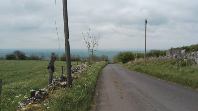
Broadway Hill is a prominent hill located in Somerset, England. Situated near the village of Broadway, it is a part of the larger Mendip Hills range. With an elevation of 311 meters (1,020 feet), it offers stunning panoramic views of the surrounding countryside.

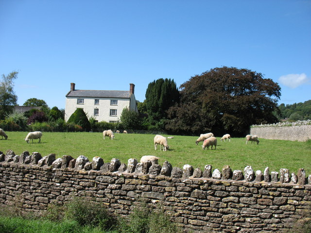
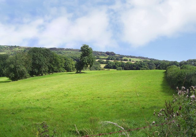
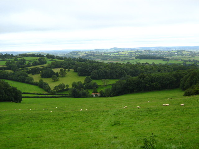
The hill is characterized by its gentle slopes and lush greenery, making it a popular destination for hikers and nature enthusiasts. The landscape is dotted with picturesque farms, meadows, and woodlands, creating a tranquil and idyllic setting. Visitors can enjoy leisurely walks along the well-marked footpaths that crisscross the hill, immersing themselves in the natural beauty of the area.

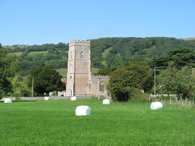
Broadway Hill is also renowned for its rich historical and archaeological significance. Evidence of prehistoric settlements has been discovered on the hill, including Iron Age hillforts and burial mounds. These remnants provide a fascinating glimpse into the region's ancient past and attract researchers and history enthusiasts.

Additionally, the hill is a designated Site of Special Scientific Interest (SSSI) due to its diverse range of flora and fauna. Rare plant species, such as the orchid-rich grasslands, can be found here, along with various bird species, butterflies, and other wildlife.

Overall, Broadway Hill in Somerset offers a captivating blend of natural beauty, historical intrigue, and ecological importance. Whether it's for a leisurely stroll, a hike, or an exploration of the area's history, visitors are sure to be enchanted by its charm and tranquility.

If you have any feedback on the listing, please let us know in the comments section below.

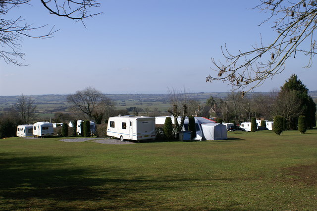
Broadway Hill Images

Images are sourced within 2km of 51.241728/-2.7218079 or Grid Reference ST4949. Thanks to Geograph Open Source API. All images are credited.

Broad Road near Rodney Stoke A view down Broad Road at the top of the descent into Rodney Stoke.
The view west goes over the Somerset Levels to the Bristol Channel.
Broad Road near Rodney Stoke
A view down Broad Road at the top of the descent into Rodney Stoke. The view west goes over the Somerset Levels to the Bristol Channel.
In Rodney Stoke
In Rodney Stoke
St Leonard's church, Rodney Stoke
St Leonard's church, Rodney Stoke - monument to Sir Edward Rodney This monument has two oval recesses featuring the busts of Sir Edward Rodney (†1657) and his wife (†1659) under a canopy with a raised curtain. They are flanked left and right by two seated angels, a third sits on a cloud below the canopy. It was Sir Edward who gave the church its chancel screen, pulpit, and font cover.
St Leonard's church, Rodney Stoke - monument to Sir Edward Rodney
This monument has two oval recesses featuring the busts of Sir Edward Rodney (†1657) and his wife (†1659) under a canopy with a raised curtain. They are flanked left and right by two seated angels, a third sits on a cloud below the canopy. It was Sir Edward who gave the church its chancel screen, pulpit, and font cover.
St Leonard's church, Rodney Stoke - monument to Anne Lakes This monument in the north chapel is to Anne Lakes (†1630), wife of George Rodney and daughter of Sir Thomas Lakes of Channons in Middlesex. Her effigy in alabaster lies on top of a sarcophagus base below a delicate arch supported by Ionic columns. The arch is decorated inside with stars and clouds.
St Leonard's church, Rodney Stoke - monument to Anne Lakes
This monument in the north chapel is to Anne Lakes (†1630), wife of George Rodney and daughter of Sir Thomas Lakes of Channons in Middlesex. Her effigy in alabaster lies on top of a sarcophagus base below a delicate arch supported by Ionic columns. The arch is decorated inside with stars and clouds.
St Leonard's church, Rodney Stoke - monument to Anne Lakes (2) detail
St Leonard's church, Rodney Stoke - monument to Anne Lakes (3) detail
St Leonard's church, Rodney Stoke - monument to George Rodney The monument to George Rodney (†1651) shows him as the demi-figure in a shroud rising from a coffin set between two earth -bound putti. An angel in the clouds in the open segmental pediment blows a trumpet. The base plinth is decorated with strapwork.
St Leonard's church, Rodney Stoke - monument to George Rodney
The monument to George Rodney (†1651) shows him as the demi-figure in a shroud rising from a coffin set between two earth -bound putti. An angel in the clouds in the open segmental pediment blows a trumpet. The base plinth is decorated with strapwork.
Westbury-Sub Mendip Church Saint Lawrence, with parts dating back to the 12th century.
Westbury-Sub Mendip Church
Saint Lawrence, with parts dating back to the 12th century.
Mendip Edge Scenery On the south west slope of the Mendip Hills near Rodney Stoke.
Mendip Edge Scenery
On the south west slope of the Mendip Hills near Rodney Stoke.
Lower Stoke Farm
Lower Stoke Farm
St Leonard's Church In Rodney Stoke founded 1175
St Leonard's Church
In Rodney Stoke founded 1175
Caravan Park On Westclose Hill
Caravan Park
On Westclose Hill
Meadows on Westbury Moor Taken from the footpath over Lodge Hill, which can be seen snaking back towards the left of the picture.
Meadows on Westbury Moor
Taken from the footpath over Lodge Hill, which can be seen snaking back towards the left of the picture.
Long Drove,Westbury Moor
Looking South from Lodge Hill
Show me another place!

Broadway Hill is located at Grid Ref: ST4949 (Lat: 51.241728, Lng: -2.7218079)

Administrative County: Somerset

District: Mendip

Police Authority: Avon and Somerset

What 3 Words

///lengthen.billiard.option. Near Draycott, Somerset

Related Wikis

Church of St Lawrence, Westbury-sub-Mendip

The Church of St Lawrence in Westbury-sub-Mendip, Somerset, England was built in the 12th century. It is a Grade II* listed building. == History == The...

Westbury-sub-Mendip

Westbury-sub-Mendip is a village and civil parish in Somerset, England. The village is on the southern slopes of the Mendip Hills, 4 miles (6.4 km) from...

Lodge Hill railway station

Lodge Hill railway station was a station on the Bristol and Exeter Railway's Cheddar Valley line in Somerset, England from 1870 until 1963. The station...

Rodney Stoke

Rodney Stoke is a small village and civil parish, located at grid reference ST486501, 5 miles north-west of Wells, in the English county of Somerset. The...

Rodney Stoke SSSI

Rodney Stoke (grid reference ST492507) is a 69.6 hectare (172.0 acre) biological Site of Special Scientific Interest, just north of the village of Rodney...

Brimble Pit and Cross Swallet Basins

Brimble Pit and Cross Swallet Basins (grid reference ST512505) is a 154.3 hectare (381.3 acre) geological Site of Special Scientific Interest between Wookey...

Westbury Camp

Westbury Camp is a univallate Iron Age hill fort in the Mendip Hills in Somerset, England. The hill fort is situated in the parish of Rodney Stoke, approximately...

St Paul's Church, Easton

St Paul's Church is a Church of England church in Easton, Somerset, England. The church, which was designed by Richard Carver and built in 1843, has been...

Nearby Amenities

Located within 500m of 51.241728,-2.7218079
Westclose Hill
Natural: peak
Source: NPE
Lat/Long: 51.2426318/-2.7226261
Old Ditch
Place: hamlet
Source: NPE
Lat/Long: 51.2408827/-2.7176409
Man Made: pumping_station
Source: OS OpenData StreetView
Lat/Long: 51.2380478/-2.7233414
Broadway Hill
Natural: peak
Source: OS OpenData StreetView
Lat/Long: 51.2396868/-2.7190284
Barrier: stile
Material: stone
Source: survey;gps
Stile: stepover
Lat/Long: 51.2436874/-2.7269527
Barrier: stile
Material: wood
Source: survey;gps
Stile: stepover
Lat/Long: 51.242993/-2.7251315
Barrier: stile
Material: wood
Source: survey;gps
Stile: stepover
Lat/Long: 51.242632/-2.724131
Barrier: stile
Source: survey;gps
Stile: stepover
Lat/Long: 51.2405691/-2.7193061
Barrier: stile
Material: stone
Source: survey;gps
Stile: stepover
Lat/Long: 51.241661/-2.7217387
Bench
Source: survey;gps
Lat/Long: 51.2395108/-2.718329
Barrier: stile
Material: wood
Source: survey;gps
Stile: stepover
Lat/Long: 51.2380102/-2.7193972
The data included in this document is from www.openstreetmap.org. The data is made available under ODbL.

Have you been to Broadway Hill?

Leave your review of Broadway Hill below (or comments, questions and feedback).