Blaze Fell

Hill, Mountain in Cumberland Eden

England

Blaze Fell

Coombs Wood View down very steep slopes to the woodland beside the Eden.
Coombs Wood Credit: Richard Webb

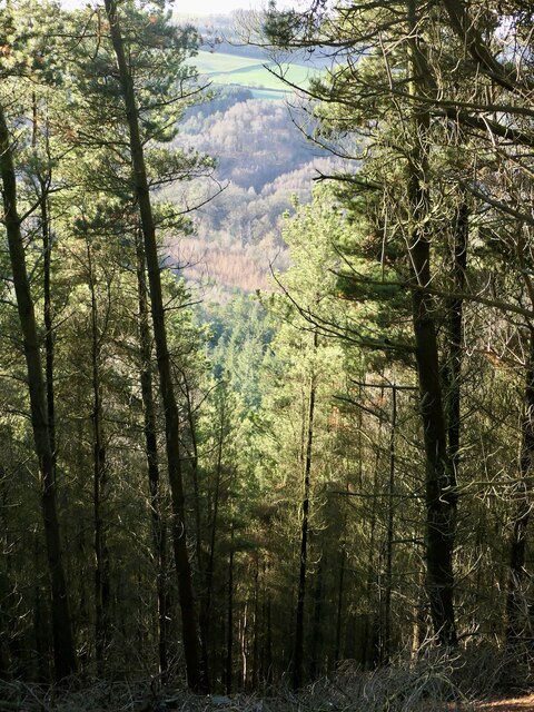
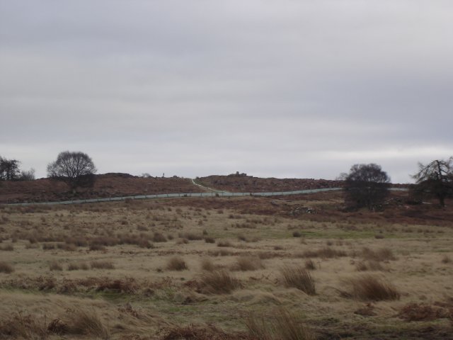
Blaze Fell is a prominent hill located in Cumberland, England. Standing at an elevation of approximately 1,836 feet (560 meters), it is considered one of the highest peaks in the Lake District National Park. The fell is situated in the northern part of the park, near the town of Buttermere, offering breathtaking panoramic views of the surrounding landscape.

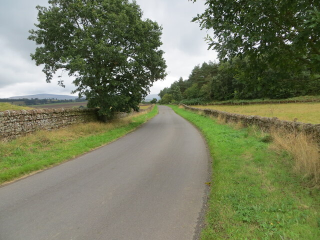
This picturesque hill is a popular destination for hikers and outdoor enthusiasts, offering a variety of trails suitable for all skill levels. The ascent to the summit is relatively moderate, making it an ideal choice for families and those seeking a less challenging hike. The well-marked paths wind through lush green valleys, rocky outcrops, and babbling streams, providing an immersive experience in the natural beauty of the Lake District.

At the top of Blaze Fell, visitors are rewarded with stunning vistas that stretch as far as the eye can see. On clear days, it is possible to spot the shimmering waters of the nearby Buttermere Lake, as well as the towering peaks of surrounding mountains such as Grasmoor and High Stile.

Blaze Fell is also known for its rich biodiversity, with a diverse range of flora and fauna calling the hill home. It is not uncommon to encounter grazing sheep and other wildlife during a hike. Birdwatchers will be delighted by the opportunity to spot various species, including the elusive golden eagle and peregrine falcon.

Overall, Blaze Fell offers a tranquil and invigorating escape into nature, combining stunning views, a variety of hiking trails, and an abundance of wildlife, making it a must-visit destination for nature lovers and outdoor enthusiasts alike.

If you have any feedback on the listing, please let us know in the comments section below.

Blaze Fell Images

Images are sourced within 2km of 54.782089/-2.7847656 or Grid Reference NY4943. Thanks to Geograph Open Source API. All images are credited.

Coombs Wood View down very steep slopes to the woodland beside the Eden.
Coombs Wood
View down very steep slopes to the woodland beside the Eden.
Grass track between harvested fields Looking north-eastward towards Baron Wood.
Grass track between harvested fields
Looking north-eastward towards Baron Wood.
Tree enclosed minor road beside Baron Wood Looking north-westward.
Tree enclosed minor road beside Baron Wood
Looking north-westward.
Field edge tractor track Looking south-westward from the road near Beech, Ash, Oak and Elm Cottages.
Field edge tractor track
Looking south-westward from the road near Beech, Ash, Oak and Elm Cottages.
Well enclosed minor road near Baronwood Farm Looking eastward.
Well enclosed minor road near Baronwood Farm
Looking eastward.
Ordnance Survey Cut Mark This mark can be found on a roadside field entrance gatepost at Baronwood Cottages.
The recorded details give a height of 140.4046 metres above sea level.
For more detail see : <span class="nowrap"><a title="https://www.bench-marks.org.uk/bm179921" rel="nofollow ugc noopener" href="https://www.bench-marks.org.uk/bm179921">Link</a><img style="margin-left:2px;" alt="External link" title="External link - shift click to open in new window" src="https://s1.geograph.org.uk/img/external.png" width="10" height="10"/></span>
Ordnance Survey Cut Mark
This mark can be found on a roadside field entrance gatepost at Baronwood Cottages. The recorded details give a height of 140.4046 metres above sea level. For more detail see : LinkExternal link
The Road to Nord Vue Stables
Tarn Wadling On the top rail of the field gate a small plaque has been fixed with this dedication "Part of this woodland is dedicated to the memory of Frederick Rockett of Torquay Devon." Tarn Wadling is cared for by the Woodland Trust <span class="nowrap"><a title="http://www.wt-woods.org.uk/TarnWadling" rel="nofollow ugc noopener" href="http://www.wt-woods.org.uk/TarnWadling">Link</a><img style="margin-left:2px;" alt="External link" title="External link - shift click to open in new window" src="https://s1.geograph.org.uk/img/external.png" width="10" height="10"/></span>
Tarn Wadling
On the top rail of the field gate a small plaque has been fixed with this dedication "Part of this woodland is dedicated to the memory of Frederick Rockett of Torquay Devon." Tarn Wadling is cared for by the Woodland Trust LinkExternal link
Gateway Left open for ease during silage making
Gateway
Left open for ease during silage making
Blackrack Bridge There are two Blackrack Bridges over the Blackrack Beck, this is the one on the A6
Blackrack Bridge
There are two Blackrack Bridges over the Blackrack Beck, this is the one on the A6
Shops I would say that this building has been converted from a garage/car showroom because with the coming of the M6, passing trade would have disappeared.
Shops
I would say that this building has been converted from a garage/car showroom because with the coming of the M6, passing trade would have disappeared.
Farm at Nunclose
Farm at Nunclose
Blaze Fell from the west The most recent OS map shows this area as Access Land, which it is, reachable via a gate at NY487441. Unfortunately the 'summit' (if 242 m can qualify as a peak!) area is fenced off with barbed wire as its immediate surroundings have the appearance of being currently quarried - not "Quarries (dis)" as the map would suggest. Saw several deer roaming wild near the summit. On a clear day this location affords excellent views across to both the Lakes and the Pennines.
Blaze Fell from the west
The most recent OS map shows this area as Access Land, which it is, reachable via a gate at NY487441. Unfortunately the 'summit' (if 242 m can qualify as a peak!) area is fenced off with barbed wire as its immediate surroundings have the appearance of being currently quarried - not "Quarries (dis)" as the map would suggest. Saw several deer roaming wild near the summit. On a clear day this location affords excellent views across to both the Lakes and the Pennines.
Trig Point on Blaze Fell looking towards Barrock Fell If you go here beware of deep excavations, large pieces of unattached sandstone and some rather tricky rabbit holes!
Trig Point on Blaze Fell looking towards Barrock Fell
If you go here beware of deep excavations, large pieces of unattached sandstone and some rather tricky rabbit holes!
Blaze Fell Quarry & Trig Point (plus a quarry troll?) He's not strictly part of the local geography, but I couldn't find anything forbidding the addition of a little human interest to 'supplementary' photos. Reuben, age 6, was good company on our little trek up the hill!
Blaze Fell Quarry & Trig Point (plus a quarry troll?)
He's not strictly part of the local geography, but I couldn't find anything forbidding the addition of a little human interest to 'supplementary' photos. Reuben, age 6, was good company on our little trek up the hill!
Looking over farmland towards the Skelton radio masts from Blaze Fell
"Settlement" from Blaze Fell Earthworks can still be seen in the middle section of the picture, passing on both sides of the wall, encompassing the two trees and most of the sheep. Can't find out what age the settlement is from. Presumably they had a good (defensive?) reason for perching themselves in such a draughty, exposed location!
"Settlement" from Blaze Fell
Earthworks can still be seen in the middle section of the picture, passing on both sides of the wall, encompassing the two trees and most of the sheep. Can't find out what age the settlement is from. Presumably they had a good (defensive?) reason for perching themselves in such a draughty, exposed location!
Low Plains from Blaze Fell Settlement Penrith can just be made out in the distance
Low Plains from Blaze Fell Settlement
Penrith can just be made out in the distance
Show me another place!

Blaze Fell is located at Grid Ref: NY4943 (Lat: 54.782089, Lng: -2.7847656)

Administrative County: Cumbria

District: Eden

Police Authority: Cumbria

What 3 Words

///retailing.spooked.polar. Near Wetheral, Cumbria

Nearby Locations

Blaze Fell

Related Wikis

Tarn Wadling

Tarn Wadling (formerly spelled Turnewathelane, Terne Wathelyne, among others) was a lake between Carlisle and Penrith, near the village of High Hesket...

Hesket, Cumbria

Hesket (also Hesket-in-the-Forest) is a large civil parish in the Eden District of Cumbria, England, on the main A6 between Carlisle and Penrith. At the...

High Hesket

High Hesket is a village near the A6 road, in the parish of Hesket, in the Eden district, in the English county of Cumbria. The village was on the A6 road...

Armathwaite Castle

Armathwaite Castle is in the village of Armathwaite, Cumbria, England, by the River Eden. Originally built to defend against Scottish raiders in the 15th...

Armathwaite

Armathwaite is a village in the English ceremonial county of Cumbria. Historically within the county of Cumberland, Armathwaite lies on the River Eden...

Armathwaite railway station

Armathwaite is a railway station on the Settle and Carlisle Line, which runs between Carlisle and Leeds via Settle. The station, situated 9 miles 75 chains...
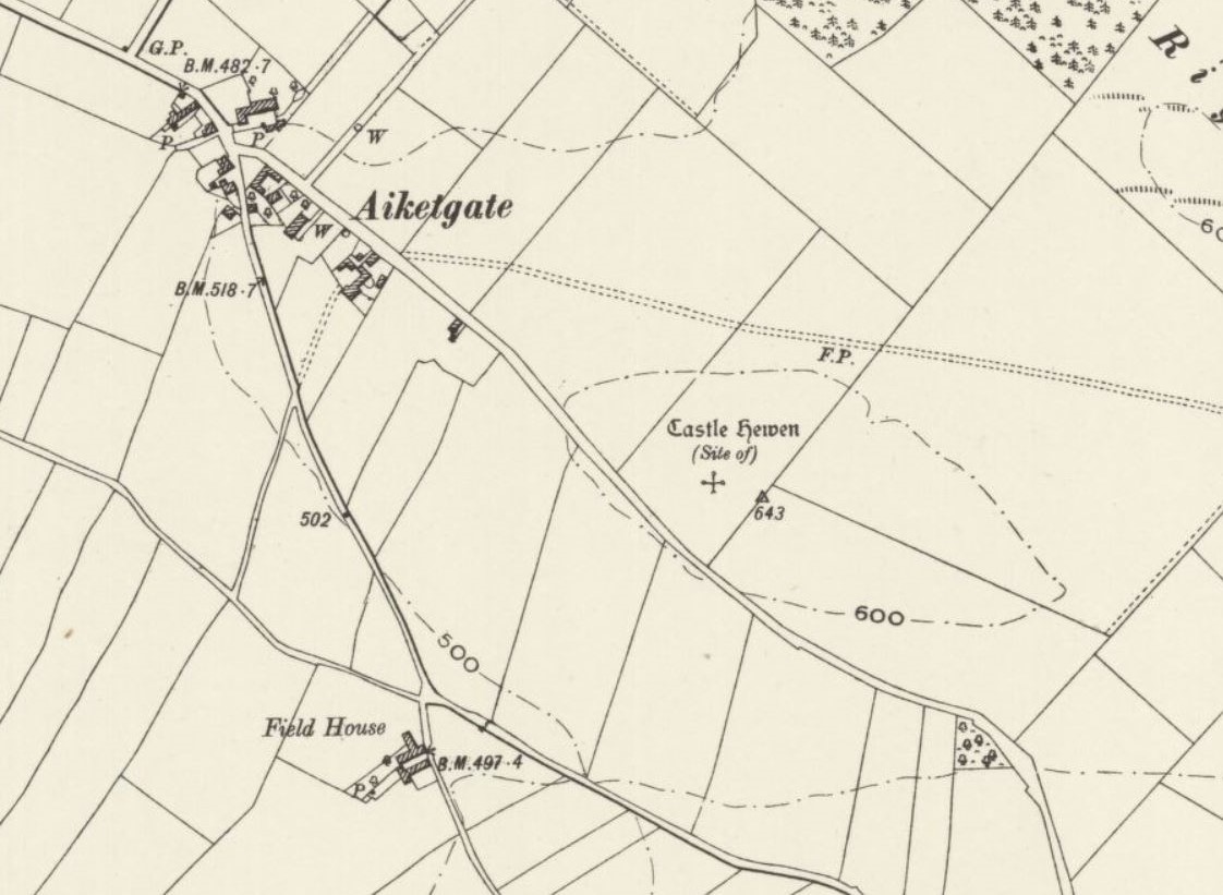
Castle Hewen

Castle Hewen (also recorded as Castlewen; Castle Luen; Castellewyn; Castellewyne; Castlehewings; Castle-Ewaine and Castle Lewen) was a Romano-British castle...

Calthwaite railway station

Calthwaite railway station in Hesket parish, was situated on the Lancaster and Carlisle Railway (the West Coast Main Line) between Carlisle and Penrith...

Have you been to Blaze Fell?

Leave your review of Blaze Fell below (or comments, questions and feedback).