Alderston Hill

Hill, Mountain in East Lothian

Scotland

Alderston Hill

Letham Holdings A large area of land west of Haddington has been used for small holdings. Nowadays there is a fair scattering of trophy homes amongst the small flocks of sheep and gardening enterprise. A house with a bit of land is very attractive to horse owners. This view is of the more traditional land use, the foreground field contains sheep.
Letham Holdings Credit: Richard Webb

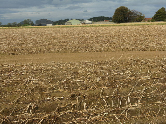
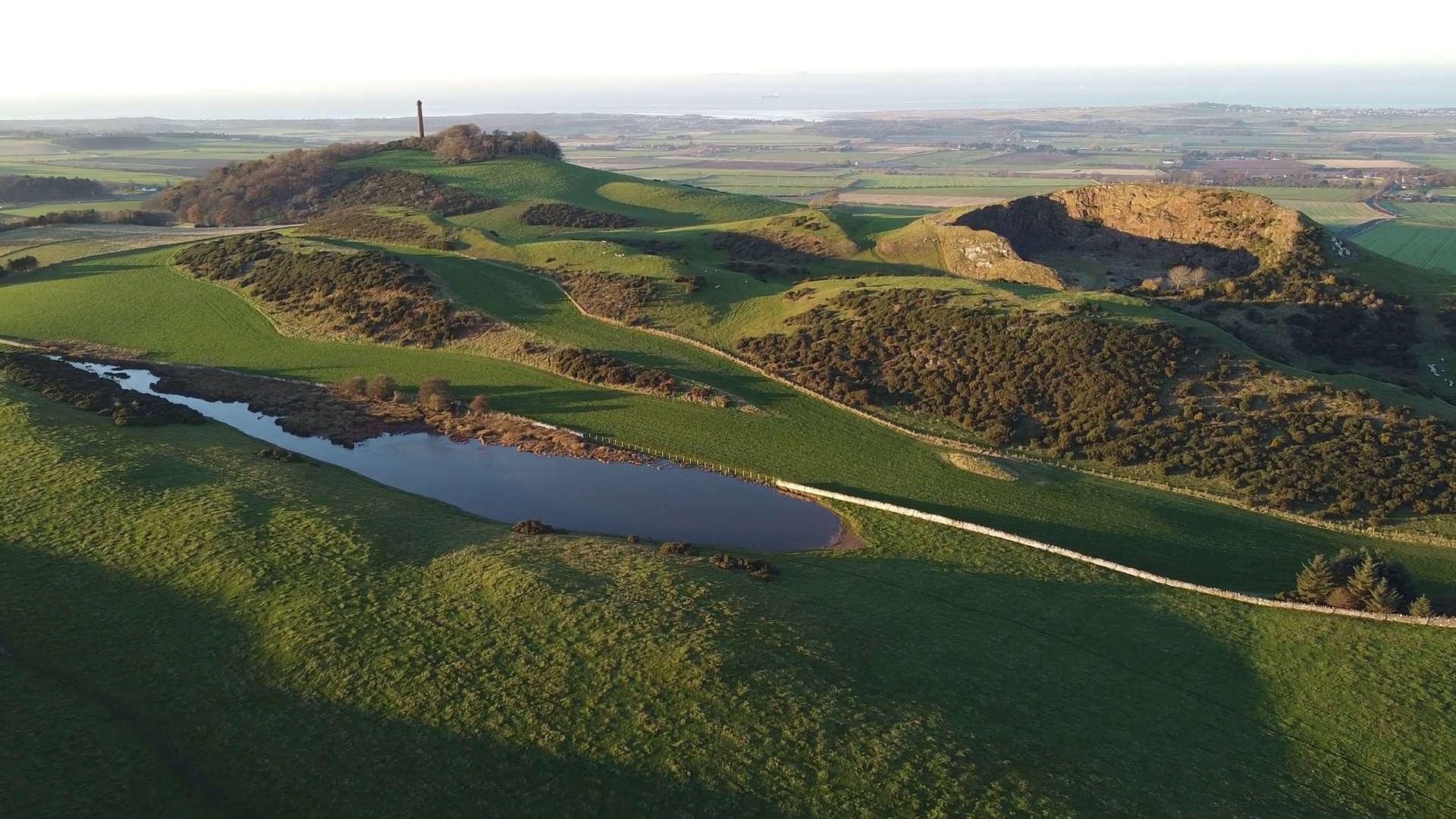
Alderston Hill is a prominent hill located in East Lothian, Scotland. Standing at an elevation of approximately 185 meters (607 feet), it is a notable landmark in the region. Situated about 2 kilometers south of the town of Haddington, Alderston Hill offers stunning panoramic views of the surrounding countryside.

The hill is primarily composed of sedimentary rocks, particularly sandstone and shale, which were formed during the Carboniferous period. Its slopes are covered with a mixture of grasses, heather, and scattered shrubs, creating a picturesque landscape. The area is also home to a variety of wildlife, including birds, rabbits, and occasionally deer.

Alderston Hill is a popular destination for outdoor enthusiasts, offering several walking trails and paths that cater to various fitness levels. The main route up the hill is a well-defined path that starts from the village of Samuelston, providing a gradual ascent for visitors. Along the way, walkers can enjoy the peacefulness of the countryside and admire the breathtaking views as they reach the summit.

At the top of Alderston Hill, there is a trig point, which serves as a marker for geodetic surveys. This feature adds to the hill's charm and is often used as a reference point for orienteering and map reading activities.

Whether it's for a leisurely stroll or a more challenging hike, Alderston Hill offers a pleasant and rewarding outdoor experience, showcasing the natural beauty of East Lothian.

If you have any feedback on the listing, please let us know in the comments section below.

Alderston Hill Images

Images are sourced within 2km of 55.967553/-2.8154045 or Grid Reference NT4975. Thanks to Geograph Open Source API. All images are credited.

Letham Holdings A large area of land west of Haddington has been used for small holdings. Nowadays there is a fair scattering of trophy homes amongst the small flocks of sheep and gardening enterprise. A house with a bit of land is very attractive to horse owners. This view is of the more traditional land use, the foreground field contains sheep.
Letham Holdings
A large area of land west of Haddington has been used for small holdings. Nowadays there is a fair scattering of trophy homes amongst the small flocks of sheep and gardening enterprise. A house with a bit of land is very attractive to horse owners. This view is of the more traditional land use, the foreground field contains sheep.
Barley bales and barn at Garleton With the Firth of Forth in the distance.
Barley bales and barn at Garleton
With the Firth of Forth in the distance.
Potato field at Byres farm With tops burnt down prior to harvest and to prevent the spread of potato blight to the tubers.
Potato field at Byres farm
With tops burnt down prior to harvest and to prevent the spread of potato blight to the tubers.
Rye Hill from Byres Farm road With the Hopetoun Monument on Byres Hill beyond.
Rye Hill from Byres Farm road
With the Hopetoun Monument on Byres Hill beyond.
A1 The new dual carriageway A1 looking eastwards. The strip of land between the new and old road is narrow here and is not in production.
A1
The new dual carriageway A1 looking eastwards. The strip of land between the new and old road is narrow here and is not in production.
A small wood near Merryhatton A clump of pines off a road to Huntington.
A small wood near Merryhatton
A clump of pines off a road to Huntington.
The Haddington Branch The North British Railway upset a lot of people when they chose to ignore Haddington and run some distance to the north of the town. Going north meant easier gradients and missing the high ground around Pencraig.  Haddington had to put up with a branch line.

There is no doubt that Haddington could support a service to Edinburgh now, but lack of capacity between Longniddry and Edinburgh is probably a problem. The trackbed is now a cycle path.
The Haddington Branch
The North British Railway upset a lot of people when they chose to ignore Haddington and run some distance to the north of the town. Going north meant easier gradients and missing the high ground around Pencraig. Haddington had to put up with a branch line. There is no doubt that Haddington could support a service to Edinburgh now, but lack of capacity between Longniddry and Edinburgh is probably a problem. The trackbed is now a cycle path.
Cereals, Bangly Winter crops near the quarry.
Cereals, Bangly
Winter crops near the quarry.
A battered ash, Coates Beyond the tatty tree is a field of winter cereals.
A battered ash, Coates
Beyond the tatty tree is a field of winter cereals.
The A1 west of Haddington Looking east to the slip road off to the A199 and B6471 into Haddington, with Traprain Law in the distance.
The A1 west of Haddington
Looking east to the slip road off to the A199 and B6471 into Haddington, with Traprain Law in the distance.
Farmland east of Haddington Typical East Lothian farmscape, seen from the bridge over the A1 looking northeast towards Huntington.
Farmland east of Haddington
Typical East Lothian farmscape, seen from the bridge over the A1 looking northeast towards Huntington.
Barley near Merryhatton
Barley, hedge and broken gate at Merryhatton
Winter wheat at Coates Looking west to the farm buildings and house.
Winter wheat at Coates
Looking west to the farm buildings and house.
Stubble field and cottage at Coates Probably barley stubble. The Pentland Hills on the skyline are about 35km away.
Stubble field and cottage at Coates
Probably barley stubble. The Pentland Hills on the skyline are about 35km away.
Rape stubble near Blakeny Knowe With the Hopetoun Monument in silhouette about 3km to the east.
Rape stubble near Blakeny Knowe
With the Hopetoun Monument in silhouette about 3km to the east.
Spring barley near Haddington Looking southwest from the road to Letham Mains, with the Moorfoot and Lammermuir Hills in the distance.
Spring barley near Haddington
Looking southwest from the road to Letham Mains, with the Moorfoot and Lammermuir Hills in the distance.
Spring barley near Ugstonrigg Looking west from the road to Letham Mains.
Spring barley near Ugstonrigg
Looking west from the road to Letham Mains.
Show me another place!

Alderston Hill is located at Grid Ref: NT4975 (Lat: 55.967553, Lng: -2.8154045)

Unitary Authority: East Lothian

Police Authority: The Lothians and Scottish Borders

What 3 Words

///screen.keys.aimless. Near Haddington, East Lothian

Nearby Locations

Alderston Hill

Related Wikis

Hopetoun Monument

The Hopetoun Monument is a monument in the Garleton Hills, near Camptoun, East Lothian, Scotland. It is 95 feet (29 m) tall and is situated on Byres Hill...

Haddington line

The Haddington line was a branch railway line connecting the Burgh of Haddington to the main line railway network at Longniddry. It was the first branch...

East Lothian Community Hospital

East Lothian Community Hospital is a hospital located on Station Road, Haddington, East Lothian, Scotland. The hospital is operated by NHS Lothian. �...

Byres Castle

Byres Castle was a castle located at Byres, in East Lothian, Scotland. The castle was a stronghold of the Lindsay family, known as Lord Lindsay of the...

Skid Hill

Skid Hill is a 186 metres high hill of eastern Scotland, the highest of the Garleton Hills. == Geology == The hill origin is volcanic and it shows both...

Garleton Hills

The Garleton Hills, in East Lothian, Scotland, are a range of igneous hills, to the north of Haddington. == Geography == Although Skid Hill, the highest...

Herdmanflat Hospital

Herdmanflat Hospital was a psychiatric hospital in Aberlady Road, Haddington, Scotland. It was operated by NHS Lothian. == History == The hospital was...

Haddington railway station

Haddington railway station served the town of Haddington, Scotland. Services were provided by trains on the Haddington line. == History == The station...

Nearby Amenities

Located within 500m of 55.967553,-2.8154045
Tourism: guest_house
Lat/Long: 55.971451/-2.8165562
Alderston Hill
Place: locality
Lat/Long: 55.9670379/-2.8160723
Generator Method: wind_turbine
Generator Source: wind
Power: generator
Lat/Long: 55.9692346/-2.8105197
Power: pole
Lat/Long: 55.9632406/-2.8138622
Power: pole
Lat/Long: 55.9641456/-2.8124838
Power: pole
Lat/Long: 55.9650396/-2.8110966
Power: pole
Lat/Long: 55.9660009/-2.8096021
Power: pole
Lat/Long: 55.9667173/-2.8086963
Power: pole
Lat/Long: 55.9674618/-2.8077511
Power: pole
Lat/Long: 55.9700676/-2.8177393
Power: pole
Lat/Long: 55.9710006/-2.817503
Power: pole
Lat/Long: 55.9716765/-2.8173674
The data included in this document is from www.openstreetmap.org. The data is made available under ODbL.

Have you been to Alderston Hill?

Leave your review of Alderston Hill below (or comments, questions and feedback).