Bangly Hill

Hill, Mountain in East Lothian

Scotland

Bangly Hill

Barley bales and barn at Garleton With the Firth of Forth in the distance.
Barley bales and barn at Garleton Credit: M J Richardson

Bangly Hill is a prominent hill located in East Lothian, Scotland. Situated in the southeast region of the country, it forms part of the scenic landscape of the area. With an elevation of approximately 205 meters (673 feet), it offers stunning panoramic views of the surrounding countryside.

The hill is characterized by its gentle slopes, covered in lush green vegetation, including grasses, heather, and patches of woodland. It is a popular destination for hikers and nature enthusiasts, who are drawn to its natural beauty and tranquility. Walking trails and paths crisscross the area, making it accessible for visitors of all ages and fitness levels.

At the summit of Bangly Hill, there is a trig point, which serves as a marker for geodetic surveying and offers visitors a prime vantage point to admire the breathtaking vistas. On clear days, one can enjoy sweeping views of the East Lothian coastline, the Firth of Forth, and even the distant hills of the Scottish Borders.

The hill is also home to a diverse range of wildlife, including various bird species such as skylarks and meadow pipits, as well as small mammals like rabbits and voles. It is not uncommon to spot these creatures while exploring the hillside.

Bangly Hill is easily accessible by road, with parking facilities available nearby. Its natural beauty, tranquil atmosphere, and panoramic views make it a must-visit destination for anyone seeking to immerse themselves in the stunning landscapes of East Lothian.

If you have any feedback on the listing, please let us know in the comments section below.
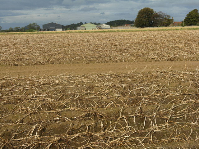
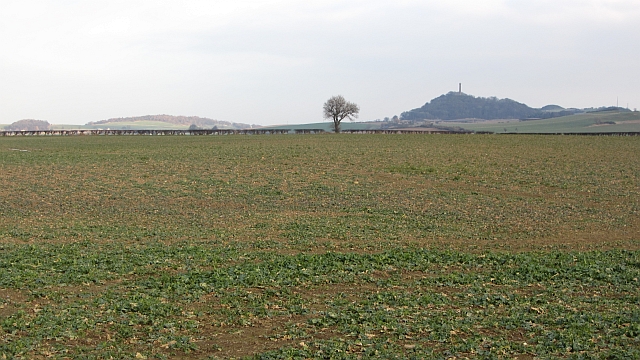
Bangly Hill Images

Images are sourced within 2km of 55.972577/-2.8218712 or Grid Reference NT4875. Thanks to Geograph Open Source API. All images are credited.

Barley bales and barn at Garleton With the Firth of Forth in the distance.
Barley bales and barn at Garleton
With the Firth of Forth in the distance.
Potato field at Byres farm With tops burnt down prior to harvest and to prevent the spread of potato blight to the tubers.
Potato field at Byres farm
With tops burnt down prior to harvest and to prevent the spread of potato blight to the tubers.
Rye Hill from Byres Farm road With the Hopetoun Monument on Byres Hill beyond.
Rye Hill from Byres Farm road
With the Hopetoun Monument on Byres Hill beyond.
A small wood near Merryhatton A clump of pines off a road to Huntington.
A small wood near Merryhatton
A clump of pines off a road to Huntington.
The Haddington Branch The North British Railway upset a lot of people when they chose to ignore Haddington and run some distance to the north of the town. Going north meant easier gradients and missing the high ground around Pencraig.  Haddington had to put up with a branch line.

There is no doubt that Haddington could support a service to Edinburgh now, but lack of capacity between Longniddry and Edinburgh is probably a problem. The trackbed is now a cycle path.
The Haddington Branch
The North British Railway upset a lot of people when they chose to ignore Haddington and run some distance to the north of the town. Going north meant easier gradients and missing the high ground around Pencraig. Haddington had to put up with a branch line. There is no doubt that Haddington could support a service to Edinburgh now, but lack of capacity between Longniddry and Edinburgh is probably a problem. The trackbed is now a cycle path.
Cereals, Bangly Winter crops near the quarry.
Cereals, Bangly
Winter crops near the quarry.
A battered ash, Coates Beyond the tatty tree is a field of winter cereals.
A battered ash, Coates
Beyond the tatty tree is a field of winter cereals.
Oilseed rape, Coates The crop is sitting out the frost awaiting temperatures which will allow growth.
Oilseed rape, Coates
The crop is sitting out the frost awaiting temperatures which will allow growth.
Cotty Burn Car Park entrance An access point to the Haddington-Longniddry Railway Walk car park. The railway bridge over the road is visible among the overgrowing trees.
Cotty Burn Car Park entrance
An access point to the Haddington-Longniddry Railway Walk car park. The railway bridge over the road is visible among the overgrowing trees.
Barley near Merryhatton
Barley, hedge and broken gate at Merryhatton
Winter wheat at Coates Looking west to the farm buildings and house.
Winter wheat at Coates
Looking west to the farm buildings and house.
Stubble field and cottage at Coates Probably barley stubble. The Pentland Hills on the skyline are about 35km away.
Stubble field and cottage at Coates
Probably barley stubble. The Pentland Hills on the skyline are about 35km away.
Rape stubble near Blakeny Knowe With the Hopetoun Monument in silhouette about 3km to the east.
Rape stubble near Blakeny Knowe
With the Hopetoun Monument in silhouette about 3km to the east.
Oilseed rape stubble Much coarser and duller than cereal stubbles.
Oilseed rape stubble
Much coarser and duller than cereal stubbles.
Winter wheat near Redhouse Dean A long way yet from being ready for harvest.
Winter wheat near Redhouse Dean
A long way yet from being ready for harvest.
Looking east from the top of Bangly Brae Over oilseed rape stubble towards the faintly visible Cockenzie Power Station and Arthur's Seat.
Looking east from the top of Bangly Brae
Over oilseed rape stubble towards the faintly visible Cockenzie Power Station and Arthur's Seat.
Garleton Lodge from the top of Bangly Brae Accommodation available for holidays, weddings, self-catering and corporate events.
Garleton Lodge from the top of Bangly Brae
Accommodation available for holidays, weddings, self-catering and corporate events.
Show me another place!

Bangly Hill is located at Grid Ref: NT4875 (Lat: 55.972577, Lng: -2.8218712)

Unitary Authority: East Lothian

Police Authority: The Lothians and Scottish Borders

What 3 Words

///joked.bother.loudness. Near Haddington, East Lothian

Nearby Locations

Bangly Hill

Related Wikis

Hopetoun Monument

The Hopetoun Monument is a monument in the Garleton Hills, near Camptoun, East Lothian, Scotland. It is 95 feet (29 m) tall and is situated on Byres Hill...

Haddington line

The Haddington line was a branch railway line connecting the Burgh of Haddington to the main line railway network at Longniddry. It was the first branch...

Byres Castle

Byres Castle was a castle located at Byres, in East Lothian, Scotland. The castle was a stronghold of the Lindsay family, known as Lord Lindsay of the...

Skid Hill

Skid Hill is a 186 metres high hill of eastern Scotland, the highest of the Garleton Hills. == Geology == The hill origin is volcanic and it shows both...

Nearby Amenities

Located within 500m of 55.972577,-2.8218712
Power: pole
Lat/Long: 55.9715152/-2.8225106
Power: pole
Lat/Long: 55.9715828/-2.8212092
Power: pole
Lat/Long: 55.9727866/-2.8175266
Power: pole
Lat/Long: 55.9714416/-2.8238705
Power: pole
Lat/Long: 55.9736791/-2.8164534
Power: pole
Lat/Long: 55.9739561/-2.8155346
Power: pole
Lat/Long: 55.9723873/-2.8187362
Power: pole
Lat/Long: 55.972006/-2.8198794
Power: pole
Lat/Long: 55.9710695/-2.8292532
Power: pole
Lat/Long: 55.9713831/-2.8265071
Power: pole
Lat/Long: 55.9712316/-2.8278799
Power: pole
Lat/Long: 55.9713817/-2.8251575
Tourism: guest_house
Lat/Long: 55.971451/-2.8165562
Bangly Hill
Natural: peak
Lat/Long: 55.9726097/-2.8219528
Power: pole
Lat/Long: 55.9700676/-2.8177393
Power: pole
Lat/Long: 55.9710006/-2.817503
Power: pole
Lat/Long: 55.9716765/-2.8173674
Power: pole
Lat/Long: 55.972274/-2.816886
Power: pole
Lat/Long: 55.9724503/-2.8160064
Power: pole
Lat/Long: 55.9726131/-2.8150853
Power: pole
Lat/Long: 55.9728237/-2.8139453
The data included in this document is from www.openstreetmap.org. The data is made available under ODbL.

Have you been to Bangly Hill?

Leave your review of Bangly Hill below (or comments, questions and feedback).