Blackcastle Hill

Hill, Mountain in Roxburghshire

Scotland

Blackcastle Hill

Borders  Abbeys  Way  in  Ashkirk  Forest
Borders Abbeys Way in Ashkirk Forest Credit: Martin Dawes

Blackcastle Hill is a prominent hill located in Roxburghshire, a historic county in the Scottish Borders region of Scotland. Standing at an elevation of approximately 218 meters (715 feet), it is often referred to as a hill rather than a mountain due to its relatively modest height. Despite its size, Blackcastle Hill offers stunning panoramic views of the surrounding landscape, making it a popular destination for hikers and nature enthusiasts.

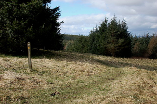
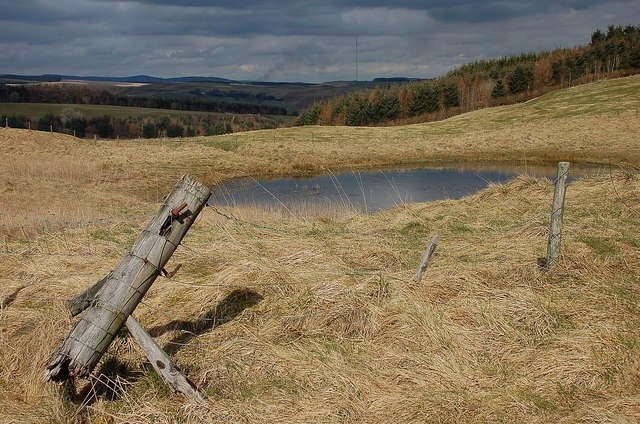
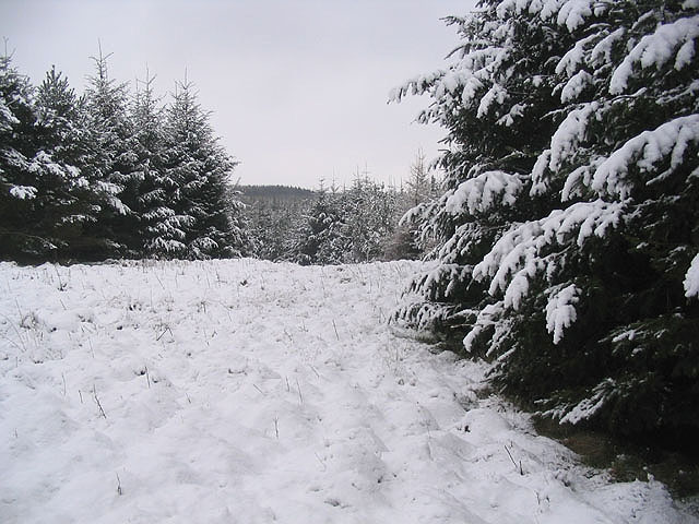
The hill is characterized by its gentle slopes, which are primarily covered in grass and heather. The summit of Blackcastle Hill is adorned with a small cairn, providing a vantage point from which visitors can enjoy breathtaking vistas of the rolling hills and picturesque valleys that make up the beautiful Roxburghshire countryside. On clear days, it is even possible to catch glimpses of the distant Cheviot Hills to the south.

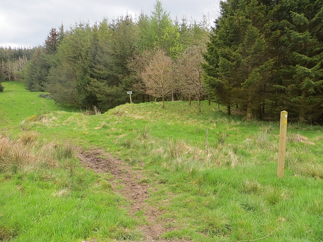
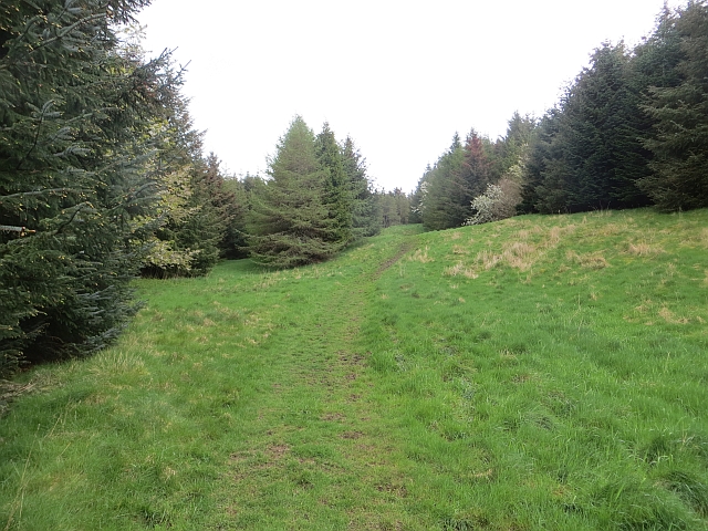
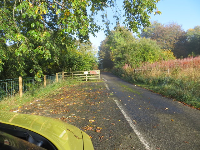
Blackcastle Hill is easily accessible via a well-maintained footpath that starts from the nearby village of Newcastleton. The path meanders through delightful woodlands and open fields, offering visitors a chance to immerse themselves in the tranquility and natural beauty of the area. Along the way, walkers may encounter various wildlife, including birds of prey, deer, and rabbits.

With its accessibility, stunning views, and diverse wildlife, Blackcastle Hill provides a scenic and peaceful escape for outdoor enthusiasts looking to explore the natural wonders of Roxburghshire. Whether it is for a leisurely stroll or a more challenging hike, this hill offers an enjoyable experience for visitors of all ages and abilities.

If you have any feedback on the listing, please let us know in the comments section below.

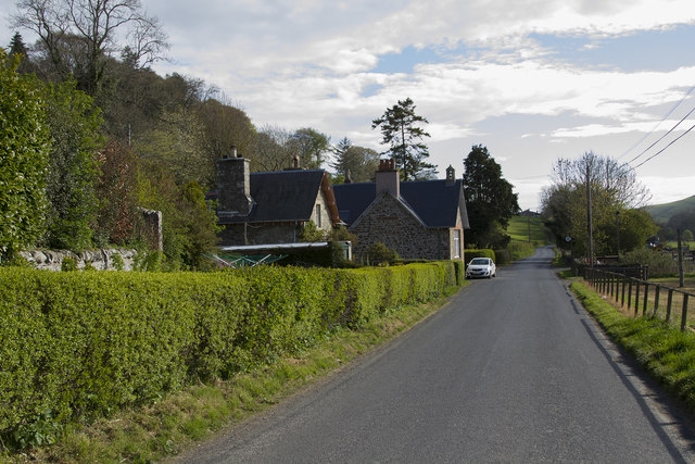
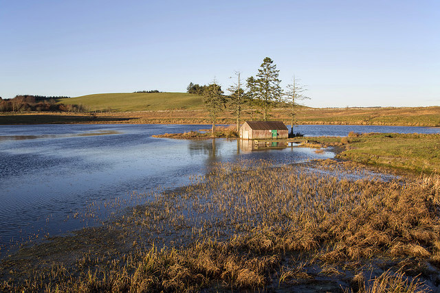
Blackcastle Hill Images

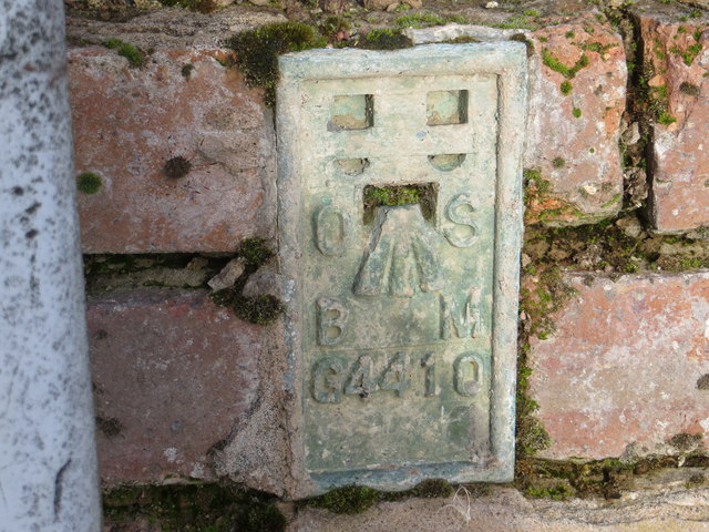
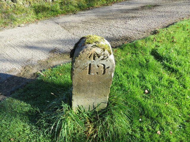
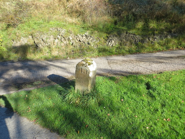
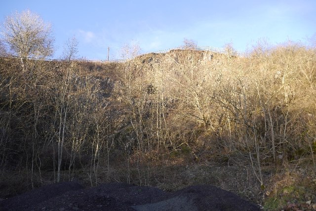
Images are sourced within 2km of 55.48585/-2.8227359 or Grid Reference NT4821. Thanks to Geograph Open Source API. All images are credited.

Borders  Abbeys  Way  in  Ashkirk  Forest
Borders Abbeys Way in Ashkirk Forest
Pond  and  newly  resurfaced  forest  track Constant traffic, large stone carrying lorries
Pond and newly resurfaced forest track
Constant traffic, large stone carrying lorries
Borders Abbeys Way, Ashkirk Forest Easy walking through this mature plantation.
Borders Abbeys Way, Ashkirk Forest
Easy walking through this mature plantation.
Pond by the forest track, Ashkirk Hill On the Borders Abbeys Way before the descent to the Ale Water. The TV transmitter mast near the A7 is in view ahead.
Pond by the forest track, Ashkirk Hill
On the Borders Abbeys Way before the descent to the Ale Water. The TV transmitter mast near the A7 is in view ahead.
A small pond on Ashkirk Hill
Border Abbeys Way on Ashkirk Hill This path forms part of the Border Abbeys Way, a circular long-distance walking route in the Scottish Borders.  A little snow still lingers in shady corners of the plantation.
Border Abbeys Way on Ashkirk Hill
This path forms part of the Border Abbeys Way, a circular long-distance walking route in the Scottish Borders. A little snow still lingers in shady corners of the plantation.
Ride, Ashkirk Hill A well used path which is waymarked as part of the Border Abbeys Way. It is also popular with horse riders and with the common riding season upon us, there was plenty of evidence of recent use.
Ride, Ashkirk Hill
A well used path which is waymarked as part of the Border Abbeys Way. It is also popular with horse riders and with the common riding season upon us, there was plenty of evidence of recent use.
Ride, Ashkirk Hill A well used path which is waymarked as part of the Border Abbeys Way. It is also popular with horse riders and with the common riding season upon us, there was plenty of evidence of recent use.c
Ride, Ashkirk Hill
A well used path which is waymarked as part of the Border Abbeys Way. It is also popular with horse riders and with the common riding season upon us, there was plenty of evidence of recent use.c
Forest Ride In Cross Plantation south of Roughside Hill.
Forest Ride
In Cross Plantation south of Roughside Hill.
A symbolic gravestone in Ashkirk Parish Churchyard This 18th century stone, which is leaning forwards, displays the classic symbols of mortality with crossed femur bones, a horizontal hourglass and a death’s head skull. A winged soul at the top of the stone is a symbol of immortality representing the human spirit.
A symbolic gravestone in Ashkirk Parish Churchyard
This 18th century stone, which is leaning forwards, displays the classic symbols of mortality with crossed femur bones, a horizontal hourglass and a death’s head skull. A winged soul at the top of the stone is a symbol of immortality representing the human spirit.
He was only 363 when he died The inscription on this Crawford gravestone in Ashkirk Parish Churchyard is interesting and amusing because the 18th century mason has carved the age of Robert Crawford as 363 when he died. The inscription reads:

HERE LYES
JOHN CRAWFORD
LATE TENNENT IN
DRAYDIAN WHO
DIED MAY 26 1744
AGID 78

Also Robert Crawford Son
late tenant in Branksholme
Town who died Sept 7 1767
Aged 363 years

For a view of the other side of the stone, see <a href="https://www.geograph.org.uk/photo/4739479">NT4622 : A symbolic gravestone in Ashkirk Parish Churchyard</a>.
He was only 363 when he died
The inscription on this Crawford gravestone in Ashkirk Parish Churchyard is interesting and amusing because the 18th century mason has carved the age of Robert Crawford as 363 when he died. The inscription reads: HERE LYES JOHN CRAWFORD LATE TENNENT IN DRAYDIAN WHO DIED MAY 26 1744 AGID 78 Also Robert Crawford Son late tenant in Branksholme Town who died Sept 7 1767 Aged 363 years For a view of the other side of the stone, see NT4622 : A symbolic gravestone in Ashkirk Parish Churchyard.
By-passed section of road (A7) at Synton Mossend Looking north-westward.
By-passed section of road (A7) at Synton Mossend
Looking north-westward.
Ordnance Survey Flush Bracket G4410 This can be found on the wall of the foundations of a demolished farm building at Ashkirktown.
For more detail see : <span class="nowrap"><a title="http://www.bench-marks.org.uk/bm17575" rel="nofollow ugc noopener" href="http://www.bench-marks.org.uk/bm17575">Link</a><img style="margin-left:2px;" alt="External link" title="External link - shift click to open in new window" src="https://s1.geograph.org.uk/img/external.png" width="10" height="10"/></span>
Ordnance Survey Flush Bracket G4410
This can be found on the wall of the foundations of a demolished farm building at Ashkirktown. For more detail see : LinkExternal link
Ordnance Survey Cut Mark with Rivet This can be found in the driveway to Dryden Stables.
For more information see : <span class="nowrap"><a title="http://www.bench-marks.org.uk/bm72387" rel="nofollow ugc noopener" href="http://www.bench-marks.org.uk/bm72387">Link</a><img style="margin-left:2px;" alt="External link" title="External link - shift click to open in new window" src="https://s1.geograph.org.uk/img/external.png" width="10" height="10"/></span>
Ordnance Survey Cut Mark with Rivet
This can be found in the driveway to Dryden Stables. For more information see : LinkExternal link
Milestone Edinburgh 43 miles (re-positioned) This milestone once stood beside the A7 at NT 475 230  but during re-alignment of the road was discarded. The owner of Dryden Stables found it in a ditch and re-positioned it on his driveway. A bit of history preserved.
Milestone Edinburgh 43 miles (re-positioned)
This milestone once stood beside the A7 at NT 475 230 but during re-alignment of the road was discarded. The owner of Dryden Stables found it in a ditch and re-positioned it on his driveway. A bit of history preserved.
Quarry, Synton 8 years after <a href="https://www.geograph.org.uk/photo/1048573">NT4823 : Quarry, Synton</a>
Quarry, Synton
8 years after NT4823 : Quarry, Synton
The edge of Ashkirk The village of Ashkirk is very spread out but does have a small concentrated group of houses near the junction with the A7. This picture was taken just on the edge of the village close to the Ale Water which is the stream / burn that runs through the village.
The edge of Ashkirk
The village of Ashkirk is very spread out but does have a small concentrated group of houses near the junction with the A7. This picture was taken just on the edge of the village close to the Ale Water which is the stream / burn that runs through the village.
Synton Loch The landscape is showing winter colours in this early December view. Some wildfowl and swans were on the loch.
Synton Loch
The landscape is showing winter colours in this early December view. Some wildfowl and swans were on the loch.
Show me another place!

Blackcastle Hill is located at Grid Ref: NT4821 (Lat: 55.48585, Lng: -2.8227359)

Unitary Authority: The Scottish Borders

Police Authority: The Lothians and Scottish Borders

What 3 Words

///goodbye.regret.seasonal. Near Selkirk, Scottish Borders

Related Wikis

Ashkirk

Ashkirk is a small village on the Ale Water, in the Scottish Borders area of Scotland. It is located just off the A7 road, approximately 6 miles (10 kilometres...

Woll, Scottish Borders

Woll is a village on the Ale Water, off the A7, in the Ettrick Forest, north of Hawick, and south of Selkirk in the Scottish Borders area of Scotland....

Salenside

Salenside is a village off the A7, on the Ale Water, near Ashkirk, in the Scottish Borders area of Scotland, in the former Selkirkshire. There was a Salenside...

Bowismiln

Bowismiln is a village in the Scottish Borders area of Scotland. == See also == List of places in the Scottish Borders List of places in Scotland ��2...

Nearby Amenities

Located within 500m of 55.48585,-2.8227359
Blackcastle Hill
Natural: peak
Lat/Long: 55.485806/-2.8222927
Noexit: yes
Lat/Long: 55.4820716/-2.8255016
Power: pole
Lat/Long: 55.4883812/-2.8184629
Power: pole
Lat/Long: 55.4888714/-2.8180329
Power: pole
Lat/Long: 55.4892099/-2.8177239
The data included in this document is from www.openstreetmap.org. The data is made available under ODbL.

Have you been to Blackcastle Hill?

Leave your review of Blackcastle Hill below (or comments, questions and feedback).