Iffley
Settlement in Oxfordshire Oxford
England
Iffley

Iffley is a charming village located in Oxfordshire, England. Situated just 2 miles south-east of the city of Oxford, it is a popular residential area that blends the tranquility of countryside living with easy access to urban amenities.
The village is best known for its picturesque setting along the River Thames. The iconic Iffley Lock, a historic lock and weir on the river, is a focal point of the area and attracts visitors from far and wide. The lock offers a peaceful spot for walking, picnicking, and enjoying the natural beauty of the surroundings.
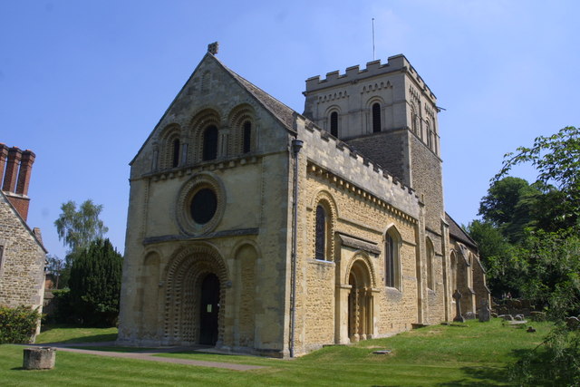
Iffley is also renowned for its historic architecture. The Iffley Church, dedicated to St. Mary the Virgin, dates back to the 12th century and is a stunning example of Norman Romanesque design. The church's interior features an impressive Norman arch, a beautifully preserved rood screen, and a rare medieval stained glass window.
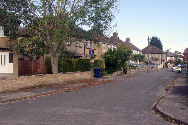
The village itself is characterized by its quaint thatched-roof cottages, well-tended gardens, and a sense of community. There are a few local amenities, including a village hall, a primary school, and a popular pub, The Isis Tavern, which offers a warm welcome to locals and visitors alike.
For those seeking outdoor activities, Iffley offers numerous opportunities. The nearby Shotover Country Park provides ample space for walking, cycling, and enjoying nature. Additionally, the University of Oxford's renowned Iffley Road Sports Complex, known for its track and field facilities, attracts athletes and sports enthusiasts.
In summary, Iffley is a delightful village that combines its natural beauty, rich history, and convenient location to offer residents and visitors a peaceful and idyllic setting in the heart of Oxfordshire.
If you have any feedback on the listing, please let us know in the comments section below.
Iffley Images
Images are sourced within 2km of 51.729931/-1.235449 or Grid Reference SP5203. Thanks to Geograph Open Source API. All images are credited.


Iffley is located at Grid Ref: SP5203 (Lat: 51.729931, Lng: -1.235449)
Administrative County: Oxfordshire
District: Oxford
Police Authority: Thames Valley
What 3 Words
///spider.riots.truth. Near Cowley, Oxfordshire
Nearby Locations
Related Wikis
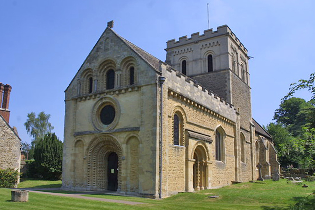
St Mary the Virgin, Iffley
The Church of St Mary the Virgin, Iffley is a Church of England parish church in the village of Iffley, Oxfordshire, England, now absorbed as a suburb...
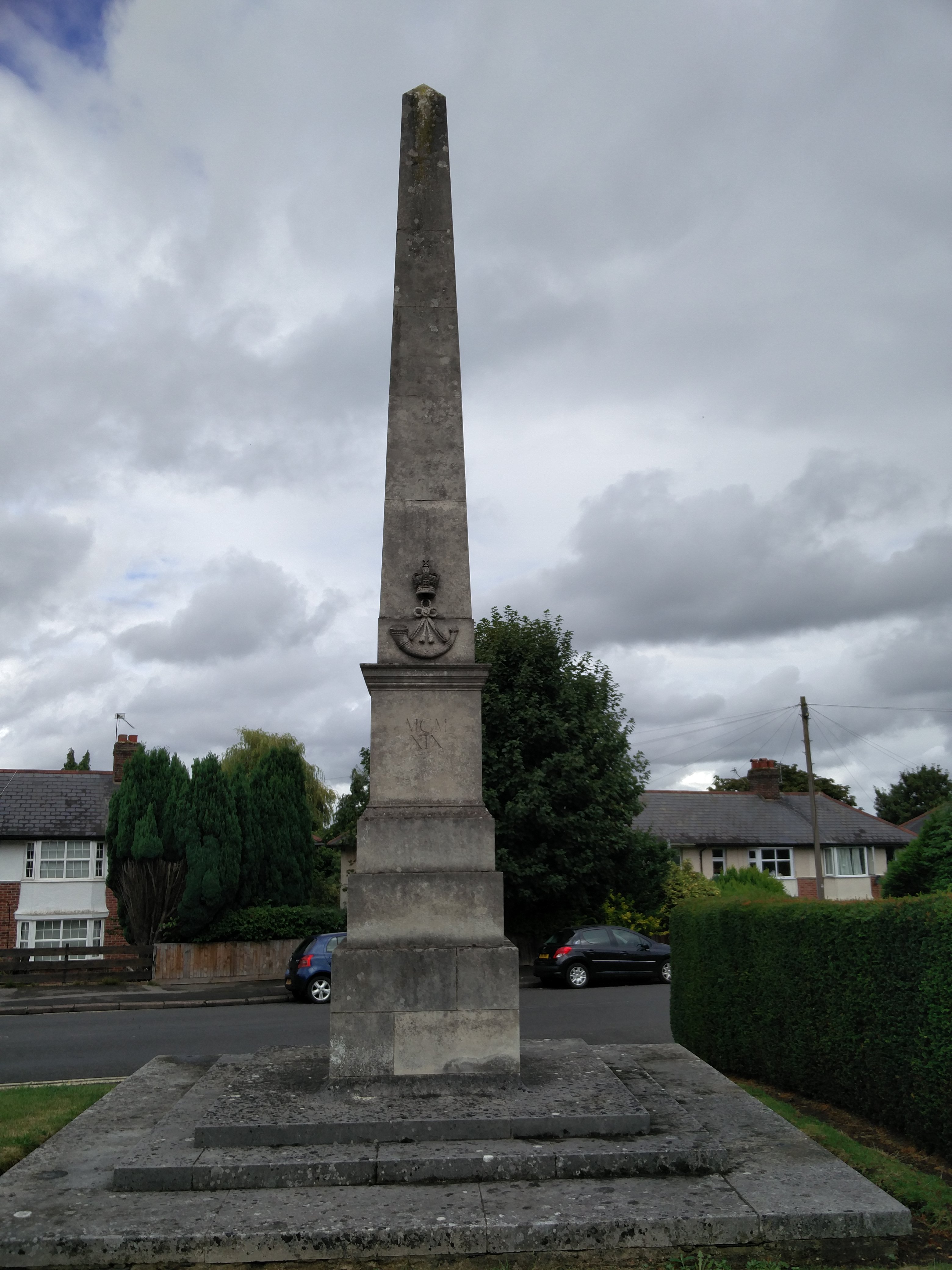
Oxfordshire and Buckinghamshire Light Infantry War Memorial
The Oxfordshire and Buckinghamshire Light Infantry War Memorial is a First World War memorial in the Cowley area of Oxford in southern England. Designed...

Iffley Meadows
Iffley Meadows is a 36.1-hectare (89-acre) biological Site of Special Scientific Interest in Oxford in Oxfordshire. It is owned by Oxford City Council...
Iffley
Iffley is a village in a designated Conservation Area in Oxfordshire, England. It lies within the boundaries of the city of Oxford, between Cowley and...
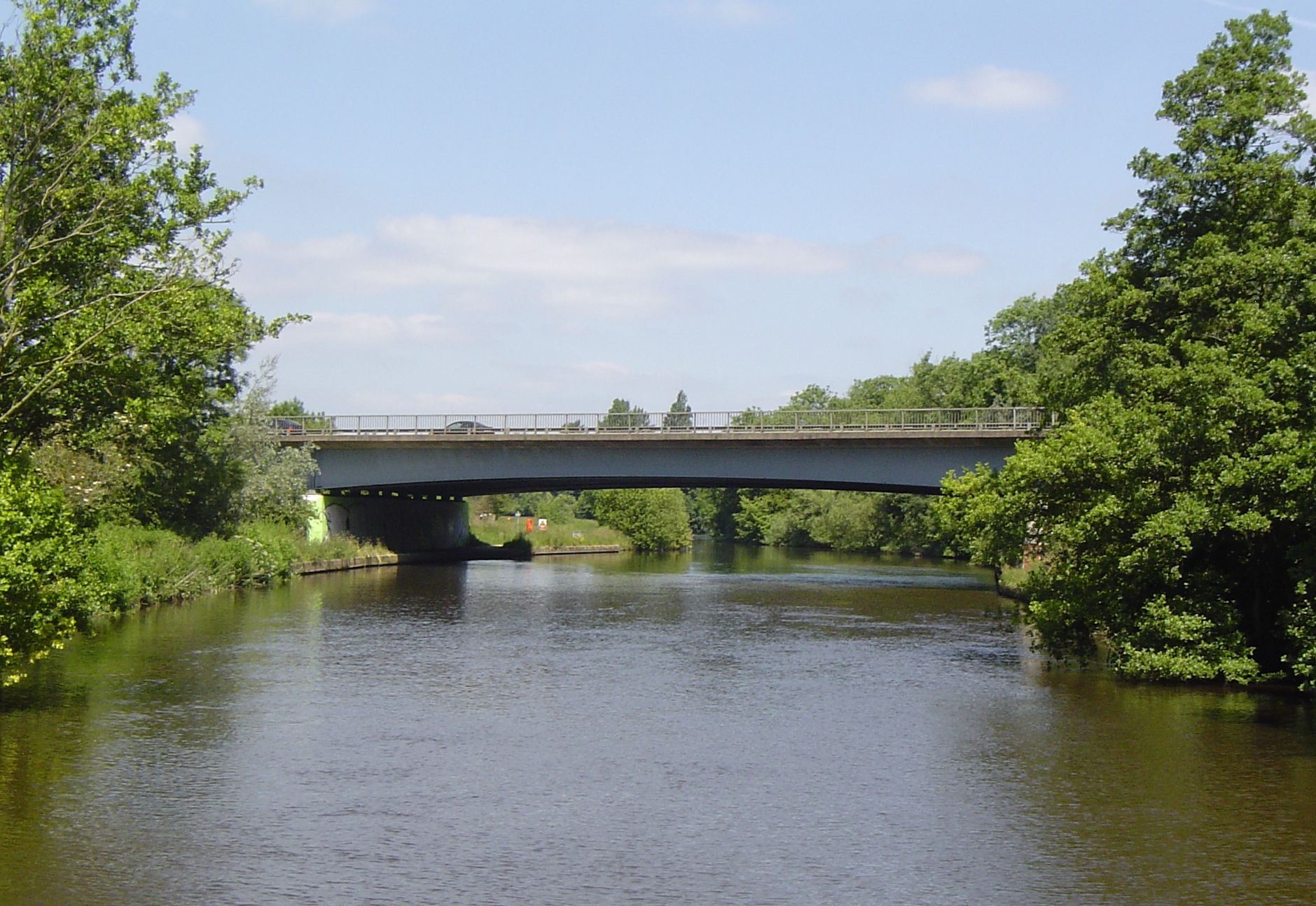
Isis Bridge
Isis Bridge is a modern road bridge across the River Thames just south of Oxford, England. It carries the Oxford Ring Road, part of the A423 road, across...

City of Oxford Rowing Club
City of Oxford Rowing Club is a rowing club on the River Thames based on Meadow Lane, Donnington, Oxford, Oxfordshire. == History == The club was founded...

Rose Hill, Oxfordshire
Rose Hill is a residential area, with some housing that has been council-owned, on the southern outskirts of Oxford, England. According to the 2001 Census...
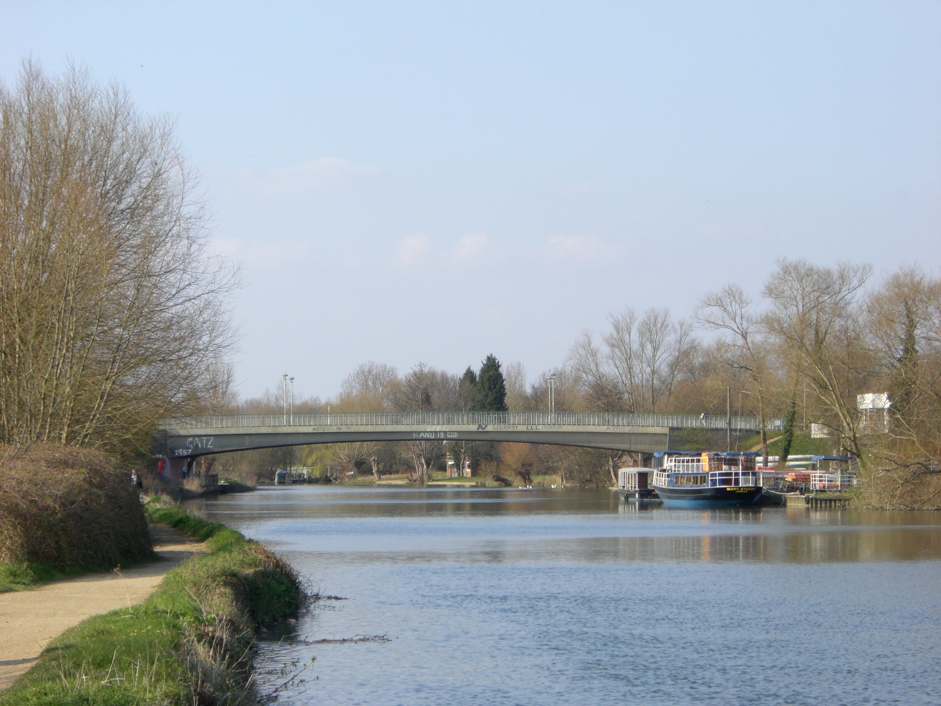
Donnington Bridge
Donnington Bridge is a modern road bridge (completed in 1962) over the River Thames, in the south of the city of Oxford, England. At this point the river...
Nearby Amenities
Located within 500m of 51.729931,-1.235449Have you been to Iffley?
Leave your review of Iffley below (or comments, questions and feedback).