Patrick's Hill

Hill, Mountain in Herefordshire

England

Patrick's Hill

Farm track near Richard's Castle In valleys of springs of rivers,
           By Onny and Teme and Clun,
          The country for easy livers,
           The quietest under the sun.

Excerpt from 'A Shropshire Lad' by AE Housman
Farm track near Richard's Castle Credit: Jeremy Bolwell

Patrick's Hill is a prominent geographical feature located in the county of Herefordshire, England. Situated near the village of Patrick's Hill, the hill stands at an elevation of approximately 300 meters and offers breathtaking panoramic views of the surrounding countryside.

Covered in lush greenery, the hill is characterized by its gentle slopes and rolling terrain, making it a popular destination for nature lovers and outdoor enthusiasts. The hill is primarily composed of sedimentary rocks, with layers of limestone and sandstone contributing to its distinctive appearance.

The area surrounding Patrick's Hill is rich in biodiversity, with a variety of plant and animal species calling it home. Visitors can expect to encounter a diverse range of flora, including wildflowers, grasses, and ferns. The hill is also home to several species of birds, making it an ideal spot for birdwatching enthusiasts.

At the summit of Patrick's Hill, there is a small viewing platform that provides visitors with an uninterrupted view of the Herefordshire countryside. On clear days, it is possible to see for miles, with vistas encompassing rolling hills, farmland, and even glimpses of distant villages.

The hill is accessible via a network of footpaths that wind their way through the surrounding countryside, offering visitors the opportunity to explore the area at their own pace. Whether it's for a leisurely hike, a picnic, or simply to enjoy the tranquility of nature, Patrick's Hill offers a serene and picturesque escape from the hustle and bustle of daily life.

If you have any feedback on the listing, please let us know in the comments section below.

Patrick's Hill Images

Images are sourced within 2km of 52.314079/-2.7719896 or Grid Reference SO4768. Thanks to Geograph Open Source API. All images are credited.

Farm track near Richard's Castle In valleys of springs of rivers,
           By Onny and Teme and Clun,
          The country for easy livers,
           The quietest under the sun.

Excerpt from 'A Shropshire Lad' by AE Housman
Farm track near Richard's Castle
In valleys of springs of rivers, By Onny and Teme and Clun, The country for easy livers, The quietest under the sun. Excerpt from 'A Shropshire Lad' by AE Housman
Lane and footpath near Richard's Castle A waymarker sits between lanes at the junction point.
Lane and footpath near Richard's Castle
A waymarker sits between lanes at the junction point.
April's House, Waterloo Lane, near Richard's Castle A large and impressive house in an isolated spot. Interesting circular saw blade
April's House, Waterloo Lane, near Richard's Castle
A large and impressive house in an isolated spot. Interesting circular saw blade
Orleton Rise Holiday Park A static caravan holiday park within easy reach of many local attractions; Ludlow, Tenbury, Leominster (no, I'm not joking), the Teme valley, Mortimer Forest, the Clee Hills, Richard's Castle, the Mortimer Trail plus numerous small villages with pubs and a wide choice of restaurants. Or visitors could just stay on site drinking their own beer and eating their own barbecue food.
Orleton Rise Holiday Park
A static caravan holiday park within easy reach of many local attractions; Ludlow, Tenbury, Leominster (no, I'm not joking), the Teme valley, Mortimer Forest, the Clee Hills, Richard's Castle, the Mortimer Trail plus numerous small villages with pubs and a wide choice of restaurants. Or visitors could just stay on site drinking their own beer and eating their own barbecue food.
View from a footpath near Orleton The footpath here follows a field edge with lovely views across neighbouring fields to a bungalow and Titterstone Clee behind.
View from a footpath near Orleton
The footpath here follows a field edge with lovely views across neighbouring fields to a bungalow and Titterstone Clee behind.
Footpath through a rape field near Portway The oil seed rape is losing its yellow flowers now as May comes to an end and it is getting hard to struggle through the crop as it grows.
Footpath through a rape field near Portway
The oil seed rape is losing its yellow flowers now as May comes to an end and it is getting hard to struggle through the crop as it grows.
Old building in Orleton I have been watching that tile and waiting for it to fall for, well, maybe five years. This old building could well have been a smithy or a garage, or a coach house for the neighbouring roadside inn. Someone will know.
Old building in Orleton
I have been watching that tile and waiting for it to fall for, well, maybe five years. This old building could well have been a smithy or a garage, or a coach house for the neighbouring roadside inn. Someone will know.
The Maidenhead Inn in Orleton is for sale
Tree in a Field
Tree in a Field
Big field near Richards Castle Harvested cornfield to the east of Richards Castle.
Big field near Richards Castle
Harvested cornfield to the east of Richards Castle.
B4361 passes The Maidenhead Inn
B4361 northwest of Bilbury
Mistletoe-infested tree alongside B4361
B4361 Junction The view at the junction of B4361 with the B4262 at Portway.
B4361 Junction
The view at the junction of B4361 with the B4262 at Portway.
End of Millbrook Way, Orleton The junction with the B4361.  The historic centre of the village is east of the north-south road.  In the mid 20th century Millbrook Way ran through countryside between the Maidenhead Inn on the B4361 and the village centre, but it is now lined with houses
End of Millbrook Way, Orleton
The junction with the B4361. The historic centre of the village is east of the north-south road. In the mid 20th century Millbrook Way ran through countryside between the Maidenhead Inn on the B4361 and the village centre, but it is now lined with houses
Footpath signs near Orleton The two footpaths signed here mean that walkers can avoid longer walks on the roads. On the left, the path leads to Broad Green along field edges, opposite, the path crosses a large field to reach the historic centre of Orleton
Footpath signs near Orleton
The two footpaths signed here mean that walkers can avoid longer walks on the roads. On the left, the path leads to Broad Green along field edges, opposite, the path crosses a large field to reach the historic centre of Orleton
Footpath to Merefield The path leads past two places with the name Merefield and then joins a network of paths in the valley west of Richards Castle
Footpath to Merefield
The path leads past two places with the name Merefield and then joins a network of paths in the valley west of Richards Castle
Trees with mistletoe By the B4361 south of Richards Castle
Trees with mistletoe
By the B4361 south of Richards Castle
Show me another place!

Patrick's Hill is located at Grid Ref: SO4768 (Lat: 52.314079, Lng: -2.7719896)

Unitary Authority: County of Herefordshire

Police Authority: West Mercia

What 3 Words

///speeded.skin.motored. Near Orleton, Herefordshire
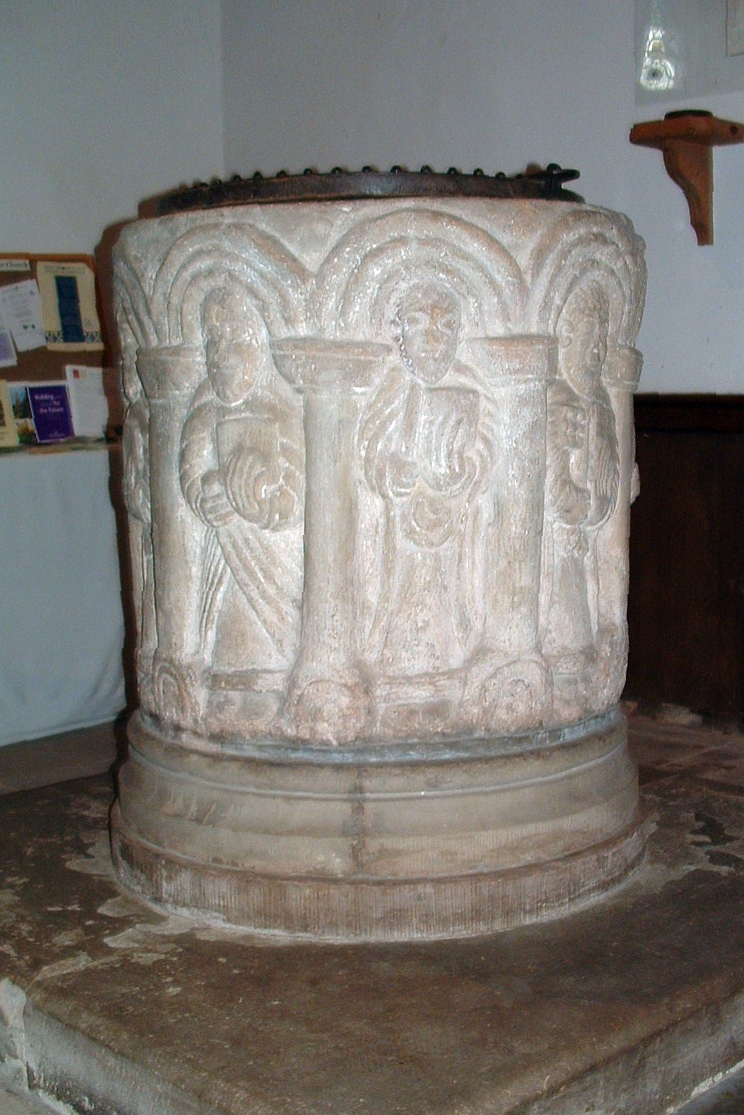
Related Wikis

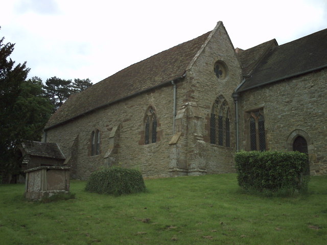
St Bartholomew's Church, Richard's Castle

St Bartholomew's Church is a redundant Anglican church in the village of Richard's Castle, Herefordshire, England. It is recorded in the National Heritage...

Richard's Castle

Richard's Castle is a village, castle and two civil parishes on the border of the counties of Herefordshire and Shropshire in England. The Herefordshire...

Orleton

Orleton is a small village and civil parish in northern Herefordshire, England, at grid reference SO493672. The population of the civil parish at the 2011...
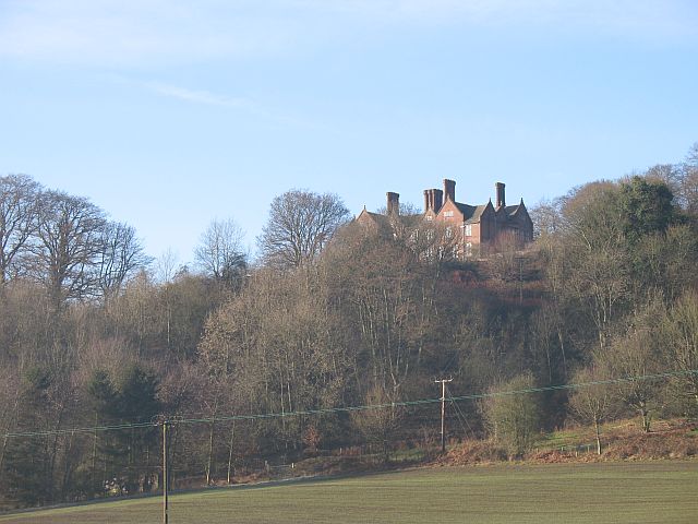
Gatley Park

Gatley Park is an English 17th-century park and country house lying near Leinthall Earls, Herefordshire. Both the park and the house are separately listed...

Nearby Amenities

Located within 500m of 52.314079,-2.7719896
Woodhouse
Place: locality
Lat/Long: 52.3150712/-2.7662535
Generator Method: photovoltaic
Generator Output Electricity: yes
Generator Source: solar
Generator Type: solar_photovoltaic_panel
Location: roof
Power: generator
Lat/Long: 52.311068/-2.7714381
The data included in this document is from www.openstreetmap.org. The data is made available under ODbL.

Have you been to Patrick's Hill?

Leave your review of Patrick's Hill below (or comments, questions and feedback).