Millrigg Knott

Hill, Mountain in Westmorland South Lakeland

England

Millrigg Knott

Fields above Browfoot
Fields above Browfoot Credit: David Purchase

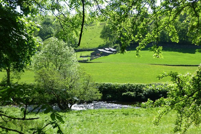
Millrigg Knott is a picturesque hill located in Westmorland, a historic county in the North West of England. Situated in the Lake District National Park, it forms part of the stunning landscape that draws visitors from all over the world.

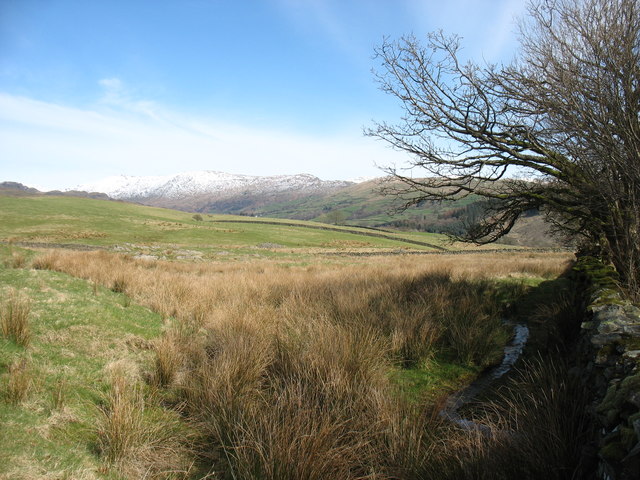
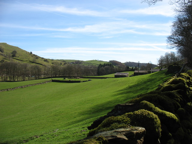
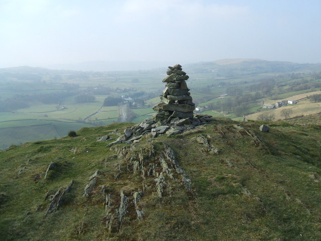
Rising to an elevation of approximately 550 meters (1,800 feet), Millrigg Knott offers breathtaking views of the surrounding countryside. Its prominent position allows for uninterrupted vistas of the rolling hills, lush meadows, and tranquil lakes that characterize this region. On a clear day, one can even catch a glimpse of the distant Scottish mountains.

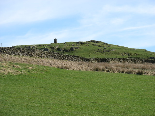
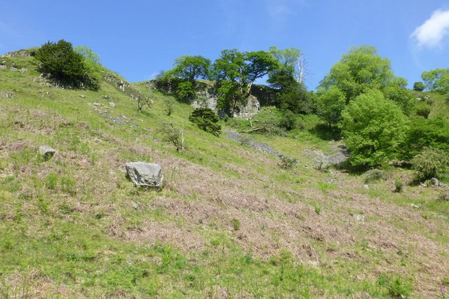
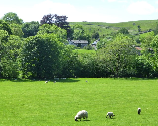
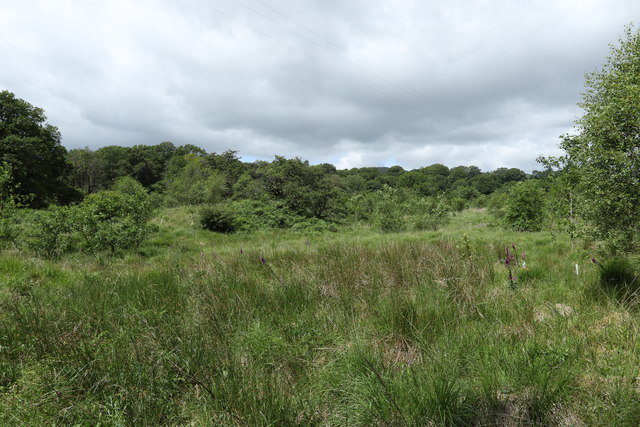
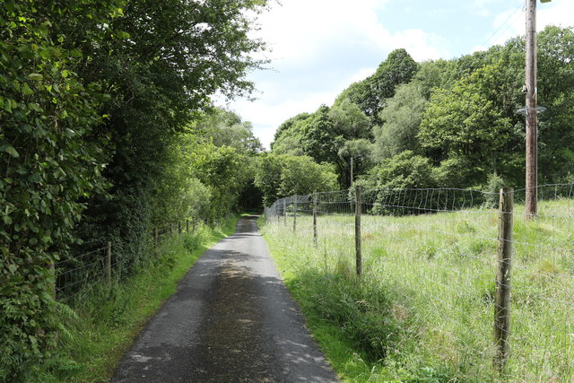
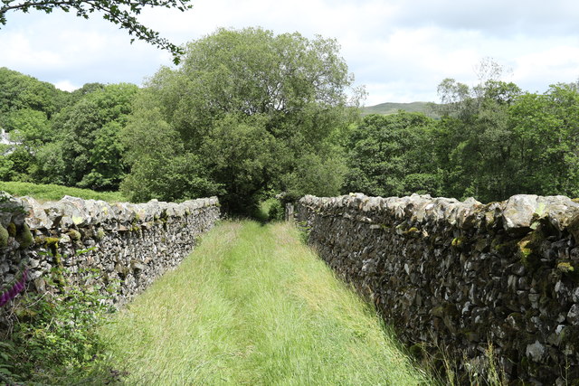
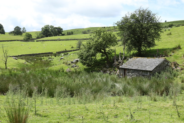
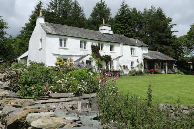
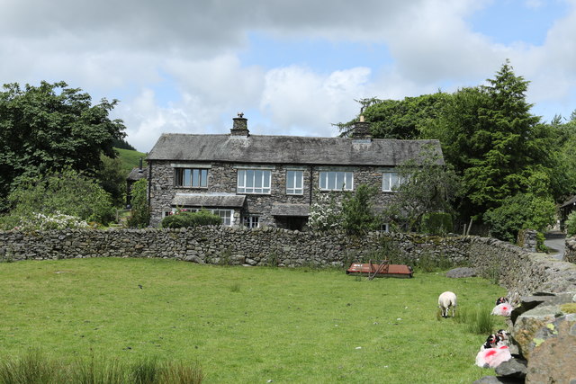
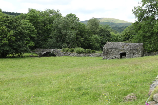
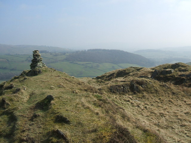
The terrain of Millrigg Knott is a mix of grassy slopes and rocky outcrops, making it a popular destination for hikers and nature enthusiasts. The hill is dotted with ancient stone walls, remnants of the area's agricultural past, adding to its charm and historical significance.

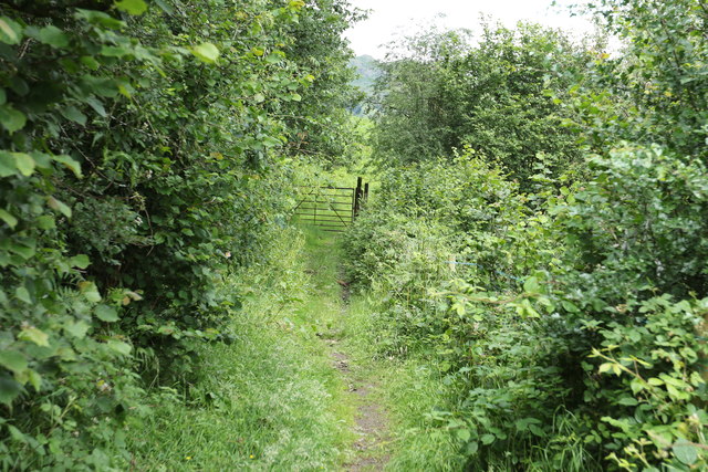
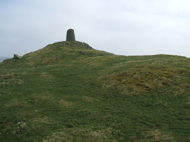
The summit of Millrigg Knott is marked by a cairn, offering a sense of achievement to those who reach its peak. Many visitors choose to bring a picnic and spend time absorbing the peaceful atmosphere, while others prefer to explore the surrounding trails that lead to nearby attractions such as waterfalls and picturesque villages.

As with many hills in the Lake District, Millrigg Knott is home to a variety of wildlife. Birdwatchers can spot species such as peregrine falcons, buzzards, and kestrels soaring through the skies, while sheep and wild ponies graze on the lower slopes.

Overall, Millrigg Knott is a hidden gem within the Westmorland landscape, offering nature lovers and outdoor enthusiasts a chance to connect with the beauty and tranquility of the Lake District.

If you have any feedback on the listing, please let us know in the comments section below.

Millrigg Knott Images

Images are sourced within 2km of 54.402581/-2.826996 or Grid Reference NY4601. Thanks to Geograph Open Source API. All images are credited.

Fields above Browfoot
Williamson's Monument, High Knott The name Hugill Fell applies to a large area of hill, of which High Knott is just one summit.

For several years a strongly worded sign forbidding access appeared at the spot where Wainwright's route to the monument left the bridleway. On 24 March 2017 this sign was no longer there. However I suspect direct action by an irate bagger of Wainwright's Outlying Fells, rather than a change of heart by the landowner. I spotted an identical notice 2.5 hours later in the square 1km to the south - see <a href="https://www.geograph.org.uk/photo/5342405">SD4599 : Welcome to Hugill Fell !</a>.
Williamson's Monument, High Knott
The name Hugill Fell applies to a large area of hill, of which High Knott is just one summit. For several years a strongly worded sign forbidding access appeared at the spot where Wainwright's route to the monument left the bridleway. On 24 March 2017 this sign was no longer there. However I suspect direct action by an irate bagger of Wainwright's Outlying Fells, rather than a change of heart by the landowner. I spotted an identical notice 2.5 hours later in the square 1km to the south - see SD4599 : Welcome to Hugill Fell !.
Farmland at Goose Howe Farm
Pool Scar Whitehowe Wood on the right.
Pool Scar
Whitehowe Wood on the right.
Browfoot beyond the pasture And across the River Kent.
Browfoot beyond the pasture
And across the River Kent.
Goose Howe Across the River Kent.
Goose Howe
Across the River Kent.
Gate across the track Looking north towards Kentmere.
Gate across the track
Looking north towards Kentmere.
Hollingsworth and Vose Global manufacturer with this one of their sites at Waterford Bridge.
Hollingsworth and Vose
Global manufacturer with this one of their sites at Waterford Bridge.
Grassland in Kentmere Hall Plantation Just south of Hollingsworth and Vose.
Grassland in Kentmere Hall Plantation
Just south of Hollingsworth and Vose.
Footpath to Sawmill Cottage In the Kentmere Hall Plantation.
Footpath to Sawmill Cottage
In the Kentmere Hall Plantation.
Stone wall on either side This footpath leads to Sawmill Cottage.
Stone wall on either side
This footpath leads to Sawmill Cottage.
Old barn at Croft Head In Ulthwaite Fold
Old barn at Croft Head
In Ulthwaite Fold
Croft Head Just north of Ulthwaite Bridge
Croft Head
Just north of Ulthwaite Bridge
House north of Ulthwaite Bridge At Croft Head
House north of Ulthwaite Bridge
At Croft Head
Road to Croft Head From Ulthwaite Bridge.
Road to Croft Head
From Ulthwaite Bridge.
Ulthwaite Bridge Looking west
Ulthwaite Bridge
Looking west
Barn near Ulthwaite Bridge Near the River Kent.
Barn near Ulthwaite Bridge
Near the River Kent.
Field on the bank of the River Kent At Ulthwaite Bridge.
Field on the bank of the River Kent
At Ulthwaite Bridge.
Show me another place!

Millrigg Knott is located at Grid Ref: NY4601 (Lat: 54.402581, Lng: -2.826996)

Administrative County: Cumbria

District: South Lakeland

Police Authority: Cumbria

What 3 Words

///shatters.pylon.expressed. Near Staveley, Cumbria

Nearby Locations

Millrigg Knott

Related Wikis

High Knott

High Knott, marked on some Ordnance Survey maps as Williamson's Monument, is a hill in the eastern part of the English Lake District, near Staveley, Cumbria...

Hugill Fell

Hugill Fell is a hill in the English Lake District, near Staveley, Cumbria, on the western side of the Kentmere valley. The Database of British and Irish...

Potter Fell

Potter Fell is a fell near the villages of Burneside and Staveley, Cumbria, England, reaching a maximum height of 1,400 feet (430 m) at Brunt Knott. Alfred...

Reston Scar

Reston Scar is a fell in the Lake District of Cumbria, England. With a height of 837 feet (255 m), it overlooks the north side of Staveley village, and...

Nearby Amenities

Located within 500m of 54.402581,-2.826996
Millrigg Knott
Ele: 299.6
Is In Country Code: GB
Is In County: Cumbria
Is In Region: Lake District
Natural: peak
Source: npe
Lat/Long: 54.403087/-2.8276336
Millrigg Lead mine
Abandoned: yes
Historic: mine
Man Made: mine
Mineral: lead
Lat/Long: 54.4044724/-2.8269826
Abandoned: yes
Historic: mine_shaft
Man Made: mineshaft
Mineral: lead
Lat/Long: 54.4037332/-2.8230307
Abandoned: yes
Historic: mine_shaft
Man Made: mineshaft
Mineral: lead
Lat/Long: 54.407015/-2.8276299
The data included in this document is from www.openstreetmap.org. The data is made available under ODbL.

Have you been to Millrigg Knott?

Leave your review of Millrigg Knott below (or comments, questions and feedback).