Broom Craig

Hill, Mountain in Angus

Scotland

Broom Craig

Track beyond the road end A good LRT continues beyond the road end in Glen Lethnot, its purpose being to transport those who wish to shoot grouse or deer into the hills. Walkers are tolerated rather than encouraged.
Track beyond the road end Credit: Gordon Hatton

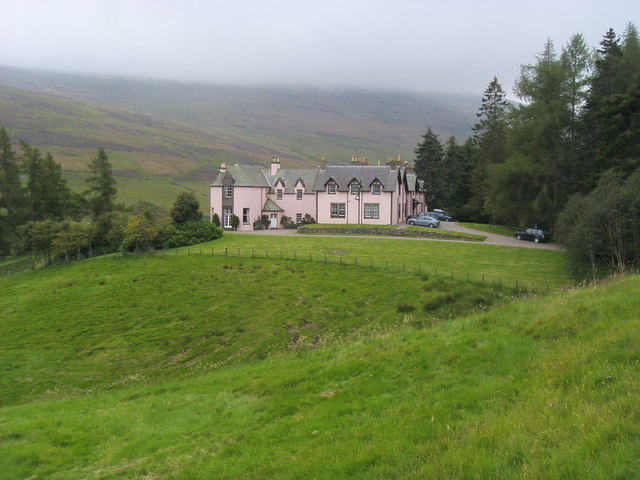
Broom Craig is a prominent hill located in the Angus region of Scotland. Situated near the small village of Edzell, it is a popular destination for hikers and nature enthusiasts.

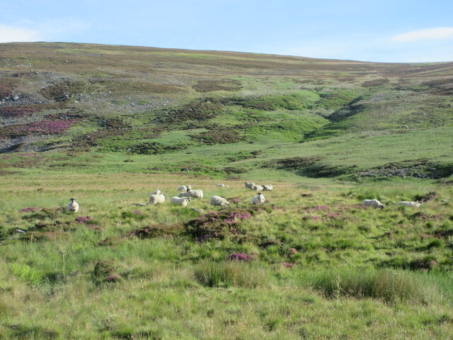
Rising to a height of about 1,300 feet (400 meters), Broom Craig offers breathtaking panoramic views from its summit. The hill is part of the picturesque Angus Glens, surrounded by rolling moorlands and lush greenery. Its distinctive rocky outcrop serves as a landmark in the area.

The ascent to the top of Broom Craig can be challenging, involving steep and rugged terrain. Nevertheless, the effort is rewarded with stunning vistas across the surrounding countryside, including glimpses of the nearby Grampian Mountains. On clear days, it is even possible to see as far as the North Sea.

The hill is home to a diverse range of flora and fauna, including heather, moss, and various bird species. Visitors may also come across grazing sheep and deer during their exploration of the area. Broom Craig is particularly picturesque during the spring and summer months when wildflowers bloom and the landscape comes alive with vibrant colors.

For those seeking outdoor adventures, Broom Craig offers opportunities for rock climbing and bouldering. However, it is important to exercise caution and ensure proper safety measures are taken.

Overall, Broom Craig is a natural gem in the Angus region, providing visitors with a chance to immerse themselves in the beauty of Scotland's countryside and enjoy an invigorating outdoor experience.

If you have any feedback on the listing, please let us know in the comments section below.

Broom Craig Images

Images are sourced within 2km of 56.848463/-2.8821128 or Grid Reference NO4673. Thanks to Geograph Open Source API. All images are credited.

Track beyond the road end A good LRT continues beyond the road end in Glen Lethnot, its purpose being to transport those who wish to shoot grouse or deer into the hills. Walkers are tolerated rather than encouraged.
Track beyond the road end
A good LRT continues beyond the road end in Glen Lethnot, its purpose being to transport those who wish to shoot grouse or deer into the hills. Walkers are tolerated rather than encouraged.
Bridge to Waterhead The Water of Saughs flows benath the bridge, but soon becomes the West Water, presumably after the confluence with the Burn of Corscarie.
Bridge to Waterhead
The Water of Saughs flows benath the bridge, but soon becomes the West Water, presumably after the confluence with the Burn of Corscarie.
Little arch bridge over the Mill Burn Little stone bridge carrying the Glen Lethnot road over the Mill Burn.
Little arch bridge over the Mill Burn
Little stone bridge carrying the Glen Lethnot road over the Mill Burn.
Glascorrie in Glen Lethnot Looking from the Glen Lethnot Road northwards to Glascorrie Cottage.
Glascorrie in Glen Lethnot
Looking from the Glen Lethnot Road northwards to Glascorrie Cottage.
Glen Lethnot and the West Water The West Water heading down Glen Lethnot viewed from above near Hunthill.
Glen Lethnot and the West Water
The West Water heading down Glen Lethnot viewed from above near Hunthill.
Hunthill Lodge The pink-walled Hunthill Lodge viewed from the Glen Lethnot road to the north.
Hunthill Lodge
The pink-walled Hunthill Lodge viewed from the Glen Lethnot road to the north.
Track above Glen Lethnot Track heading down the north side of Glen Lethnot, with Black Craig ahead on the opposite side of the glen.
Track above Glen Lethnot
Track heading down the north side of Glen Lethnot, with Black Craig ahead on the opposite side of the glen.
Footbridge in Glen Lethnot Footbridge over the Water of Saughs in Glen Lethnot, with Corrie na Berran beyond.
Footbridge in Glen Lethnot
Footbridge over the Water of Saughs in Glen Lethnot, with Corrie na Berran beyond.
Sheep in Glen Lethnot Sheep on the north side of the track in Glen Lethnot.
Sheep in Glen Lethnot
Sheep on the north side of the track in Glen Lethnot.
Track in Glen Lethnot Track heading from the road end in Glen Lethnot.
Track in Glen Lethnot
Track heading from the road end in Glen Lethnot.
New road bridge at Waterhead, Glen Lethnot Replacement bridge at Waterhead.
New road bridge at Waterhead, Glen Lethnot
Replacement bridge at Waterhead.
4x4's and 8x8's Rough terrain vehicles on the Lethnot estate.
4x4's and 8x8's
Rough terrain vehicles on the Lethnot estate.
Water of Saughs Upper Glen Lethnot.
Water of Saughs
Upper Glen Lethnot.
Bridge at Waterhead The Waters of Saugh at the bridge at Waterhead
Bridge at Waterhead
The Waters of Saugh at the bridge at Waterhead
Hunthill Lodge Hunthill Lodge Glen Lethnot
Hunthill Lodge
Hunthill Lodge Glen Lethnot
West Water/Water of Saughs The river in Glen Lethnot changes its name - somewhere.  This is near the head of the public road.
West Water/Water of Saughs
The river in Glen Lethnot changes its name - somewhere. This is near the head of the public road.
Wood above Blackhaugh A larch wood shelters Hunthill Lodge and surrounding buildings from snow laden winds off the hill.
Wood above Blackhaugh
A larch wood shelters Hunthill Lodge and surrounding buildings from snow laden winds off the hill.
Waterhead The last habitation in Glen Lethnot, still covered in snow, while every other dwelling in the glen was mostly snow free.
Waterhead
The last habitation in Glen Lethnot, still covered in snow, while every other dwelling in the glen was mostly snow free.
Show me another place!

Broom Craig is located at Grid Ref: NO4673 (Lat: 56.848463, Lng: -2.8821128)

Unitary Authority: Angus

Police Authority: Tayside

What 3 Words

///tonic.lecturers.signified. Near Brechin, Angus

Nearby Locations

Broom Craig

Related Wikis

Five Glens of Angus

The Five Glens of Angus are the five Highland glens located in the western portion of the Angus region of Scotland. The five glens from westernmost to...

Angus (UK Parliament constituency)

Angus is a county constituency of the House of Commons of the Parliament of the United Kingdom (at Westminster). It elects one Member of Parliament (MP...

Tarfside

Tarfside is a small hamlet in Angus, Scotland. It is situated in Glen Esk, on the upper course of the River North Esk, around 8 miles north of Edzell,...

Loch Lee

National grid reference NO431800 Loch Lee is a loch in Angus, Scotland south of the Grampian Mountains that is fed by the Water of Lee and the Water of...

Invermark Castle

Invermark Castle is an oblong tower house dating from the 16th century, at the east of Loch Lee, Angus, Scotland. It is near the head of Glen Esk. ��2...

Invermark Lodge

Invermark Lodge is a hunting lodge which was built near Invermark Castle in 1852 for John Ramsay, 13th Earl of Dalhousie. It is now a listed building...

Ben Tirran

Ben Tirran (896 m) is a mountain in the Grampian Mountains of Scotland. It lies in the vast Mounth area of the eastern Highlands in Angus, on the northern...

Milden, Angus

Milden is a hamlet, estate and farmstead in Glenesk, Angus, Scotland. It is situated in the upper course of the Glen Esk valley, where the Burn of Turret...

Nearby Amenities

Located within 500m of 56.848463,-2.8821128
Broom Craig
Ele: 602
Natural: peak
Lat/Long: 56.8484121/-2.8811649
The data included in this document is from www.openstreetmap.org. The data is made available under ODbL.

Have you been to Broom Craig?

Leave your review of Broom Craig below (or comments, questions and feedback).