Ickleton

Settlement in Cambridgeshire South Cambridgeshire

England

Ickleton

Great Chesterford Church Some of my antecedents are buried in the family plot to the left of this picture
Great Chesterford Church Credit: Julian Baker

Ickleton is a quaint village located in the county of Cambridgeshire, England. Situated approximately 12 miles southeast of Cambridge, it lies in the picturesque countryside of the South Cambridgeshire district. With a population of around 700 residents, Ickleton offers a peaceful and close-knit community atmosphere.

The village has a rich history that can be traced back to the Roman period, with evidence of a Roman villa discovered nearby. Today, Ickleton retains its charming character, with many historic buildings and landmarks. St. Mary Magdalene Church, a Grade I listed building, stands proudly in the heart of the village, showcasing stunning architectural features dating back to the 13th century.

Ickleton is also known for its beautiful surroundings and natural landscapes. The village is surrounded by rolling hills, open fields, and picturesque farmland, providing ample opportunities for outdoor activities such as hiking, cycling, and horse riding. The River Cam flows nearby, offering scenic walks and fishing spots.

Despite its small size, Ickleton boasts a vibrant community life. The village has a primary school, a community center, and a local pub where residents can gather and socialize. Additionally, various community events and festivals are organized throughout the year, including the Ickleton May Day celebration and the Ickleton Christmas Fair.

Overall, Ickleton offers a tranquil and idyllic setting for those seeking a peaceful village lifestyle, while still providing easy access to nearby towns and cities such as Cambridge.

If you have any feedback on the listing, please let us know in the comments section below.

Ickleton Images

Images are sourced within 2km of 52.072187/0.177436 or Grid Reference TL4943. Thanks to Geograph Open Source API. All images are credited.

Great Chesterford Church Some of my antecedents are buried in the family plot to the left of this picture
Great Chesterford Church
Some of my antecedents are buried in the family plot to the left of this picture
The Green, Great Chesterford, Essex
Fields at Great Chesterford
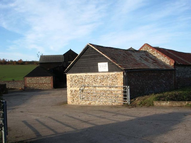
Dells Farm, Great Chesterford
Field Farm Cottages
Field Farm Cottages
Stump Cross Roundabout
Field track beyond a little-used farm store at Hinxton Piles of beets surrounded by straw bales, a few empty farm buildings then this track heading nowhere.
Field track beyond a little-used farm store at Hinxton
Piles of beets surrounded by straw bales, a few empty farm buildings then this track heading nowhere.
Unused farm store near Hinxton
Great Chesterford station The station was built in 1845 by the Eastern Counties Railway, and is still in mainline passenger service.  A branch line was opened by the Newmarket & Chesterford Railway in 1848, and closed in 1851.  The buildings on No.2 (Cambridge) platform have been demolished, along with the signal box at the north end of the London platform, but the station building itself survives, it is currently used as offices.  A new ticket office has recently been opened.  

The picture was taken from the footbridge, looking southwards towards London.
Great Chesterford station
The station was built in 1845 by the Eastern Counties Railway, and is still in mainline passenger service. A branch line was opened by the Newmarket & Chesterford Railway in 1848, and closed in 1851. The buildings on No.2 (Cambridge) platform have been demolished, along with the signal box at the north end of the London platform, but the station building itself survives, it is currently used as offices. A new ticket office has recently been opened. The picture was taken from the footbridge, looking southwards towards London.
Road sign near Genome Campus On the A1301 near Stump Cross.
Road sign near Genome Campus
On the A1301 near Stump Cross.
Old Milepost Old milepost at Great Chesterford, Essex on what was the old A.11. For close up view see <a title="https://www.geograph.org.uk/photo/1304771" href="https://www.geograph.org.uk/photo/1304771">Link</a> for info on the post see <span class="nowrap"><a title="http://milestones.megalithia.com/sites/tl505429.htm" rel="nofollow ugc noopener" href="http://milestones.megalithia.com/sites/tl505429.htm">Link</a><img style="margin-left:2px;" alt="External link" title="External link - shift click to open in new window" src="https://s1.geograph.org.uk/img/external.png" width="10" height="10"/></span> do look at their home page.
Old Milepost
Old milepost at Great Chesterford, Essex on what was the old A.11. For close up view see Link for info on the post see LinkExternal link do look at their home page.
Old Milestone Old milepost at Great Chesterford, Essex on part of what was the A.11. For overall view see <a title="https://www.geograph.org.uk/photo/1304766" href="https://www.geograph.org.uk/photo/1304766">Link</a> For more info see <span class="nowrap"><a title="http://milestones.megalithia.com/sites/tl505429.htm" rel="nofollow ugc noopener" href="http://milestones.megalithia.com/sites/tl505429.htm">Link</a><img style="margin-left:2px;" alt="External link" title="External link - shift click to open in new window" src="https://s1.geograph.org.uk/img/external.png" width="10" height="10"/></span> do look at their home page.
Old Milestone
Old milepost at Great Chesterford, Essex on part of what was the A.11. For overall view see Link For more info see LinkExternal link do look at their home page.
All Saints: the parish church of Great Chesterford This church dates back to the 13th century. The tower is 15th century, which was rebuilt in 1792 and altered in 1842 when the church was completely restored.
All Saints: the parish church of Great Chesterford
This church dates back to the 13th century. The tower is 15th century, which was rebuilt in 1792 and altered in 1842 when the church was completely restored.
Essex border on the M11
The Post Office in School Street at Great Chesterford
A view of the end of Field Farm Drive at Stump Cross
'Crown & Thistle' public house at Great Chesterford
Manor Lane, looking southeast This lane, that leads to Manor Farm, has some very interesting old timber-framed houses along both sides.
Manor Lane, looking southeast
This lane, that leads to Manor Farm, has some very interesting old timber-framed houses along both sides.
Show me another place!

Ickleton is located at Grid Ref: TL4943 (Lat: 52.072187, Lng: 0.177436)

Administrative County: Cambridgeshire

District: South Cambridgeshire

Police Authority: Cambridgeshire

What 3 Words

///label.turkeys.teardrop. Near Great Chesterford, Essex

Nearby Locations

Ickleton

Related Wikis

Ickleton

Ickleton is a village and civil parish about 9 miles (14 km) south of Cambridge in Cambridgeshire, England. The village is beside the River Cam, close...

St Mary Magdalene Church, Ickleton

St Mary Magdalene Church is the Church of England parish church in the village of Ickleton in Cambridgeshire. The church is a Grade I listed building....

Ickleton Priory

Ickleton Priory was a Benedictine priory of nuns at Ickleton, Cambridgeshire, England. It was established in the middle of the 12th century and suppressed...

Wellcome Sanger Institute

The Wellcome Sanger Institute, previously known as The Sanger Centre and Wellcome Trust Sanger Institute, is a non-profit British genomics and genetics...

Nearby Amenities

Located within 500m of 52.072187,0.177436
Source: npe
Lat/Long: 52.0734145/0.1837713
Source: npe
Lat/Long: 52.0729885/0.1820118
Source: npe
Lat/Long: 52.0721984/0.1811573
Source: npe
Lat/Long: 52.0711172/0.1818332
Created By: POI Editor
Source: npe
Lat/Long: 52.070744/0.1819729
Created By: POI Editor
Source: npe
Lat/Long: 52.0699088/0.1823991
Created By: POI Editor
Source: npe
Lat/Long: 52.069433/0.1828428
Ickleton Mill Lane Level Crossing
Railway: level_crossing
Lat/Long: 52.0744289/0.1827527
Post Office
Ickelton Post Office
Addr City: Saffron Waldon
Addr County: Cambridgeshire
Addr Housenumber: 32-34
Addr Postcode: CB10 1SL
Addr Street: Church Street
Addr Village: Ickleton
Brand: Post Office
Brand Wikidata: Q1783168
Operator: Costcutter
Ref Pol Id: 23003
Source: survey
Website: https://www.postoffice.co.uk/branch-finder/2561131/ickleton
Lat/Long: 52.0720864/0.1782789
Ickleton
Is In: Cambridgeshire, England, UK
Place: village
Population: 650
Wikidata: Q2054431
Wikipedia: en:Ickleton
Lat/Long: 52.0703602/0.1760421
Post Box
Collection Times: Mo-Fr 09:00; Sa 07:00
Operator: Royal Mail
Post Box Type: wall
Ref: CB10 54
Royal Cypher: GVIR
Royal Cypher Wikidata: Q33102169
Source: survey
Lat/Long: 52.0741488/0.1796151
Bus Stop
Coploe Road
Naptan AtcoCode: 0500SICKL001
Naptan Bearing: NE
Naptan BusStopType: CUS
Naptan CommonName: Coploe Road
Naptan Indicator: opp
Naptan Landmark: Duxford Road
Naptan NaptanCode: cmbgadmd
Naptan ShortCommonName: Coploe Road
Naptan Street: Abbey Street
Naptan Verified: no
Public Transport: platform
Source: naptan_import
Lat/Long: 52.0701758/0.1723375
Bus Stop
Church Street
Naptan AtcoCode: 0500SICKL002
Naptan Bearing: NW
Naptan CommonName: Church Street
Naptan Indicator: opp
Naptan Landmark: Church Street
Naptan NaptanCode: cmbgadmg
Naptan Street: Frogge Street
Naptan Verified: no
Public Transport: platform
Shelter: yes
Source: naptan_import
Lat/Long: 52.0718195/0.178064
Bus Stop
Coploe Road
Naptan AtcoCode: 0500SICKL003
Naptan Bearing: SW
Naptan CommonName: Coploe Road
Naptan Indicator: near
Naptan Landmark: Coploe Road
Naptan NaptanCode: cmbgadmj
Naptan ShortCommonName: Coploe Road
Naptan Street: Abbey Street
Naptan Verified: no
Public Transport: platform
Source: naptan_import
Lat/Long: 52.0700958/0.1723869
Bus Stop
Butchers Hill
Naptan AtcoCode: 0500SICKL004
Naptan Bearing: S
Naptan BusStopType: CUS
Naptan CommonName: Butchers Hill
Naptan Indicator: opp
Naptan Landmark: Church Street
Naptan NaptanCode: cmbgadmp
Naptan ShortCommonName: Butchers Hill
Naptan Street: Brookhampton Street
Naptan Verified: no
Source: naptan_import
Lat/Long: 52.0741627/0.1798381
Bus Stop
Butchers Hill
Naptan AtcoCode: 0500SICKL005
Naptan Bearing: NE
Naptan CommonName: Butchers Hill
Naptan Indicator: near
Naptan Landmark: Church Street
Naptan NaptanCode: cmbgadmt
Naptan ShortCommonName: Butchers Hill
Naptan Street: Brookhampton Street
Naptan Verified: no
Source: naptan_import
Lat/Long: 52.0741865/0.1797464
Bus Stop
Church Street
Naptan AtcoCode: 0500SICKL006
Naptan Bearing: SE
Naptan CommonName: Church Street
Naptan Indicator: near
Naptan Landmark: Church Street
Naptan NaptanCode: cmbgadmw
Naptan Street: Frogge Street
Naptan Verified: no
Public Transport: platform
Source: naptan_import
Lat/Long: 52.0716817/0.1784052
Source: OS_OpenData_StreetView
Lat/Long: 52.0730333/0.1827323
Ickleton Mill Lane Level Crossing
Railway: level_crossing
Lat/Long: 52.0744437/0.1828022
War Memorial
Historic: memorial
Wikidata: Q26677095
Lat/Long: 52.0724816/0.1800004
Post Box
Collection Times: Mo-Fr 16:00; Sa 11:30
Operator: Royal Mail
Post Box Design: type_a
Post Box Type: pillar
Ref: CB10 53
Royal Cypher: EIIR
Royal Cypher Wikidata: Q33102113
Source: survey
Lat/Long: 52.0720571/0.1782227
Barrier: kissing_gate
Lat/Long: 52.0761376/0.1781317
The data included in this document is from www.openstreetmap.org. The data is made available under ODbL.

Have you been to Ickleton?

Leave your review of Ickleton below (or comments, questions and feedback).