Brown Hill

Hill, Mountain in Banffshire

Scotland

Brown Hill

River Dee
River Dee Credit: thejackrustles

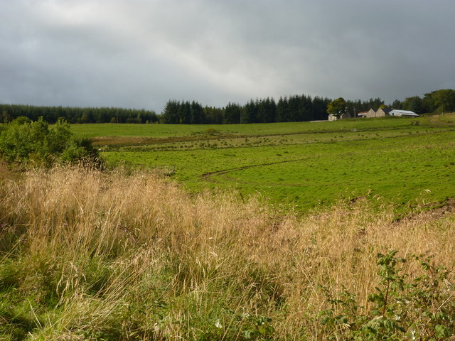
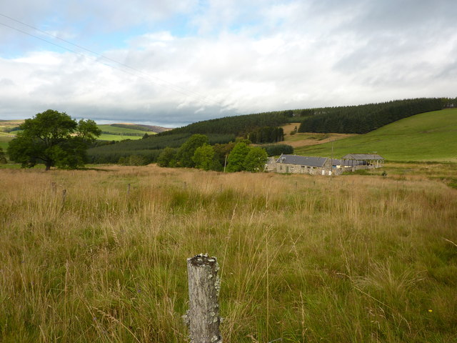
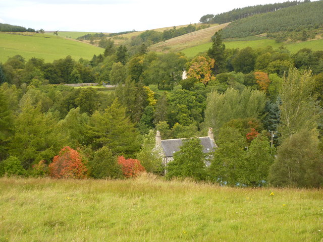
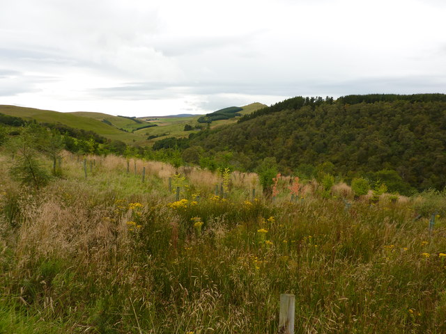
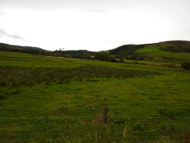
Brown Hill is a prominent hill located in the region of Banffshire, Scotland. With an elevation of approximately 365 meters (1,198 feet), it offers stunning panoramic views of the surrounding landscape. Situated near the village of Cornhill, it is easily accessible and attracts visitors from both locals and tourists alike.

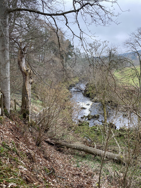
The hill is characterized by its gentle slopes and lush greenery, making it a popular destination for outdoor enthusiasts. Its relatively low height makes it an ideal spot for hikers of all levels, offering a pleasant and manageable ascent. The well-maintained trails leading up to the summit provide a rewarding hiking experience, where one can savor the picturesque beauty of the Scottish countryside.

As climbers ascend Brown Hill, they are treated to breathtaking vistas that stretch across the rolling hills, meandering rivers, and charming villages of Banffshire. On a clear day, the views from the top extend as far as the stunning coastline, allowing visitors to appreciate the diverse natural beauty of the area.

The hill is also home to a variety of wildlife, including rabbits, hares, and numerous bird species, making it a haven for nature enthusiasts and birdwatchers. The tranquil atmosphere and serene surroundings make it an ideal spot for relaxation and contemplation.

Overall, Brown Hill in Banffshire offers a tranquil escape into nature, providing a perfect blend of scenic beauty and outdoor adventure. Whether it is a leisurely stroll or a more challenging hike, this hill offers an enriching experience for all who visit.

If you have any feedback on the listing, please let us know in the comments section below.
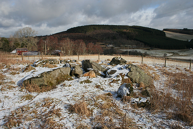
Brown Hill Images

Images are sourced within 2km of 57.416978/-2.9338007 or Grid Reference NJ4436. Thanks to Geograph Open Source API. All images are credited.

River Dee
River Dee
Drumduan, a farm on Aswanley Estate
Westerpark, Aswanley Estate Farmhouse which is now holiday accommodation.
Westerpark, Aswanley Estate
Farmhouse which is now holiday accommodation.
Netherton, a house by the River Deveron
Rooftop of Auchinhandoch A house by the River Deveron, Strathbogie, opposite Beldorney Castle, the tennis courts and grounds of which can be glimpsed through the trees.
Rooftop of Auchinhandoch
A house by the River Deveron, Strathbogie, opposite Beldorney Castle, the tennis courts and grounds of which can be glimpsed through the trees.
Young plantation near Howiemill Looking south west, up the valley of the River Deveron. The hill in the centre distance is Craig Dorney.
Young plantation near Howiemill
Looking south west, up the valley of the River Deveron. The hill in the centre distance is Craig Dorney.
Shed and waste bins for Succoth Farm
Rough pasture land, Strathbogie Looking south west, up the valley of the River Deveron.
Rough pasture land, Strathbogie
Looking south west, up the valley of the River Deveron.
Nether Dumeath Recumbent Stone Circle (1) Approaching the circle, which is in an enclosure in a field, it is obvious that most of the stones are no longer standing. See <span class="nowrap"><a title="https://canmore.org.uk/site/17280/nether-dumeath" rel="nofollow ugc noopener" href="https://canmore.org.uk/site/17280/nether-dumeath">Link</a><img style="margin-left:2px;" alt="External link" title="External link - shift click to open in new window" src="https://s1.geograph.org.uk/img/external.png" width="10" height="10"/></span> for more details. <a href="https://www.geograph.org.uk/photo/4838828">NJ4237 : Nether Dumeath Recumbent Stone Circle (2)</a>
Nether Dumeath Recumbent Stone Circle (1)
Approaching the circle, which is in an enclosure in a field, it is obvious that most of the stones are no longer standing. See LinkExternal link for more details. NJ4237 : Nether Dumeath Recumbent Stone Circle (2)
Nether Dumeath Recumbent Stone Circle (2) A general view of the circle, with the Hill of Dumeath in the background.  See <span class="nowrap"><a title="https://canmore.org.uk/site/17280/nether-dumeath" rel="nofollow ugc noopener" href="https://canmore.org.uk/site/17280/nether-dumeath">Link</a><img style="margin-left:2px;" alt="External link" title="External link - shift click to open in new window" src="https://s1.geograph.org.uk/img/external.png" width="10" height="10"/></span> for more details. <a href="https://www.geograph.org.uk/photo/4838833">NJ4237 : Nether Dumeath Recumbent Stone Circle (3)</a>
Nether Dumeath Recumbent Stone Circle (2)
A general view of the circle, with the Hill of Dumeath in the background. See LinkExternal link for more details. NJ4237 : Nether Dumeath Recumbent Stone Circle (3)
Nether Dumeath Recumbent Stone Circle (3) The circle from the south-east, showing that most of the stones have fallen or nearly fallen.  See <span class="nowrap"><a title="https://canmore.org.uk/site/17280/nether-dumeath" rel="nofollow ugc noopener" href="https://canmore.org.uk/site/17280/nether-dumeath">Link</a><img style="margin-left:2px;" alt="External link" title="External link - shift click to open in new window" src="https://s1.geograph.org.uk/img/external.png" width="10" height="10"/></span> for more details. <a href="https://www.geograph.org.uk/photo/4838838">NJ4237 : Nether Dumeath Recumbent Stone Circle (4)</a>
Nether Dumeath Recumbent Stone Circle (3)
The circle from the south-east, showing that most of the stones have fallen or nearly fallen. See LinkExternal link for more details. NJ4237 : Nether Dumeath Recumbent Stone Circle (4)
Nether Dumeath Recumbent Stone Circle (4) The large stone closets to the camera, is the recumbent, which has fallen on its face, and may not be in its exact original position. Behind it is one of the two remaining orthostats, leaning over at a steep angle. See <span class="nowrap"><a title="https://canmore.org.uk/site/17280/nether-dumeath" rel="nofollow ugc noopener" href="https://canmore.org.uk/site/17280/nether-dumeath">Link</a><img style="margin-left:2px;" alt="External link" title="External link - shift click to open in new window" src="https://s1.geograph.org.uk/img/external.png" width="10" height="10"/></span> for more details. <a href="https://www.geograph.org.uk/photo/4838847">NJ4237 : Nether Dumeath Recumbent Stone Circle (5)</a>
Nether Dumeath Recumbent Stone Circle (4)
The large stone closets to the camera, is the recumbent, which has fallen on its face, and may not be in its exact original position. Behind it is one of the two remaining orthostats, leaning over at a steep angle. See LinkExternal link for more details. NJ4237 : Nether Dumeath Recumbent Stone Circle (5)
Nether Dumeath Recumbent Stone Circle (5) The long stone nearest the camera is the west flanker, and behind it is the remaining stone of the western arc.  See <span class="nowrap"><a title="https://canmore.org.uk/site/17280/nether-dumeath" rel="nofollow ugc noopener" href="https://canmore.org.uk/site/17280/nether-dumeath">Link</a><img style="margin-left:2px;" alt="External link" title="External link - shift click to open in new window" src="https://s1.geograph.org.uk/img/external.png" width="10" height="10"/></span> for more details. <a href="https://www.geograph.org.uk/photo/4838853">NJ4237 : Nether Dumeath Recumbent Stone Circle (6)</a>
Nether Dumeath Recumbent Stone Circle (5)
The long stone nearest the camera is the west flanker, and behind it is the remaining stone of the western arc. See LinkExternal link for more details. NJ4237 : Nether Dumeath Recumbent Stone Circle (6)
Nether Dumeath Recumbent Stone Circle (6) On the left is the fallen west flanker, and on the right is the fallen and displaced recumbent. Between them is an assortment of boulders, some from field clearance and some being fragments of the east flanker and other stones of the circle.  See <span class="nowrap"><a title="https://canmore.org.uk/site/17280/nether-dumeath" rel="nofollow ugc noopener" href="https://canmore.org.uk/site/17280/nether-dumeath">Link</a><img style="margin-left:2px;" alt="External link" title="External link - shift click to open in new window" src="https://s1.geograph.org.uk/img/external.png" width="10" height="10"/></span> for more details. <a href="https://www.geograph.org.uk/photo/4838856">NJ4237 : Nether Dumeath Recumbent Stone Circle (7)</a>
Nether Dumeath Recumbent Stone Circle (6)
On the left is the fallen west flanker, and on the right is the fallen and displaced recumbent. Between them is an assortment of boulders, some from field clearance and some being fragments of the east flanker and other stones of the circle. See LinkExternal link for more details. NJ4237 : Nether Dumeath Recumbent Stone Circle (7)
Nether Dumeath Recumbent Stone Circle (7) The stone with the slope is the only stone on the western arc of the circle that has not completely fallen.  See <span class="nowrap"><a title="https://canmore.org.uk/site/17280/nether-dumeath" rel="nofollow ugc noopener" href="https://canmore.org.uk/site/17280/nether-dumeath">Link</a><img style="margin-left:2px;" alt="External link" title="External link - shift click to open in new window" src="https://s1.geograph.org.uk/img/external.png" width="10" height="10"/></span> for more details. <a href="https://www.geograph.org.uk/photo/4838860">NJ4237 : Nether Dumeath Recumbent Stone Circle (8)</a>
Nether Dumeath Recumbent Stone Circle (7)
The stone with the slope is the only stone on the western arc of the circle that has not completely fallen. See LinkExternal link for more details. NJ4237 : Nether Dumeath Recumbent Stone Circle (8)
Nether Dumeath Recumbent Stone Circle (8) This is the last stone standing, though from this angle it looks much more upright than it really is!  See <span class="nowrap"><a title="https://canmore.org.uk/site/17280/nether-dumeath" rel="nofollow ugc noopener" href="https://canmore.org.uk/site/17280/nether-dumeath">Link</a><img style="margin-left:2px;" alt="External link" title="External link - shift click to open in new window" src="https://s1.geograph.org.uk/img/external.png" width="10" height="10"/></span> for more details. <a href="https://www.geograph.org.uk/photo/4838865">NJ4237 : Nether Dumeath Recumbent Stone Circle (9)</a>
Nether Dumeath Recumbent Stone Circle (8)
This is the last stone standing, though from this angle it looks much more upright than it really is! See LinkExternal link for more details. NJ4237 : Nether Dumeath Recumbent Stone Circle (9)
Nether Dumeath Recumbent Stone Circle (9) This is the only stone of the western arc which has not completely fallen. To its left are some of the smaller boulders and stone fragments piled up between the west flanker and the recumbent.  See <span class="nowrap"><a title="https://canmore.org.uk/site/17280/nether-dumeath" rel="nofollow ugc noopener" href="https://canmore.org.uk/site/17280/nether-dumeath">Link</a><img style="margin-left:2px;" alt="External link" title="External link - shift click to open in new window" src="https://s1.geograph.org.uk/img/external.png" width="10" height="10"/></span> for more details. <a href="https://www.geograph.org.uk/photo/4838869">NJ4237 : Nether Dumeath Recumbent Stone Circle (10)</a>
Nether Dumeath Recumbent Stone Circle (9)
This is the only stone of the western arc which has not completely fallen. To its left are some of the smaller boulders and stone fragments piled up between the west flanker and the recumbent. See LinkExternal link for more details. NJ4237 : Nether Dumeath Recumbent Stone Circle (10)
Nether Dumeath Recumbent Stone Circle (10) The leaning stone is on the east arc of the circle. It's a moot point whether it can still be described as standing!  See <span class="nowrap"><a title="https://canmore.org.uk/site/17280/nether-dumeath" rel="nofollow ugc noopener" href="https://canmore.org.uk/site/17280/nether-dumeath">Link</a><img style="margin-left:2px;" alt="External link" title="External link - shift click to open in new window" src="https://s1.geograph.org.uk/img/external.png" width="10" height="10"/></span> for more details. <a href="https://www.geograph.org.uk/photo/4838824">NJ4237 : Nether Dumeath Recumbent Stone Circle (1)</a>
Nether Dumeath Recumbent Stone Circle (10)
The leaning stone is on the east arc of the circle. It's a moot point whether it can still be described as standing! See LinkExternal link for more details. NJ4237 : Nether Dumeath Recumbent Stone Circle (1)
Show me another place!

Brown Hill is located at Grid Ref: NJ4436 (Lat: 57.416978, Lng: -2.9338007)

Unitary Authority: Aberdeenshire

Police Authority: North East

What 3 Words

///bullion.hostels.wicked. Near Huntly, Aberdeenshire

Nearby Locations

Brown Hill Smiddy Hillocks

Related Wikis

Beldorney Castle

Beldorney Castle is a Z-plan castle dating from the mid-16th century, about two miles south of Glass, in hilly country in the valley of the Deveron, in...

Glass, Aberdeenshire

Glass is a parish about 8 miles west of Huntly, Aberdeenshire, Scotland. It is now wholly located in Aberdeenshire but before the reorganisation of Scottish...

Blairmore School

Blairmore School was an independent boarding preparatory school in Glass near Huntly, Aberdeenshire until its closure in 1993. The site is now owned and...

Torry Burn, Huntly

Torry Burn is a burn which marks the boundary of the parish of Huntly, Aberdeenshire, Scotland. == References ==

Nearby Amenities

Located within 500m of 57.416978,-2.9338007
Brown Hill
Ele: 483
Natural: peak
Lat/Long: 57.4172247/-2.9340333
The data included in this document is from www.openstreetmap.org. The data is made available under ODbL.

Have you been to Brown Hill?

Leave your review of Brown Hill below (or comments, questions and feedback).