Craig Hill

Hill, Mountain in Angus

Scotland

Craig Hill

Naked Tam Faint straight path heading over Naked Tam.
Naked Tam Credit: Scott Cormie

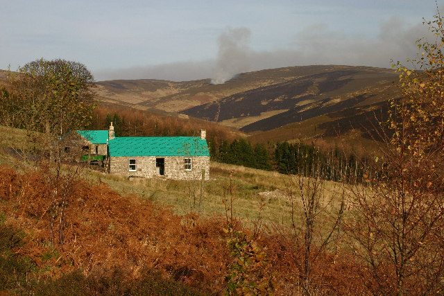
Craig Hill is a prominent landmark located in the county of Angus, Scotland. Standing at an impressive height of 455 meters (1,493 feet), it is one of the most iconic hills in the region. Also known as the Angus Hill or Mountain, Craig Hill offers breathtaking views of the surrounding landscape and is a popular destination for hikers and nature enthusiasts.

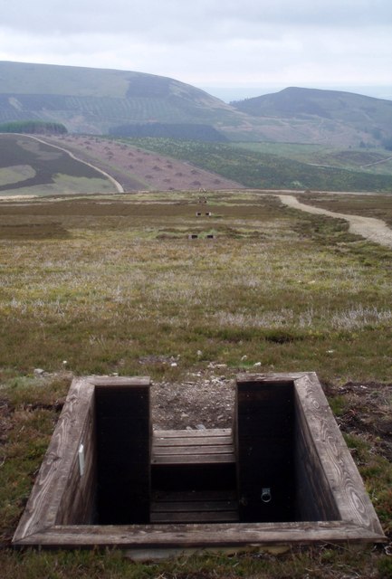
The hill is characterized by its distinct rugged terrain, featuring steep slopes and rocky outcrops. Its summit, marked by a cairn, provides an excellent vantage point to admire the panoramic vistas of the Angus Glens and the rolling countryside. On clear days, it is even possible to catch glimpses of the North Sea coastline.

Craig Hill is home to a diverse range of flora and fauna, including heather, bilberry, and various species of birds. The hill is surrounded by a network of walking trails that cater to different levels of difficulty, making it accessible for both experienced hikers and casual walkers.

In addition to its natural beauty, Craig Hill holds historical significance. It is believed to have been a site of human activity since prehistoric times, with evidence of ancient settlements and burial mounds discovered in the vicinity. The hill also played a role in the Jacobite uprisings of the 18th century, as it served as a lookout point for local clans.

Overall, Craig Hill in Angus, Scotland, is a stunning natural landmark that offers a combination of scenic beauty, wildlife, and historical significance, making it a must-visit destination for those exploring the region.

If you have any feedback on the listing, please let us know in the comments section below.

Craig Hill Images

Images are sourced within 2km of 56.783383/-2.9219435 or Grid Reference NO4366. Thanks to Geograph Open Source API. All images are credited.

Naked Tam Faint straight path heading over Naked Tam.
Naked Tam
Faint straight path heading over Naked Tam.
Track up ridge This is part of a track system on the hills above Glenogil, in Angus. This particular track is seen heading up to Duthriss Hill (centre), it then goes to Dog Hillock (left) then round to Hill of Glansie (hidden and right).
These tracks enable access to grouse butts, used for shooting.
Track up ridge
This is part of a track system on the hills above Glenogil, in Angus. This particular track is seen heading up to Duthriss Hill (centre), it then goes to Dog Hillock (left) then round to Hill of Glansie (hidden and right). These tracks enable access to grouse butts, used for shooting.
View from Rough Craig An eastern view from Rough Craig over the Angus Hills, with the North Sea visible on the horizon - also my 2000th submission to Geograph!
View from Rough Craig
An eastern view from Rough Craig over the Angus Hills, with the North Sea visible on the horizon - also my 2000th submission to Geograph!
Glenogil reservoir From the edge of the reservoir.
Glenogil reservoir
From the edge of the reservoir.
Mochrie, Glen Ogil Heather burning in the background.
Mochrie, Glen Ogil
Heather burning in the background.
Snow over Craig Hill After a heavy snowfall, the melting snow really reveals the landscape features, such as tracks ridges from raised beds, and old sheep holding pens.
Snow over Craig Hill
After a heavy snowfall, the melting snow really reveals the landscape features, such as tracks ridges from raised beds, and old sheep holding pens.
Toward the head of Toardy Burn In the snow
Toward the head of Toardy Burn
In the snow
Bettywharran - Glen Ogil Upgrading landrover track.
Bettywharran - Glen Ogil
Upgrading landrover track.
Craig  Mou View from the East side of Glen Ogil looking through Craig Mou,a gap in the hills, that leads to Glen Moy. Some of the exposed rock on the Southside can be seen though there is more on the North side. The hill in the distance through the Gap is Mount Blair.
Craig Mou
View from the East side of Glen Ogil looking through Craig Mou,a gap in the hills, that leads to Glen Moy. Some of the exposed rock on the Southside can be seen though there is more on the North side. The hill in the distance through the Gap is Mount Blair.
Old fence posts on Naked Tam.
An oasis in the heather. A pool between Naked Tam and Auld Darkney.
An oasis in the heather.
A pool between Naked Tam and Auld Darkney.
The top of Auld Darkney.
Cleared Forestry, Glen Ogil. At the foot of Mid Shank a plantation has recently been felled. Branches have been stacked into piles and the young plantation behind is revealed.
Cleared Forestry, Glen Ogil.
At the foot of Mid Shank a plantation has recently been felled. Branches have been stacked into piles and the young plantation behind is revealed.
Deer fence, approaching Bogs of Boggandure. This fence marks the boundary between the recently felled forestry plantation and the heather moorland that makes up most of St Arnold's Seat.
Deer fence, approaching Bogs of Boggandure.
This fence marks the boundary between the recently felled forestry plantation and the heather moorland that makes up most of St Arnold's Seat.
Grouse butts. receding into the distance along the side of the track. Each has a slatted wooden floor for drainage and a ring to tie your gun dog to.
Grouse butts.
receding into the distance along the side of the track. Each has a slatted wooden floor for drainage and a ring to tie your gun dog to.
The Keillor Burn. The burn cuts between the hills here in a relatively steep valley. This point provides a convenient crossing.
The Keillor Burn.
The burn cuts between the hills here in a relatively steep valley. This point provides a convenient crossing.
Pass between Glen Moy and Glen Ogle
Meanders on the Noran Water The Upper course of the Noran Water.
Meanders on the Noran Water
The Upper course of the Noran Water.
Show me another place!

Craig Hill is located at Grid Ref: NO4366 (Lat: 56.783383, Lng: -2.9219435)

Unitary Authority: Angus

Police Authority: Tayside

What 3 Words

///nuptials.spreads.crawled. Near Kirriemuir, Angus

Nearby Locations

Craig Hill

Related Wikis

Angus (UK Parliament constituency)

Angus is a county constituency of the House of Commons of the Parliament of the United Kingdom (at Westminster). It elects one Member of Parliament (MP...

Auchnacree

Auchnacree is an estate in Angus, Scotland, five miles north of Forfar.In 1921 the estate overseer, Mr Frank Rae, discovered what is now called the Auchnacree...

Five Glens of Angus

The Five Glens of Angus are the five Highland glens located in the western portion of the Angus region of Scotland. The five glens from westernmost to...

Noranside

Noranside is a hamlet in Angus, Scotland, located at 56° 44' 0" North, 2° 52' 0" West,. The prison HMP Noranside was operated there from 1966 to 2011....

Nearby Amenities

Located within 500m of 56.783383,-2.9219435
Craig Hill
Ele: 428
Natural: peak
Lat/Long: 56.7830179/-2.9211574
The data included in this document is from www.openstreetmap.org. The data is made available under ODbL.

Have you been to Craig Hill?

Leave your review of Craig Hill below (or comments, questions and feedback).