Kirk Hill

Hill, Mountain in Aberdeenshire

Scotland

Kirk Hill

Baderonach Hill Summit A "formal" cairn at the summit of Baderonach Hill 475m (Trump)
Baderonach Hill Summit Credit: Ralph Greig

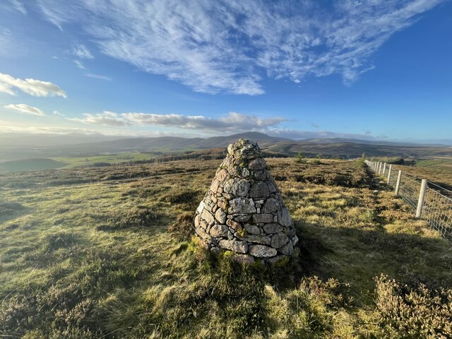
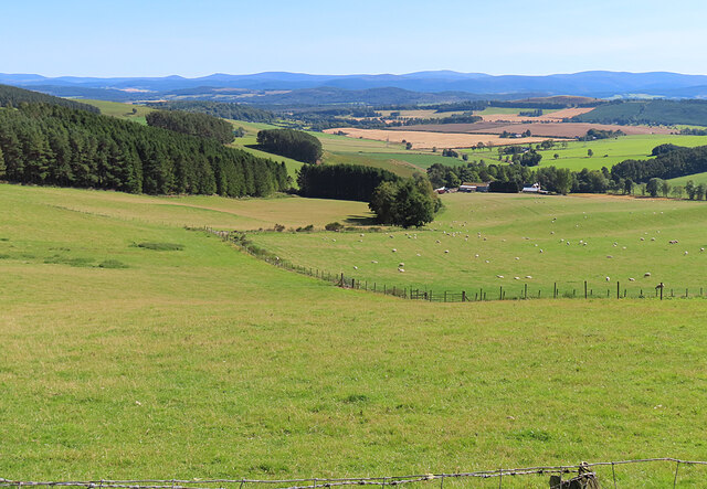
Kirk Hill is a prominent landmark located in Aberdeenshire, Scotland. Rising to an impressive height of 1,014 feet (309 meters), it is considered one of the tallest hills in the region. Situated within close proximity to the village of Kirkton of Skene, Kirk Hill offers breathtaking panoramic views of the surrounding countryside.

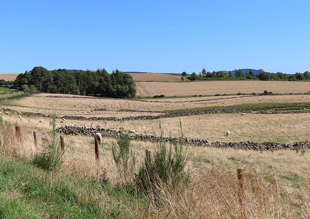
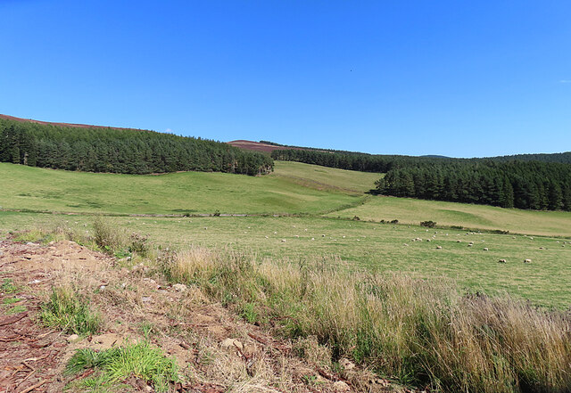
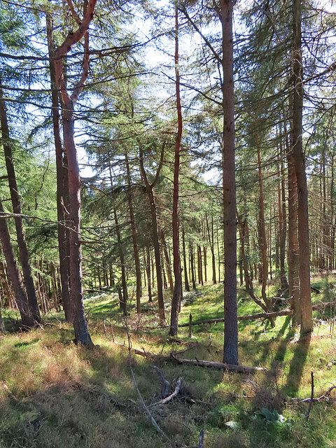
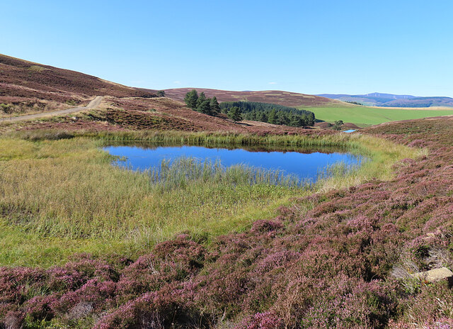
The hill is predominantly covered with heather and grass, creating a picturesque landscape that changes with the seasons. During spring and summer, vibrant wildflowers dot the slopes, adding a splash of color to the area. The hill is also home to a diverse range of wildlife, including birds, rabbits, and deer, making it a popular spot for nature enthusiasts and photographers.

At the summit of Kirk Hill, visitors are rewarded with an unobstructed vista that stretches for miles. On clear days, it is possible to see as far as the Cairngorms National Park, which is approximately 50 miles away. These stunning views make Kirk Hill a popular destination for hikers and nature lovers alike.

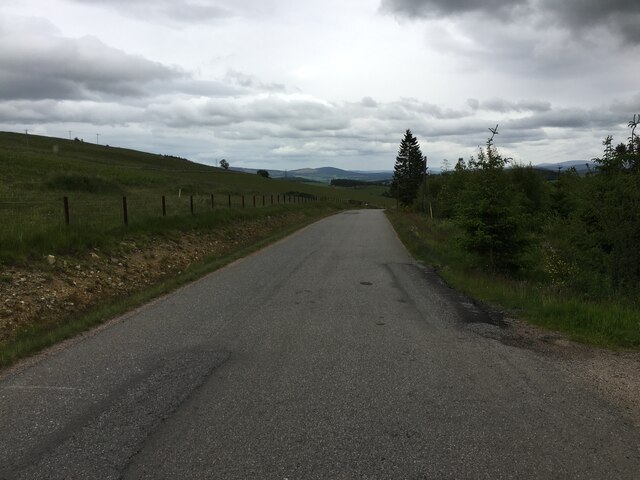
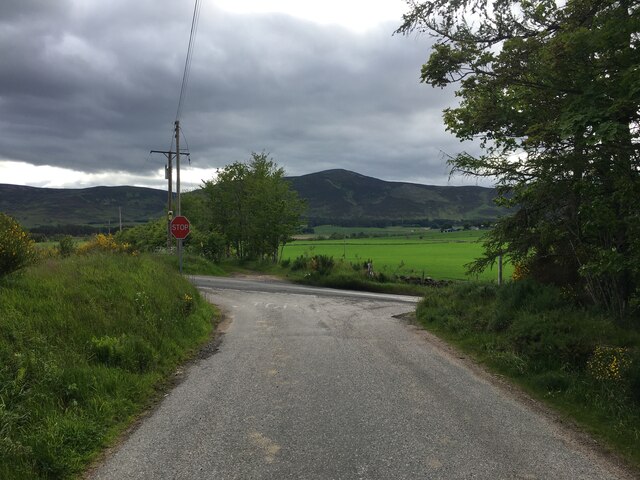
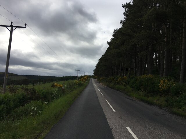
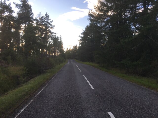
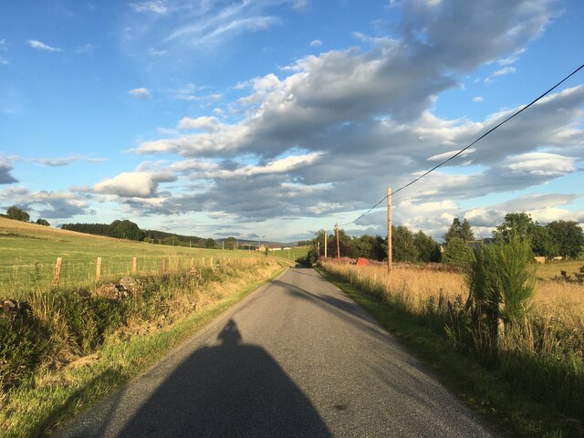
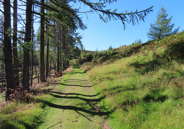
Several walking trails traverse the hill, catering to different levels of difficulty and providing opportunities for exploration. The paths meander through the beautiful countryside, offering glimpses of ancient woodlands and charming Scottish farmland. The trails are well-maintained and signposted, ensuring a safe and enjoyable experience for visitors.

Kirk Hill is not only a natural wonder but also holds historical significance. The hill takes its name from the nearby Kirkton of Skene, a small village that dates back centuries. The hill has been a site of human activity for thousands of years, with evidence of ancient settlements and burial mounds found in the area.

Overall, Kirk Hill in Aberdeenshire is a stunning natural landmark that combines breathtaking views, diverse wildlife, and a rich history. Whether visitors are seeking a challenging hike or a peaceful stroll amidst nature, Kirk Hill offers an unforgettable experience for all.

If you have any feedback on the listing, please let us know in the comments section below.

Kirk Hill Images

Images are sourced within 2km of 57.151033/-2.9330057 or Grid Reference NJ4307. Thanks to Geograph Open Source API. All images are credited.

Baderonach Hill Summit A "formal" cairn at the summit of Baderonach Hill 475m (Trump)
Baderonach Hill Summit
A "formal" cairn at the summit of Baderonach Hill 475m (Trump)
Minor road towards Migvie
Minor road near Migvie
Road junction near Logie Coldstone
A97 near Migvie
A97 near Migvie
A97 near Witchock Loch
Minor road near Migvie
Field Dykes The fields at Coynach Hill are delineated by old drystane dykes, some of them ruinous.
Field Dykes
The fields at Coynach Hill are delineated by old drystane dykes, some of them ruinous.
Fields near Reinacharn Hill farming on the slopes of Molly Watt's Hill.
Fields near Reinacharn
Hill farming on the slopes of Molly Watt's Hill.
Fields at Reinacharn Looking downhill from the track north-east of Keeper's Cottage towards the flatter ground closer to the River Dee.
Fields at Reinacharn
Looking downhill from the track north-east of Keeper's Cottage towards the flatter ground closer to the River Dee.
Tillyreach Hillock According to the map Tillyreach Hillock is the small hill at the foot of this field.
Tillyreach Hillock
According to the map Tillyreach Hillock is the small hill at the foot of this field.
Drummy Hillock A track runs along outside the forestry plantation on Drummy Hillock.
Drummy Hillock
A track runs along outside the forestry plantation on Drummy Hillock.
Sheep near Drummy Hillock Sheep in a sloping field with an open view towards Morven on the skyline.
Sheep near Drummy Hillock
Sheep in a sloping field with an open view towards Morven on the skyline.
Forest Belt This apparently unnamed strip of woodland is between two tracks east of Reinacharn Lodge.
Forest Belt
This apparently unnamed strip of woodland is between two tracks east of Reinacharn Lodge.
Forest Track This is the upper of two tracks that enclose a block of forest above Reinacharn Lodge.
Forest Track
This is the upper of two tracks that enclose a block of forest above Reinacharn Lodge.
Remains of a Fishing Hut The demise of the hut has been chronicled by Geograph contributors. See <a href="https://www.geograph.org.uk/photo/680832">NJ4408 : Fishing hut at Lazy Well</a>, taken in 2008 and <a href="https://www.geograph.org.uk/photo/2024069">NJ4408 : Weatherproof wooden bothy</a>, taken in 2010.
Remains of a Fishing Hut
The demise of the hut has been chronicled by Geograph contributors. See NJ4408 : Fishing hut at Lazy Well, taken in 2008 and NJ4408 : Weatherproof wooden bothy, taken in 2010.
Lazy Well Lazy Well is the name given to this artificial pool, created by a dam to the north.
Lazy Well
Lazy Well is the name given to this artificial pool, created by a dam to the north.
Tufted Hair-grass (Deschampsia cespitosa) A very common and widespread species of grass.
Tufted Hair-grass (Deschampsia cespitosa)
A very common and widespread species of grass.
Show me another place!

Kirk Hill is located at Grid Ref: NJ4307 (Lat: 57.151033, Lng: -2.9330057)

Unitary Authority: Aberdeenshire

Police Authority: North East

What 3 Words

///boldest.improvise.spark. Near Aboyne, Aberdeenshire

Related Wikis

Migvie Castle

Migvie Castle was a 13th-century castle to the west of Migvie, Aberdeenshire, Scotland. Its remains were listed as a scheduled monument in 2007. ��2�...

Blue cairn circle

Blue cairn circle is a 21 metres (69 ft) diameter stone circle in Aberdeenshire, Scotland. In the center is a large stone cairn with several pits in it...

Logie Coldstone

Logie Coldstone (Scottish Gaelic: Lògaidh) is a village in Aberdeenshire, Scotland. The village lies north of the River Dee, near Tarland in the Cromar...

Blelack

Blelack (, Scottish Gaelic: Blàth Bholg) is a place in Aberdeenshire, Scotland, the location of Blelack House, a Scottish mansion house with origins in...

Tarland

Tarland (Gaelic: Turlann) is a village in Aberdeenshire, Scotland and is located 5 miles (8 km) northwest of Aboyne, and 30 miles (50 km) west of Aberdeen...

Towie, Aberdeenshire

Towie is a small hamlet and civil parish in Aberdeenshire, Scotland, close to Alford and Lumsden, on the River Don.One of the most notable features of...

Towie Castle

Towie Castle was a 17th-century tower house, about 3.5 miles (5.6 km) southwest of Kildrummy in Aberdeenshire, Scotland, on the right bank of the Don....

Tomnaverie stone circle

Tomnaverie stone circle is a recumbent stone circle set on the top of a small hill in lowland northeast Scotland. Construction started from about 2500...

Nearby Amenities

Located within 500m of 57.151033,-2.9330057
Power: pole
Lat/Long: 57.1485839/-2.9266594
Power: pole
Lat/Long: 57.1487651/-2.9278028
Power: pole
Lat/Long: 57.1489589/-2.9290336
Power: pole
Lat/Long: 57.1491526/-2.9302439
Power: pole
Lat/Long: 57.1493366/-2.9314387
Power: pole
Lat/Long: 57.149515/-2.932595
Power: pole
Lat/Long: 57.1496516/-2.9334687
Power: pole
Lat/Long: 57.1498886/-2.9345813
Power: pole
Lat/Long: 57.1501436/-2.9357607
Power: pole
Lat/Long: 57.1503346/-2.9366369
Power: pole
Lat/Long: 57.1505242/-2.9375388
Power: pole
Lat/Long: 57.1507179/-2.9384407
Power: pole
Lat/Long: 57.1509521/-2.9395636
Power: pole
Lat/Long: 57.1511542/-2.940463
Power: pole
Lat/Long: 57.1515681/-2.9406037
Power: pole
Lat/Long: 57.1490341/-2.9334063
Power: pole
Lat/Long: 57.1484404/-2.9333344
Power: pole
Lat/Long: 57.1481476/-2.9334577
Power: pole
Lat/Long: 57.1478242/-2.9336967
Power: pole
Lat/Long: 57.1474897/-2.9339716
Power: pole
Lat/Long: 57.1470548/-2.9337455
Power: pole
Lat/Long: 57.1466129/-2.9333241
Power: pole
Lat/Long: 57.1474786/-2.936891
Power: pole
Lat/Long: 57.1478951/-2.9355373
Power: pole
Lat/Long: 57.147999/-2.935207
Power: pole
Lat/Long: 57.1480584/-2.9345511
Power: pole
Lat/Long: 57.1480961/-2.9340898
Power: pole
Lat/Long: 57.1481351/-2.9327537
Power: pole
Lat/Long: 57.1481211/-2.9317606
Power: pole
Lat/Long: 57.1480689/-2.931131
Power: pole
Lat/Long: 57.1484627/-2.9316282
Power: pole
Lat/Long: 57.1487763/-2.9315113
The data included in this document is from www.openstreetmap.org. The data is made available under ODbL.

Have you been to Kirk Hill?

Leave your review of Kirk Hill below (or comments, questions and feedback).