Cairn of Meadows

Hill, Mountain in Angus

Scotland

Cairn of Meadows

West Burn Looking south down the West Burn, high above the northern side of Glen Lethnot.
West Burn Credit: Scott Cormie

The Cairn of Meadows is a prominent hill located in the county of Angus, Scotland. It stands at an elevation of approximately 465 meters (1,526 feet) above sea level, making it a notable landmark in the region. The hill is part of the broader Sidlaw Hills range and offers stunning panoramic views of the surrounding countryside.

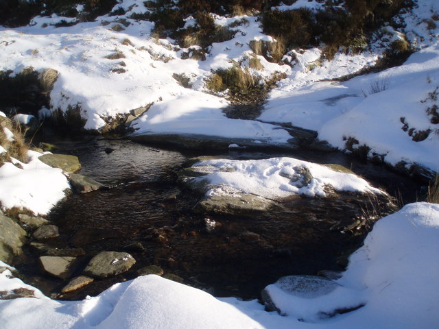
Cairn of Meadows is characterized by its gentle slopes and grassy terrain, making it a relatively accessible hill for hikers and outdoor enthusiasts. The path to the summit is well-established and provides a pleasant ascent through the picturesque landscape. Once at the top, visitors are rewarded with breathtaking vistas of the rolling hills, lush farmland, and distant mountains.

The hill is also known for its historical significance, as it is home to a prehistoric burial cairn. Cairns were built by ancient civilizations as burial monuments and often contain human remains or valuable artifacts. Although the exact age and origins of the cairn on Cairn of Meadows are uncertain, it adds an intriguing element to the site's allure.

Nature lovers can enjoy a variety of flora and fauna in the area, including heather, wildflowers, and various bird species. The hill is a popular destination for birdwatching enthusiasts, as it provides an ideal habitat for several avian species, such as peregrine falcons and buzzards.

Overall, Cairn of Meadows offers a unique blend of natural beauty, historical significance, and recreational opportunities, making it a must-visit destination for both locals and tourists exploring the Angus region of Scotland.

If you have any feedback on the listing, please let us know in the comments section below.

Cairn of Meadows Images

Images are sourced within 2km of 56.862365/-2.9275273 or Grid Reference NO4374. Thanks to Geograph Open Source API. All images are credited.

West Burn Looking south down the West Burn, high above the northern side of Glen Lethnot.
West Burn
Looking south down the West Burn, high above the northern side of Glen Lethnot.
Moorland on the Cairn of Meadows The southern flank of the Cairn of Meadows, high above the northern side of Glen Lethnot.
Moorland on the Cairn of Meadows
The southern flank of the Cairn of Meadows, high above the northern side of Glen Lethnot.
Peat hag on Horse Holm Looking north over a peat hag on Horse Holm above the northern side of Glen Lethnot.
Peat hag on Horse Holm
Looking north over a peat hag on Horse Holm above the northern side of Glen Lethnot.
Woodland on Easter Cruys Woodland growing on the steep northern flank of Easter Cruys, here viewed over the course of the Water of Effock.
Woodland on Easter Cruys
Woodland growing on the steep northern flank of Easter Cruys, here viewed over the course of the Water of Effock.
Path by the Burn of Duskintry A path above the Burn of Duskintry, a tributary of the Water of Saughs. The path leads from Glen Lethnot to the Shank of Donald Young.
Path by the Burn of Duskintry
A path above the Burn of Duskintry, a tributary of the Water of Saughs. The path leads from Glen Lethnot to the Shank of Donald Young.
The Shank of Donald Young Relatively flat ground on the Shank of Donald Young. The moorland here is managed for grouse shooting, the lighter coloured areas indicate where heather burning has taken place.
The Shank of Donald Young
Relatively flat ground on the Shank of Donald Young. The moorland here is managed for grouse shooting, the lighter coloured areas indicate where heather burning has taken place.
Glen Lethnot The upper region of Glen Lethnot viewed over the course of the Water of Saughs. The Burn of Duskintry merges with the former stream between the Shank of Donald Young and Ruragh, visible in the left of the image.
Glen Lethnot
The upper region of Glen Lethnot viewed over the course of the Water of Saughs. The Burn of Duskintry merges with the former stream between the Shank of Donald Young and Ruragh, visible in the left of the image.
Track above the Water of Saughs An estate track in Glen Lethnot on steep ground above the Water of Saughs. The weather is beginning to change, as heavy cloud fills up the valleys, leaving the higher ground uncovered. For comparison, see Geograph image <a href="https://www.geograph.org.uk/photo/4015979">NO4572 : Track in Glen Lethnot</a> taken a few hours earlier in the day.
Track above the Water of Saughs
An estate track in Glen Lethnot on steep ground above the Water of Saughs. The weather is beginning to change, as heavy cloud fills up the valleys, leaving the higher ground uncovered. For comparison, see Geograph image NO4572 : Track in Glen Lethnot taken a few hours earlier in the day.
Footbridge over Water of Saughs on the bottom east of "The Little Hill of Donald Young"
Footbridge over Water of Saughs
on the bottom east of "The Little Hill of Donald Young"
Steady as she goes!!! My wife makes slow but sure progress over the Water of Saughs
Steady as she goes!!!
My wife makes slow but sure progress over the Water of Saughs
Hill tops above the Water of Saughs
Heather covered Hillside Patches of burnt heather are picked out in white by the snow.
Heather covered Hillside
Patches of burnt heather are picked out in white by the snow.
Heather on the side of Cairn of Meadows
Ford on the track above Water of Saughs
Track above the Water of Saughs
Looking toward West Craig. The glen floor is flat until this point. There is a choice of routes either up the back of West Craig or to the left by the Shank of Donald Young.
Looking toward West Craig.
The glen floor is flat until this point. There is a choice of routes either up the back of West Craig or to the left by the Shank of Donald Young.
Track on The shank of Donald Young A track follows the Eastern edge of the shank on this wet and misty day, a useful navigational aid in a landscape that looked very much the same in all directions.

The area is named after one of the less fortunate participants of The Battle of Saughs. The battle is renowned in local folklore.
Track on The shank of Donald Young
A track follows the Eastern edge of the shank on this wet and misty day, a useful navigational aid in a landscape that looked very much the same in all directions. The area is named after one of the less fortunate participants of The Battle of Saughs. The battle is renowned in local folklore.
The summit of Cruys The summit has been disfigured by a new fence, much worse for wear after being exposed to months of lying snow. The gate is one of few places where the double electric fence can be crossed. There are stiles on the west ridge of Cruys and at the summit of Cairn of Meadows.
The cairn is just beyond the fence on the Lethnot side.
The summit of Cruys
The summit has been disfigured by a new fence, much worse for wear after being exposed to months of lying snow. The gate is one of few places where the double electric fence can be crossed. There are stiles on the west ridge of Cruys and at the summit of Cairn of Meadows. The cairn is just beyond the fence on the Lethnot side.
Show me another place!

Cairn of Meadows is located at Grid Ref: NO4374 (Lat: 56.862365, Lng: -2.9275273)

Unitary Authority: Angus

Police Authority: Tayside

What 3 Words

///sourcing.recipient.lake. Near Kirriemuir, Angus

Nearby Locations

Cairn of Meadows

Related Wikis

Five Glens of Angus

The Five Glens of Angus are the five Highland glens located in the western portion of the Angus region of Scotland. The five glens from westernmost to...

Loch Lee

National grid reference NO431800 Loch Lee is a loch in Angus, Scotland south of the Grampian Mountains that is fed by the Water of Lee and the Water of...

Invermark Castle

Invermark Castle is an oblong tower house dating from the 16th century, at the east of Loch Lee, Angus, Scotland. It is near the head of Glen Esk. ��2...

Invermark Lodge

Invermark Lodge is a hunting lodge which was built near Invermark Castle in 1852 for John Ramsay, 13th Earl of Dalhousie. It is now a listed building...

Ben Tirran

Ben Tirran (896 m) is a mountain in the Grampian Mountains of Scotland. It lies in the vast Mounth area of the eastern Highlands in Angus, on the northern...

Falls of Damff

Falls of Damff is a waterfall in Cairngorms National Park in Scotland. == See also == Waterfalls of Scotland == References ==

Falls of Unich

Falls of Unich is a waterfall of Scotland. == See also == Waterfalls of Scotland == References == Media related to Falls of Unich at Wikimedia Commons

Angus (UK Parliament constituency)

Angus is a county constituency of the House of Commons of the Parliament of the United Kingdom (at Westminster). It elects one Member of Parliament (MP...

Nearby Amenities

Located within 500m of 56.862365,-2.9275273
Cairn of Meadows
Ele: 687
Natural: peak
Lat/Long: 56.8616789/-2.9276768
The data included in this document is from www.openstreetmap.org. The data is made available under ODbL.

Have you been to Cairn of Meadows?

Leave your review of Cairn of Meadows below (or comments, questions and feedback).