Commonside Hill

Hill, Mountain in Roxburghshire

Scotland

Commonside Hill

Inside the monument on Dryden Knowes This is a view up the inside of the cone-shaped monument to the Rev Henry Scott Riddell on the northwest side of the A7 at Teviothead. On previous visits the access door has been locked but on this occasion it was open. For a view of the monument with more information, see <a href="https://www.geograph.org.uk/photo/378497">NT4106 : The Colterscleuch Monument</a>.
Inside the monument on Dryden Knowes Credit: Walter Baxter

Commonside Hill is a prominent hill located in the county of Roxburghshire, Scotland. Situated near the village of Lilliesleaf, it is a notable landmark in the area.

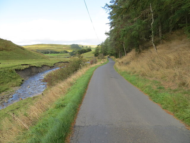
With an elevation of approximately 303 meters (994 feet), Commonside Hill stands tall and offers stunning panoramic views of the surrounding countryside. The hill is characterized by its gentle slopes and lush greenery, making it a popular destination for outdoor enthusiasts and nature lovers.

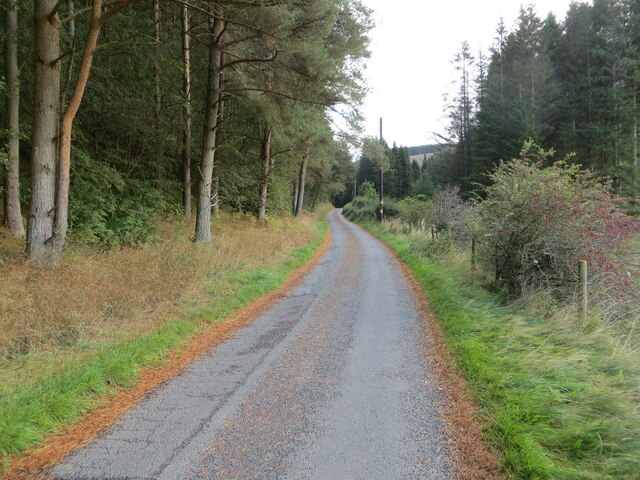
The hill is easily accessible, with well-maintained footpaths leading to its summit. Hikers and walkers can enjoy a pleasant and relatively easy ascent, suitable for all ages and fitness levels. The climb is rewarded with breathtaking vistas of the nearby Teviot Valley and the rolling hills of Roxburghshire.

Commonside Hill also holds historical significance. On its southern slopes, there are remnants of an Iron Age hill fort, known as Lilliesleaf Fort, which dates back to around 500 BC. Archaeological finds such as pottery shards and earthworks provide insights into the lives of the ancient inhabitants of the area.

The hill and its surrounding countryside are home to a diverse range of flora and fauna. Visitors may spot various bird species, including buzzards and owls, as well as rabbits and deer. During spring and summer, the hillside bursts with colorful wildflowers, creating a picturesque and serene environment.

Overall, Commonside Hill in Roxburghshire offers a delightful blend of natural beauty, recreational opportunities, and historical intrigue, making it a must-visit destination for both locals and tourists.

If you have any feedback on the listing, please let us know in the comments section below.

Commonside Hill Images

Images are sourced within 2km of 55.359465/-2.9099616 or Grid Reference NT4207. Thanks to Geograph Open Source API. All images are credited.

Inside the monument on Dryden Knowes This is a view up the inside of the cone-shaped monument to the Rev Henry Scott Riddell on the northwest side of the A7 at Teviothead. On previous visits the access door has been locked but on this occasion it was open. For a view of the monument with more information, see <a href="https://www.geograph.org.uk/photo/378497">NT4106 : The Colterscleuch Monument</a>.
Inside the monument on Dryden Knowes
This is a view up the inside of the cone-shaped monument to the Rev Henry Scott Riddell on the northwest side of the A7 at Teviothead. On previous visits the access door has been locked but on this occasion it was open. For a view of the monument with more information, see NT4106 : The Colterscleuch Monument.
Sheep on Dryden Knowes A line of sheep file past the monument on Dryden Knowes in early January. For more information about the monument, see <a href="https://www.geograph.org.uk/photo/378497">NT4106 : The Colterscleuch Monument</a>.
Sheep on Dryden Knowes
A line of sheep file past the monument on Dryden Knowes in early January. For more information about the monument, see NT4106 : The Colterscleuch Monument.
For Sale by Auction Slightly derelict building by the A7, labelled as 'Change House' on medium scale OS map, but not at all on the largest scale.
For Sale by Auction
Slightly derelict building by the A7, labelled as 'Change House' on medium scale OS map, but not at all on the largest scale.
Change House, Teviotdale Derelict cottage, currently for sale by auction.
Change House, Teviotdale
Derelict cottage, currently for sale by auction.
Looking across the River Teviot Towards Teviotdale Cottage from the A7.
Looking across the River Teviot
Towards Teviotdale Cottage from the A7.
Teindside Bridge, Teviotdale Carrying the A7 over the River Teviot, with the confluence with the Northouse Burn just beyond.
Teindside Bridge, Teviotdale
Carrying the A7 over the River Teviot, with the confluence with the Northouse Burn just beyond.
Looking down Teviotdale From Tiendside Bridge on the A7.
Looking down Teviotdale
From Tiendside Bridge on the A7.
Teviotdale farmland Looking across the valley towards Broadhaugh Hill from Tiendside Bridge
Teviotdale farmland
Looking across the valley towards Broadhaugh Hill from Tiendside Bridge
Tiendside Bridge over the Teviot The A7 crosses the River Teviot.
Tiendside Bridge over the Teviot
The A7 crosses the River Teviot.
The River Teviot Looking upstream from Tiendside Bridge carrying the A7 over the river.
The River Teviot
Looking upstream from Tiendside Bridge carrying the A7 over the river.
Farmland at Colterscleuch The sheep in this field on the southeast side of the A7 are highlighted by late afternoon December sunshine.
Farmland at Colterscleuch
The sheep in this field on the southeast side of the A7 are highlighted by late afternoon December sunshine.
Road, Teindside Signposted to Teindside Wetlands.
Road, Teindside
Signposted to Teindside Wetlands.
Teindside Bridge The A7 crosses the Teviot.
Teindside Bridge
The A7 crosses the Teviot.
Woodland, Commonside Fine display of snowdrops.
Woodland, Commonside
Fine display of snowdrops.
Beside the Teviot Upstream of Teindside Bridge.
Beside the Teviot
Upstream of Teindside Bridge.
Telephone box and exchange building On the A7 beside Teindside Bridge
Telephone box and exchange building
On the A7 beside Teindside Bridge
Minor road beside Northhouse Burn Looking south-eastward.
Minor road beside Northhouse Burn
Looking south-eastward.
Minor road beside Northhouse Burn Looking north-westward.
Minor road beside Northhouse Burn
Looking north-westward.
Show me another place!

Commonside Hill is located at Grid Ref: NT4207 (Lat: 55.359465, Lng: -2.9099616)

Unitary Authority: The Scottish Borders

Police Authority: The Lothians and Scottish Borders

What 3 Words

///reinforce.blotches.riverboat. Near Teviothead, Scottish Borders

Nearby Locations

Commonside Hill

Related Wikis

Teviothead

Teviothead (Scottish Gaelic: Ceann Tìbhiot) is a small village and civil parish in Teviotdale in the Scottish Borders, known locally as Teviotheid. It...

Broadhaugh

Broadhaugh is a hamlet in the Scottish Borders area of Scotland, in the parish of Teviothead, in former Roxburghshire. == See also == List of places in...

Caerlanrig

Caerlanrig - also spelled 'Carlenrig' - (Gaelic: Cathair Lannraig) is a hamlet in the parish of Cavers, Borders, Scotland, lying on the River Teviot, 6...

River Teviot

The River Teviot (; Scottish Gaelic: Abhainn Tìbhiot), or Teviot Water, is a river of the Scottish Borders area of Scotland, and is the largest tributary...

Newmill-on-Teviot

Newmill-on-Teviot, commonly called Newmill, is a hamlet in the Scottish Borders, 7 kilometres (4.3 mi) south of Hawick on the River Teviot. The remains...

Falnash

Falnash (Scots: Fawenesh) is a village in the Scottish Borders of Scotland. It is near Teviothead, in the former Roxburghshire, and in the parish of Teviothead...

Branxholme

Branxholme is a hamlet in the Scottish Borders area of Scotland, overlooking the River Teviot, three miles southwest of Hawick, on the A7 road to Langholm...

Burnfoot, Roberton

Burnfoot (Scottish Gaelic: Bun na h-Aibhne) is a hamlet in the Scottish Borders area of Scotland, close to Roberton, by the Borthwick Water. The nearest...

Nearby Amenities

Located within 500m of 55.359465,-2.9099616
Power: tower
Lat/Long: 55.3603341/-2.9121478
Power: tower
Lat/Long: 55.3615759/-2.9092692
Power: tower
Lat/Long: 55.359125/-2.9140745
Power: tower
Lat/Long: 55.3629282/-2.9061343
Power: tower
Lat/Long: 55.3603371/-2.9121408
Commonside
Place: locality
Lat/Long: 55.3576737/-2.9110998
Power: pole
Lat/Long: 55.3571636/-2.9156758
Power: pole
Lat/Long: 55.3577784/-2.9148312
Power: pole
Lat/Long: 55.3583214/-2.9140768
Power: pole
Lat/Long: 55.3588586/-2.913312
Power: pole
Lat/Long: 55.3593884/-2.9125807
Power: pole
Lat/Long: 55.3601188/-2.9099492
Power: pole
Lat/Long: 55.3596943/-2.9114787
Power: pole
Lat/Long: 55.3599373/-2.9118907
Power: pole
Lat/Long: 55.360069/-2.9121224
Power: pole
Lat/Long: 55.3603822/-2.9129644
Power: pole
Lat/Long: 55.3607745/-2.9140253
Power: pole
Lat/Long: 55.3605462/-2.9083965
Power: pole
Lat/Long: 55.3608316/-2.9073922
Power: pole
Lat/Long: 55.3601364/-2.9080643
Power: pole
Lat/Long: 55.3596343/-2.9076781
Power: pole
Lat/Long: 55.3611433/-2.9062181
Power: pole
Lat/Long: 55.3614434/-2.905116
Power: pole
Lat/Long: 55.3617346/-2.9040551
The data included in this document is from www.openstreetmap.org. The data is made available under ODbL.

Have you been to Commonside Hill?

Leave your review of Commonside Hill below (or comments, questions and feedback).