Red Craig

Hill, Mountain in Aberdeenshire

Scotland

Red Craig

Water of Tanar and Mount Keen The famous Mounth road climbs up towards the cone of the hill of the same name.
Water of Tanar and Mount Keen Credit: Richard Webb

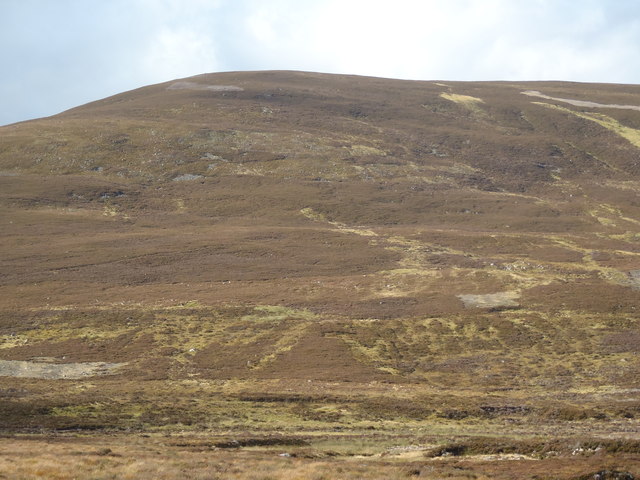
Red Craig is a prominent hill located in Aberdeenshire, Scotland. It sits within the Cairngorms National Park, approximately 8 kilometers southeast of the village of Ballater. With an elevation of 678 meters (2,224 feet), it offers breathtaking panoramic views of the surrounding countryside.

The hill is characterized by its distinctive red sandstone cliffs, from which it derives its name. These cliffs are a result of geological processes that took place millions of years ago. The reddish hue of the rocks creates a striking contrast against the greenery of the surrounding landscape.

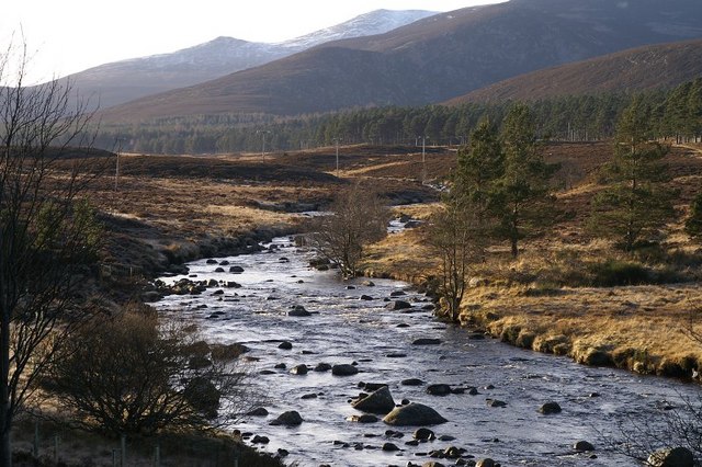
Red Craig is a popular destination for hikers and outdoor enthusiasts due to its accessibility and stunning vistas. There are several well-marked trails that lead to the summit, catering to different levels of experience and fitness. The ascent can be steep in parts, but the effort is rewarded with awe-inspiring views of the surrounding mountains, valleys, and the nearby River Dee.

The hill is also home to a diverse range of flora and fauna, making it an ideal spot for nature enthusiasts. Visitors may encounter a variety of bird species, including golden eagles and peregrine falcons, as well as red deer and mountain hares.

Overall, Red Craig offers a memorable experience for those seeking to immerse themselves in the natural beauty of Aberdeenshire. Whether it's a challenging hike or a leisurely stroll, this hill provides a unique opportunity to appreciate Scotland's stunning landscapes.

If you have any feedback on the listing, please let us know in the comments section below.
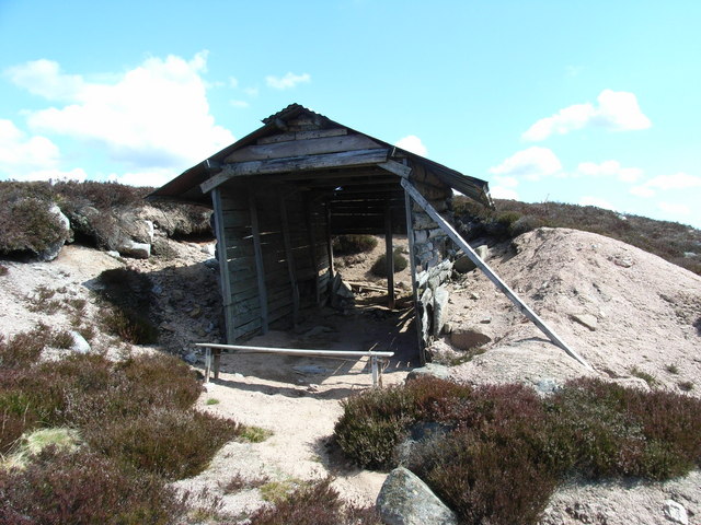
Red Craig Images

Images are sourced within 2km of 57.003548/-2.9510088 or Grid Reference NO4290. Thanks to Geograph Open Source API. All images are credited.

Water of Tanar and Mount Keen The famous Mounth road climbs up towards the cone of the hill of the same name.
Water of Tanar and Mount Keen
The famous Mounth road climbs up towards the cone of the hill of the same name.
The Mount Keen Road crosses Glen Tanar The main route from Ballater crosses upper Glen Tanar here, while a feeder from the Dinnet direction joins in after climbing the glen. The straight on road once led to Shiel of Glen Tanar which has burnt down.
The Mount Keen Road crosses Glen Tanar
The main route from Ballater crosses upper Glen Tanar here, while a feeder from the Dinnet direction joins in after climbing the glen. The straight on road once led to Shiel of Glen Tanar which has burnt down.
Mount Keen Road What was once the main route of the road from Ballater is now just a path, traversing this moorland hillside in Glen Tanar. Another drove route came up Glen Tanar itself and the routes combined to cross the Mounth just west of the granite cone of Mount Keen.
Mount Keen Road
What was once the main route of the road from Ballater is now just a path, traversing this moorland hillside in Glen Tanar. Another drove route came up Glen Tanar itself and the routes combined to cross the Mounth just west of the granite cone of Mount Keen.
Gathering Cairn across the heather moor Lochnagar can just be seen in the extreme right hand of the picture above the green at the head of Glen Tanar
Gathering Cairn across the heather moor
Lochnagar can just be seen in the extreme right hand of the picture above the green at the head of Glen Tanar
Track leading towards Gathering Cairn The tracks on these grouse moors are built to facilitate grouse management
Track leading towards Gathering Cairn
The tracks on these grouse moors are built to facilitate grouse management
Derelict shed The shed has almost transformed itself into a pile of rusted tin & weathered timber.  What I like about the geograph site is you can compare photos and see the changes over a period of time
Derelict shed
The shed has almost transformed itself into a pile of rusted tin & weathered timber. What I like about the geograph site is you can compare photos and see the changes over a period of time
Track through the heather A distinct track leading up the hillside towards Gathering Cairn
Track through the heather
A distinct track leading up the hillside towards Gathering Cairn
Land management for biodiversity Showing the burnt heather patches to encourage new growth.  Glen Tanar Estate are doing everything they can to encourage new growth on the moorland.  Clachen Yell is to the right of the col behind the burnt heather.
Land management for biodiversity
Showing the burnt heather patches to encourage new growth. Glen Tanar Estate are doing everything they can to encourage new growth on the moorland. Clachen Yell is to the right of the col behind the burnt heather.
Solar Panels & Clachan Yell A satellite dish & solar panels on a remote hillside????? Clachan Yell in the background
Solar Panels & Clachan Yell
A satellite dish & solar panels on a remote hillside????? Clachan Yell in the background
Gathering Cairn Heather-clad ground on the Gathering Cairn, with hills beyond the Water of Gairney visible in the distance.
Gathering Cairn
Heather-clad ground on the Gathering Cairn, with hills beyond the Water of Gairney visible in the distance.
Foot Bridge Foot bridge over the Water of Tanar for the path up Mount Keen
Foot Bridge
Foot bridge over the Water of Tanar for the path up Mount Keen
Fir Bog & Shiel of Glentanar Looking South West across Fir Bog towards the green patch of Shiel of Glentanar with the mountain of Lochnagar just visible 19 km away.
Fir Bog & Shiel of Glentanar
Looking South West across Fir Bog towards the green patch of Shiel of Glentanar with the mountain of Lochnagar just visible 19 km away.
Gathering Cairn Looking South across the North Eastern flank of Gathering Cairn with Braid Cairn behind and the roof of a small shelter in the centre of the photograph. This view shows the poor state of the track junction. The track generally remains much the same until 2 km East of here where it is being improved considerably.
Gathering Cairn
Looking South across the North Eastern flank of Gathering Cairn with Braid Cairn behind and the roof of a small shelter in the centre of the photograph. This view shows the poor state of the track junction. The track generally remains much the same until 2 km East of here where it is being improved considerably.
Derelict Shelter This derelict shelter is not exactly windproof, which is probably why it is not shown on the Geograph map although it is shown on earlier Ordnance Survey maps.
Derelict Shelter
This derelict shelter is not exactly windproof, which is probably why it is not shown on the Geograph map although it is shown on earlier Ordnance Survey maps.
Track Junction Junction of track to the new Mt Keen bridge in upper Glen Tanar.
Track Junction
Junction of track to the new Mt Keen bridge in upper Glen Tanar.
Fir Bog & Gathering Cairn Looking southeast up the slope of Fir Bog towards the peak of Gathering Cairn.
Fir Bog & Gathering Cairn
Looking southeast up the slope of Fir Bog towards the peak of Gathering Cairn.
Fir Bog & Red Craig Northeast across the slope of Fir Bog towards the summits of Red Craig on the left and Black Craig on the right.
Fir Bog & Red Craig
Northeast across the slope of Fir Bog towards the summits of Red Craig on the left and Black Craig on the right.
Heather slopes on the eastern flank of Head of Garbh Choire
Show me another place!

Red Craig is located at Grid Ref: NO4290 (Lat: 57.003548, Lng: -2.9510088)

Unitary Authority: Aberdeenshire

Police Authority: North East

What 3 Words

///guests.imitate.torched. Near Ballater, Aberdeenshire

Nearby Locations

Red Craig

Related Wikis

Mount Keen

Mount Keen (Scottish Gaelic: Monadh Caoin) is a 939-metre-high (3,081 ft) mountain in Scotland and the most easterly Munro. It can be accessed from several...

Kincardine and Deeside

Kincardine and Deeside was formerly (1975–96) a local government district in the Grampian Region of Scotland. In 1996 it was included in the Aberdeenshire...

Dee Castle

Dee Castle was a 15th-century castle, about 5 miles (8.0 km) east of Ballater, Aberdeenshire, Scotland, and south of the River Dee.It may be known alternatively...

Cambus O'May railway station

Cambus O'May railway station or Cambus O'May Halt, served Aberdeenshire, Scotland from 1876 to 1966 on the Deeside Railway. It was intended to serve the...

River Muick

River Muick () is a river of the Grampian Mountains of Aberdeenshire, Scotland. A tributary of the River Dee, it flows for about 6 kilometres (3.7 mi)...

Cambus O' May bridge

The Cambus O' May bridge spans the River Dee to the east of Ballater, Aberdeenshire, Scotland. It was paid for by the estate of Alexander Gordon, who...

Glen Tanar

Glen Tanar (Scottish Gaelic: Gleann Tanar) is a glen in Aberdeenshire, eastern Scotland, through which the Water of Tanar flows. Near the mouth of the...

Muir of Dinnet

Muir of Dinnet is a national nature reserve (NNR) situated close to the village of Dinnet in Aberdeenshire, Scotland. The reserve extends 1166 hectares...

Nearby Amenities

Located within 500m of 57.003548,-2.9510088
Red Craig
Ele: 599
Natural: peak
Lat/Long: 57.0035443/-2.9495661
The data included in this document is from www.openstreetmap.org. The data is made available under ODbL.

Have you been to Red Craig?

Leave your review of Red Craig below (or comments, questions and feedback).