Ewes Hill

Hill, Mountain in Midlothian

Scotland

Ewes Hill

Over Shiels road
Over Shiels road Credit: Richard Webb

Ewes Hill is a prominent hill located in Midlothian, Scotland. It is situated near the small village of Ewes, approximately 10 miles south of the town of Langholm. Standing at a height of 1,302 feet (397 meters) above sea level, it offers panoramic views of the surrounding countryside.

The hill is part of the Southern Uplands, a range of rolling hills and valleys that stretch across southern Scotland. Ewes Hill is characterized by its gentle slopes and grassy terrain, making it a popular destination for hikers and nature enthusiasts. The hill is also home to a variety of wildlife, including red grouse, buzzards, and mountain hares.

Ewes Hill is easily accessible by foot, with several designated walking trails leading to its summit. The main route starts from the village of Ewes and winds its way up the hillside, offering stunning views along the way. On clear days, it is possible to see as far as the Lake District in England.

The hill has a rich history, with archaeological remains suggesting that it has been inhabited since prehistoric times. The surrounding area is dotted with ancient burial sites and stone circles, providing further evidence of human activity in the region.

Overall, Ewes Hill is a picturesque and historically significant landmark in Midlothian. Its natural beauty and accessibility make it a popular destination for both locals and tourists alike, offering a peaceful retreat from the hustle and bustle of urban life.

If you have any feedback on the listing, please let us know in the comments section below.
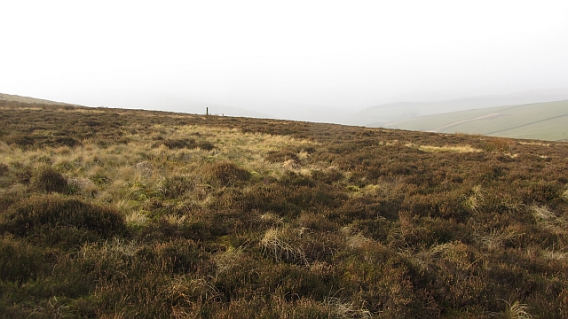
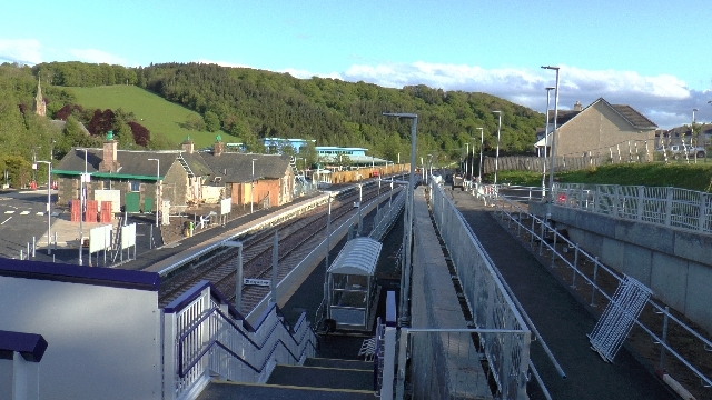
Ewes Hill Images

Images are sourced within 2km of 55.708878/-2.9194523 or Grid Reference NT4246. Thanks to Geograph Open Source API. All images are credited.

Over Shiels road
Over Shiels road
Newly planted hillside, Symington A block of young trees to the right of the shelter belt. View from The Struther.
Newly planted hillside, Symington
A block of young trees to the right of the shelter belt. View from The Struther.
Royal Scot on the Borders Railway This steam special is heading for Tweedbank and will be hauled back to Edinburgh by a vintage diesel as there is no passing loop or turntable at the Tweedbank terminus. The line at this location near Stow is very close to the A7 road. The vertical fence posts clearly show the camber of the line at this section of the line.
Royal Scot on the Borders Railway
This steam special is heading for Tweedbank and will be hauled back to Edinburgh by a vintage diesel as there is no passing loop or turntable at the Tweedbank terminus. The line at this location near Stow is very close to the A7 road. The vertical fence posts clearly show the camber of the line at this section of the line.
Royal Scot on the Borders Railway The steam special is approaching Watherston near Stow as it makes its way to Tweedbank Station.
Royal Scot on the Borders Railway
The steam special is approaching Watherston near Stow as it makes its way to Tweedbank Station.
Forest on Wetherston Hill The A7 road at Galabank can be seen in the background. Viewed from an Edinburgh bound flight from Prague.
Forest on Wetherston Hill
The A7 road at Galabank can be seen in the background. Viewed from an Edinburgh bound flight from Prague.
Farm road, Watherston A wide enclosed track climbing to the ridge on the west side of the Gala Water.
Farm road, Watherston
A wide enclosed track climbing to the ridge on the west side of the Gala Water.
Borders Railway, Watherston The A7 runs close to the railway here and has a sharp bend by Galabank.
Borders Railway, Watherston
The A7 runs close to the railway here and has a sharp bend by Galabank.
Dean Burn Under Watherston Hill.
Dean Burn
Under Watherston Hill.
Yellow road, Gala Water Approaching Symington Mains on the quiet single track road on the west side of the Gala Water.
Yellow road, Gala Water
Approaching Symington Mains on the quiet single track road on the west side of the Gala Water.
Forestry on Watherston Hill With the valley of the Gala Water beyond and the Luggate Water in the foreground.
Forestry on Watherston Hill
With the valley of the Gala Water beyond and the Luggate Water in the foreground.
Settlement, Symington A hilltop earthwork on a spur above the Gala Water.
Settlement, Symington
A hilltop earthwork on a spur above the Gala Water.
Symington Hillhead Gathering pens beside a ruin.
Symington Hillhead
Gathering pens beside a ruin.
Watherston Hill Moorland on Watherston Hill. Much of the hill is wooded.
Watherston Hill
Moorland on Watherston Hill. Much of the hill is wooded.
Woodland edge, Watherston Hill There is a stack of silage bales and a mobile telephone mast on this spur overlooking the Gala Water and A7. There are also a pair of poles,  the remains of a barn.
Woodland edge, Watherston Hill
There is a stack of silage bales and a mobile telephone mast on this spur overlooking the Gala Water and A7. There are also a pair of poles, the remains of a barn.
Symington Mains Farm View from the slopes of Watherston Hill.
Symington Mains Farm
View from the slopes of Watherston Hill.
Symington Hill The eastern flank of the Moorfoot Hills is largely improved agricultural land and used for cattle raising.
Symington Hill
The eastern flank of the Moorfoot Hills is largely improved agricultural land and used for cattle raising.
Grazing land, Symington Improved grazing above the Gala Water. In Summer cattle graze these hills along with sheep.
Grazing land, Symington
Improved grazing above the Gala Water. In Summer cattle graze these hills along with sheep.
Forest edge, Watherston Hill A conifer wood which appeared to survive the onslaught of recent storms. There is also some moorland on Watherston Hill.
Forest edge, Watherston Hill
A conifer wood which appeared to survive the onslaught of recent storms. There is also some moorland on Watherston Hill.
Show me another place!

Ewes Hill is located at Grid Ref: NT4246 (Lat: 55.708878, Lng: -2.9194523)

Unitary Authority: The Scottish Borders

Police Authority: The Lothians and Scottish Borders

What 3 Words

///coping.lion.thick. Near Lauder, Scottish Borders

Nearby Locations

Ewes Hill Watherston Hill

Related Wikis

Allanshaugh

Allanshaugh is a fermtoun in the Scottish Borders area of Scotland. == See also == List of places in the Scottish Borders List of places in Scotland...

Fountainhall railway station

Fountainhall railway station served the village of Fountainhall, Scottish Borders from 1848 to 1969 on the Waverley Route. == History == The station opened...

Stow railway station

Stow is a railway station on the Borders Railway, which runs between Edinburgh Waverley and Tweedbank. The station, situated 26 miles 45 chains (43 km...

Stow of Wedale

Stow of Wedale, or more often Stow, is a village in the Scottish Borders area of Scotland (historically Midlothian), 7 miles (11 kilometres) north of...

Nearby Amenities

Located within 500m of 55.708878,-2.9194523
Watherston Hill
Ele: 414
Natural: peak
Lat/Long: 55.7088244/-2.9191046
Power: pole
Lat/Long: 55.71314/-2.9189973
Power: pole
Lat/Long: 55.7130453/-2.9200739
Power: pole
Lat/Long: 55.7129478/-2.9211861
Power: pole
Lat/Long: 55.7128518/-2.9222678
Power: pole
Lat/Long: 55.7127614/-2.9232858
The data included in this document is from www.openstreetmap.org. The data is made available under ODbL.

Have you been to Ewes Hill?

Leave your review of Ewes Hill below (or comments, questions and feedback).