Hyde
Settlement in Dorset
England
Hyde

Hyde is a small village located in the county of Dorset, England. Situated in the Cranborne Chase and West Wiltshire Downs Area of Outstanding Natural Beauty, Hyde boasts breathtaking landscapes and a rich history.
The village is nestled in the heart of the Dorset countryside, surrounded by rolling hills, lush meadows, and picturesque woodlands. It is known for its idyllic setting, providing a peaceful and tranquil atmosphere for residents and visitors alike. Hyde is also home to a number of traditional thatched cottages, which add to its charm and character.
The village has a close-knit community and a strong sense of community spirit. The locals take great pride in their village, organizing various events and activities throughout the year to bring people together. Hyde also has a village hall, which serves as a hub for social gatherings and community events.
In terms of amenities, Hyde offers limited facilities. However, nearby towns and villages provide a wider range of services, including shops, schools, and healthcare facilities. The village is well-connected to the surrounding areas by a network of roads, making it easily accessible for residents and visitors alike.
For those who enjoy outdoor activities, Hyde is a paradise. The surrounding countryside offers ample opportunities for walking, hiking, cycling, and horse riding. The village is also close to several nature reserves and country parks, where visitors can explore the local flora and fauna.
In summary, Hyde is a charming village nestled in the beautiful Dorset countryside. With its stunning landscapes, rich history, and strong sense of community, it is a delightful place to live or visit for those seeking a peaceful and idyllic rural retreat.
If you have any feedback on the listing, please let us know in the comments section below.
Hyde Images
Images are sourced within 2km of 50.725192/-2.7522329 or Grid Reference SY4792. Thanks to Geograph Open Source API. All images are credited.


Hyde is located at Grid Ref: SY4792 (Lat: 50.725192, Lng: -2.7522329)
Unitary Authority: Dorset
Police Authority: Dorset
What 3 Words
///superbly.nuns.second. Near Bridport, Dorset
Nearby Locations
Related Wikis

Holy Trinity Church, Bothenhampton
Holy Trinity Church is a Church of England parish church at Bothenhampton, near Bridport in Dorset, England. It was designed and built by the English arts...
Bothenhampton
Bothenhampton is a village and civil parish in southwest Dorset, England, just outside the town of Bridport. It is separated from the town only by the...

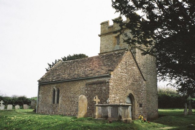
Holy Trinity Old Church, Bothenhampton
Holy Trinity Old Church in Bothenhampton, Dorset, England was built in the 13th or 14th century. It is recorded in the National Heritage List for England...
Bridport F.C.
Bridport Football Club is a football club based in Bridport, Dorset, England. Affiliated to the Dorset County Football Association, they are currently...

St. Mary's Church, Bridport
St Mary's Church is an Anglican parish church in Bridport, Dorset, England. It is a Grade I listed building. Part of the Bridport Team Ministry, it is...

Bridport East Street railway station
Bridport East Street was a railway station on the Bridport Railway in the west of the English county of Dorset. Opened on 11 March 1884, before the extension...

Bridport Museum
Bridport Museum is a museum in Bridport, Dorset, England. It is housed within an early 16th century building known as the Castle, located on South Street...
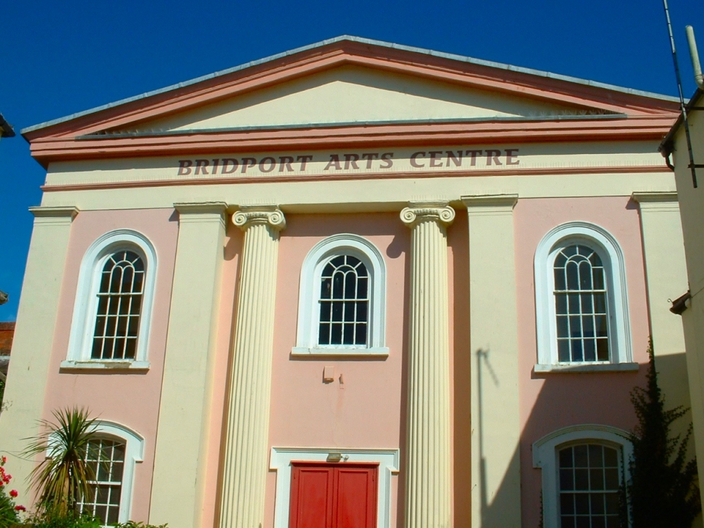
Bridport Arts Centre
Bridport Arts Centre is an arts centre in Bridport, Dorset, England. Founded in 1973, it is housed in and around a 19th-century, Grade II listed building...
Nearby Amenities
Located within 500m of 50.725192,-2.7522329Have you been to Hyde?
Leave your review of Hyde below (or comments, questions and feedback).