Big Hill

Hill, Mountain in Herefordshire

England

Big Hill

Tree in field Tree in field near Mill Orles Wood
Tree in field Credit: P Gaskell

Big Hill is a prominent geological feature located in the county of Herefordshire, England. Rising to an elevation of 338 meters (1,109 feet), it stands as one of the highest points in the region. Situated near the village of Little Marcle, Big Hill offers captivating panoramic views of the surrounding countryside, making it a popular destination for hikers, nature enthusiasts, and photographers.

The hill boasts a diverse range of flora and fauna, with its slopes being covered in a patchwork of meadows, woodlands, and hedgerows. This ecological diversity supports a variety of wildlife, including rabbits, foxes, and a multitude of bird species. The area is also known for its rich biodiversity, with numerous rare plant species making their home on the hill.

Big Hill is easily accessible, with footpaths leading to its summit from nearby villages. It is a favorite spot for walkers, who can enjoy the crisp country air and picturesque scenery as they traverse the gentle slopes. The hill also serves as a recreational area for locals and visitors alike, with many picnic spots scattered along its trails.

In addition to its natural beauty, Big Hill holds historical significance. It is believed to have been inhabited since prehistoric times, with archaeological evidence suggesting human activity dating back thousands of years. Ruins of an Iron Age hillfort can still be found on the summit, providing a glimpse into the region's ancient past.

Overall, Big Hill in Herefordshire offers a captivating blend of natural splendor, wildlife, and historical intrigue. It remains a cherished destination for those seeking a tranquil escape and a connection with the land's rich heritage.

If you have any feedback on the listing, please let us know in the comments section below.

Big Hill Images

Images are sourced within 2km of 51.989183/-2.8478971 or Grid Reference SO4132. Thanks to Geograph Open Source API. All images are credited.

Tree in field Tree in field near Mill Orles Wood
Tree in field
Tree in field near Mill Orles Wood
Wormbridge Mill Vernacular buildings at Wormbridge Mill
Wormbridge Mill
Vernacular buildings at Wormbridge Mill
Trelough Farm
Trelough Farm
Lane Lane connecting Wormbridge and Ewyas Harold.
Lane
Lane connecting Wormbridge and Ewyas Harold.
The Birches Looking across a field to The Birches, a house on the Wormbridge to Abbeydore road.
The Birches
Looking across a field to The Birches, a house on the Wormbridge to Abbeydore road.
Field Field near Wormbridge, seen from the Wormbridge to Abbeydore road.
Field
Field near Wormbridge, seen from the Wormbridge to Abbeydore road.
Field Field near Wormbridge, seen from the Wormbridge to Abbeydore road.
Field
Field near Wormbridge, seen from the Wormbridge to Abbeydore road.
Towards Quarrels Green Looking along the lane from Abbey Dore to Cockyard with Quarrels Green Farm in the  centre of the photo.
Towards Quarrels Green
Looking along the lane from Abbey Dore to Cockyard with Quarrels Green Farm in the centre of the photo.
Near Quarrels Green Looking along the lane from Abbey Dore to Cockyard near Quarrels Green Farm.
Near Quarrels Green
Looking along the lane from Abbey Dore to Cockyard near Quarrels Green Farm.
Near Quarrels Green A field off the lane from Abbey Dore to Cockyard near Quarrels Green Farm.
Near Quarrels Green
A field off the lane from Abbey Dore to Cockyard near Quarrels Green Farm.
South of Cockyard Lane south of Cockyard.
South of Cockyard
Lane south of Cockyard.
South of Cockyard Lane south of Cockyard.
South of Cockyard
Lane south of Cockyard.
Jury Cottage Farm Looking across fields to Jury Cottage Farm.
Jury Cottage Farm
Looking across fields to Jury Cottage Farm.
Road from Wormbridge towards Abbey Dore, Herefordshire Viewed across the A465 in Wormbridge.
Road from Wormbridge towards Abbey Dore, Herefordshire
Viewed across the A465 in Wormbridge.
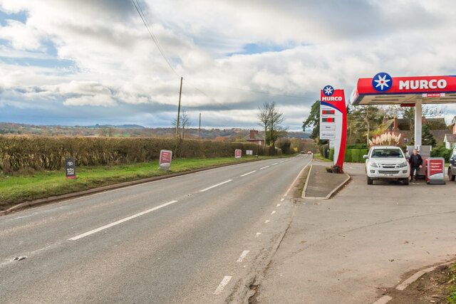
A465 The A465 near Wormbridge.  On the right is part of the Forge Filling Station.
A465
The A465 near Wormbridge. On the right is part of the Forge Filling Station.
Cereal field in the Grey Valley A revisit to the same spot from which I took this, <a href="https://www.geograph.org.uk/photo/349158">SO4033 : Newbrook Farm</a>, nine winters ago.
Newbrook Farm still there in splendid isolation.
Cereal field in the Grey Valley
A revisit to the same spot from which I took this, SO4033 : Newbrook Farm, nine winters ago. Newbrook Farm still there in splendid isolation.
Lane in the Grey Valley A very quiet corner of Herefordshire.
The road crosses the Worm Brook at the bend here.
Lane in the Grey Valley
A very quiet corner of Herefordshire. The road crosses the Worm Brook at the bend here.
Jury Cottage Farm Named on OS mapping.
Jury Cottage Farm
Named on OS mapping.
Show me another place!

Big Hill is located at Grid Ref: SO4132 (Lat: 51.989183, Lng: -2.8478971)

Unitary Authority: County of Herefordshire

Police Authority: West Mercia

What 3 Words

///regulates.guests.salmon. Near Thruxton, Herefordshire

Related Wikis

Treville, Herefordshire

Treville (called in Welsh Trefelin) is a rural area and former royal forest in the English county of Herefordshire. It is near Wormbridge and other small...

Wormbridge

Wormbridge is a village and former civil parish in Herefordshire, England, about eight miles south-west of Hereford, on the A465 road at (SO423316). The...

St Devereux railway station

St Devereux railway station was a station in Kilpeck, Herefordshire, England. The station was opened in 1854 and closed in 1958. == References == ��2...

Thruxton, Herefordshire

Thruxton is a small rural village and civil parish in Herefordshire, England. It is located within the historic area of Archenfield, near the Welsh border...

Nearby Amenities

Located within 500m of 51.989183,-2.8478971
Cefn-esco
Natural: wood
Lat/Long: 51.9891926/-2.8438851
Dyffryn Hill
Natural: wood
Lat/Long: 51.9883804/-2.8505542
Banses Wood
Natural: wood
Lat/Long: 51.991304/-2.8525514
The data included in this document is from www.openstreetmap.org. The data is made available under ODbL.

Have you been to Big Hill?

Leave your review of Big Hill below (or comments, questions and feedback).