Black Hill

Hill, Mountain in Banffshire

Scotland

Black Hill

Frolicking Frogs (Rana temporaria) Right in the middle of the road. We considered moving them nearer to water, but decided that we didn't want to disturb them in mid-frolic. I just hope she manages to find a place where the water isn't going to dry up; I have already scooped up thousands of future frogs from drying puddles on roads.
Frolicking Frogs (Rana temporaria) Credit: Anne Burgess

Black Hill is a prominent hill located in Banffshire, Scotland. Standing at an elevation of 1,168 feet (356 meters), it is a popular destination for outdoor enthusiasts and hikers. Situated within the Cairngorms National Park, this hill offers breathtaking views of the surrounding landscape, making it a must-visit for nature lovers.

The ascent to the summit of Black Hill begins from the picturesque village of Tomintoul, known as the highest village in the Cairngorms. The trail meanders through heather-covered moorland, providing an opportunity for visitors to admire the diverse flora and fauna of the area. The hike is of moderate difficulty, suitable for both experienced hikers and beginners.

Once at the summit, walkers are rewarded with panoramic vistas of the Cairngorms and the surrounding valleys. On a clear day, the view stretches as far as the Grampian Mountains, offering a truly awe-inspiring experience.

Black Hill is also home to a variety of wildlife, including red deer, golden eagles, and peregrine falcons. Birdwatchers can often spot various species of birds, such as curlews and lapwings, in the surrounding moorland.

In addition to its natural beauty, Black Hill holds historical significance. The hill was once used as a site for illicit whisky smuggling during the 18th and 19th centuries, adding an intriguing layer to its story.

Overall, Black Hill in Banffshire is a captivating destination that combines natural splendor, rewarding hikes, and a touch of history. Whether exploring its trails or simply admiring the view, visitors are sure to be enchanted by this remarkable Scottish hill.

If you have any feedback on the listing, please let us know in the comments section below.
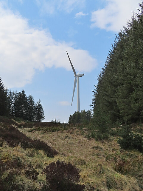
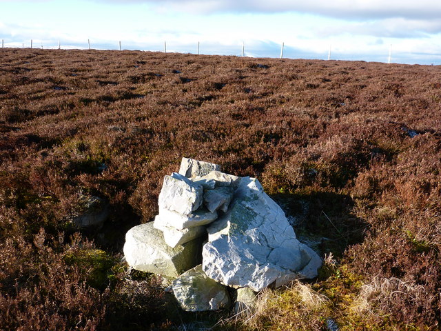
Black Hill Images

Images are sourced within 2km of 57.363584/-2.9830982 or Grid Reference NJ4030. Thanks to Geograph Open Source API. All images are credited.

Frolicking Frogs (Rana temporaria) Right in the middle of the road. We considered moving them nearer to water, but decided that we didn't want to disturb them in mid-frolic. I just hope she manages to find a place where the water isn't going to dry up; I have already scooped up thousands of future frogs from drying puddles on roads.
Frolicking Frogs (Rana temporaria)
Right in the middle of the road. We considered moving them nearer to water, but decided that we didn't want to disturb them in mid-frolic. I just hope she manages to find a place where the water isn't going to dry up; I have already scooped up thousands of future frogs from drying puddles on roads.
Approaching Three Burnshead How I can see why the burn lower down is called Three Burns, because it is joined by two short tributaries, but not why the name has travelled upstream to where there is just one burn.
Approaching Three Burnshead How
I can see why the burn lower down is called Three Burns, because it is joined by two short tributaries, but not why the name has travelled upstream to where there is just one burn.
Three Burnshead How A Howe is a hollow, so I suppose this is the hollow at the head of three burns, though only one of the three burns rises as far up as this. The turbine is in the next square.
Three Burnshead How
A Howe is a hollow, so I suppose this is the hollow at the head of three burns, though only one of the three burns rises as far up as this. The turbine is in the next square.
Three Burns The second and third parts of the Three Burns join this main stream from right and left a little further downhill. The gap in the forest offers a fine view east to Tap o' Noth in NJ4829.
Three Burns
The second and third parts of the Three Burns join this main stream from right and left a little further downhill. The gap in the forest offers a fine view east to Tap o' Noth in NJ4829.
Gullying in the Forest Road The side of the road has been ripped out by rushing water, leaving ruts big enough to swallow many a wheeled vehicle.
Gullying in the Forest Road
The side of the road has been ripped out by rushing water, leaving ruts big enough to swallow many a wheeled vehicle.
Forest Quarry Every forest has its quarries, needed for material to repair and maintain the forest roads.
Forest Quarry
Every forest has its quarries, needed for material to repair and maintain the forest roads.
Minor road near Pyke Looking north-eastward.
Minor road near Pyke
Looking north-eastward.
Greystone How on the Burn of Bank in the Cabrach
Burn of Bank main stream issuing from Greystone How
Burn of Bank being joined by Small Burn
Slopes of Hill of Bank in the Cabrach The notable feature is the zoning - the low ground is too boggy to be anything other than rough grazing, the high ground is too wild to be anything other than heather moor. Only the zone between has been any use as farmland - an unusual agrarian sandwich! No doubt the middle zone will be squeezed gradually now that the farms are out of use.
Slopes of Hill of Bank in the Cabrach
The notable feature is the zoning - the low ground is too boggy to be anything other than rough grazing, the high ground is too wild to be anything other than heather moor. Only the zone between has been any use as farmland - an unusual agrarian sandwich! No doubt the middle zone will be squeezed gradually now that the farms are out of use.
Silage in, Pyke A break in the rain has allowed the grass to be harvested from this field.
Silage in, Pyke
A break in the rain has allowed the grass to be harvested from this field.
Ruin near Pyke Decaying cottage in a small wood.
Ruin near Pyke
Decaying cottage in a small wood.
Approaching unnamed 478m top
Cairn near 478m top But not actually at the top. The top itself is very difficult to determine, but is probably along the fence line
Cairn near 478m top
But not actually at the top. The top itself is very difficult to determine, but is probably along the fence line
South-west along the top
Looking north-east along the top
Grassland near Hillock of Echt Just a field or two of grassland before the moors start at about 310m asl.
Grassland near Hillock of Echt
Just a field or two of grassland before the moors start at about 310m asl.
Show me another place!

Black Hill is located at Grid Ref: NJ4030 (Lat: 57.363584, Lng: -2.9830982)

Unitary Authority: Moray

Police Authority: North East

What 3 Words

///adapt.dates.swooned. Near Dufftown, Moray

Nearby Locations

Black Hill

Related Wikis

Wormy Hillock Henge

Wormy Hillock Henge, also known as The Dragon's Grave, is a small henge in Aberdeenshire, Scotland. It is a Scheduled Ancient Monument located in the Clashindarroch...

Cabrach

The Cabrach (Scottish Gaelic: A' Chabrach, A' Chabraich) is an estate and largely depopulated rural community in Moray, Scotland. The meaning of the name...

Clashindarroch Forest

Clashindarroch Forest is possibly the largest forest in Aberdeenshire, situated to the south-west of the market town of Huntly. Managed by Forest Enterprise...

Beldorney Castle

Beldorney Castle is a Z-plan castle dating from the mid-16th century, about two miles south of Glass, in hilly country in the valley of the Deveron, in...

Nearby Amenities

Located within 500m of 57.363584,-2.9830982
Black Hill
Ele: 504
Natural: peak
Lat/Long: 57.363295/-2.9835311
Generator Method: wind_turbine
Generator Output Electricity: 2.05 MW
Generator Source: wind
Generator Type: horizontal_axis
Power: generator
Lat/Long: 57.3604928/-2.9787326
Generator Method: wind_turbine
Generator Output Electricity: 2.05 MW
Generator Source: wind
Generator Type: horizontal_axis
Power: generator
Lat/Long: 57.3647515/-2.9778958
The data included in this document is from www.openstreetmap.org. The data is made available under ODbL.

Have you been to Black Hill?

Leave your review of Black Hill below (or comments, questions and feedback).