Bowan Hill

Hill, Mountain in Roxburghshire

Scotland

Bowan Hill

Minor road at Carlenrig Looking north-eastward.
Minor road at Carlenrig Credit: Peter Wood

Bowan Hill is a prominent hill located in the Scottish Borders region of Roxburghshire, in the southeastern part of Scotland. Standing at an elevation of approximately 454 meters (1,490 feet), it is considered one of the notable hills in the area.

Situated near the village of Bowan, the hill offers stunning panoramic views of the surrounding countryside, making it a popular spot for outdoor enthusiasts and nature lovers. The hill is part of the wider Cheviot Hills range, which straddles the border between Scotland and England.

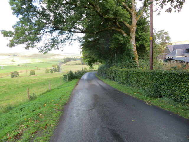
Bowan Hill is characterized by its gentle slopes, covered in heather and grasses, creating a picturesque landscape. The hill is easily accessible, with a well-marked trail leading to its summit, making it a favorite destination for hikers and walkers of all levels.

At the top of Bowan Hill, visitors can enjoy breathtaking vistas of the surrounding valleys, including the Teviot and Tweed valleys, as well as the neighboring hills and mountains. On clear days, it is even possible to see as far as the Northumberland National Park in England.

The area surrounding Bowan Hill is rich in wildlife, with various bird species, including raptors like buzzards and kestrels, often seen soaring overhead. Additionally, the hill is home to a variety of wildflowers and plants, adding to its natural beauty.

Overall, Bowan Hill offers visitors a chance to immerse themselves in the stunning Scottish countryside, providing a peaceful and scenic escape from the hustle and bustle of everyday life.

If you have any feedback on the listing, please let us know in the comments section below.

Bowan Hill Images

Images are sourced within 2km of 55.339378/-2.934191 or Grid Reference NT4005. Thanks to Geograph Open Source API. All images are credited.

Minor road at Carlenrig Looking north-eastward.
Minor road at Carlenrig
Looking north-eastward.
Inside the monument on Dryden Knowes This is a view up the inside of the cone-shaped monument to the Rev Henry Scott Riddell on the northwest side of the A7 at Teviothead. On previous visits the access door has been locked but on this occasion it was open. For a view of the monument with more information, see <a href="https://www.geograph.org.uk/photo/378497">NT4106 : The Colterscleuch Monument</a>.
Inside the monument on Dryden Knowes
This is a view up the inside of the cone-shaped monument to the Rev Henry Scott Riddell on the northwest side of the A7 at Teviothead. On previous visits the access door has been locked but on this occasion it was open. For a view of the monument with more information, see NT4106 : The Colterscleuch Monument.
Sheep on Dryden Knowes A line of sheep file past the monument on Dryden Knowes in early January. For more information about the monument, see <a href="https://www.geograph.org.uk/photo/378497">NT4106 : The Colterscleuch Monument</a>.
Sheep on Dryden Knowes
A line of sheep file past the monument on Dryden Knowes in early January. For more information about the monument, see NT4106 : The Colterscleuch Monument.
Waterlogged farmland at Dryden, Teviothead The land is saturated after a period of heavy rain. Statistics from Eskdalemuir Weather Station have shown that each month of 2011 had above average rainfall and that it was the wettest year on record.
Waterlogged farmland at Dryden, Teviothead
The land is saturated after a period of heavy rain. Statistics from Eskdalemuir Weather Station have shown that each month of 2011 had above average rainfall and that it was the wettest year on record.
Bowanhill at Teviothead A farm in Teviotdale - looking west from the A7 at the Johnnie Armstrong Gallery.
Bowanhill at Teviothead
A farm in Teviotdale - looking west from the A7 at the Johnnie Armstrong Gallery.
Teviotdale at Teviothead The Teviot runs alongside the foreground willows, Teviothead Cottage is in the trees and the Colterscleuch Monument is prominent on the skyline - for a closer view and details see Walter Baxter's image <a href="https://www.geograph.org.uk/photo/378497">NT4106 : The Colterscleuch Monument</a>.
Teviotdale at Teviothead
The Teviot runs alongside the foreground willows, Teviothead Cottage is in the trees and the Colterscleuch Monument is prominent on the skyline - for a closer view and details see Walter Baxter's image NT4106 : The Colterscleuch Monument.
The Johnnie Armstrong Gallery A craft Celtic jewellery workshop on the A7 in Teviotdale, with some beautiful gold, platinum and silver pieces based on Celtic designs.
The Johnnie Armstrong Gallery
A craft Celtic jewellery workshop on the A7 in Teviotdale, with some beautiful gold, platinum and silver pieces based on Celtic designs.
Cottages at Bowanhill
The Teviot at Bowanhill Viewed downstream from Bowanhill Bridge.
The Teviot at Bowanhill
Viewed downstream from Bowanhill Bridge.
Bowanhill
Bowanhill
Farmland at Colterscleuch The sheep in this field on the southeast side of the A7 are highlighted by late afternoon December sunshine.
Farmland at Colterscleuch
The sheep in this field on the southeast side of the A7 are highlighted by late afternoon December sunshine.
Frostly Burn Upstream of Teviothead.
Frostly Burn
Upstream of Teviothead.
Binks Hill Sheepwalk in evening light, Teviothead.
Binks Hill
Sheepwalk in evening light, Teviothead.
Colterscleuch Shiel (remains) Former shepherds cottage, demolished for safety reasons
Colterscleuch Shiel (remains)
Former shepherds cottage, demolished for safety reasons
Bridge construction, Bowanhill A new bridge being built over the Teviot.
Bridge construction, Bowanhill
A new bridge being built over the Teviot.
Frostlie Burn A headwater of the Teviot is somewhere in the vegetation beside the A7.
Frostlie Burn
A headwater of the Teviot is somewhere in the vegetation beside the A7.
Teviothead Parish Church and part of its Burial Ground Viewed from the southwest.
Teviothead Parish Church and part of its Burial Ground
Viewed from the southwest.
Minor road near to Woodbrae Looking north-eastward.
Minor road near to Woodbrae
Looking north-eastward.
Show me another place!

Bowan Hill is located at Grid Ref: NT4005 (Lat: 55.339378, Lng: -2.934191)

Unitary Authority: The Scottish Borders

Police Authority: The Lothians and Scottish Borders

What 3 Words

///guideline.struts.speeds. Near Teviothead, Scottish Borders

Nearby Locations

Bowan Hill Teviothead

Related Wikis

Teviothead

Teviothead (Scottish Gaelic: Ceann Tìbhiot) is a small village and civil parish in Teviotdale in the Scottish Borders, known locally as Teviotheid. It...

Caerlanrig

Caerlanrig - also spelled 'Carlenrig' - (Gaelic: Cathair Lannraig) is a hamlet in the parish of Cavers, Borders, Scotland, lying on the River Teviot, 6...

River Teviot

The River Teviot (; Scottish Gaelic: Abhainn Tìbhiot), or Teviot Water, is a river of the Scottish Borders area of Scotland, and is the largest tributary...

Falnash

Falnash (Scots: Fawenesh) is a village in the Scottish Borders of Scotland. It is near Teviothead, in the former Roxburghshire, and in the parish of Teviothead...

Broadhaugh

Broadhaugh is a hamlet in the Scottish Borders area of Scotland, in the parish of Teviothead, in former Roxburghshire. == See also == List of places in...

Craik, Scottish Borders

Craik is a hamlet in Craik Forest, by the Airhouse Burn in the Scottish Borders area of Scotland, close to Roberton, Scottish Borders (grid reference NT348084...

Cauldcleuch Head

Cauldcleuch Head is a hill in an unnamed range of Roxburghshire hills north of Langholm, part of the Southern Uplands of Scotland. The highest hill in...

Newmill-on-Teviot

Newmill-on-Teviot, commonly called Newmill, is a hamlet in the Scottish Borders, 7 kilometres (4.3 mi) south of Hawick on the River Teviot. The remains...

Nearby Amenities

Located within 500m of 55.339378,-2.934191
Created By: Merkaartor 0.12
Lat/Long: 55.342797/-2.937969
Bus Stop
Gallery
Bus: yes
Naptan AtcoCode: 69001257
Naptan Bearing: SW
Naptan CommonName: Gallery
Naptan Indicator: opp
Naptan NaptanCode: 72726892
Naptan Street: A7
Operator: Scottish Borders Council
Public Transport: platform
Ref: 69001257
Source: NaPTAN
Lat/Long: 55.3416823/-2.9341951
Hislop Road End
Naptan AtcoCode: 69001258
Naptan Bearing: N
Naptan BusStopType: CUS
Naptan CommonName: Hislop Road End
Naptan Indicator: opp Celtic Goldsmith
Naptan Landmark: Hislop Road End
Naptan NaptanCode: 72726872
Naptan Street: A7
Naptan Verified: no
Source: naptan_import
Lat/Long: 55.3418082/-2.9343188
Post Box
Post Box Design: waggon_top
Post Box Type: lamp
Ref: TD9 56
Royal Cypher: GR
Royal Cypher Wikidata: Q33102273
Source: survey
Lat/Long: 55.3418218/-2.9338062
Teviothead
Name Sco: Teyotheid
Place: village
Wikidata: Q3778586
Wikipedia: en:Teviothead
Lat/Long: 55.3385528/-2.9392134
Bowanhill
Place: hamlet
Lat/Long: 55.3413688/-2.9356286
Ford: yes
Lat/Long: 55.3369759/-2.9302831
Power: pole
Lat/Long: 55.3434144/-2.9370157
Power: pole
Lat/Long: 55.3426969/-2.9379401
Power: pole
Lat/Long: 55.3420995/-2.9387048
Power: pole
Lat/Long: 55.341502/-2.939485
Power: pole
Lat/Long: 55.3409998/-2.9399846
Power: pole
Lat/Long: 55.3405107/-2.9404815
Power: pole
Lat/Long: 55.3395823/-2.9413905
Power: pole
Lat/Long: 55.3388918/-2.9408665
Power: pole
Lat/Long: 55.3382255/-2.9405987
Power: pole
Lat/Long: 55.3373878/-2.9411163
Power: pole
Lat/Long: 55.3422174/-2.9365213
Power: pole
Lat/Long: 55.3417744/-2.9362393
The data included in this document is from www.openstreetmap.org. The data is made available under ODbL.

Have you been to Bowan Hill?

Leave your review of Bowan Hill below (or comments, questions and feedback).