Blackhillock

Hill, Mountain in Aberdeenshire

Scotland

Blackhillock

Minor road near Auldyne Looking eastward.
Minor road near Auldyne Credit: Peter Wood

Blackhillock is a prominent hill located in Aberdeenshire, Scotland. Situated in the eastern part of the country, it is part of the Grampian Mountains range. With an elevation of approximately 623 meters (2,044 feet), Blackhillock offers breathtaking panoramic views of the surrounding countryside.

The hill is characterized by its rugged terrain, featuring steep slopes and rocky outcrops, which make it a popular destination for hikers and outdoor enthusiasts. The summit provides a commanding vantage point, offering sweeping vistas of the Aberdeenshire landscape, including the nearby towns of Huntly and Keith.

Blackhillock is also home to a diverse range of flora and fauna, with heather, moss, and various grasses covering its slopes. The hill supports a variety of wildlife, including birds such as red grouse, golden eagles, and peregrine falcons, making it a haven for birdwatchers.

The area surrounding Blackhillock is steeped in history, with ancient stone circles and burial mounds dotted throughout the region. The hill itself has historical significance, as it played a role in the defense of the area during times of conflict.

Access to Blackhillock is relatively straightforward, with several well-marked trails and paths leading to the summit. However, the steep nature of the terrain requires a reasonable level of fitness and appropriate footwear. Visitors are advised to come prepared with suitable clothing, food, and water, as there are no facilities on the hill itself.

Overall, Blackhillock is a captivating natural landmark that offers visitors a chance to immerse themselves in the beauty and history of Aberdeenshire's mountainous landscape.

If you have any feedback on the listing, please let us know in the comments section below.

Blackhillock Images

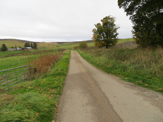
Images are sourced within 2km of 57.456453/-3.0012566 or Grid Reference NJ4041. Thanks to Geograph Open Source API. All images are credited.

Minor road near Auldyne Looking eastward.
Minor road near Auldyne
Looking eastward.
A920 towards Dufftown
Tips of Corsmaul The Tips of Corsmaul, at 410 metres, is the modest high point on the south side of the A920.
Tips of Corsmaul
The Tips of Corsmaul, at 410 metres, is the modest high point on the south side of the A920.
Moorland at Corsmaul The land south of the A920 here is mostly heather moor with occasional struggling Scots Pines. The 1:25,000 shows a feature and names it Corsmaul, but I did not find any sign of such a feature. There is a Corsmaul in the next square to the west, in the county of Banff, and a Corsmaul Croft in the nest square to the east, in the County of Aberdeen. These are the last few of several crofts collectively described as Corsmaul Crofts on the first edition of the Ordnance Survey six-inch series.
Moorland at Corsmaul
The land south of the A920 here is mostly heather moor with occasional struggling Scots Pines. The 1:25,000 shows a feature and names it Corsmaul, but I did not find any sign of such a feature. There is a Corsmaul in the next square to the west, in the county of Banff, and a Corsmaul Croft in the nest square to the east, in the County of Aberdeen. These are the last few of several crofts collectively described as Corsmaul Crofts on the first edition of the Ordnance Survey six-inch series.
Broken Fence This snow fence has evidently seen much better days. It was presumably intended to protect the A920, which is very exposed here at its highest point.
Broken Fence
This snow fence has evidently seen much better days. It was presumably intended to protect the A920, which is very exposed here at its highest point.
Sheals Looking from the A920 across the intervening moor to the abandoned buildings at Sheals, its land reverting to boggy grassland.
Sheals
Looking from the A920 across the intervening moor to the abandoned buildings at Sheals, its land reverting to boggy grassland.
A Scotch mist on Corsemaul moor Moray boundary near the summit of the A920 between Huntly and Dufftown; but it seems Big Red has reclaimed it for Historic Banffshire since my last visit in 2007. See <a href="https://www.geograph.org.uk/photo/379849">NJ3940 : Welcome to Moray</a>.
A Scotch mist on Corsemaul moor
Moray boundary near the summit of the A920 between Huntly and Dufftown; but it seems Big Red has reclaimed it for Historic Banffshire since my last visit in 2007. See NJ3940 : Welcome to Moray.
Minor road from the A920 towards Quarryhead Looking south-westward.
Minor road from the A920 towards Quarryhead
Looking south-westward.
Minor road near to the Daugh of Invermarkie Looking north-westward.
Minor road near to the Daugh of Invermarkie
Looking north-westward.
Minor road near to Myrieward Looking south-eastward.
Minor road near to Myrieward
Looking south-eastward.
Bodylair Trees A tree belt in the making by Wester Bodylair with Tom Mòr behind.
Bodylair Trees
A tree belt in the making by Wester Bodylair with Tom Mòr behind.
West by Bodylair The A920 by Bodylair heading west towards Dufftown.
West by Bodylair
The A920 by Bodylair heading west towards Dufftown.
Hill of Talnamounth Trig Point Flush Bracket S6952
A920 entering Moray with view of Ben Rinnes in the distance
Minor road at Midtown of Bellyhack Looking south-westward. Easter Corrie can be seen in the far distance.
Minor road at Midtown of Bellyhack
Looking south-westward. Easter Corrie can be seen in the far distance.
The minor metalled road ends at the deserted Wester Corrie Looking north-eastward.
The minor metalled road ends at the deserted Wester Corrie
Looking north-eastward.
Moorland near Corsemaul Looking N from position
Moorland near Corsemaul
Looking N from position
Show me another place!

Blackhillock is located at Grid Ref: NJ4041 (Lat: 57.456453, Lng: -3.0012566)

Unitary Authority: Aberdeenshire

Police Authority: North East

What 3 Words

///stumble.sharpened.saves. Near Dufftown, Moray

Nearby Locations

Blackhillock

Related Wikis

Glass, Aberdeenshire

Glass is a parish about 8 miles west of Huntly, Aberdeenshire, Scotland. It is now wholly located in Aberdeenshire but before the reorganisation of Scottish...

Drummuir

Drummuir (Scottish Gaelic: Druim Iubhair) is a small village in Scotland, in the traditional county of Banffshire, and in the Moray council area. It is...

Drummuir railway station

Drummuir railway station is a preserved station that serves the village of Drummuir, Moray, Scotland on the Keith and Dufftown Railway. The station also...

Blairmore School

Blairmore School was an independent boarding preparatory school in Glass near Huntly, Aberdeenshire until its closure in 1993. The site is now owned and...

Nearby Amenities

Located within 500m of 57.456453,-3.0012566
Natural: spring
Lat/Long: 57.4571385/-2.9964302
Croft of Aultnapaddock
Place: locality
Lat/Long: 57.4560907/-3.0053618
The data included in this document is from www.openstreetmap.org. The data is made available under ODbL.

Have you been to Blackhillock?

Leave your review of Blackhillock below (or comments, questions and feedback).