Bught Knowe

Hill, Mountain in Dumfriesshire

Scotland

Bught Knowe

Mosspaul on the A7 Labelled as a hotel on some scales of map, but fenced off and certainly not looking as if it is now a hotel. Some sources indicate that it is hostel or available to let. The hill in view is in Dumfries & Galloway.
Mosspaul on the A7 Credit: M J Richardson

The requested URL returned error: 429 Too Many Requests

If you have any feedback on the listing, please let us know in the comments section below.
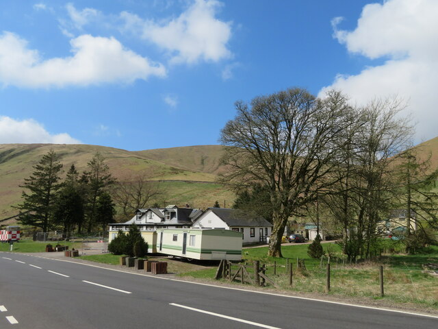
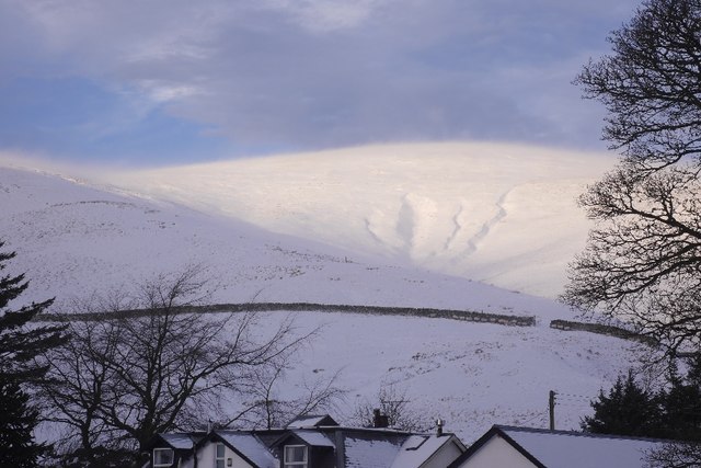
Bught Knowe Images

Images are sourced within 2km of 55.272361/-2.9502925 or Grid Reference NY3997. Thanks to Geograph Open Source API. All images are credited.

Mosspaul on the A7 Labelled as a hotel on some scales of map, but fenced off and certainly not looking as if it is now a hotel. Some sources indicate that it is hostel or available to let. The hill in view is in Dumfries & Galloway.
Mosspaul on the A7
Labelled as a hotel on some scales of map, but fenced off and certainly not looking as if it is now a hotel. Some sources indicate that it is hostel or available to let. The hill in view is in Dumfries & Galloway.
The A7 at Mosspaul With pylon and road monitoring cameras, clouds and the western slope of Dod Hill.
The A7 at Mosspaul
With pylon and road monitoring cameras, clouds and the western slope of Dod Hill.
A7 near Mosspaul
A7 near Mosspaul
A7 near Mosspaul
A7 near Mosspaul
Lay-by on the A7 near Eweslees
Autumn leaves at Burnfoot On the road from Hermitage towards the A7.
Autumn leaves at Burnfoot
On the road from Hermitage towards the A7.
Burnfoot Cottage
Burnfoot Cottage
The high road to Hermitage Castle
Glenrief On the Hermitage road out of Ewesdale.
Glenrief
On the Hermitage road out of Ewesdale.
View up Glen Reif Upper Ewes Water.
View up Glen Reif
Upper Ewes Water.
Carewoodrig Burn A headwater of the Ewes Water.
Carewoodrig Burn
A headwater of the Ewes Water.
Fiddleton The road from Hermitage Castle meets the A7.
Fiddleton
The road from Hermitage Castle meets the A7.
Field, Fiddleton The power line follows the A7 over the pass at Mosspaul to Teviotdale.
Field, Fiddleton
The power line follows the A7 over the pass at Mosspaul to Teviotdale.
A7, Ewes Water The Langholm to Carlisle road passes Fiddleton and the turn off for Hermitage Castle.  This is shortly before the short climb to the watershed at Mosspaul.
A7, Ewes Water
The Langholm to Carlisle road passes Fiddleton and the turn off for Hermitage Castle. This is shortly before the short climb to the watershed at Mosspaul.
A minor road off the A7 This view is from the cattle grid on the unnamed road off he A7 which is signposted The Hermitage 7 miles. In the seven miles we met just one car travelling in the opposite direction. A good job as passing places were few and far between.
A minor road off the A7
This view is from the cattle grid on the unnamed road off he A7 which is signposted The Hermitage 7 miles. In the seven miles we met just one car travelling in the opposite direction. A good job as passing places were few and far between.
Carewoodrig Burn
Carewoodrig Burn
Wisp Hill Above Mosspaul with a lot of spindrift blowing about.
Wisp Hill
Above Mosspaul with a lot of spindrift blowing about.
Former Tollhouse by the A7, Fiddleton Toll House by the A7, in parish of Ewes (Dumfries and Galloway District), Fiddleton Bar Tollhouse, Fiddleton.

HES Category B listed.
Reference: LB9770 <span class="nowrap"><a title="http://portal.historicenvironment.scot/designation/LB9770" rel="nofollow ugc noopener" href="http://portal.historicenvironment.scot/designation/LB9770">Link</a><img style="margin-left:2px;" alt="External link" title="External link - shift click to open in new window" src="https://s1.geograph.org.uk/img/external.png" width="10" height="10"/></span>

Surveyed

Milestone Society National ID: DG.EWE
Former Tollhouse by the A7, Fiddleton
Toll House by the A7, in parish of Ewes (Dumfries and Galloway District), Fiddleton Bar Tollhouse, Fiddleton. HES Category B listed. Reference: LB9770 LinkExternal link Surveyed Milestone Society National ID: DG.EWE
Show me another place!

Bught Knowe is located at Grid Ref: NY3997 (Lat: 55.272361, Lng: -2.9502925)

Unitary Authority: Dumfries and Galloway

Police Authority: Dumfries and Galloway

What 3 Words

///cooked.widest.airfields. Near Teviothead, Scottish Borders

Nearby Locations

Bught Knowe

Related Wikis

Unthank, Dumfries and Galloway

Unthank is a village in Dumfries and Galloway, Scotland. == References == The geographic coordinates are from the Ordnance Survey.

Cauldcleuch Head

Cauldcleuch Head is a hill in an unnamed range of Roxburghshire hills north of Langholm, part of the Southern Uplands of Scotland. The highest hill in...

River Teviot

The River Teviot (; Scottish Gaelic: Abhainn Tìbhiot), or Teviot Water, is a river of the Scottish Borders area of Scotland, and is the largest tributary...

Caerlanrig

Caerlanrig - also spelled 'Carlenrig' - (Gaelic: Cathair Lannraig) is a hamlet in the parish of Cavers, Borders, Scotland, lying on the River Teviot, 6...

Nearby Amenities

Located within 500m of 55.272361,-2.9502925
Created By: Merkaartor 0.12
Lat/Long: 55.2713169/-2.9571944
Created By: Merkaartor 0.12
Lat/Long: 55.2723988/-2.9566311
Created By: Merkaartor 0.12
Lat/Long: 55.273615/-2.9560786
Created By: Merkaartor 0.12
Lat/Long: 55.2739696/-2.9557245
Power: tower
Lat/Long: 55.2764489/-2.9518467
Power: tower
Lat/Long: 55.2731554/-2.9567353
Power: tower
Lat/Long: 55.2743552/-2.9549544
Bught Knowe
Ele: 395
Natural: peak
Lat/Long: 55.2727426/-2.9498209
The data included in this document is from www.openstreetmap.org. The data is made available under ODbL.

Have you been to Bught Knowe?

Leave your review of Bught Knowe below (or comments, questions and feedback).