Bracken How

Hill, Mountain in Cumberland Eden

England

Bracken How

Dead tree near Groove Gill Dead tree near Groove Gill.
Dead tree near Groove Gill Credit: Colin Kinnear

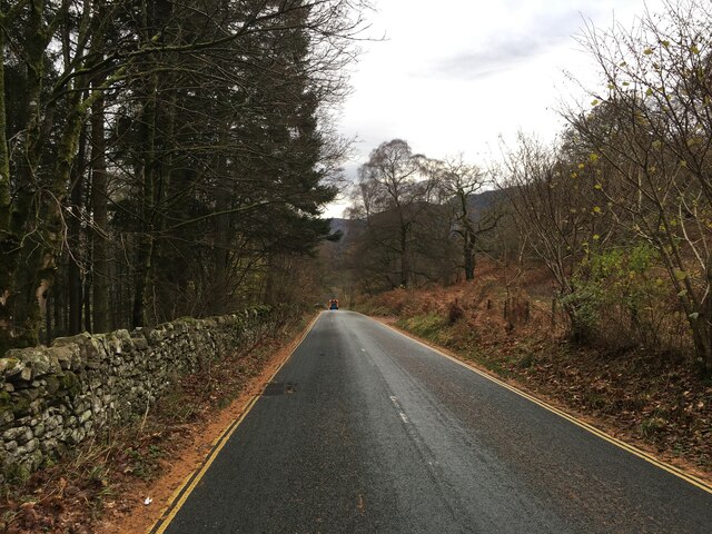
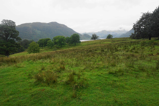
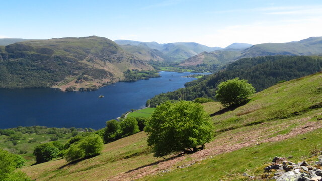
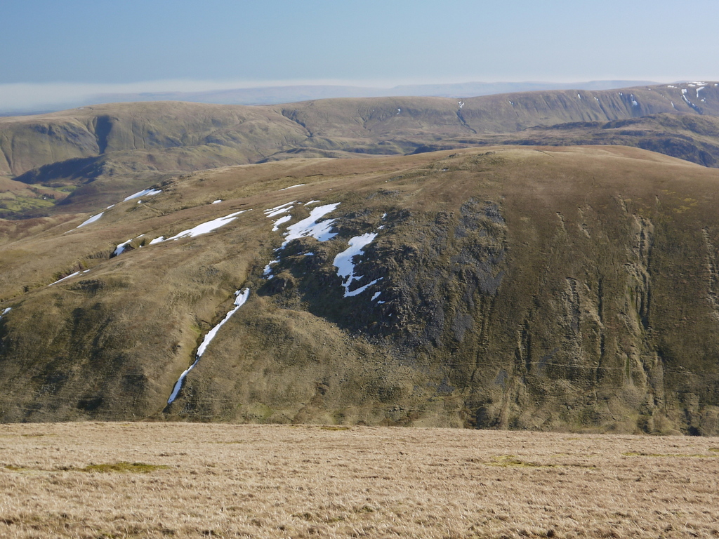
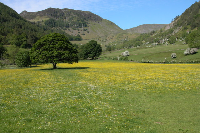
Bracken How is a prominent hill located in Cumberland, a historic county in the northwest of England. Rising to an elevation of approximately 520 meters (1,706 feet), it is classified as a hill rather than a mountain. Bracken How is situated within the Lake District National Park, a renowned area of natural beauty.

The hill is known for its distinctive shape, featuring steep slopes covered in bracken, a fern-like plant that gives the hill its name. Bracken How offers breathtaking panoramic views of the surrounding countryside, including the picturesque valleys, rolling hills, and glistening lakes that define the Lake District.

Its location within the national park makes Bracken How a popular destination for outdoor enthusiasts and nature lovers alike. The hill provides various opportunities for hiking and walking trails, allowing visitors to explore the diverse flora and fauna of the region. The surrounding area is also home to rare wildlife species, such as red deer and golden eagles, adding to the allure of Bracken How.

With its tranquil atmosphere and stunning vistas, Bracken How offers a peaceful retreat for those seeking solace in nature. Whether it's a leisurely stroll or a more challenging hike, visitors to Bracken How can immerse themselves in the beauty of the Lake District and experience the enchanting allure of this captivating hill.

If you have any feedback on the listing, please let us know in the comments section below.
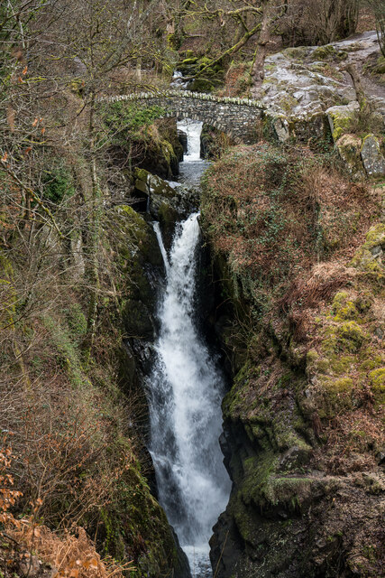
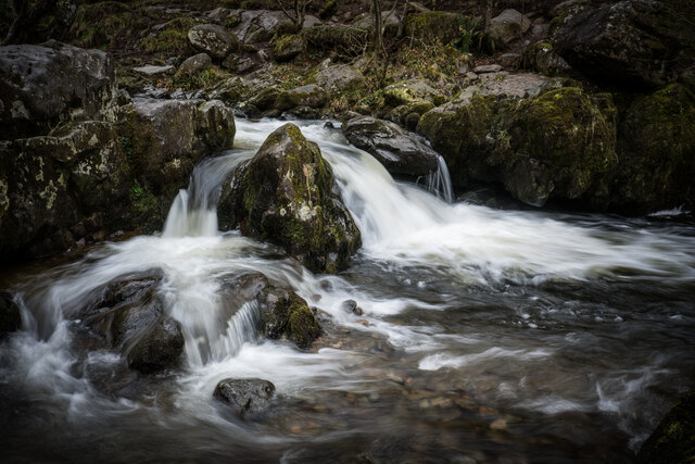
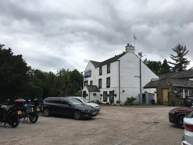
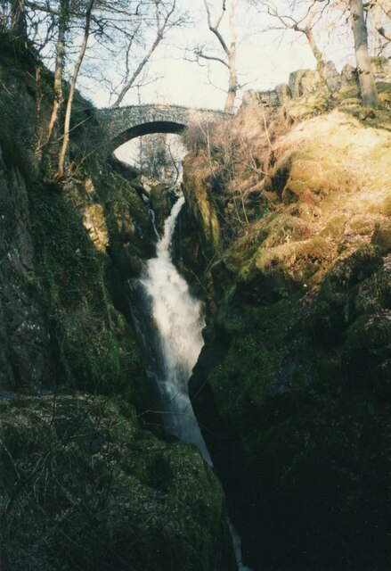
Bracken How Images

Images are sourced within 2km of 54.581118/-2.9406461 or Grid Reference NY3921. Thanks to Geograph Open Source API. All images are credited.

Dead tree near Groove Gill Dead tree near Groove Gill.
Dead tree near Groove Gill
Dead tree near Groove Gill.
Aira Force Aira Force is a waterfall where Aira Beck plunges an impressive 65 feet down a rocky ravine approximately one kilometre before it reaches Ullswater. 

Aira Force lies on land owned by the National Trust. The Trust purchased the 750 acre Gowbarrow Park (on which the force lies) in 1906 and has provided facilities, such as car parking, disabled access, graded paths, and viewing platforms which have contributed towards making Aira Force one of the most famous and most visited waterfalls in the Lake District.

A small arched bridge spans the stream just as the beck goes over the falls giving a spectacular view from the top as the water makes its leap. There is also a second bridge at the foot of the falls.

<span class="nowrap"><a title="http://www.nationaltrust.org.uk/aira-force-and-ullswater/" rel="nofollow ugc noopener" href="http://www.nationaltrust.org.uk/aira-force-and-ullswater/">Link</a><img style="margin-left:2px;" alt="External link" title="External link - shift click to open in new window" src="https://s1.geograph.org.uk/img/external.png" width="10" height="10"/></span>   Aira Force and Ullswater Visitor Information (National Trust)
Aira Force
Aira Force is a waterfall where Aira Beck plunges an impressive 65 feet down a rocky ravine approximately one kilometre before it reaches Ullswater. Aira Force lies on land owned by the National Trust. The Trust purchased the 750 acre Gowbarrow Park (on which the force lies) in 1906 and has provided facilities, such as car parking, disabled access, graded paths, and viewing platforms which have contributed towards making Aira Force one of the most famous and most visited waterfalls in the Lake District. A small arched bridge spans the stream just as the beck goes over the falls giving a spectacular view from the top as the water makes its leap. There is also a second bridge at the foot of the falls. LinkExternal link Aira Force and Ullswater Visitor Information (National Trust)
Footbridge above Aira Force This footbridge, spanning the top of Aira Force, provides a dramatic view of the waterfall.
Footbridge above Aira Force
This footbridge, spanning the top of Aira Force, provides a dramatic view of the waterfall.
A5091 near Matterdale
A5091 towards Ullswater
Artist Studio at Dockray
Dockray - Royal Hotel
Grazing land above Aira Beck There is a view down to Ullswater. Place Fell is to the left but the foothills of Helvellyn are hidden by low cloud.
Grazing land above Aira Beck
There is a view down to Ullswater. Place Fell is to the left but the foothills of Helvellyn are hidden by low cloud.
Aira Force The path which goes below the waterfall has been closed due to subsidence, so this is the best view you can currently get of Aira Force.
Aira Force
The path which goes below the waterfall has been closed due to subsidence, so this is the best view you can currently get of Aira Force.
Path to Park Brow The path gives access from the A5091 to the waterfalls on Aira Beck. Round How is in the background.
Path to Park Brow
The path gives access from the A5091 to the waterfalls on Aira Beck. Round How is in the background.
Aira Beck Looking downstream above High Force. The beck descends several waterfalls on its way to Ullswater.
Aira Beck
Looking downstream above High Force. The beck descends several waterfalls on its way to Ullswater.
Aira Force Waterfall, Dockray, Cumbria
Aira Beck Cascades
Aira Beck Cascades
Royal Hotel, Dockray
Ruined building near Dowthwaitehead
Minor road towards Dockray
Aira Force One of the better known waterfalls in northern England, and not a long walk from the lakeside.
Aira Force
One of the better known waterfalls in northern England, and not a long walk from the lakeside.
Hill slope at Spying How with view towards Ullswater
Show me another place!

Bracken How is located at Grid Ref: NY3921 (Lat: 54.581118, Lng: -2.9406461)

Administrative County: Cumbria

District: Eden

Police Authority: Cumbria

What 3 Words

///wriggle.overlaps.trouble. Near Keswick, Cumbria

Related Wikis

Dockray, Eden

Dockray (traditionally Dockwray) is a village in the civil parish of Matterdale, in the Eden district, in the county of Cumbria, England. In the 2011 census...
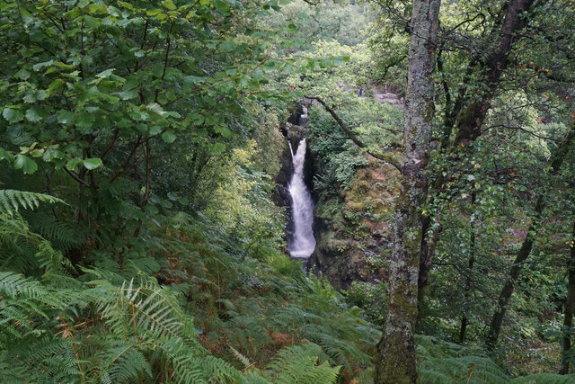
Aira Force

Aira Force is a waterfall in the English Lake District, in the civil parish of Matterdale and the county of Cumbria. The site of the waterfall is owned...

Gowbarrow Fell

Gowbarrow Fell (Windy hill) is a low fell in the English Lake District. It is an outlier of the Eastern Fells, standing to the north of Ullswater, bounded...

Ulcat Row

Ulcat Row (also Ulcatrow) is a village in the civil parish of Matterdale, in the Eden district, in the county of Cumbria, England. In the 2011 census,...

Hart Side

Hart Side (the hill side frequented by harts) is a subsidiary top on one of the east ridges of Stybarrow Dodd, which is a mountain (or fell) in the English...

Glenridding Dodd

Glenridding Dodd (the rounded hill above Glenridding) is a small fell in the English Lake District, at the end of a ridge descending from the Helvellyn...

Sheffield Pike

Sheffield Pike (possibly meaning "the peak above the sheep fold") is a fell in the English Lake District, a prominent intermediate top on one of the eastern...
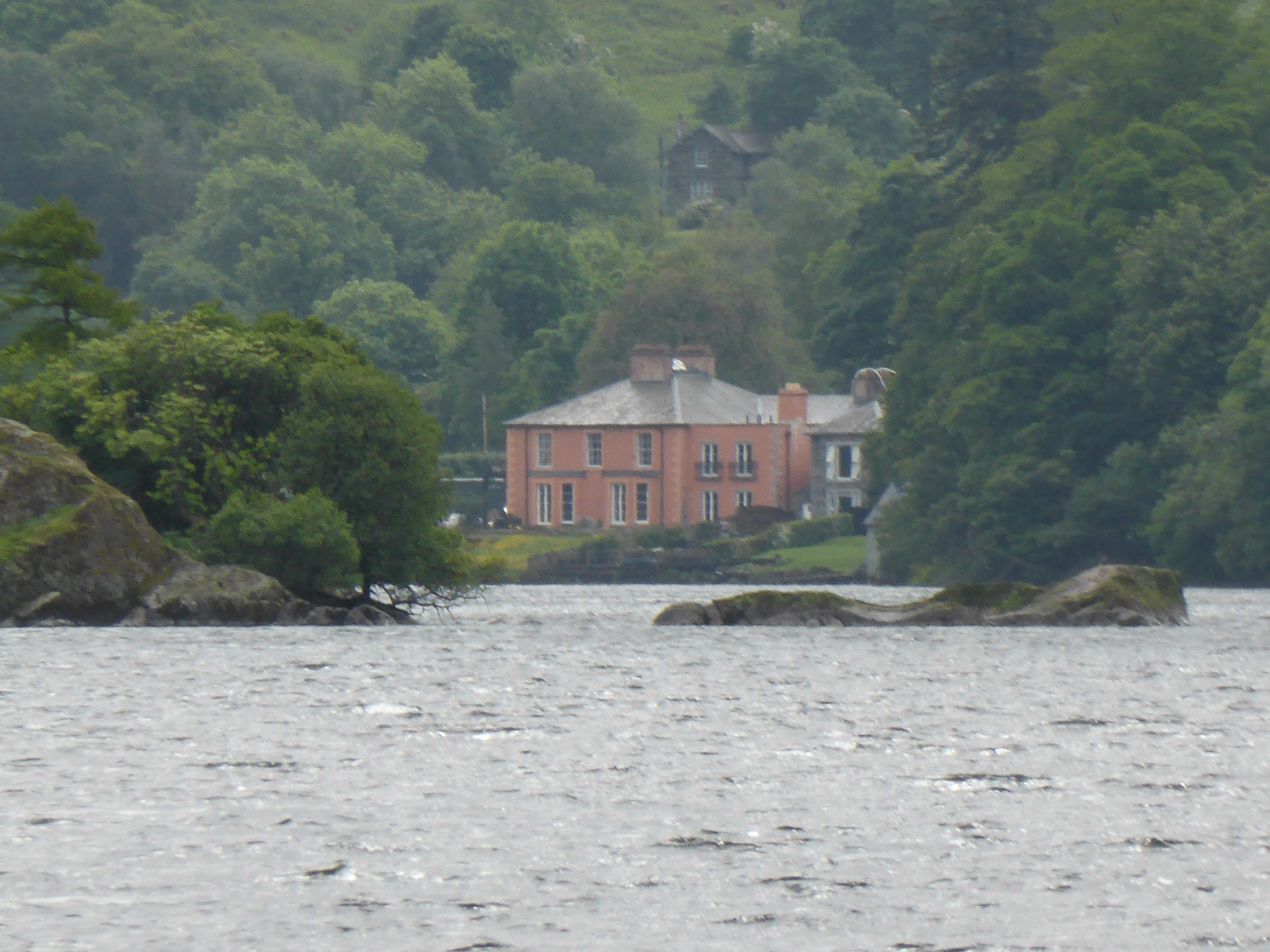
Glenridding House

Glenridding House is a Regency era building in Glenridding on Ullswater, constructed between 1807 and 1814. It was a private summer villa until about 1860...

Nearby Amenities

Located within 500m of 54.581118,-2.9406461
Round How
Place: locality
Lat/Long: 54.5791881/-2.942132
Bracken How
Place: locality
Lat/Long: 54.5819613/-2.9411235
Brunt Crag
Place: locality
Lat/Long: 54.5805108/-2.9356105
Bench
Backrest: yes
Lat/Long: 54.5816639/-2.9347319
Glencoyne Park
Place: locality
Lat/Long: 54.5796968/-2.9364688
Barrier: stile
Material: wood
Stile: stepover
Lat/Long: 54.581464/-2.9354315
Power: pole
Lat/Long: 54.5836914/-2.9349754
The data included in this document is from www.openstreetmap.org. The data is made available under ODbL.

Have you been to Bracken How?

Leave your review of Bracken How below (or comments, questions and feedback).