Bad na Beinne

Hill, Mountain in Aberdeenshire

Scotland

Bad na Beinne

Morven Summit View south-east towards Loch Davan from the top of 872m high Morven.
<span class="nowrap"><a title="www.royal-deeside.org.uk" rel="nofollow ugc noopener" href="http://www.royal-deeside.org.uk">Link</a><img style="margin-left:2px;" alt="External link" title="External link - shift click to open in new window" src="https://s1.geograph.org.uk/img/external.png" width="10" height="10"/></span>
Morven Summit Credit: Colin Smith

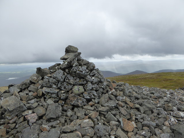
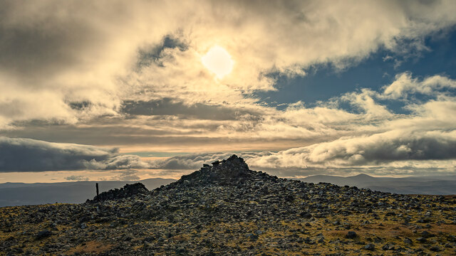
Bad na Beinne, located in Aberdeenshire, Scotland, is a prominent hill/mountain standing at an elevation of approximately 1,268 feet (386 meters) above sea level. Situated within the Cairngorms National Park, it offers stunning panoramic views of the surrounding area.

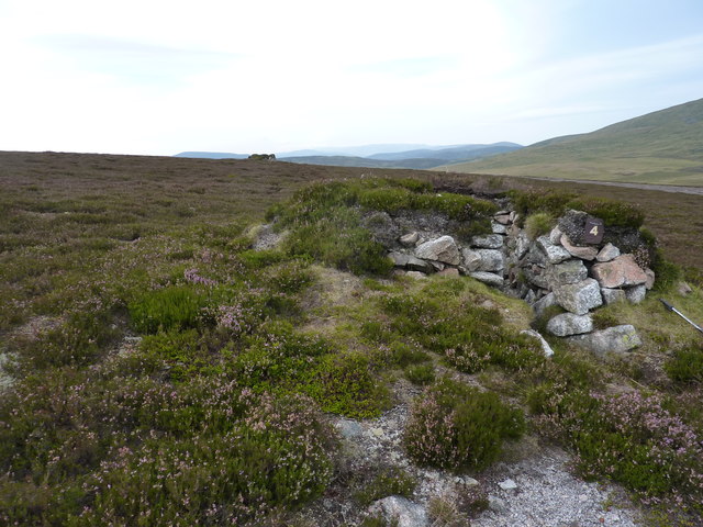
The hill/mountain is characterized by its rugged and rocky terrain, covered in heather and grasses. It is part of a range of hills known as the Eastern Cairngorms, which are renowned for their wild and untouched landscapes.

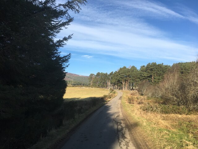
Bad na Beinne is a popular destination for hikers, mountaineers, and nature enthusiasts alike. There are several well-marked trails leading to the summit, varying in difficulty, allowing visitors of different fitness levels to enjoy the climb. The ascent offers a challenging but rewarding experience, with breathtaking vistas of the Cairngorms, including the neighboring peaks of Lochnagar and Mount Keen.

The hill/mountain also boasts a diverse range of wildlife and plant species. It serves as a habitat for various bird species, including golden eagles, peregrine falcons, and ptarmigans. Red deer and mountain hares can often be spotted in the area, adding to the natural beauty and appeal of Bad na Beinne.

In addition to its natural splendor, Bad na Beinne holds historical significance as well. The hill/mountain has been a source of inspiration for artists and writers throughout the years, capturing its allure and mystique in various works of art and literature.

Overall, Bad na Beinne offers a unique and awe-inspiring experience for visitors, combining natural beauty, outdoor activities, and a glimpse into Scotland's rich cultural and historical heritage.

If you have any feedback on the listing, please let us know in the comments section below.

Bad na Beinne Images

Images are sourced within 2km of 57.120744/-3.0045816 or Grid Reference NJ3903. Thanks to Geograph Open Source API. All images are credited.

Morven Summit View south-east towards Loch Davan from the top of 872m high Morven.
<span class="nowrap"><a title="www.royal-deeside.org.uk" rel="nofollow ugc noopener" href="http://www.royal-deeside.org.uk">Link</a><img style="margin-left:2px;" alt="External link" title="External link - shift click to open in new window" src="https://s1.geograph.org.uk/img/external.png" width="10" height="10"/></span>
Morven Summit
View south-east towards Loch Davan from the top of 872m high Morven. LinkExternal link
Lochnagar from Morven Looking south-westwards from the summit of Morven, over the Dee Valley, to lofty Lochnagar (a Munro).
<span class="nowrap"><a title="www.royal-deeside.org.uk" rel="nofollow ugc noopener" href="http://www.royal-deeside.org.uk">Link</a><img style="margin-left:2px;" alt="External link" title="External link - shift click to open in new window" src="https://s1.geograph.org.uk/img/external.png" width="10" height="10"/></span>
Lochnagar from Morven
Looking south-westwards from the summit of Morven, over the Dee Valley, to lofty Lochnagar (a Munro). LinkExternal link
Estate track on the moor A very wide ( 10 or 11 feet ) conspicuous track heading west from Redburn, up and through the moor. In the background is Morven.
Estate track on the moor
A very wide ( 10 or 11 feet ) conspicuous track heading west from Redburn, up and through the moor. In the background is Morven.
Shooting butts on the grouse moor But I didn't hear a grouse cackling all day.
Shooting butts on the grouse moor
But I didn't hear a grouse cackling all day.
Morven from Geallaig Hill A brindled landscape across the lower slopes of Morven resulting from muirburn - seasonal burning of patches of heather moorland as a means of habitat management for grouse. Towards the summit the underlying rock changes, the soil does not support heather and the muirburn stops.
Morven from Geallaig Hill
A brindled landscape across the lower slopes of Morven resulting from muirburn - seasonal burning of patches of heather moorland as a means of habitat management for grouse. Towards the summit the underlying rock changes, the soil does not support heather and the muirburn stops.
Boggy pool on Morven On a flat area at just over 600 metres above sea level.
Boggy pool on Morven
On a flat area at just over 600 metres above sea level.
Hillside below Mid Cairn, Morven A patch of mossy, stony hillside, and a view towards Crannach Hill and Culblean Hill, in shadow.
Hillside below Mid Cairn, Morven
A patch of mossy, stony hillside, and a view towards Crannach Hill and Culblean Hill, in shadow.
Mid Cairn, Morven A navigational aid on the way to Morven's summit.
Mid Cairn, Morven
A navigational aid on the way to Morven's summit.
Summit cairn, Morven The cairn takes Morven (name derived from mor bheinn - 'big hill' in Gaelic) to a height of 872 metres above sea level.
Summit cairn, Morven
The cairn takes Morven (name derived from mor bheinn - 'big hill' in Gaelic) to a height of 872 metres above sea level.
Eastern slope of Morven looking towards Little Cairn
Morven A very long telephoto view of Morven, near Aboyne in Deeside.
Morven
A very long telephoto view of Morven, near Aboyne in Deeside.
Rough path towards Morven
Path towards Mid Cairn of Morven
Towards the summit of Morven
Trig point on Morven
Summit plateau of Morven
Summit of Morvan The Corbetts are peaks in Scotland that are between 2,500 and 3,000 feet (762.0 and 914.4 m) high with a prominence of at least 500 feet (152.4 m)
Summit of Morvan
The Corbetts are peaks in Scotland that are between 2,500 and 3,000 feet (762.0 and 914.4 m) high with a prominence of at least 500 feet (152.4 m)
Minor road towards Groddie
Show me another place!

Bad na Beinne is located at Grid Ref: NJ3903 (Lat: 57.120744, Lng: -3.0045816)

Unitary Authority: Aberdeenshire

Police Authority: North East

What 3 Words

///star.downturn.worms. Near Ballater, Aberdeenshire

Nearby Locations

Bad na Beinne

Related Wikis

Morven, Aberdeenshire

Morven (Scottish Gaelic: A' Mhòr Bheinn) is a Corbett in Aberdeenshire, Scotland. It is 871 m (2858 ft) high. The poet, Lord Byron, who spent some of his...

Blue cairn circle

Blue cairn circle is a 21 metres (69 ft) diameter stone circle in Aberdeenshire, Scotland. In the center is a large stone cairn with several pits in it...

Logie Coldstone

Logie Coldstone (Scottish Gaelic: Lògaidh) is a village in Aberdeenshire, Scotland. The village lies north of the River Dee, near Tarland in the Cromar...

Blelack

Blelack (, Scottish Gaelic: Blàth Bholg) is a place in Aberdeenshire, Scotland, the location of Blelack House, a Scottish mansion house with origins in...

Nearby Amenities

Located within 500m of 57.120744,-3.0045816
Hunting Stand
Lat/Long: 57.1244366/-3.0084146
Hunting Stand
Lat/Long: 57.1242516/-3.0078682
Hunting Stand
Lat/Long: 57.1240564/-3.0072985
Hunting Stand
Lat/Long: 57.1238232/-3.0066027
Hunting Stand
Lat/Long: 57.1236254/-3.0060142
Hunting Stand
Lat/Long: 57.1233961/-3.0052748
The data included in this document is from www.openstreetmap.org. The data is made available under ODbL.

Have you been to Bad na Beinne?

Leave your review of Bad na Beinne below (or comments, questions and feedback).