Blairlick Hill

Hill, Mountain in Aberdeenshire

Scotland

Blairlick Hill

Moorland bog Featureless, other than to note that this was a particularly boggy stretch.
Moorland bog Credit: Peter Aikman

Blairlick Hill is a prominent hill located in Aberdeenshire, Scotland. It is situated near the village of Lumphanan and is part of the picturesque and expansive Cairngorms National Park. Standing at an elevation of approximately 481 meters (1,578 feet), Blairlick Hill offers breathtaking panoramic views of the surrounding countryside.

The hill is easily accessible by foot, with several walking trails leading up to its summit. The most popular route starts from Lumphanan and takes hikers through a mixture of woodland and open moorland. Along the way, visitors can enjoy the diverse flora and fauna that inhabit the area, including heather, wildflowers, and various bird species.

At the top of Blairlick Hill, there is a cairn that marks the highest point. This provides a perfect spot for hikers to rest, take in the stunning vistas, and capture memorable photographs. On clear days, one can see the rolling hills, meandering rivers, and distant mountains that make up the Aberdeenshire landscape.

Blairlick Hill also holds historical significance. It is believed to have been a site of ancient settlements, with archaeological evidence suggesting human habitation dating back thousands of years. Today, visitors can explore the remnants of stone circles and other prehistoric structures scattered across the hillside.

Overall, Blairlick Hill is a must-visit destination for nature lovers, outdoor enthusiasts, and history buffs alike. Its natural beauty, accessibility, and historical significance make it a popular attraction in Aberdeenshire.

If you have any feedback on the listing, please let us know in the comments section below.

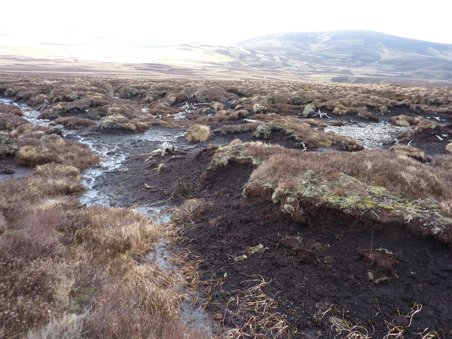
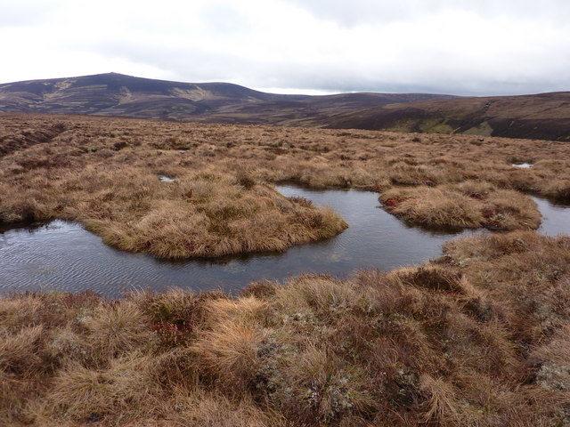
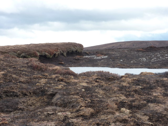
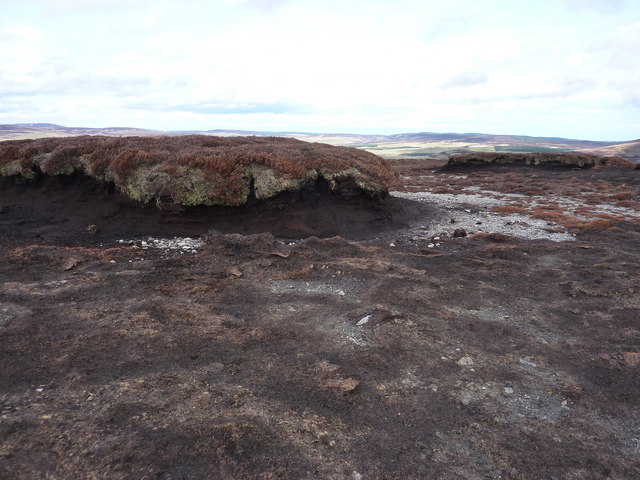
Blairlick Hill Images

Images are sourced within 2km of 57.290682/-3.0149831 or Grid Reference NJ3822. Thanks to Geograph Open Source API. All images are credited.

Moorland bog Featureless, other than to note that this was a particularly boggy stretch.
Moorland bog
Featureless, other than to note that this was a particularly boggy stretch.
Peat haggs in the moorland As the haggs are eroded, the old roots of a long-lost forest are exposed
Peat haggs in the moorland
As the haggs are eroded, the old roots of a long-lost forest are exposed
Moorland with an ancient drain There are many such drains cut a long time ago to try and drain the moor
Moorland with an ancient drain
There are many such drains cut a long time ago to try and drain the moor
A pond in the bog on the moor In the distance - The Buck of the Cabrach
A pond in the bog on the moor
In the distance - The Buck of the Cabrach
Moorland on western slopes of Sand Hill
The top of Sand Hill The patch of grass and heather overhanging the peat hagg is the summit of Sand Hill
The top of Sand Hill
The patch of grass and heather overhanging the peat hagg is the summit of Sand Hill
The peat hagg at the top of Sand Hill
Gale making waves on a small pond in the bog near the top of Sand Hill It was blowing a gale most of the day
Gale making waves on a small pond in the bog near the top of Sand Hill
It was blowing a gale most of the day
Moorland to the south-east of Sand Hill
Burn of Eastlewie One of the many small burns feeding the Allt Deveron.
Burn of Eastlewie
One of the many small burns feeding the Allt Deveron.
Moorland east of Sand Hill Through it runs a small burn - the Burn of Eastlewie
Moorland east of Sand Hill
Through it runs a small burn - the Burn of Eastlewie
Looking over the moor to the north of Dun Mount In the dip the Burn of Eastlewie joins the Burn of Cross
Looking over the moor to the north of Dun Mount
In the dip the Burn of Eastlewie joins the Burn of Cross
Looking over the moor towards the Burn of Cross
This tiny burn is carving out a valley in the boulder clay
Burn draining the moor to the west of Mount Meddin The erosion is revealing the rocks in the boulder clay
Burn draining the moor to the west of Mount Meddin
The erosion is revealing the rocks in the boulder clay
Looking between Mount Meddin and Kebbuck Knowe
Moorland and the valley of the Burn of Cookies-shiel Beyond the burn are the lower slopes of Kebbuck Knowe, an outlier of The Buck
Moorland and the valley of the Burn of Cookies-shiel
Beyond the burn are the lower slopes of Kebbuck Knowe, an outlier of The Buck
Moorland and the valleys of the Burn of Cookies-shiel and the Burn of  Blaidsaughs In the background, The Buck of the Cabrach
Moorland and the valleys of the Burn of Cookies-shiel and the Burn of Blaidsaughs
In the background, The Buck of the Cabrach
Show me another place!

Blairlick Hill is located at Grid Ref: NJ3822 (Lat: 57.290682, Lng: -3.0149831)

Unitary Authority: Moray

Police Authority: North East

What 3 Words

///vowel.guides.upholding. Near Dufftown, Moray

Nearby Locations

Blairlick Hill

Related Wikis

Cabrach

The Cabrach (Scottish Gaelic: A' Chabrach, A' Chabraich) is an estate and largely depopulated rural community in Moray, Scotland. The meaning of the name...

Clashindarroch Forest

Clashindarroch Forest is possibly the largest forest in Aberdeenshire, situated to the south-west of the market town of Huntly. Managed by Forest Enterprise...

Peatfold Burn

Peatfold Burn is a burn which marks the boundary of the parish of Huntly, Aberdeenshire, Scotland. == References ==

Badenyon Castle

Badenyon Castle was a castle, dating from the 13th century around 7.5 miles (12.1 km) west of Kildrummy, north of Coulins Burn, in Aberdeenshire, Scotland...

Nearby Amenities

Located within 500m of 57.290682,-3.0149831
Ford: yes
Lat/Long: 57.2902972/-3.0082553
The data included in this document is from www.openstreetmap.org. The data is made available under ODbL.

Have you been to Blairlick Hill?

Leave your review of Blairlick Hill below (or comments, questions and feedback).