Little Eycott Hill

Hill, Mountain in Cumberland Eden

England

Little Eycott Hill

Field and boundary of Greystoke Forest
Field and boundary of Greystoke Forest Credit: Steven Brown

Little Eycott Hill is a prominent hill located in the county of Cumberland, England. Situated within the Lake District National Park, it forms part of the expansive landscape that has earned this region its status as a UNESCO World Heritage Site. While not classified as a mountain due to its lower elevation, Little Eycott Hill showcases beautiful scenic views and offers a popular hiking destination for outdoor enthusiasts.

Standing at approximately 427 meters (1,400 feet) above sea level, the hill is characterized by its gentle slopes and lush green vegetation, which is abundant in the area. It is predominantly covered in heather moorland, interspersed with patches of woodland and rocky outcrops. The hill is also home to a diverse range of wildlife, including various bird species, such as curlews and skylarks, as well as red deer and rare butterflies.

Little Eycott Hill is easily accessible, with several well-marked footpaths leading to its summit. The ascent provides a rewarding experience for walkers, who can enjoy the panoramic views of the surrounding countryside, including nearby fells and valleys. On clear days, it is even possible to catch glimpses of the famous Scafell Pike, the highest peak in England.

The hill is managed by the Lake District National Park Authority, which works to preserve its natural beauty and protect its ecological significance. Visitors are encouraged to respect the environment and adhere to the designated trails to minimize any negative impact on the delicate ecosystem.

If you have any feedback on the listing, please let us know in the comments section below.

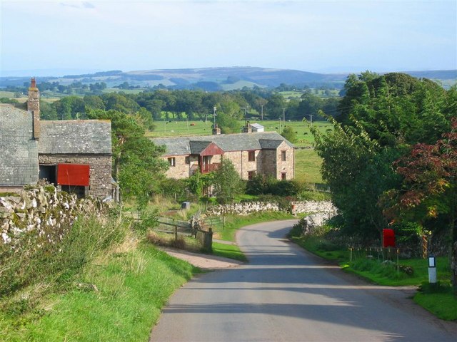
Little Eycott Hill Images

Images are sourced within 2km of 54.662092/-2.9544847 or Grid Reference NY3830. Thanks to Geograph Open Source API. All images are credited.
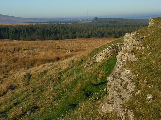
Field and boundary of Greystoke Forest
Farm track near Greystoke Forest
Outcrops of limestone on Highbanks [Murrah Hill] Highbanks and Murrah Hill are names which do not appear on OS maps and have been created perhaps as the hill feature qualifies as a TuMP - a hill with at least 30 metres or more prominence. There are several surface outcrops of limestone on the hill, almost in the form of pavement; this is one of the examples. There's surely a rogue boulder perched beside the outcrop, presumably an erratic.
The distant trees seen through thin mist are in the Greystoke Forest.
Outcrops of limestone on Highbanks [Murrah Hill]
Highbanks and Murrah Hill are names which do not appear on OS maps and have been created perhaps as the hill feature qualifies as a TuMP - a hill with at least 30 metres or more prominence. There are several surface outcrops of limestone on the hill, almost in the form of pavement; this is one of the examples. There's surely a rogue boulder perched beside the outcrop, presumably an erratic. The distant trees seen through thin mist are in the Greystoke Forest.
Limestone outcrops, Berrier Hill Two parallel outcrops cross Berrier Hill which is rough pasture beside Greystoke Forest. In the distance you can just make out the two Caldbeck transmitters.
Limestone outcrops, Berrier Hill
Two parallel outcrops cross Berrier Hill which is rough pasture beside Greystoke Forest. In the distance you can just make out the two Caldbeck transmitters.
Greystoke Forest A view across the extensive forestry to Carrock Fell from Berrier Hill.
Greystoke Forest
A view across the extensive forestry to Carrock Fell from Berrier Hill.
Rally car in south Greystoke Barry Lindsay on the Greystoke Stages 2014 in the south of the forest
Rally car in south Greystoke
Barry Lindsay on the Greystoke Stages 2014 in the south of the forest
The fields of Mungrisdale The grass crop is being harvested on the flat pastures east of the village as seen from the north east ridge of Souther Fell.
The fields of Mungrisdale
The grass crop is being harvested on the flat pastures east of the village as seen from the north east ridge of Souther Fell.
Fields at Low Murrah
Cow Snout Wood
Cow Snout Wood
Little Eycott Hill Little Eycott Hill is the modest rise on the far side of the field, not one of the higher hills in the distance (Great Dodd and Clough Head). However it is described by Bill Birkett in his "Complete Lakeland Fells", and so must be visited by those walkers collecting the 'Birketts'.
Little Eycott Hill
Little Eycott Hill is the modest rise on the far side of the field, not one of the higher hills in the distance (Great Dodd and Clough Head). However it is described by Bill Birkett in his "Complete Lakeland Fells", and so must be visited by those walkers collecting the 'Birketts'.
Fields and woods near Eycott Hill
The summit of Little Eycott Hill This modest hill has three distinct tops, but I think that this one (the most northerly) is just the highest.
The summit of Little Eycott Hill
This modest hill has three distinct tops, but I think that this one (the most northerly) is just the highest.
Field with trees north-west of Berrier A field with the groove of a minor stream beyond which lies rougher ground with rocky knolls. The mountains more distant are Blencathra, Bannerdale Crags and Souther Fell.
Field with trees north-west of Berrier
A field with the groove of a minor stream beyond which lies rougher ground with rocky knolls. The mountains more distant are Blencathra, Bannerdale Crags and Souther Fell.
On Murrah Hill
On Murrah Hill
Sheep and snowed moorland near Eycott Hill Eycott Hill is a small area of moorland rising to no more than 350 m. close to Berrier just inside the north-eastern edge of the Lake District National Park.
Sheep and snowed moorland near Eycott Hill
Eycott Hill is a small area of moorland rising to no more than 350 m. close to Berrier just inside the north-eastern edge of the Lake District National Park.
Cow Snout Wood Cow Snout Wood appears to be part of the larger Greystoke Forest - it's at least adjacent to it; the view is from a minor road to the south.
Cow Snout Wood
Cow Snout Wood appears to be part of the larger Greystoke Forest - it's at least adjacent to it; the view is from a minor road to the south.
Moorland with rushes Little Eycott Hill lies beyond the foreground rushes in this location east of Mungrisdale and near the north-eastern edge of the Lake District National Park.
Moorland with rushes
Little Eycott Hill lies beyond the foreground rushes in this location east of Mungrisdale and near the north-eastern edge of the Lake District National Park.
Rock outcrop near to farm road The rocks lie close to a road crossing access land north of Eycott Hill. Carrock Fell lies in the distance.
Rock outcrop near to farm road
The rocks lie close to a road crossing access land north of Eycott Hill. Carrock Fell lies in the distance.
Show me another place!

Little Eycott Hill is located at Grid Ref: NY3830 (Lat: 54.662092, Lng: -2.9544847)

Administrative County: Cumbria

District: Eden

Police Authority: Cumbria

What 3 Words

///riverboat.reach.loving. Near Penrith, Cumbria

Related Wikis

Nearby Amenities

Located within 500m of 54.662092,-2.9544847
Fairy Knott
Is In: Cumbria
Place: locality
Lat/Long: 54.6654407/-2.9580874
Little Eycott Hill
Natural: peak
Lat/Long: 54.6618761/-2.9549537
Ford: yes
Lat/Long: 54.659297/-2.9527597
The data included in this document is from www.openstreetmap.org. The data is made available under ODbL.

Have you been to Little Eycott Hill?

Leave your review of Little Eycott Hill below (or comments, questions and feedback).