Birks

Hill, Mountain in Westmorland Eden

England

Birks

Glenamara Park
Glenamara Park Credit: Anthony Foster

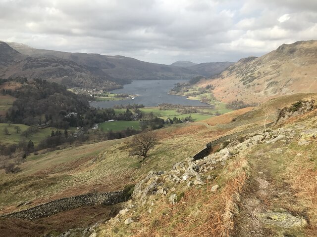
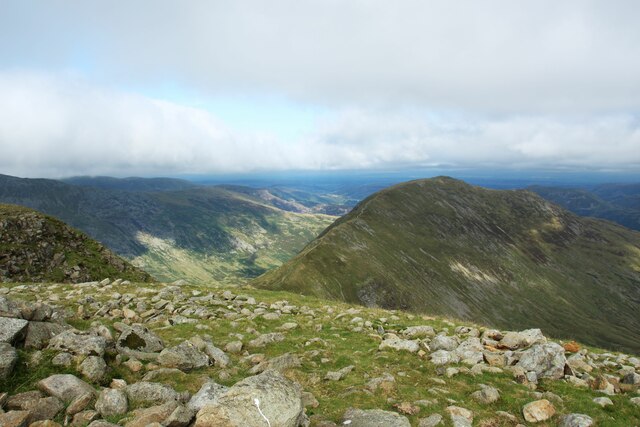
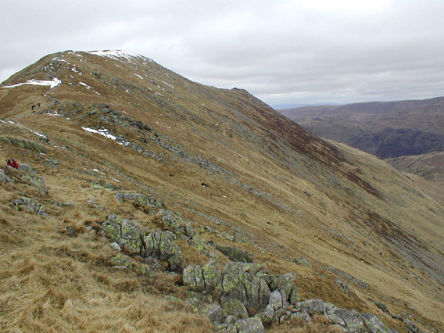
Birks is a hill located in Westmorland, a historic county in the northwestern region of England. Situated within the Lake District National Park, Birks is a prominent mountain that offers stunning panoramic views of the surrounding landscapes.

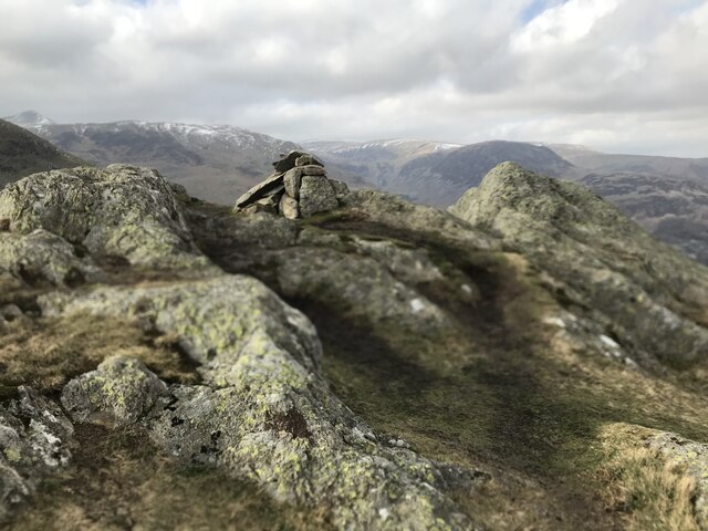
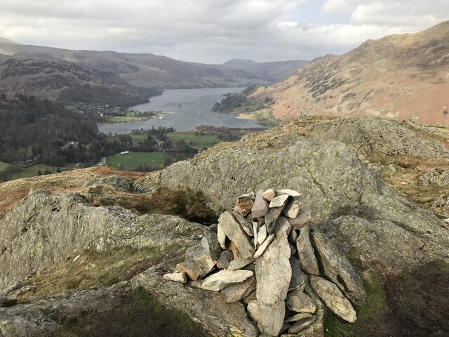
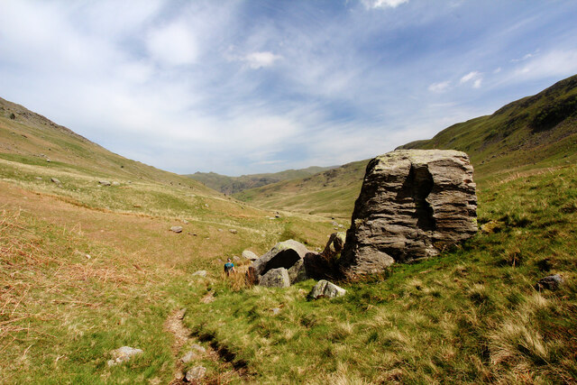
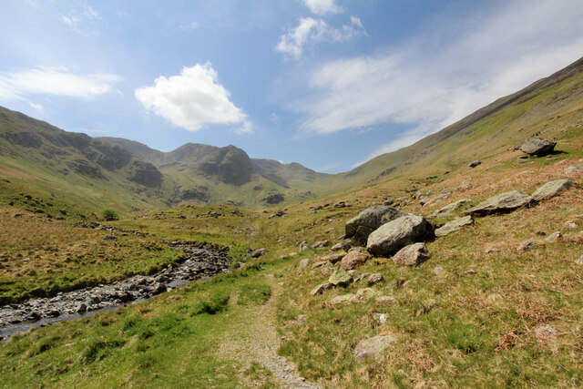
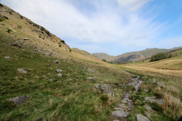
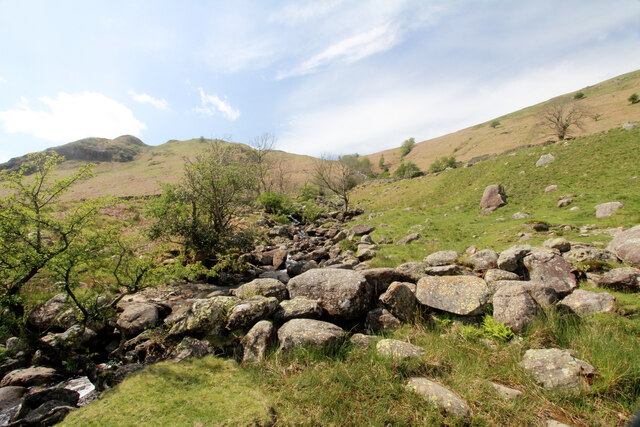
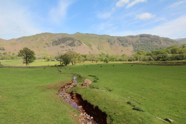
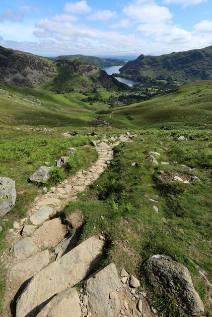
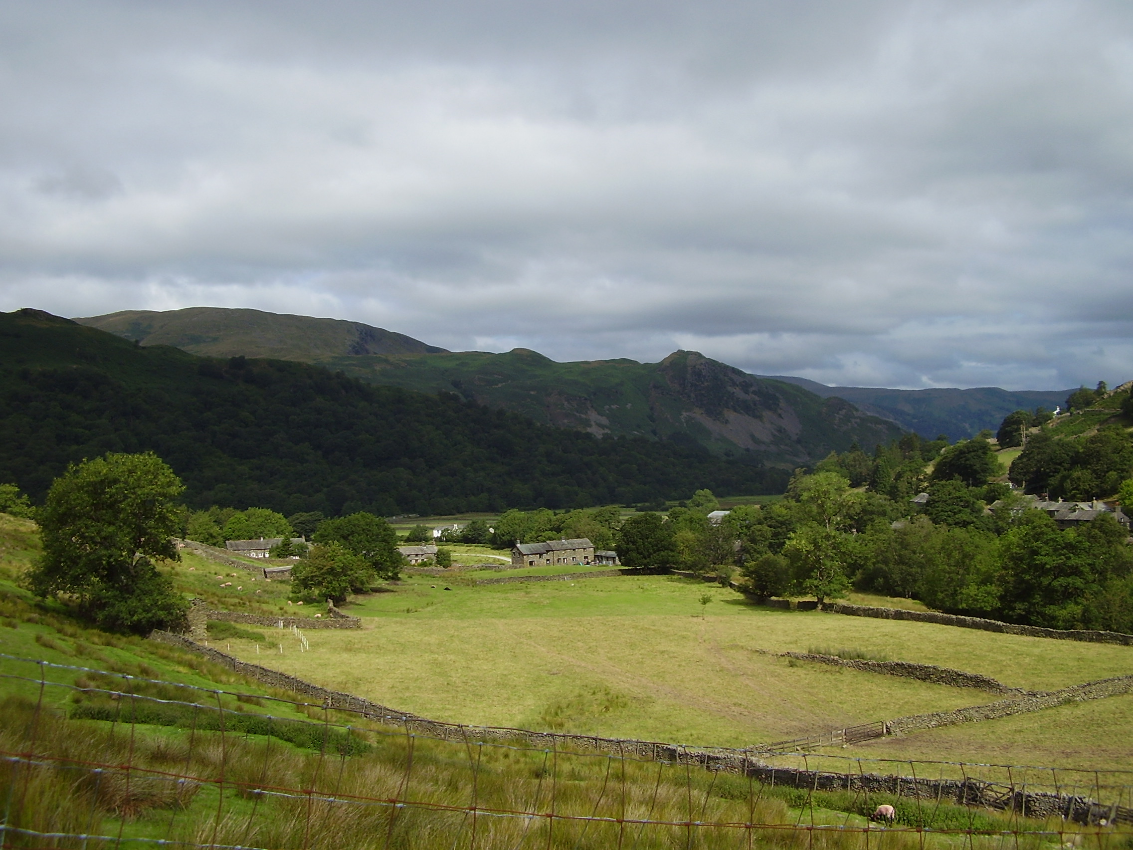
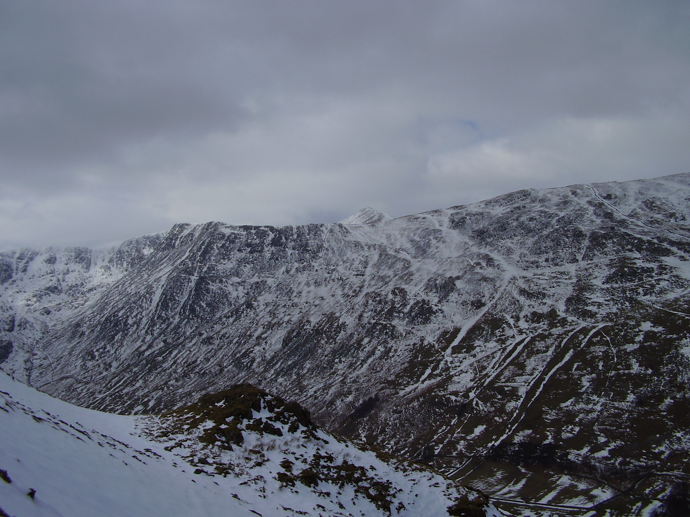
Standing at an elevation of approximately 610 meters (2,000 feet), Birks is a popular destination for hikers and outdoor enthusiasts seeking a challenging yet rewarding trek. The ascent to the summit can be reached via various routes, with the most common starting point being the village of Kentmere. The path takes walkers through picturesque valleys, woodlands, and open moorlands, showcasing the diverse natural beauty of the Lake District.

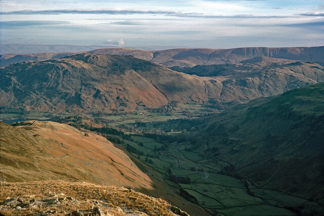
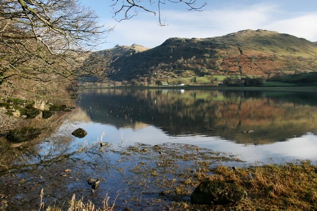
At the summit of Birks, hikers are rewarded with breathtaking vistas spanning across the fells and lakes of Westmorland and beyond. On clear days, it is possible to see the peaks of neighboring mountains, such as Helvellyn and High Street, adding to the allure of this remote and wild location.

Birks is home to a variety of flora and fauna, with heather-covered slopes and rocky outcrops providing habitats for numerous bird species, including the rare ring ouzel. The surrounding valleys are dotted with charming stone walls and traditional farmhouses, contributing to the idyllic rural character of the area.

Whether you are an avid hillwalker or simply someone seeking to immerse themselves in the natural beauty of the Lake District, Birks is a must-visit destination. Its challenging trails, breathtaking views, and rich biodiversity make it an unforgettable experience for all who venture to its summit.

If you have any feedback on the listing, please let us know in the comments section below.

Birks Images

Images are sourced within 2km of 54.520722/-2.9591557 or Grid Reference NY3814. Thanks to Geograph Open Source API. All images are credited.

Glenamara Park
Glenamara Park
Arnison Crag summit
Arnison Crag summit
Arnison Crag summit
Arnison Crag summit
Path descending Deepdale A less than distinct path (shown on older maps, but now intermittently missing on more recent mapping) drops steeply down from Deepdale Hause between Cofa Pike and St Sunday Crag, wending its way rather damply between moraines higher up the dale, then traversing above a gorge mid-dale before reaching this section, mostly dry underfoot, and on gentle slopes on the left bank of Deepdale Beck. Only when it meets the even fainter route down from the NE end of St Sunday Crag does it suddenly transform into a public right of way and become a much more convincing track.
Path descending Deepdale
A less than distinct path (shown on older maps, but now intermittently missing on more recent mapping) drops steeply down from Deepdale Hause between Cofa Pike and St Sunday Crag, wending its way rather damply between moraines higher up the dale, then traversing above a gorge mid-dale before reaching this section, mostly dry underfoot, and on gentle slopes on the left bank of Deepdale Beck. Only when it meets the even fainter route down from the NE end of St Sunday Crag does it suddenly transform into a public right of way and become a much more convincing track.
Path beside Deepdale Beck The path in the lower part of Deepdale (downstream of the rocky gorge) generally stays on boulder-studded slopes above the left bank of the beck, remaining a lot drier underfoot than the faint route in the upper dale which wends its way rather boggily between moraines. At the head of the dale, it is much steeper (and a bit loose in spots) just below Deepdale hause between Cofa Pike (a prominent eminence north of Fairfield, though somewhat dwarfed from this angle by the shady Greenhow End at the centre of the picture) and St. Sunday Crag. There are a number of crags, much loved by less famous climbers looking for new routes in the latter half of the twentieth century after the easier routes on bigger crags, and much harder lines elsewhere had long been claimed.
Path beside Deepdale Beck
The path in the lower part of Deepdale (downstream of the rocky gorge) generally stays on boulder-studded slopes above the left bank of the beck, remaining a lot drier underfoot than the faint route in the upper dale which wends its way rather boggily between moraines. At the head of the dale, it is much steeper (and a bit loose in spots) just below Deepdale hause between Cofa Pike (a prominent eminence north of Fairfield, though somewhat dwarfed from this angle by the shady Greenhow End at the centre of the picture) and St. Sunday Crag. There are a number of crags, much loved by less famous climbers looking for new routes in the latter half of the twentieth century after the easier routes on bigger crags, and much harder lines elsewhere had long been claimed.
Path descending Deepdale The path down Deepdale (or up it, if you are heading that way to reach any of a number of minor climbing crags) skirts the foot of St. Sunday Crag's unfrequented east spur and at this point, seems further from Deepdale Beck than it has been for much of the mile or so behind the photographer.
Path descending Deepdale
The path down Deepdale (or up it, if you are heading that way to reach any of a number of minor climbing crags) skirts the foot of St. Sunday Crag's unfrequented east spur and at this point, seems further from Deepdale Beck than it has been for much of the mile or so behind the photographer.
Coldcove Gill Coldcove Gill drains the area between the unfrequented east spur of St. Sunday Crag (down which a very faint path seems to arrive in Deepdale) and it much more popular north ridge traversed by both a public footpath and a very fine (and popular) scrambling route. As the two "off-piste" routes (one down the spur, one down the dale) join, the path becomes a much more well-defined track, and a public right of way, just about at the point that this view was taken.
Coldcove Gill
Coldcove Gill drains the area between the unfrequented east spur of St. Sunday Crag (down which a very faint path seems to arrive in Deepdale) and it much more popular north ridge traversed by both a public footpath and a very fine (and popular) scrambling route. As the two "off-piste" routes (one down the spur, one down the dale) join, the path becomes a much more well-defined track, and a public right of way, just about at the point that this view was taken.
Sand Gill The path down Deepdale strays away from Deepdale Beck, to stick close to the break of slope at the edge of the fertile plain around Bridgend. Sand Gill drops steeply to the field edge, then cuts a narrow channel across the grassland on its way to join Deepdale Beck and onwards to Goldrill Beck.
Sand Gill
The path down Deepdale strays away from Deepdale Beck, to stick close to the break of slope at the edge of the fertile plain around Bridgend. Sand Gill drops steeply to the field edge, then cuts a narrow channel across the grassland on its way to join Deepdale Beck and onwards to Goldrill Beck.
Looking to St Sunday Crag from Fairfield Looking across the upland landscape from the top of Fairfield to St Sunday Crag.
Looking to St Sunday Crag from Fairfield
Looking across the upland landscape from the top of Fairfield to St Sunday Crag.
Pitch path in Little Cove Being one of the more popular routes from Glenridding onto Helvellyn via Striding Edge, the path following Mires Beck was inevitably subject to a lot of erosion. On this steeper section, potential gullying has been prevented by an excellent piece of path construction using stone that blends in with its surroundings. The view down to Glenridding and Ullswater is a splendid excuse for those labouring upwards to take a break and get the camera out.
Pitch path in Little Cove
Being one of the more popular routes from Glenridding onto Helvellyn via Striding Edge, the path following Mires Beck was inevitably subject to a lot of erosion. On this steeper section, potential gullying has been prevented by an excellent piece of path construction using stone that blends in with its surroundings. The view down to Glenridding and Ullswater is a splendid excuse for those labouring upwards to take a break and get the camera out.
Grisedale from a path to Striding Edge I confess that I seem to have exhausted all the routes to pinpoint the exact position of this image. This is certainly Grisedale and the walk along Striding Edge started in Patterdale.  I have examined all the relevant Geograph images between this area of the walk and Patterdale/Glenridding and this is the best solution.  But why has no one else taken this view again for Geograph in the last 48 years?
Grisedale from a path to Striding Edge
I confess that I seem to have exhausted all the routes to pinpoint the exact position of this image. This is certainly Grisedale and the walk along Striding Edge started in Patterdale. I have examined all the relevant Geograph images between this area of the walk and Patterdale/Glenridding and this is the best solution. But why has no one else taken this view again for Geograph in the last 48 years?
Lanty's Tarn
Lanty's Tarn
Low crag and broken wall on east side of Birks The wall which descends from high on the hill is almost completely collapsed.
Place Fell is at the centre of the image, Arnison Crag is nearer and to the right.
Low crag and broken wall on east side of Birks
The wall which descends from high on the hill is almost completely collapsed. Place Fell is at the centre of the image, Arnison Crag is nearer and to the right.
Lanty's Tarn See <a href="https://www.geograph.org.uk/photo/139712">NY3816 : Lanty's Tarn</a> for some history and explanation of the name.
Lanty's Tarn
See NY3816 : Lanty's Tarn for some history and explanation of the name.
Deepdale Beck
Deepdale Beck
Coldcove Gill Looking towards the summit of Birks.
Coldcove Gill
Looking towards the summit of Birks.
The A592 nearing Patterdale The slopes of Place Fell are ahead.
The A592 nearing Patterdale
The slopes of Place Fell are ahead.
The path to Thornhow End Thornhow End is a good approach to Birks and St Sunday Crag.
The path to Thornhow End
Thornhow End is a good approach to Birks and St Sunday Crag.
Show me another place!

Birks is located at Grid Ref: NY3814 (Lat: 54.520722, Lng: -2.9591557)

Administrative County: Cumbria

District: Eden

Police Authority: Cumbria

What 3 Words

///generally.pockets.beefed. Near Ambleside, Cumbria

Nearby Locations

Birks Patterdale

Related Wikis

Birks (Lake District)

Birks is a fell in the English Lake District situated two kilometres south west of the village of Patterdale in the Eastern Fells. The fells summit sits...

St Sunday Crag

St Sunday Crag is a fell in the English Lake District, part of the Fairfield group in the Eastern Fells. It is a prominent feature in the Patterdale skyline...

Arnison Crag

Arnison Crag is a fell in the English Lake District, an outlier of the Fairfield group in the Eastern Fells. It looks down on Patterdale village and the...

Patterdale

Patterdale (Saint Patrick's Dale) is a small village and civil parish in the eastern part of the English Lake District in the Eden District of Cumbria...

Birkhouse Moor

Birkhouse Moor is a fell in the English Lake District, an outlier of the Helvellyn range in the Eastern Fells. It is properly an eastern ridge of Helvellyn...

Hartsop above How

Hartsop above How is a fell in the English Lake District, an outlier of the Helvellyn range in the Eastern Fells. It stands above Brothers Water and the...

Glenridding

Glenridding is a village at the southern end of Ullswater, in the English Lake District. The village is popular with mountain walkers who can scale England...

Brothers Water

Brothers Water is a small lake in the Hartsop valley, in the eastern region of the Lake District in England. Once called Broad Water, it lies at the northern...

Nearby Amenities

Located within 500m of 54.520722,-2.9591557
Ford: yes
Lat/Long: 54.5242224/-2.9603848
Birks
Ele: 622
Natural: peak
Wikidata: Q4916505
Wikipedia: en:Birks (Lake District)
Lat/Long: 54.520736/-2.9589011
The data included in this document is from www.openstreetmap.org. The data is made available under ODbL.

Have you been to Birks?

Leave your review of Birks below (or comments, questions and feedback).