Sheffield Pike

Hill, Mountain in Westmorland Eden

England

Sheffield Pike

Looking up Glenridding Looking up Glenridding.
Looking up Glenridding Credit: Colin Kinnear

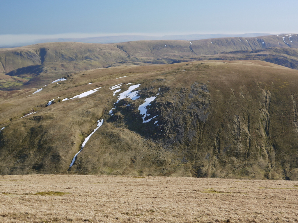
Sheffield Pike is a prominent hill located in the county of Westmorland, in the Lake District National Park, Cumbria, England. Standing at an elevation of 2,215 feet (675 meters), it offers stunning panoramic views of the surrounding landscape.

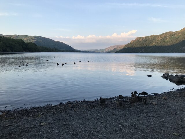
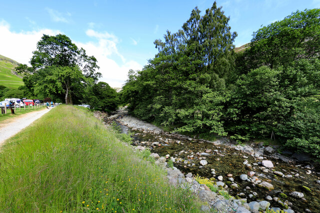
Situated near the shores of Ullswater, Sheffield Pike is a popular hiking destination due to its relatively easy accessibility and well-defined footpaths. The climb to the summit typically starts from the village of Glenridding, where a trail ascends gradually through picturesque woodlands. As hikers progress, the path becomes steeper but remains manageable for most abilities.

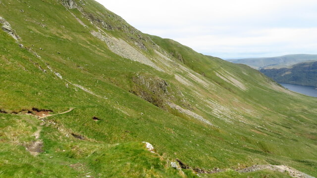
Once at the summit, visitors are rewarded with breathtaking vistas that encompass Ullswater and the surrounding fells. On a clear day, it is possible to see as far as Helvellyn, one of the highest peaks in the Lake District. The summit itself is adorned with a trig point, serving as a marker for surveying purposes.

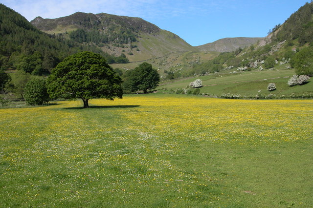
Sheffield Pike is also known for its rich biodiversity. The hill is covered in a patchwork of heather moorland, bracken, and rocky outcrops, providing habitats for various plant and animal species. It is not uncommon to spot birds of prey, such as buzzards or peregrine falcons, soaring above the ridges.

Overall, Sheffield Pike offers a rewarding hiking experience, combining a moderate ascent with breathtaking views. It is a must-visit for outdoor enthusiasts and nature lovers exploring the Lake District.

If you have any feedback on the listing, please let us know in the comments section below.

Sheffield Pike Images

Images are sourced within 2km of 54.554929/-2.9769361 or Grid Reference NY3618. Thanks to Geograph Open Source API. All images are credited.

Looking up Glenridding Looking up Glenridding.
Looking up Glenridding
Looking up Glenridding.
Ullswater
Ullswater
Mires Beck On the lower eastern slope of Birkhouse Moor.
Mires Beck
On the lower eastern slope of Birkhouse Moor.
View to Glenridding and Ullswater View from the eastern slope of Birkhouse Moor.
View to Glenridding and Ullswater
View from the eastern slope of Birkhouse Moor.
Path across Birkhouse Moor
Looking over Glenridding Beck to Rowten Beck
Greenside Mine Former lead mine that reached its peak production in the late 19th / early 20th centuries with final closure in 1962. Info from Wikipedia: <span class="nowrap"><a title="https://en.wikipedia.org/wiki/Greenside_Mine" rel="nofollow ugc noopener" href="https://en.wikipedia.org/wiki/Greenside_Mine">Link</a><img style="margin-left:2px;" alt="External link" title="External link - shift click to open in new window" src="https://s1.geograph.org.uk/img/external.png" width="10" height="10"/></span>
Greenside Mine
Former lead mine that reached its peak production in the late 19th / early 20th centuries with final closure in 1962. Info from Wikipedia: LinkExternal link
Glenridding Beck passes Gillside Campsite It still feels distressingly crowded and almost urban this close to the centre of Glenridding, but keep faith, it gets better soon, if steeper and hotter....
Glenridding Beck passes Gillside Campsite
It still feels distressingly crowded and almost urban this close to the centre of Glenridding, but keep faith, it gets better soon, if steeper and hotter....
Peaty ponds punctuate path on Birkhouse Moor One of two paths climbing the fell to Striding Edge, the one coming up Little Cove from Gillside encounters more wet ground on the crest of the ridge than it did on its ascent of the cirque. Even in a long, hot, dry summer like 2022, these peaty ponds show the water table to be barely below the ground surface. Looking over the valley of Red Tarn Beck, the view extends to Catstycam and Swirral Edge and beyond them, the long north ridge of Helvellyn to Raise.
Peaty ponds punctuate path on Birkhouse Moor
One of two paths climbing the fell to Striding Edge, the one coming up Little Cove from Gillside encounters more wet ground on the crest of the ridge than it did on its ascent of the cirque. Even in a long, hot, dry summer like 2022, these peaty ponds show the water table to be barely below the ground surface. Looking over the valley of Red Tarn Beck, the view extends to Catstycam and Swirral Edge and beyond them, the long north ridge of Helvellyn to Raise.
Rowten Beck
Rowten Beck
Looking across Glenridding Beck
Looking across Glenridding Beck towards Birkhouse Moor
Track off Greenside Road Leads to the north end of the village, in case you have done the extra mileage to avoid the exorbitant parking charges in the centre.
Track off Greenside Road
Leads to the north end of the village, in case you have done the extra mileage to avoid the exorbitant parking charges in the centre.
Ullswater shoreline at Glenridding
Summit cairn at Sheffield Pike & view to Ullswater
View towards Ullswater from path below Glencoyne Head
Path contouring around the northern side of Glencoyne
Glencoyne Head above Ullswater
Show me another place!

Sheffield Pike is located at Grid Ref: NY3618 (Lat: 54.554929, Lng: -2.9769361)

Administrative County: Cumbria

District: Eden

Police Authority: Cumbria

What 3 Words

///interacts.warned.present. Near Keswick, Cumbria

Nearby Locations

Nick Head Sheffield Pike

Related Wikis

Sheffield Pike

Sheffield Pike (possibly meaning "the peak above the sheep fold") is a fell in the English Lake District, a prominent intermediate top on one of the eastern...
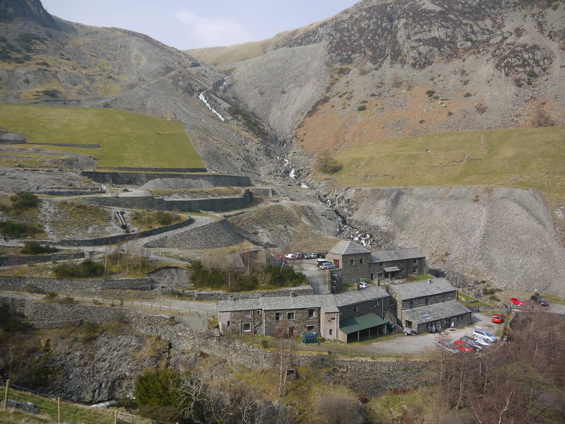
Greenside Mine

Greenside Mine (sometimes referred to as Greenside Lead Mine) was a successful lead mine in the Lake District of England. Between 1825 and 1961 the mine...

Glenridding Dodd

Glenridding Dodd (the rounded hill above Glenridding) is a small fell in the English Lake District, at the end of a ridge descending from the Helvellyn...

Hart Side

Hart Side (the hill side frequented by harts) is a subsidiary top on one of the east ridges of Stybarrow Dodd, which is a mountain (or fell) in the English...

Nearby Amenities

Located within 500m of 54.554929,-2.9769361
Sheffield Pike
Ele: 675
Natural: peak
Source: npe
Wikidata: Q7492731
Wikipedia: en:Sheffield Pike
Lat/Long: 54.5548898/-2.9769945
Barrier: stile
Lat/Long: 54.5580681/-2.9727992
Ford: yes
Lat/Long: 54.5568091/-2.983213
Bleabank Side
Place: locality
Lat/Long: 54.5567115/-2.9819118
Ford: yes
Lat/Long: 54.5575345/-2.9813795
The data included in this document is from www.openstreetmap.org. The data is made available under ODbL.

Have you been to Sheffield Pike?

Leave your review of Sheffield Pike below (or comments, questions and feedback).