Bents Hill

Hill, Mountain in Roxburghshire

Scotland

Bents Hill

A view by Lang Grain Another small tributary of the River Teviot in this corner of the Craik Forest.  The distinctive peak of Skelfhill Pen can be noted in the far distance.
A view by Lang Grain Credit: James T M Towill

Bents Hill is an imposing hill located in Roxburghshire, a historic county in the southern part of Scotland. Situated amidst the breathtaking landscape of the Scottish Borders, Bents Hill rises to an elevation of approximately 300 meters (984 feet), making it a notable landmark in the region.

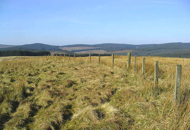
This hill is renowned for its distinctive shape, characterized by a gently sloping ascent that culminates in a prominent peak. The terrain is primarily composed of heather-covered moorland, lending a rustic charm to the area. Bents Hill is also surrounded by lush greenery, with scattered patches of woodland dotting its slopes.

Due to its elevation and commanding views, Bents Hill offers visitors stunning panoramic vistas of the surrounding countryside. On a clear day, one can see vast stretches of rolling hills, verdant valleys, and meandering rivers. This natural beauty makes the hill a popular destination for hikers, nature enthusiasts, and photographers, who flock to its summit to capture the breathtaking scenery.

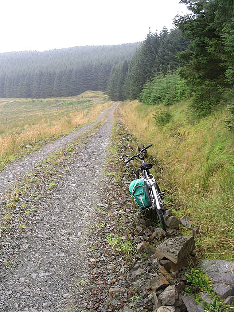
Bents Hill is easily accessible by foot, with well-defined paths leading to the top. Its location, nestled within the Scottish Borders, also provides opportunities for visitors to explore the nearby towns and villages renowned for their historical significance and cultural heritage. The hill's tranquil and serene environment provides a welcome escape from the hustle and bustle of everyday life, allowing visitors to immerse themselves in the beauty of nature.

Overall, Bents Hill in Roxburghshire is a captivating natural feature, offering both locals and tourists an opportunity to experience the majesty of the Scottish landscape while enjoying panoramic views and a tranquil atmosphere.

If you have any feedback on the listing, please let us know in the comments section below.
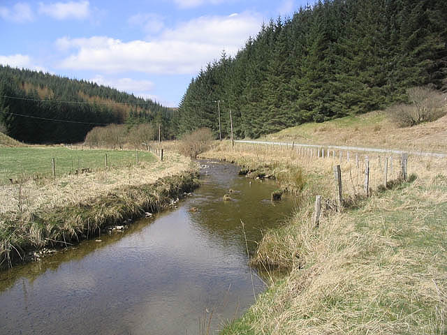
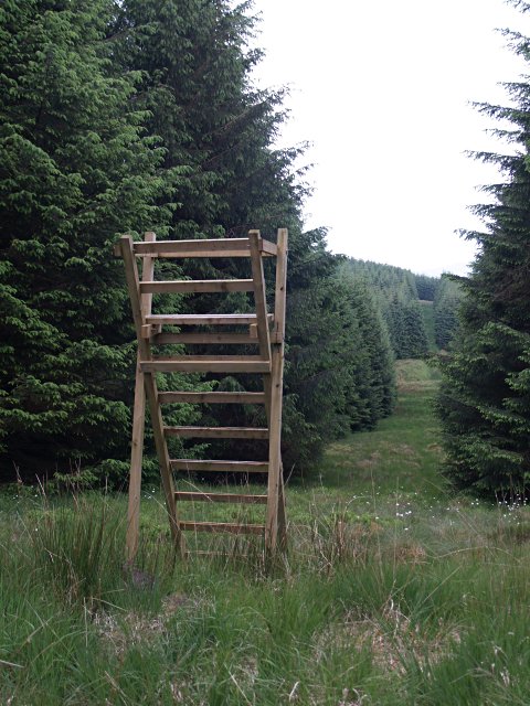
Bents Hill Images

Images are sourced within 2km of 55.305826/-3.025841 or Grid Reference NT3401. Thanks to Geograph Open Source API. All images are credited.

A view by Lang Grain Another small tributary of the River Teviot in this corner of the Craik Forest.  The distinctive peak of Skelfhill Pen can be noted in the far distance.
A view by Lang Grain
Another small tributary of the River Teviot in this corner of the Craik Forest. The distinctive peak of Skelfhill Pen can be noted in the far distance.
On a forestry road below Crooked Braes The sun is getting lower on a beautiful November afternoon in the Craik Forest.
On a forestry road below Crooked Braes
The sun is getting lower on a beautiful November afternoon in the Craik Forest.
Easter Cleuch The forestry track crossing Easter Cleuch.  Either side of the stream has been planted with native broadleaved tree species.
Easter Cleuch
The forestry track crossing Easter Cleuch. Either side of the stream has been planted with native broadleaved tree species.
Moss festooned forestry on Lamblair Edge Damp, dark Sitka plantations featuring extensive moss growth.

This photograph was taken during the Coronavirus (COVID-19) pandemic of 2020.
Moss festooned forestry on Lamblair Edge
Damp, dark Sitka plantations featuring extensive moss growth. This photograph was taken during the Coronavirus (COVID-19) pandemic of 2020.
Footbridge over the River Teviot Next to a ford near Merrylaw.
Footbridge over the River Teviot
Next to a ford near Merrylaw.
Rowantree Hill The unmarked summit of Rowantree Hill at 372m with Craik Forest in the background.
Rowantree Hill
The unmarked summit of Rowantree Hill at 372m with Craik Forest in the background.
Thornycleuch Knowe Rough grazing by Craik Forest and the summit of Byehass Fell in the distance.
Thornycleuch Knowe
Rough grazing by Craik Forest and the summit of Byehass Fell in the distance.
Upland grazing Rough grazing for hill sheep to the southeast of Byehass Fell and the edge of Craik Forest on the left.
Upland grazing
Rough grazing for hill sheep to the southeast of Byehass Fell and the edge of Craik Forest on the left.
The River Teviot To the east of Merrylaw at the edge of Craik Forest.
The River Teviot
To the east of Merrylaw at the edge of Craik Forest.
Forestry road and logs Near Merrylaw.
Forestry road and logs
Near Merrylaw.
Forest watchtower It's not clear what one would watch for from here, it's too short for a firewatch.  Wildlife perhaps?  But this sort of forest doesn't seem to support much except for the odd buzzard or heron.
Forest watchtower
It's not clear what one would watch for from here, it's too short for a firewatch. Wildlife perhaps? But this sort of forest doesn't seem to support much except for the odd buzzard or heron.
Forestry road at Rams Cleuch
Scrubland at Rams Cleuch
Building at Ramsaycleuchburn A ruined building by a forestry road at the edge of the square.
Building at Ramsaycleuchburn
A ruined building by a forestry road at the edge of the square.
Observation hide in Craik Forest By a forestry road overlooking Worms Cleuch, between Lamblair Edge and Ramsaygrain West.
Observation hide in Craik Forest
By a forestry road overlooking Worms Cleuch, between Lamblair Edge and Ramsaygrain West.
Quarry at Peat Rig in Craik Forest
Forestry road at Crooked Braes
Forestry at Hill Head Viewed from a forestry road west-southwest of Merrylaw.
Forestry at Hill Head
Viewed from a forestry road west-southwest of Merrylaw.
Show me another place!

Bents Hill is located at Grid Ref: NT3401 (Lat: 55.305826, Lng: -3.025841)

Unitary Authority: The Scottish Borders

Police Authority: The Lothians and Scottish Borders

What 3 Words

///embraced.fidgeting.titles. Near Teviothead, Scottish Borders

Nearby Locations

Bents Hill Crooked Braes

Related Wikis

River Teviot

The River Teviot (; Scottish Gaelic: Abhainn Tìbhiot), or Teviot Water, is a river of the Scottish Borders area of Scotland, and is the largest tributary...

Falnash

Falnash (Scots: Fawenesh) is a village in the Scottish Borders of Scotland. It is near Teviothead, in the former Roxburghshire, and in the parish of Teviothead...

Caerlanrig

Caerlanrig - also spelled 'Carlenrig' - (Gaelic: Cathair Lannraig) is a hamlet in the parish of Cavers, Borders, Scotland, lying on the River Teviot, 6...

Craik, Scottish Borders

Craik is a hamlet in Craik Forest, by the Airhouse Burn in the Scottish Borders area of Scotland, close to Roberton, Scottish Borders (grid reference NT348084...

Have you been to Bents Hill?

Leave your review of Bents Hill below (or comments, questions and feedback).