Catstye Cam

Hill, Mountain in Westmorland Eden

England

Catstye Cam

Striding Edge from Swallow Scarth Descending from Nethermost Pike on the way to Helvellyn, the low point above Nethermost Cove is Swallow Scarth, offering a view ahead to the most exciting part of the day's walk, along Striding Edge. In winter conditions, a good head for heights needs to be supplemented with crampons, and whilst an ice-axe is good for balance, it's unlikely to stop a fall on shallow snow over rock, so don't fall off ! We recommend that you don't (as I did on a similar day in the same place, but travelling in the opposite direction) manage to stick the front points of one crampon into the trouser leg of the other foot, leaving oneself teetering on the very top of the edge with a climber's axe too short to reach the ground, pondering the best way out of the predicament. Good balance and a cool head are key. The day seen here was less fraught, but the cloud had rolled in from the west, and daylight was limited, so a headtorch was needed before reaching the car, even though, back in 1987, one was still allowed parking in Grisedale.

Note, although submitted as having been taken 1987-02-22, diary entries are a little sparse, and it might just conceivably have been February 15th (although I would have expected to be too hung over on that Sunday, following a caving club dinner the previous night).
Striding Edge from Swallow Scarth Credit: Andy Waddington

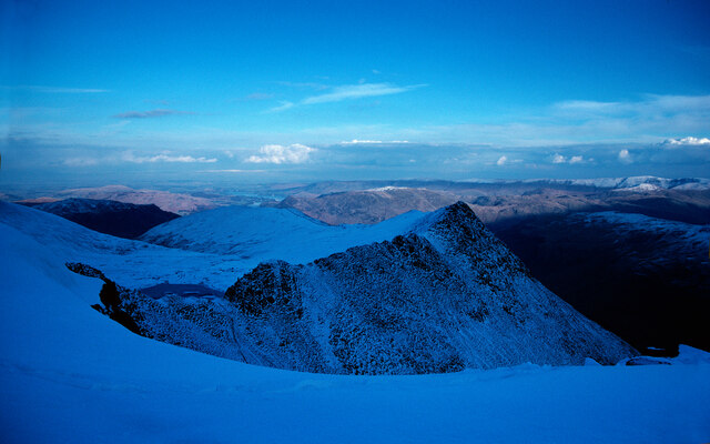
Catstye Cam is a prominent hill located in the Lake District National Park, specifically in the county of Cumbria, England. Standing at an elevation of 890 meters (2,920 feet), it is considered one of the fells in the Eastern Fells region of the park. Catstye Cam is situated on the eastern edge of the Helvellyn range, which is widely regarded as one of the most popular and challenging mountain areas in the Lake District.

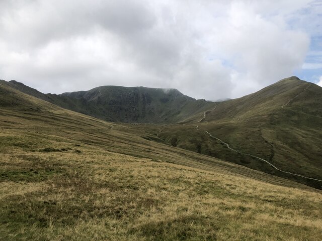
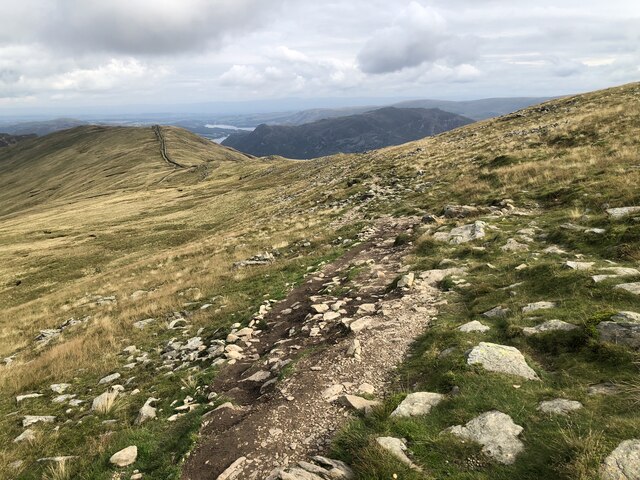
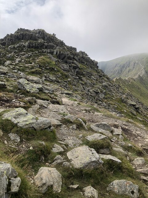
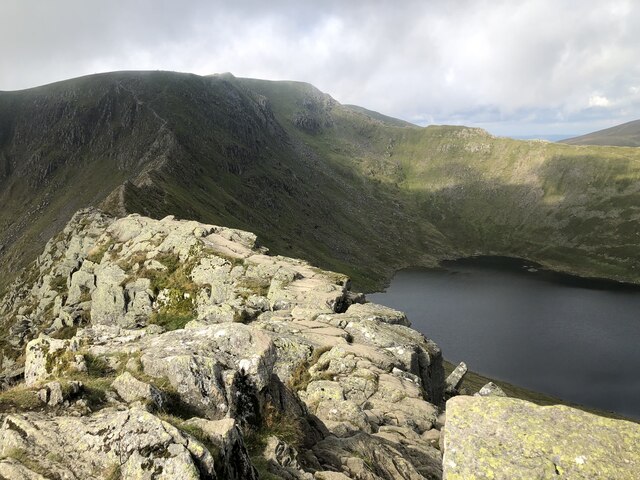
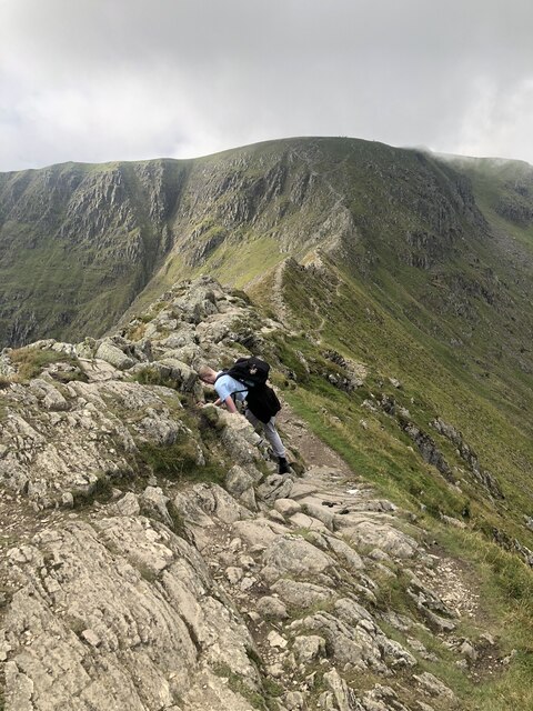
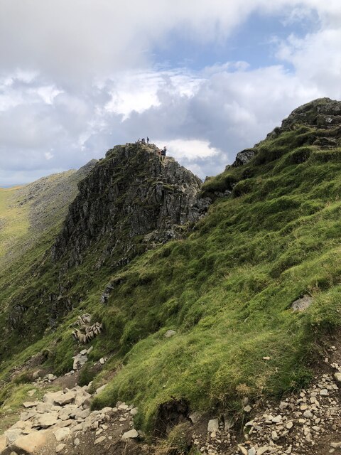
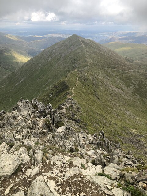
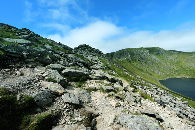
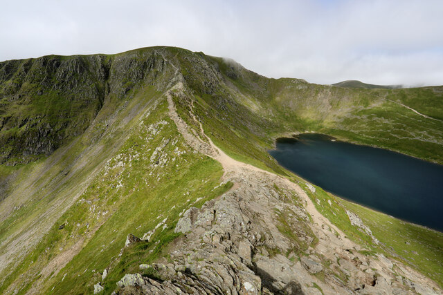
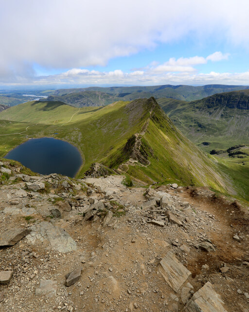
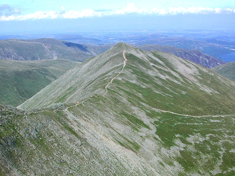
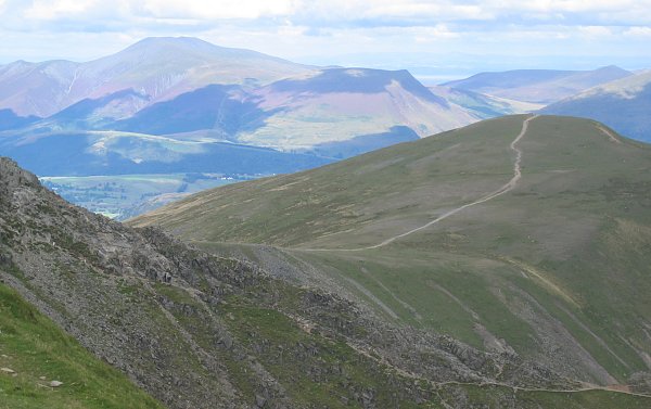
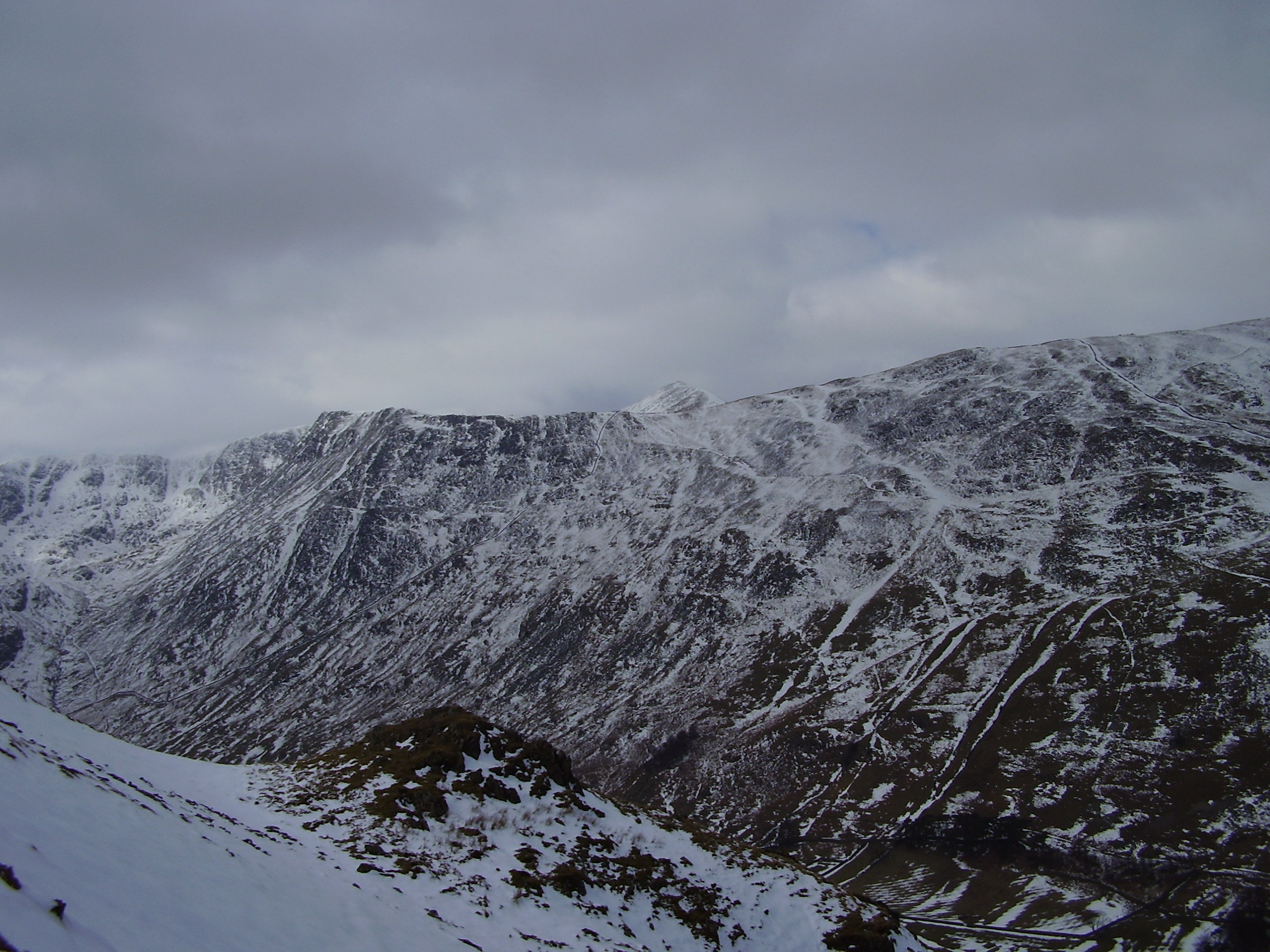
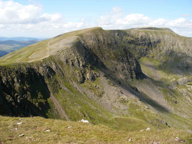
The summit of Catstye Cam offers breathtaking panoramic views of the surrounding landscape, including the nearby Helvellyn and Striding Edge. The terrain is rugged and rocky, with steep slopes and crags, making it a favorite among experienced hikers and mountaineers seeking a thrilling adventure. The ascent to Catstye Cam can be achieved from various starting points, such as Glenridding or Patterdale, and often involves traversing Striding Edge, a notorious ridge connecting the mountain to Helvellyn.

Catstye Cam is part of a network of peaks that attract outdoor enthusiasts throughout the year, providing opportunities for both summer hiking and winter mountaineering. The area is known for its unpredictable weather conditions, which can change rapidly, so it is important for visitors to come prepared with appropriate clothing and equipment.

Overall, Catstye Cam offers a challenging and rewarding experience for those seeking an exhilarating climb, stunning views, and a taste of the natural beauty that the Lake District National Park has to offer.

If you have any feedback on the listing, please let us know in the comments section below.

Catstye Cam Images

Images are sourced within 2km of 54.533439/-3.0088764 or Grid Reference NY3415. Thanks to Geograph Open Source API. All images are credited.

Striding Edge from Swallow Scarth Descending from Nethermost Pike on the way to Helvellyn, the low point above Nethermost Cove is Swallow Scarth, offering a view ahead to the most exciting part of the day's walk, along Striding Edge. In winter conditions, a good head for heights needs to be supplemented with crampons, and whilst an ice-axe is good for balance, it's unlikely to stop a fall on shallow snow over rock, so don't fall off ! We recommend that you don't (as I did on a similar day in the same place, but travelling in the opposite direction) manage to stick the front points of one crampon into the trouser leg of the other foot, leaving oneself teetering on the very top of the edge with a climber's axe too short to reach the ground, pondering the best way out of the predicament. Good balance and a cool head are key. The day seen here was less fraught, but the cloud had rolled in from the west, and daylight was limited, so a headtorch was needed before reaching the car, even though, back in 1987, one was still allowed parking in Grisedale.

Note, although submitted as having been taken 1987-02-22, diary entries are a little sparse, and it might just conceivably have been February 15th (although I would have expected to be too hung over on that Sunday, following a caving club dinner the previous night).
Striding Edge from Swallow Scarth
Descending from Nethermost Pike on the way to Helvellyn, the low point above Nethermost Cove is Swallow Scarth, offering a view ahead to the most exciting part of the day's walk, along Striding Edge. In winter conditions, a good head for heights needs to be supplemented with crampons, and whilst an ice-axe is good for balance, it's unlikely to stop a fall on shallow snow over rock, so don't fall off ! We recommend that you don't (as I did on a similar day in the same place, but travelling in the opposite direction) manage to stick the front points of one crampon into the trouser leg of the other foot, leaving oneself teetering on the very top of the edge with a climber's axe too short to reach the ground, pondering the best way out of the predicament. Good balance and a cool head are key. The day seen here was less fraught, but the cloud had rolled in from the west, and daylight was limited, so a headtorch was needed before reaching the car, even though, back in 1987, one was still allowed parking in Grisedale. Note, although submitted as having been taken 1987-02-22, diary entries are a little sparse, and it might just conceivably have been February 15th (although I would have expected to be too hung over on that Sunday, following a caving club dinner the previous night).
Fold, Helvellyn Gill
Path across Birkhouse Moor
Path & wall between Birkhouse Moor and Striding Edge
Helvellyn Helvellyn (centre), with Striding edge on the left and Swirral Edge & Catsty Cam on the right of the image.
Helvellyn
Helvellyn (centre), with Striding edge on the left and Swirral Edge & Catsty Cam on the right of the image.
Looking back along the path above Bleaberry Crag
High Spying How at the start of Striding Edge
Striding Edge, Helvellyn, and Red Tarn
On Striding Edge
On Striding Edge
Striding Edge
Striding Edge
Swirral Edge and Catstye Cam
The path to Glenridding
Looking over Glenridding Beck to Rowten Beck
Peaty ponds punctuate path on Birkhouse Moor One of two paths climbing the fell to Striding Edge, the one coming up Little Cove from Gillside encounters more wet ground on the crest of the ridge than it did on its ascent of the cirque. Even in a long, hot, dry summer like 2022, these peaty ponds show the water table to be barely below the ground surface. Looking over the valley of Red Tarn Beck, the view extends to Catstycam and Swirral Edge and beyond them, the long north ridge of Helvellyn to Raise.
Peaty ponds punctuate path on Birkhouse Moor
One of two paths climbing the fell to Striding Edge, the one coming up Little Cove from Gillside encounters more wet ground on the crest of the ridge than it did on its ascent of the cirque. Even in a long, hot, dry summer like 2022, these peaty ponds show the water table to be barely below the ground surface. Looking over the valley of Red Tarn Beck, the view extends to Catstycam and Swirral Edge and beyond them, the long north ridge of Helvellyn to Raise.
Looking back towards Hole in the Wall from High Spying How High Spying How marks the end of the easy ascent from Glenridding over the at times broad path that can be seen in the distance leading from Hole in the Wall. It's best not to be here heading upwards unless you have a head for heights and decent footwear (if you are heading down at this point without those attributes and have come from Helvellyn's summit, well done for surviving this far).
Looking back towards Hole in the Wall from High Spying How
High Spying How marks the end of the easy ascent from Glenridding over the at times broad path that can be seen in the distance leading from Hole in the Wall. It's best not to be here heading upwards unless you have a head for heights and decent footwear (if you are heading down at this point without those attributes and have come from Helvellyn's summit, well done for surviving this far).
Path over High Spying How After the hard work of climbing 700m from the shores of Ullswater at Glenridding, there's only 100m of up to reach Helvellyn, and it is all a lot more fun than what has gone before. Well, as long as you are one of those who feel happy on exposed scrambles, of course. This is the start of Striding Edge, and it is essential to stick rigidly to the crest at all times (there are skulkers' routes round quite a lot of it, really).
Path over High Spying How
After the hard work of climbing 700m from the shores of Ullswater at Glenridding, there's only 100m of up to reach Helvellyn, and it is all a lot more fun than what has gone before. Well, as long as you are one of those who feel happy on exposed scrambles, of course. This is the start of Striding Edge, and it is essential to stick rigidly to the crest at all times (there are skulkers' routes round quite a lot of it, really).
Half a kilometre of fun scrambling ahead Let's be honest, it's been a slog up 700m of ascent to reach High Spying How, the start of Striding Edge, in the summer heat. But the last 100m of up to the summit of Helvellyn are a lot more pleasant, and a straightforward, if exposed, path with a lot of exciting scrambling on the very crest if you choose to take it in weather like this. In winter conditions (eg. <a href="https://www.geograph.org.uk/photo/7028464">NY3414 : Striding Edge from Swallow Scarth</a>) it is rather more serious, so whatever the weather, be sure you know what you are taking on, as some of the scrambling is very polished - the result of its enduring popularity.
Half a kilometre of fun scrambling ahead
Let's be honest, it's been a slog up 700m of ascent to reach High Spying How, the start of Striding Edge, in the summer heat. But the last 100m of up to the summit of Helvellyn are a lot more pleasant, and a straightforward, if exposed, path with a lot of exciting scrambling on the very crest if you choose to take it in weather like this. In winter conditions (eg. NY3414 : Striding Edge from Swallow Scarth) it is rather more serious, so whatever the weather, be sure you know what you are taking on, as some of the scrambling is very polished - the result of its enduring popularity.
One of the more intimidating public footpaths There are lots of routes in the Lake District for those who like scrambling and Striding Edge is by no means one of the more difficult ones. However, it is unusual for a technical route in being a public footpath, leading some to underestimate the level of fun to be had. Particularly when seen from the top, it can be an intimidating prospect if you were expecting a walk (as clearly some of the folk we met on this summer day had been). Most of the difficulties do, in fact, have skulkers' routes and only the purists will stick rigidly to the crest all the way (our dog was allowed to cheat on some bits...)
One of the more intimidating public footpaths
There are lots of routes in the Lake District for those who like scrambling and Striding Edge is by no means one of the more difficult ones. However, it is unusual for a technical route in being a public footpath, leading some to underestimate the level of fun to be had. Particularly when seen from the top, it can be an intimidating prospect if you were expecting a walk (as clearly some of the folk we met on this summer day had been). Most of the difficulties do, in fact, have skulkers' routes and only the purists will stick rigidly to the crest all the way (our dog was allowed to cheat on some bits...)
Show me another place!

Catstye Cam is located at Grid Ref: NY3415 (Lat: 54.533439, Lng: -3.0088764)

Administrative County: Cumbria

District: Eden

Police Authority: Cumbria

What 3 Words

///lime.additives.healthier. Near Keswick, Cumbria

Related Wikis

Nearby Amenities

Located within 500m of 54.533439,-3.0088764
Source: npe
Lat/Long: 54.529081/-3.0104681
Source: npe
Lat/Long: 54.5293737/-3.0097051
Source: npe
Lat/Long: 54.5293671/-3.0088457
Source: npe
Lat/Long: 54.5294095/-3.0083838
Source: npe
Lat/Long: 54.5295637/-3.00777
Source: npe
Lat/Long: 54.5296188/-3.0067938
Source: npe
Lat/Long: 54.5296286/-3.0062311
Source: npe
Lat/Long: 54.5296267/-3.0057732
Source: npe
Lat/Long: 54.5295158/-3.0058644
Ford: stepping_stones
Lat/Long: 54.5299912/-3.0052746
Catstycam
Ele: 890
Natural: peak
Wikidata: Q1051296
Wikipedia: en:Catstye Cam
Lat/Long: 54.5334857/-3.0089207
The data included in this document is from www.openstreetmap.org. The data is made available under ODbL.

Have you been to Catstye Cam?

Leave your review of Catstye Cam below (or comments, questions and feedback).