Broad Law

Hill, Mountain in Midlothian

Scotland

Broad Law

Rough grazing beneath the Moorfoot Hills View towards the Pentland Hills from the B7007.
Rough grazing beneath the Moorfoot Hills Credit: Richard Webb

Broad Law is a prominent hill located in the county of Midlothian, Scotland. With an elevation of 840 meters (2,760 feet), it is the highest point in the region and is classified as a Corbett, a term used to describe a Scottish hill between 2,500 and 3,000 feet in height. It is situated within the picturesque Pentland Hills Regional Park, which spans across Midlothian and the neighboring county of Peeblesshire.

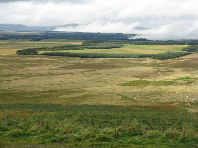
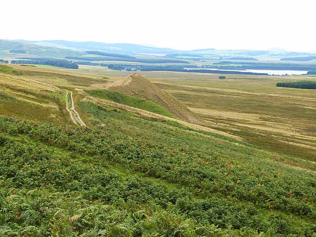
The hill offers breathtaking panoramic views of the surrounding countryside, including the rolling hills, farmland, and nearby reservoirs. On a clear day, visitors can see as far as the Firth of Forth and the Edinburgh skyline to the north. Broad Law is a popular destination for hikers and outdoor enthusiasts, as it provides a challenging yet rewarding climb.

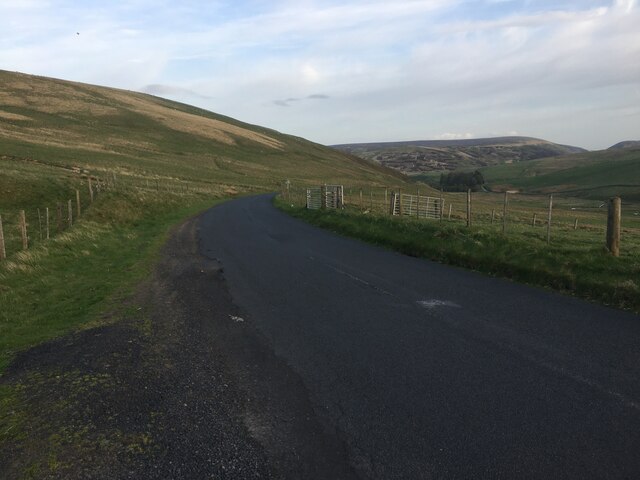
The hill is accessible by various routes, with the most common starting point being the parking area at Megget Stone, which lies to the southwest. From there, a well-maintained path leads up the slopes, passing through heather moorland and rocky terrain. The summit is marked by a trig point, which allows for accurate navigation and is often used as a reference point by hikers.

Given its exposed location, the weather conditions on Broad Law can change rapidly, and caution should be exercised, especially during winter months. It is advisable to come prepared with appropriate clothing, sturdy footwear, and navigational aids. Additionally, visitors are encouraged to follow the Scottish Outdoor Access Code and respect the local wildlife and environment.

Overall, Broad Law offers a memorable outdoor experience with its stunning vistas and challenging ascent, making it a sought-after destination for nature lovers and adventurers alike.

If you have any feedback on the listing, please let us know in the comments section below.

Broad Law Images

Images are sourced within 2km of 55.772182/-3.0462041 or Grid Reference NT3453. Thanks to Geograph Open Source API. All images are credited.

Rough grazing beneath the Moorfoot Hills View towards the Pentland Hills from the B7007.
Rough grazing beneath the Moorfoot Hills
View towards the Pentland Hills from the B7007.
B7007 near Wull Muir
B7007 near Garvald
B7007 near Garvald
Cattlegrid on the road to Blackhope
Valley of the Blackhope Water A tributary of the Tweed, via the Gala Water, viewed from the farm road leading to Blackhope.
Valley of the Blackhope Water
A tributary of the Tweed, via the Gala Water, viewed from the farm road leading to Blackhope.
Shed and Blackhope farm road near Long Cleuch A view from the track that runs alongside Long Cleuch.
Shed and Blackhope farm road near Long Cleuch
A view from the track that runs alongside Long Cleuch.
Ruined sheepfold at the head of Long Cleuch Close to the col between Mauldslie Hill and Torfichen Hill.
Ruined sheepfold at the head of Long Cleuch
Close to the col between Mauldslie Hill and Torfichen Hill.
Looking towards the quarry A disused quarry on the northern flank of the Moorfoot Hills, looking over the feeding ground of the Middleton North Burn to Gladhouse Reservoir about 5 km away.
Looking towards the quarry
A disused quarry on the northern flank of the Moorfoot Hills, looking over the feeding ground of the Middleton North Burn to Gladhouse Reservoir about 5 km away.
The Midlothian plain  Looking northwest from near Wull Muir, near the top of the Moorfoot Hills escarpment. With some funny weather over towards Dalkeith. Obviously a high humidity atmosphere - it was wet earlier and not far from wet when the photo was taken.
The Midlothian plain
Looking northwest from near Wull Muir, near the top of the Moorfoot Hills escarpment. With some funny weather over towards Dalkeith. Obviously a high humidity atmosphere - it was wet earlier and not far from wet when the photo was taken.
Gate to Wull Muir Access to the higher ground from the B7007 - little used?.
Gate to Wull Muir
Access to the higher ground from the B7007 - little used?.
Midlothian, from Wull Muir Looking north from the B7007 towards Esperston Law [270m] the dark central plantation. A large expanse of damp rough pasture north of the Moorfoot Hills, the source of the Middleton South Burn.
Midlothian, from Wull Muir
Looking north from the B7007 towards Esperston Law [270m] the dark central plantation. A large expanse of damp rough pasture north of the Moorfoot Hills, the source of the Middleton South Burn.
Looking southwest along the Moorfoot Hills escarpment The most distant hills, in the centre, are possibly the Black Mount, and Mendick Hill the pointy one to the right, about 25 km away.
Looking southwest along the Moorfoot Hills escarpment
The most distant hills, in the centre, are possibly the Black Mount, and Mendick Hill the pointy one to the right, about 25 km away.
Bracken and Grass covered hillside At Wull Muir on the Moorfoot Hills escarpment.
Bracken and Grass covered hillside
At Wull Muir on the Moorfoot Hills escarpment.
Looking northwest from the Moorfoot Hills escarpment With the Pentland Hills about 18km away, and some funny weather in between.
Looking northwest from the Moorfoot Hills escarpment
With the Pentland Hills about 18km away, and some funny weather in between.
Carcant Wind Farm
Carcant Wind Farm
B7007 looking south west
Escarpment of the Moorfoot Hills Seen from the summit of the B7007.
Escarpment of the Moorfoot Hills
Seen from the summit of the B7007.
Cyclist's memorial on the Moorfoot Hills The plaque on this very modest small stone pillar reads "In memory of Jimmy Murray 1930-2007. This stone was erected by his many cycling friends on one of his favourite cycling routes."
Cyclist's memorial on the Moorfoot Hills
The plaque on this very modest small stone pillar reads "In memory of Jimmy Murray 1930-2007. This stone was erected by his many cycling friends on one of his favourite cycling routes."
Show me another place!

Broad Law is located at Grid Ref: NT3453 (Lat: 55.772182, Lng: -3.0462041)

Unitary Authority: The Scottish Borders

Police Authority: The Lothians and Scottish Borders

What 3 Words

///mini.handyman.complain. Near Gorebridge, Midlothian

Nearby Locations

Peat Hill Broad Law

Related Wikis

Carcant

Carcant is a small settlement and a wind farm, near Heriot in the Scottish Borders area of Scotland. A famous inhabitant of Carcant was Eric Liddell....

Garvald, Scottish Borders

Garvald (Scots: Garvit) is a hamlet on the B7007, near Dewar, by the Dewar Burn, in the Moorfoot Hills, in the Scottish Borders area of Scotland, in the...

Gladhouse Reservoir

Gladhouse Reservoir, formerly known as Moorfoot Loch, is a reservoir in Midlothian, Scotland, five miles (8 km) south of Penicuik. It is the most southerly...

Dewar, Scottish Borders

Dewar is a village by the Dewar Burn and Peatrig Hill, in the Scottish Borders area of Scotland. Places nearby include Allanshaugh, Borthwick Hall, Fountainhall...

Nearby Amenities

Located within 500m of 55.772182,-3.0462041
Broad Law
Ele: 451
Natural: peak
Lat/Long: 55.7725688/-3.0451016
The data included in this document is from www.openstreetmap.org. The data is made available under ODbL.

Have you been to Broad Law?

Leave your review of Broad Law below (or comments, questions and feedback).