Bantham

Settlement in Devon South Hams

England

Bantham

Cliffs at Warren Point Looking across Leas Foot Sand from the coast path.
Cliffs at Warren Point Credit: Derek Harper

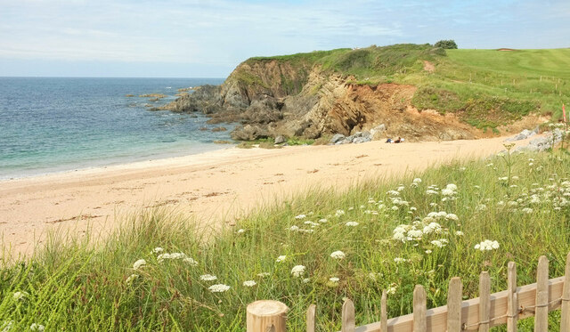
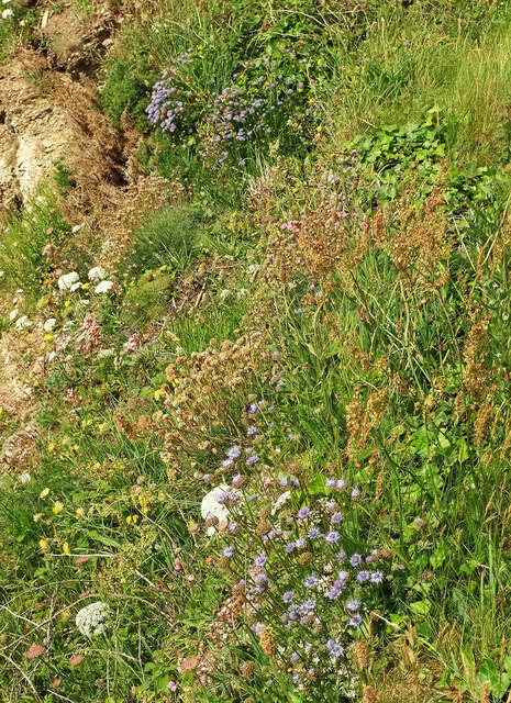
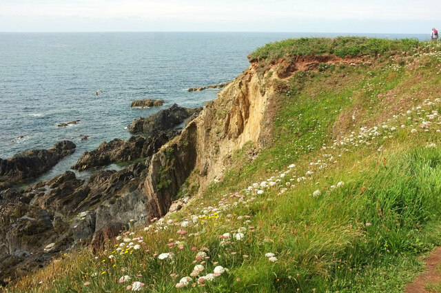
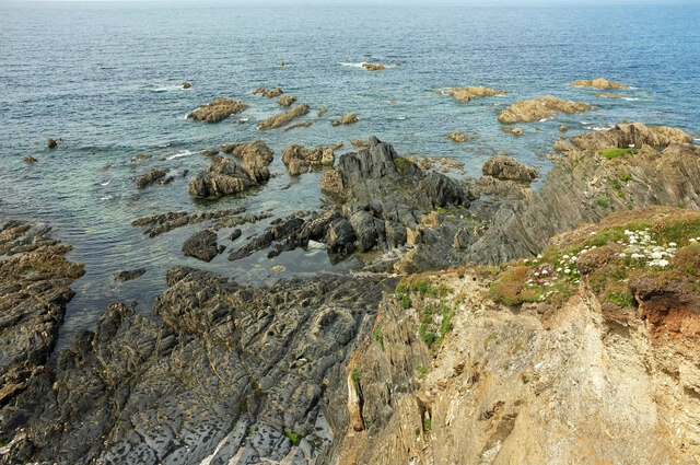
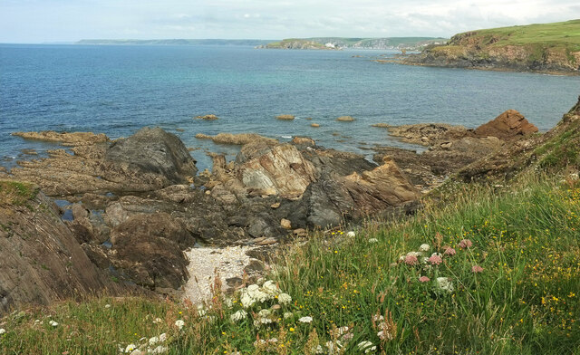
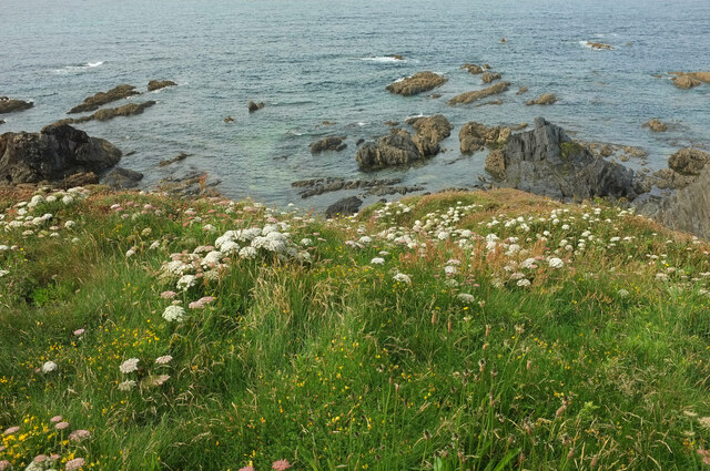
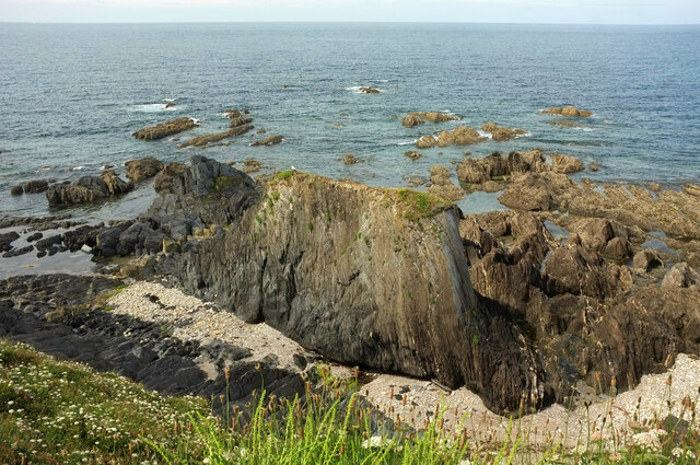
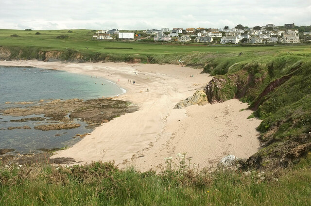
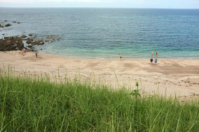
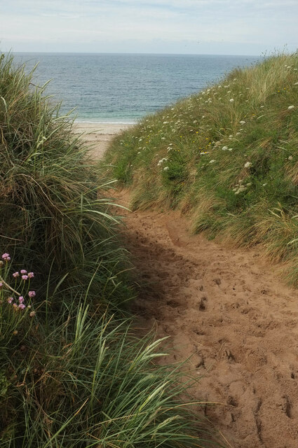
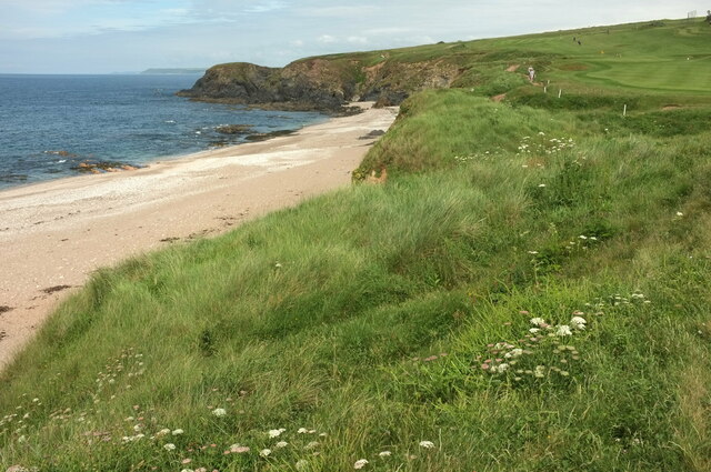
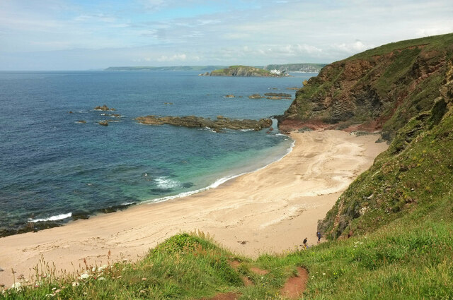
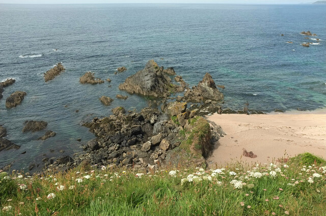
Bantham is a picturesque village located in the South Hams district of Devon, England. Situated on the south-west coast, it is nestled within an Area of Outstanding Natural Beauty, offering stunning views of the surrounding countryside and coastline. The village is renowned for its beautiful sandy beach, which stretches for over a mile and is backed by rolling sand dunes, providing a haven for beach lovers and nature enthusiasts alike.

Bantham is a popular destination for surfers, thanks to the consistent Atlantic swells that create favorable waves for riding. The beach also attracts families and sun-seekers who can enjoy swimming, picnicking, and building sandcastles. Lifeguards patrol the beach during the summer months, ensuring the safety of visitors.

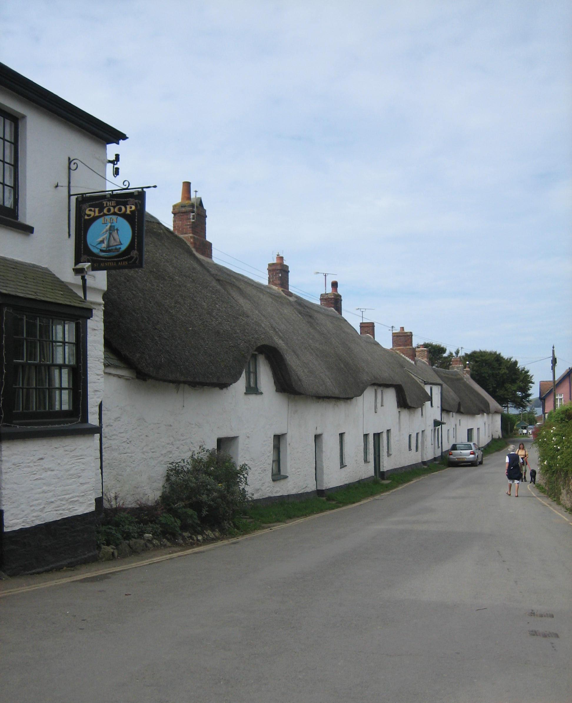
Adding to its charm, the village is home to a small, tight-knit community. There are a few traditional thatched cottages and historic buildings, including Bantham House, a Grade II listed manor house dating back to the 18th century.

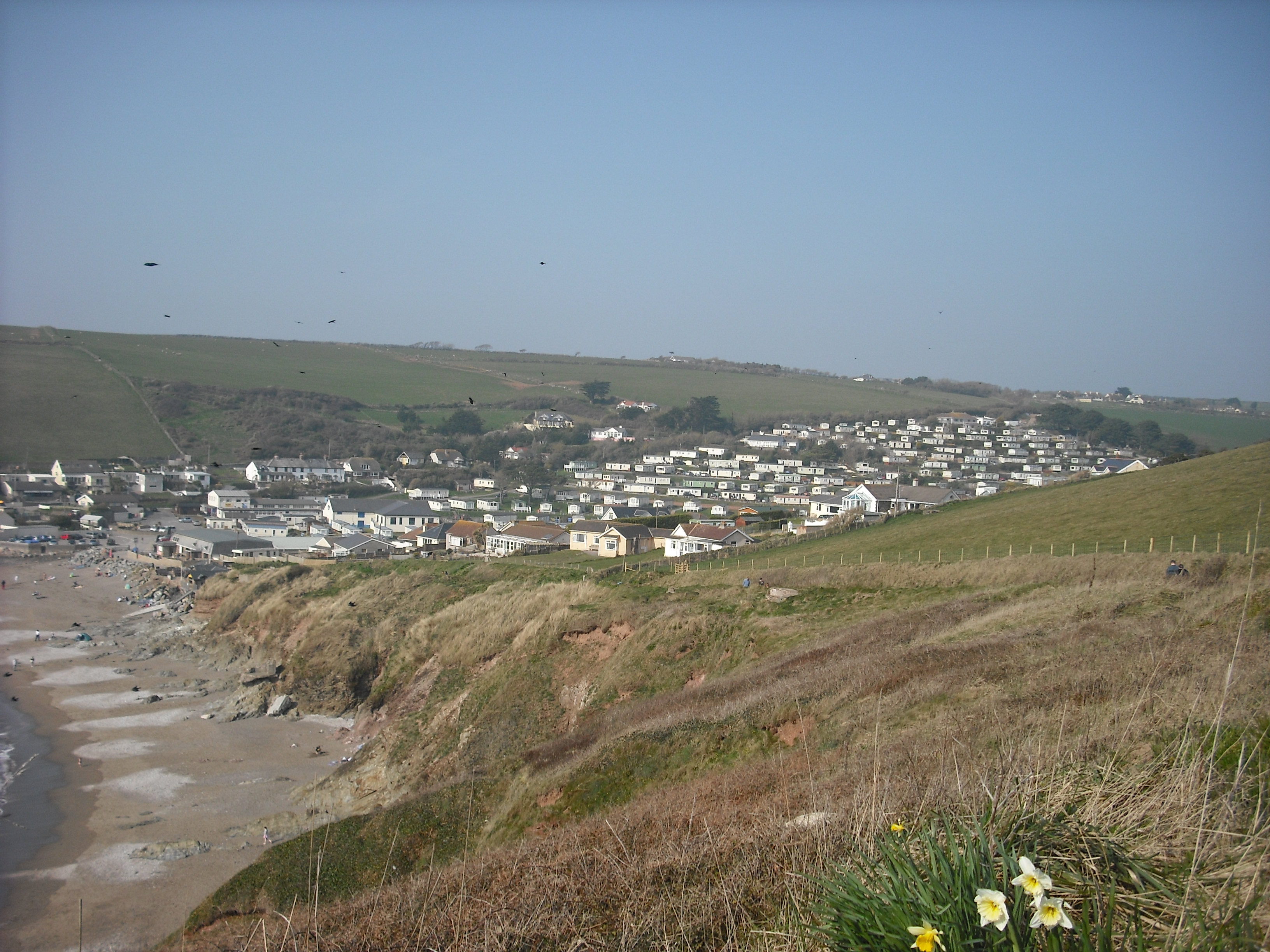
Outdoor enthusiasts are spoilt for choice in Bantham, with an array of walking and cycling routes available in the surrounding countryside. The South West Coast Path, which runs through the village, offers breathtaking views of the coastline and cliffs.

For those seeking refreshment, there is a charming pub in the heart of the village, serving local ales and traditional British cuisine. Additionally, a small café provides light bites and refreshments for beach-goers.

Overall, Bantham offers a peaceful and idyllic coastal retreat, combining natural beauty with a warm community atmosphere.

If you have any feedback on the listing, please let us know in the comments section below.

Bantham Images

Images are sourced within 2km of 50.278644/-3.866628 or Grid Reference SX6743. Thanks to Geograph Open Source API. All images are credited.

Cliffs at Warren Point Looking across Leas Foot Sand from the coast path.
Cliffs at Warren Point
Looking across Leas Foot Sand from the coast path.
Sheepsbit near Warren Point Jasione montana plus other plants on the cliffs east of the headland.
Sheepsbit near Warren Point
Jasione montana plus other plants on the cliffs east of the headland.
Cliffs near Warren Point Plus coastal rocks. Wild carrot is the dominant flower in the foreground.
Cliffs near Warren Point
Plus coastal rocks. Wild carrot is the dominant flower in the foreground.
Warren Point With The Delvers, offshore rocks seen from the coast path.
Warren Point
With The Delvers, offshore rocks seen from the coast path.
The Delvers Rocks north of Warren Point with a view along the coast to Burgh Island and beyond.
The Delvers
Rocks north of Warren Point with a view along the coast to Burgh Island and beyond.
The Delvers Rocks off Warren Point.
The Delvers
Rocks off Warren Point.
The Delvers Rocks off Warren Point.
The Delvers
Rocks off Warren Point.
Yarmouth Sand Also shown at <a title="https://www.geograph.org.uk/search.php?i=155564472" href="https://www.geograph.org.uk/search.php?i=155564472">Link</a>. Thurlestone is in the background.
Yarmouth Sand
Also shown at Link. Thurlestone is in the background.
Yarmouth Sand From the coast path.
Yarmouth Sand
From the coast path.
Path to Yarmouth Sand Thurlestone footpath 16, seen from where it is crossed by the coast path.
Path to Yarmouth Sand
Thurlestone footpath 16, seen from where it is crossed by the coast path.
Yarmouth Sand Loam Castle <a title="https://www.geograph.org.uk/search.php?i=155565115" href="https://www.geograph.org.uk/search.php?i=155565115">Link</a> is the headland at the north end of the beach. The distant headlands are Rame Head and Stoke Point.
Yarmouth Sand
Loam Castle Link is the headland at the north end of the beach. The distant headlands are Rame Head and Stoke Point.
Broad Sand A cove between Yarmouth Sand and Bantham Sand. Ahead is Burgh Island with its hotel.
Broad Sand
A cove between Yarmouth Sand and Bantham Sand. Ahead is Burgh Island with its hotel.
Rocks by Broad Sand Looking left from <a href="https://www.geograph.org.uk/photo/7153086">SX6642 : Broad Sand</a>.
Rocks by Broad Sand
Looking left from SX6642 : Broad Sand.
Goatsbeard near Butter Cove Tragopogon pratensis by the clifftop coastal path.
Goatsbeard near Butter Cove
Tragopogon pratensis by the clifftop coastal path.
Headland and Long Stone The long stone is seen from sea level at <a href="https://www.geograph.org.uk/photo/6229771">SX6543 : Long Stone</a>. Here it is seen from the clifftop coast path.
Headland and Long Stone
The long stone is seen from sea level at SX6543 : Long Stone. Here it is seen from the clifftop coast path.
Cliff southeast of Butter Cove And northwest of Broad Sand. A wide grassy shelf has developed a little down from the clifftop.
Cliff southeast of Butter Cove
And northwest of Broad Sand. A wide grassy shelf has developed a little down from the clifftop.
Rocks near Loam Castle The principal stack can be seen on the left of <a href="https://www.geograph.org.uk/photo/5924310">SX6642 : Rocks, Loam Castle</a>.
Rocks near Loam Castle
The principal stack can be seen on the left of SX6642 : Rocks, Loam Castle.
The Delvers Another view of rocks off Warren Point shown in <a href="https://www.geograph.org.uk/photo/7153053">SX6642 : The Delvers</a>.
The Delvers
Another view of rocks off Warren Point shown in SX6642 : The Delvers.
Show me another place!

Bantham is located at Grid Ref: SX6743 (Lat: 50.278644, Lng: -3.866628)

Administrative County: Devon

District: South Hams

Police Authority: Devon and Cornwall

What 3 Words

///distract.stolen.seemingly. Near Kingsbridge, Devon

Related Wikis

Bantham

Bantham is a coastal village in south Devon, England. It is in the South Hams district and lies on the estuary of the River Avon a quarter of a mile from...

Thurlestone

Thurlestone is a village located 5 miles (8.0 km) west of Kingsbridge in the South Hams district in south Devon, England. There is an electoral ward in...

River Avon, Devon

The River Avon, also known as the River Aune, is a river in the county of Devon in the southwest of England. It rises in the southern half of Dartmoor...

SS Louis Sheid

SS Louis Sheid was a 6,057 ton Belgian steamer that ran aground off Devon after escaping U-47 following the rescue of the captain and crew of the freighter...

South Milton Ley

South Milton Ley (grid reference SX685422) is a 162,000 square metres (40 acres) wetland in the South Hams, Devon, England. It was notified as a Site of...

Bigbury-on-Sea

Bigbury-on-Sea is a village in the South Hams district on the south coast of Devon, England. It is part of the civil parish of Bigbury which is centred...

Burgh Island Hotel

The Burgh Island Hotel is a hotel on Burgh Island, Devon in England. == History == In the 1890s, the music hall star George H. Chirgwin built a prefabricated...

Challaborough

Challaborough is a village and popular surfing beach in the District of South Hams on the south coast of Devon, England. The village is in the parish of...

Nearby Amenities

Located within 500m of 50.278644,-3.866628
Source: PGS
Lat/Long: 50.2788009/-3.8714478
Source: PGS
Lat/Long: 50.2788497/-3.871688
Source: PGS
Lat/Long: 50.2791195/-3.8730988
Source: PGS
Lat/Long: 50.2812231/-3.8718639
Source: PGS
Lat/Long: 50.2813473/-3.8713698
Source: PGS
Lat/Long: 50.2813479/-3.8708024
Source: PGS
Lat/Long: 50.2815333/-3.8703288
Source: PGS
Lat/Long: 50.2817054/-3.8697839
Source: PGS
Lat/Long: 50.2819786/-3.8693331
Source: PGS
Lat/Long: 50.2821706/-3.8690744
Source: PGS
Lat/Long: 50.2823894/-3.8687948
Created By: almien_coastlines
Source: PGS
Lat/Long: 50.282963/-3.868404
Source: PGS
Lat/Long: 50.282344/-3.8651803
Source: PGS
Lat/Long: 50.2794424/-3.8679195
Source: PGS
Lat/Long: 50.2791476/-3.8690748
Source: PGS
Lat/Long: 50.2790568/-3.8697079
Source: PGS
Lat/Long: 50.278993/-3.8702212
Source: PGS
Lat/Long: 50.2789108/-3.8705309
Source: PGS
Lat/Long: 50.2788233/-3.8708059
Bantham
Is In: Devon, England, UK
Place: hamlet
Wikidata: Q4857211
Wikipedia: en:Bantham
Lat/Long: 50.2784234/-3.868506
Bantham Village Stores
Shop: convenience
Lat/Long: 50.2788514/-3.8674313
Chapel Cross
Place: locality
Lat/Long: 50.2781321/-3.8600518
Barrier: stile
Lat/Long: 50.2745844/-3.8681233
Barrier: stile
Lat/Long: 50.2757858/-3.8671363
Barrier: stile
Lat/Long: 50.2762026/-3.8670848
Barrier: kissing_gate
Lat/Long: 50.2772558/-3.8687241
Langmans Cross
Place: locality
Lat/Long: 50.2779035/-3.8597635
Source: PGS
Lat/Long: 50.2788266/-3.8705472
Defibrillator
Emergency: defibrillator
Lat/Long: 50.2784092/-3.8687022
Cafe
Outdoor Seating: yes
Lat/Long: 50.2789835/-3.8671324
Barrier: kissing_gate
Lat/Long: 50.2784826/-3.8710579
Bench
Backrest: yes
Lat/Long: 50.278528/-3.8708938
Post Box
Brand: Royal Mail
Brand Wikidata: Q638098
Brand Wikipedia: en:Royal Mail
Collection Times: Mo-Fr 16:00; Sa 11:30; Su off
Operator: Royal Mail
Operator Wikidata: Q638098
Post Box Design: ludlow
Post Box Mounting: building
Post Box Type: wall
Ref: TQ7 78
Royal Cypher: GVIR
Royal Cypher Wikidata: Q33102169
Source: survey;streetlevel imagery;aerial imagery
Lat/Long: 50.2788428/-3.8672305
Bench
Lat/Long: 50.2787215/-3.8719521
Leisure: picnic_table
Lat/Long: 50.2787285/-3.8718725
Turning Circle
Lat/Long: 50.2784418/-3.8706091
unknown helipad
Aeroway: helipad
Surface: grass
Lat/Long: 50.2780151/-3.8725035
The data included in this document is from www.openstreetmap.org. The data is made available under ODbL.

Have you been to Bantham?

Leave your review of Bantham below (or comments, questions and feedback).