Carn Allt a' Chlaiginn
Hill, Mountain in Banffshire
Scotland
Carn Allt a' Chlaiginn

Carn Allt a' Chlaiginn is a prominent hill located in the county of Banffshire, Scotland. It is situated on the eastern side of the Cairngorms National Park, near the village of Tomintoul. The hill stands at an elevation of approximately 862 meters (2,828 feet) above sea level.
Carn Allt a' Chlaiginn is known for its distinctive shape, with a steep and rugged northwestern face and a gentler slope to the southeast. The hill is composed primarily of granite, which gives it a unique appearance and contributes to its popularity among hikers and nature enthusiasts.
The summit of Carn Allt a' Chlaiginn offers breathtaking panoramic views of the surrounding countryside, including the neighboring hills and valleys. On clear days, it is possible to see as far as the Cairngorm Mountains and the Moray Firth. The hill is also home to a diverse range of flora and fauna, including heather, grasses, and various bird species.
Hiking trails and footpaths lead to the summit of Carn Allt a' Chlaiginn from different directions, providing opportunities for visitors to explore the hill and its surroundings. It is advisable for hikers to have suitable footwear and clothing, as the weather conditions can change rapidly in this region.
Overall, Carn Allt a' Chlaiginn offers a rewarding and picturesque outdoor experience for those seeking to immerse themselves in the natural beauty of Banffshire.
If you have any feedback on the listing, please let us know in the comments section below.
Carn Allt a' Chlaiginn Images
Images are sourced within 2km of 57.356352/-3.1187012 or Grid Reference NJ3230. Thanks to Geograph Open Source API. All images are credited.


Carn Allt a' Chlaiginn is located at Grid Ref: NJ3230 (Lat: 57.356352, Lng: -3.1187012)
Unitary Authority: Moray
Police Authority: North East
What 3 Words
///elder.enacts.unafraid. Near Dufftown, Moray
Nearby Locations
Related Wikis

Achnastank
Achnastank (Scottish Gaelic: Achadh nan Staing, field of the pool/ditch) is a scattered settlement, south east of Ben Rinnes, in the Scottish council area...
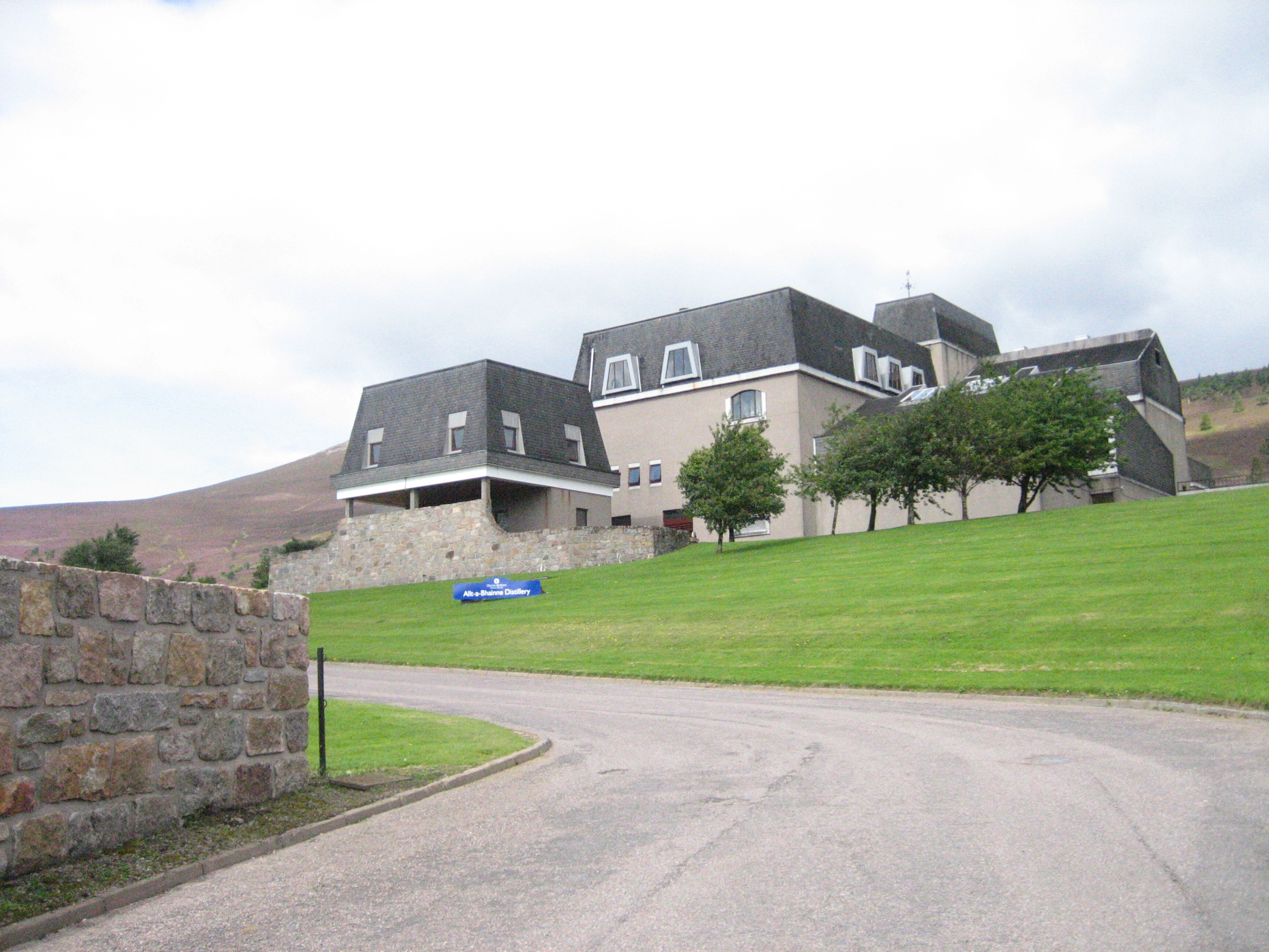
Allt-A-Bhainne distillery
Allt-A-Bhainne distillery (Scottish Gaelic: Allt a' Bhainne [al̪ˠt̪əˈvaɲə], meaning 'milk burn') is a Scotch whisky distillery in the Speyside Region of...

Cabrach
The Cabrach (Scottish Gaelic: A' Chabrach, A' Chabraich) is an estate and largely depopulated rural community in Moray, Scotland. The meaning of the name...
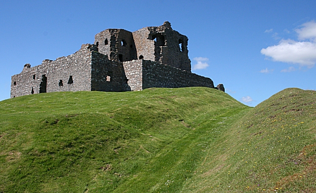
Auchindoun Castle
Auchindoun Castle is a 15th-century L-Plan tower castle located in Auchindoun near Dufftown in Moray, Scotland. == History == While there is evidence of...

Battle of Glenlivet
The Battle of Glenlivet was a Scottish clan battle fought on 3 October 1594 near Glenlivet, Moray, Scotland. It was fought between Protestant forces loyal...
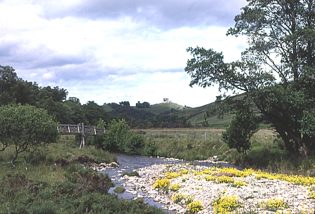
River Fiddich
The River Fiddich (Scottish Gaelic: Fiodhach / Abhainn Fhiodhaich) is a right bank tributary of the River Spey in northeast Scotland. It rises on the eastern...
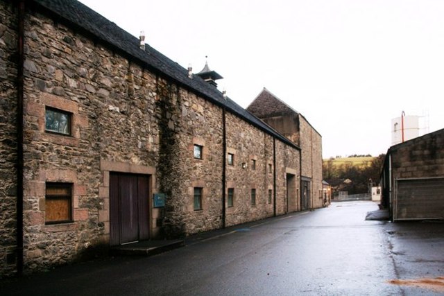
Dufftown distillery
Dufftown distillery is a Scotch whisky distillery in Dufftown, Moray, Scotland. Founded in 1895 as "Dufftown-Glenlivet Distillery", the distillery is currently...
Pittyvaich distillery
Pittyvaich distillery was a producer of single malt Scotch whisky that operated between 1974 and 1993. == History == The Pittyvaich distillery, built in...
Nearby Amenities
Located within 500m of 57.356352,-3.1187012Have you been to Carn Allt a' Chlaiginn?
Leave your review of Carn Allt a' Chlaiginn below (or comments, questions and feedback).